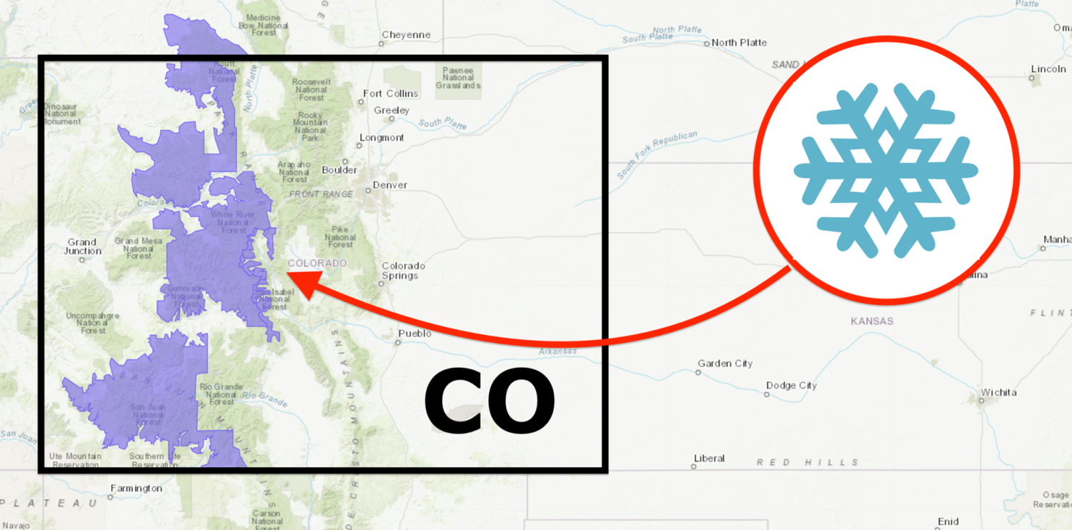
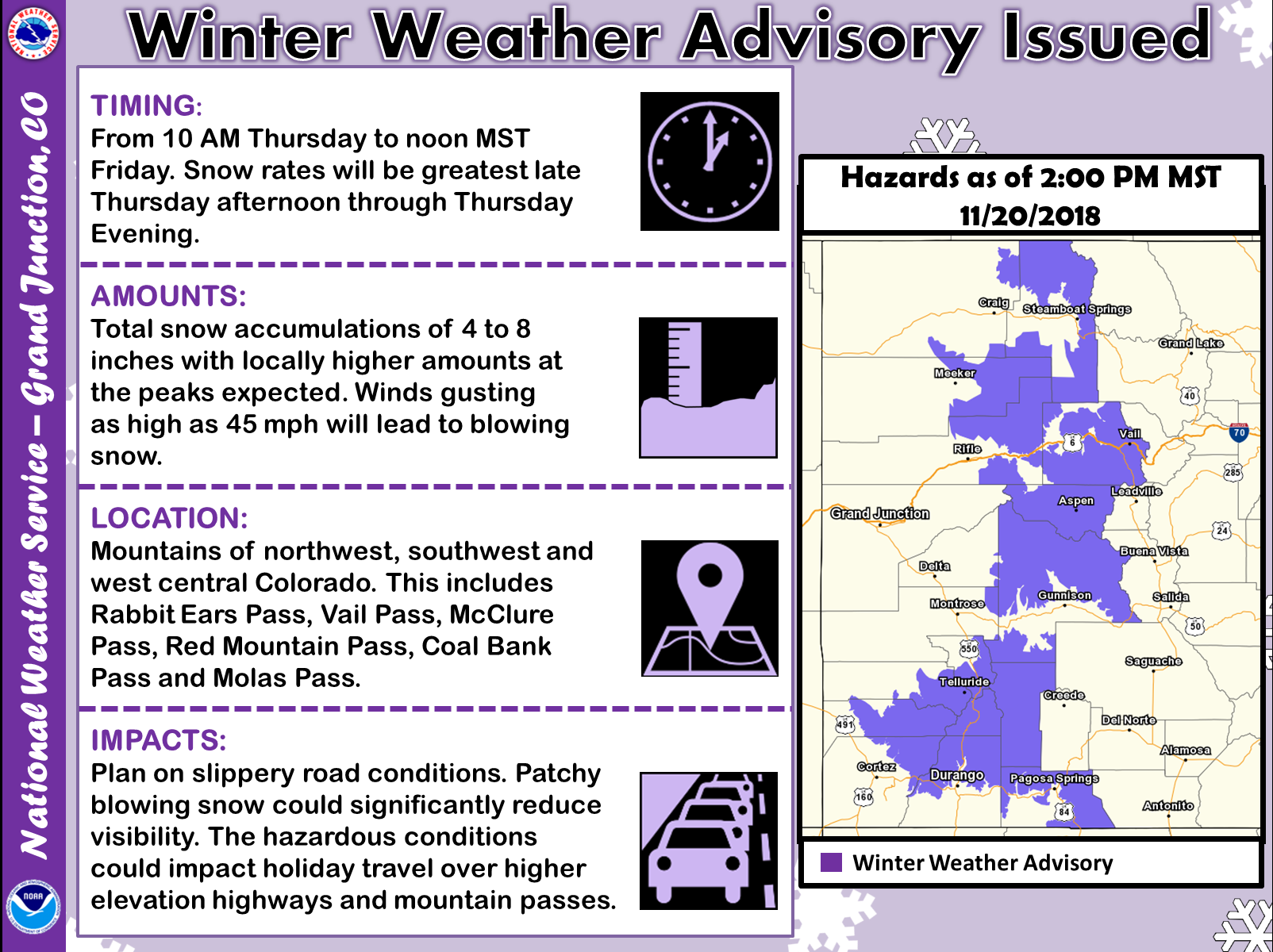
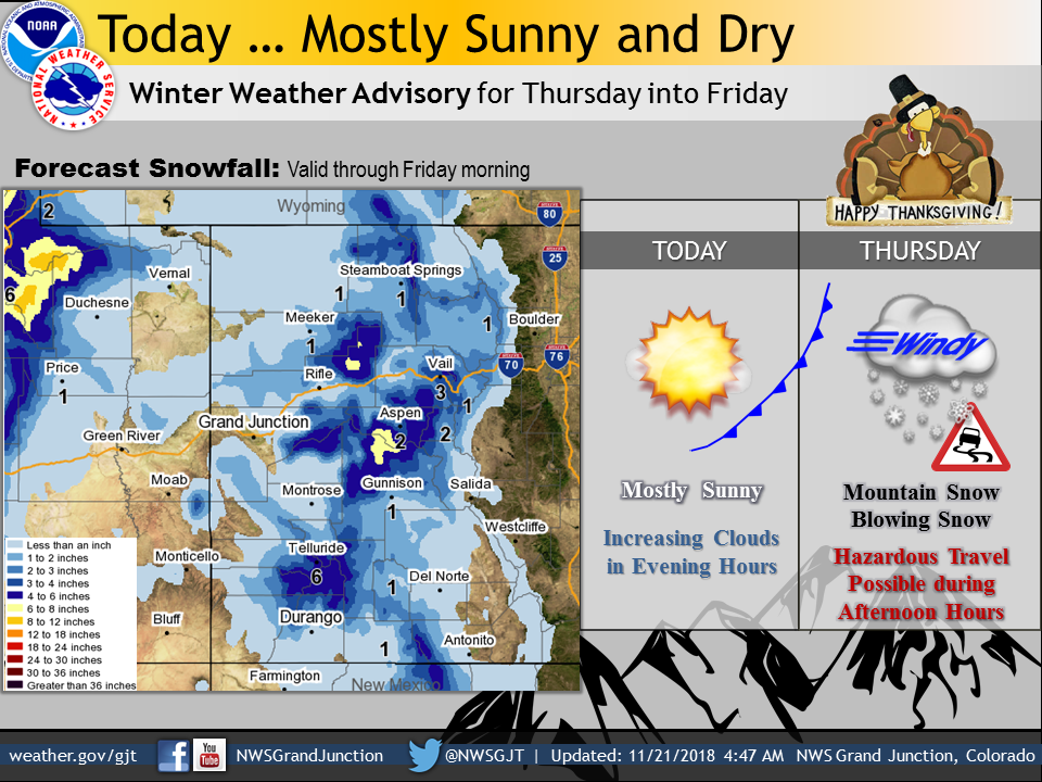
The National Weather Service has issued a Winter Weather Advisory for Colorado. It’s in effect Thursday morning through Friday. Mountain snow and high winds are forecasted to impact the area throughout that time.
Colorado:
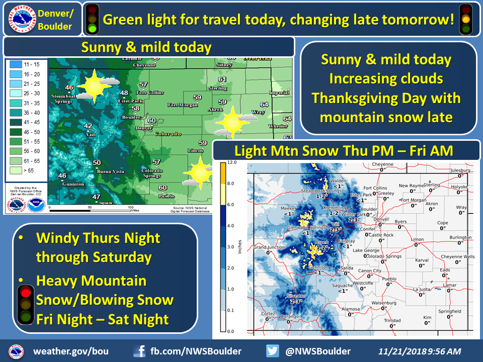
- 4-8+” of Snow Thursday – Friday Morning
“Total snow accumulations of 4 to 8 inches with locally higher amounts at the peaks expected. Winds gusting as high as 45 mph will lead to blowing snow. Limited visibility & slippery roads will lead to hazardous travel across over high elevation highways & mountain passes.”
– NOAA Grand Junction, CO
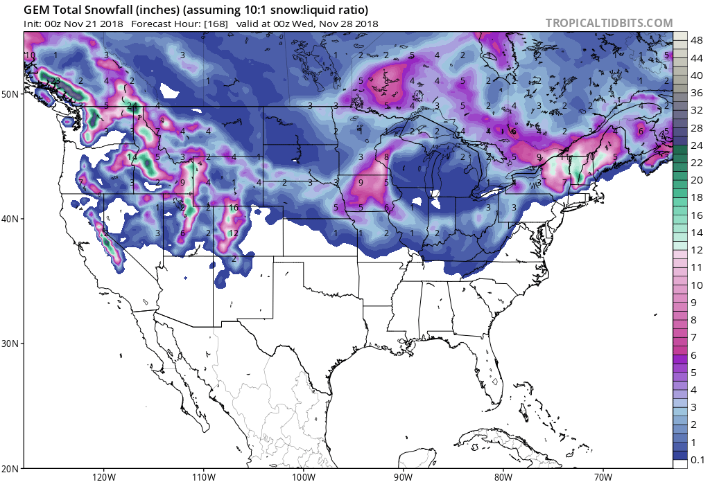
Snow levels are forecasted to drop down to 4,000ft on Thursday morning before rising to around 6,000ft during the day.
The 6-10 day outlook calls for average temperatures and below average precipitation in Colorado.
Additional Storm Info:
Colorado: 4-8+” of Snow Thursday – Friday Morning
* Snow expected. Total snow accumulations of 4 to 8 inches
  with locally higher amounts at the peaks expected.
- NOAA Grand Junction, CO
Winter Weather Advisory:
URGENT - WINTER WEATHER MESSAGE
National Weather Service Grand Junction CO
413 AM MST Wed Nov 21 2018

Elkhead and Park Mountains-
Gore and Elk Mountains/Central Mountain Valleys-
West Elk and Sawatch Mountains-Flat Tops-
Northwest San Juan Mountains-Southwest San Juan Mountains-
Including the cities of Columbine, Hahns Peak, Toponas, Aspen,
Vail, Snowmass, Crested Butte, Taylor Park, Marble, Buford,
Trappers Lake, Telluride, Ouray, Lake City, Silverton, Rico,
and Hesperus

...WINTER WEATHER ADVISORY REMAINS IN EFFECT FROM 10 AM THURSDAY
TO NOON MST FRIDAY...

* WHAT...Snow expected. Total snow accumulations of 4 to 8 inches
  with locally higher amounts at the peaks expected.

* WHERE...Mountains of northwest, southwest and west central
  Colorado. This includes Rabbit Ears Pass, Vail Pass, McClure
  Pass, Red Mountain Pass, Coal Bank Pass and Molas Pass.

* WHEN...From 10 AM Thursday to noon MST Friday. Snow rates will
  be greatest late Thursday afternoon through Thursday evening,
  impacting holiday evening commute.

* ADDITIONAL DETAILS...Plan on slippery road conditions. Patchy
  blowing snow could significantly reduce visibility. The
  hazardous conditions could impact holiday travel over higher
  elevation highways and mountain passes.