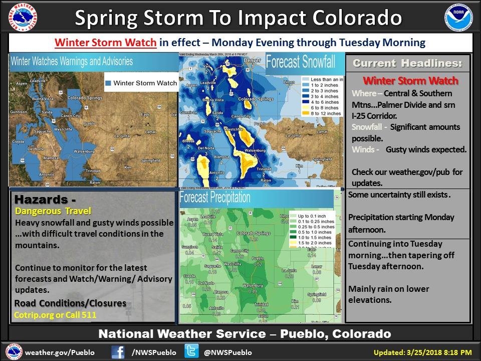
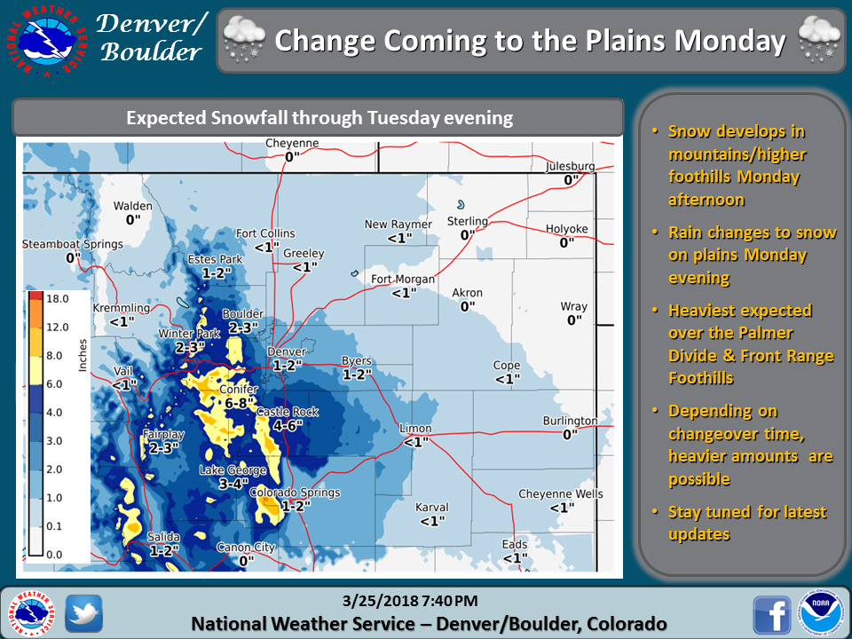
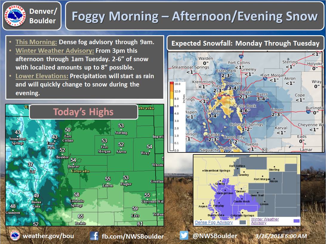
The National Weather Service has issued a Winter Weather Advisory for Colorado. It’s in effect Today – Tuesday Morning. Heavy snowfall is forecasted to impact the mountain in Colorado, but some will fall in the Front Range Foothills.
4-8+” of Snow Today – Tuesday Morning.
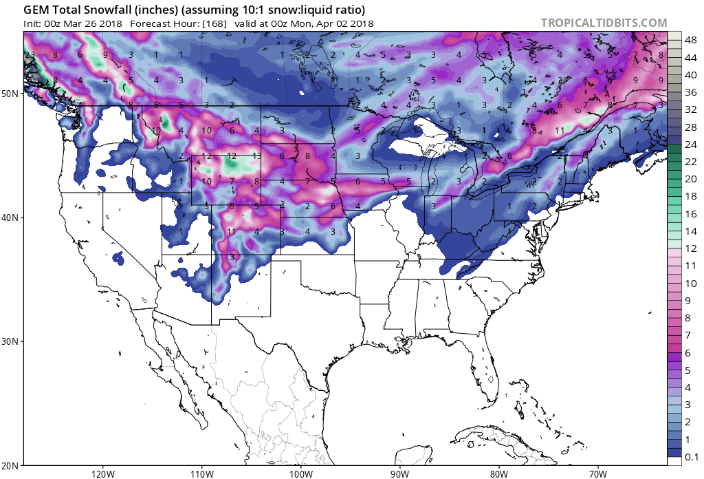
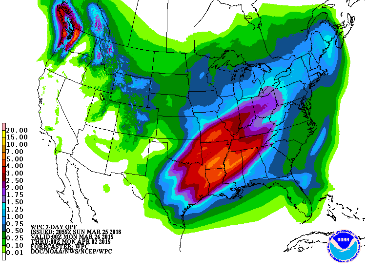
7 day snowfall totals. Image: Tropical Tidbits7 day precipitation totals. Image: NOAA
Wet and heavy snowfall is forecasted to impact the mountains below 10,000ft in Colorado.
Additional Storm Info:
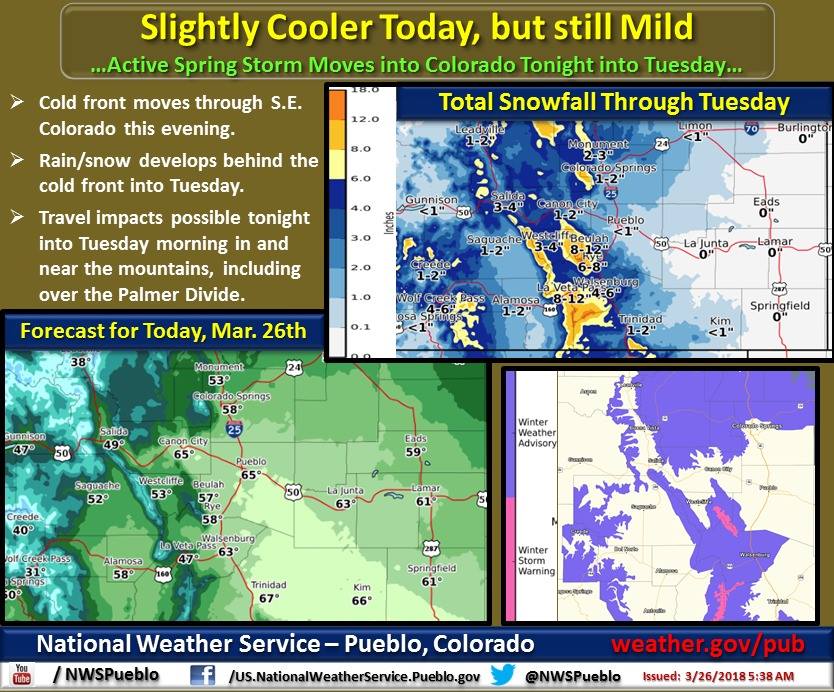
Spring storm. Image: NOAA Pueblo, COSnowfall totals. Image: NOAA Denver, CO
Colorado: 4-8+” of Snow Today – Tuesday Morning
* Total snow accumulations of 4 to 8 inches,
  with localized amounts up to 14 inches, are expected.
- NOAA Pueblo, CO
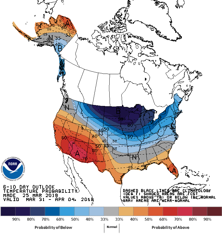
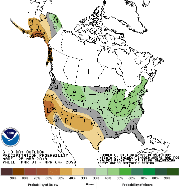
Slightly cooler today. Image: NOAA Pueblo, COAfternoon snow. Image: NOAA Denver, CO6-10 day temperature outlook. Image: NOAA6-10 day precipitation outlook. Image: NOAA
CO Winter Weather Advisory:
URGENT - WINTER WEATHER MESSAGE
National Weather Service Pueblo CO
409 AM MDT Mon Mar 26 2018
Western Mosquito Range/East Lake County Above 11000 Feet-
Eastern Sawatch Mountains Above 11000 Feet-
Western Mosquito Range/East Chaffee County Above 9000 Feet-
La Garita Mountains Above 10000 Feet-
Eastern San Juan Mountains Above 10000 Feet-
Northern Sangre de Cristo Mountains Between 8500 And 11000 Feet-
Northern Sangre de Cristo Mountains Above 11000 Feet-
Southern Sangre de Cristo Mountains Between 7500 and 11000 Feet-
Northwestern Fremont County Above 8500 Feet-
Wet Mountains between 6300 and 10000 Feet-
Walsenburg Vicinity/Upper Huerfano River Basin Below 7500 Feet-
...WINTER WEATHER ADVISORY IN EFFECT FROM 8 PM THIS EVENING TONOON MDT TUESDAY...
* WHAT...Snow expected. Total snow accumulations of 4 to 8 inches, with localized amounts up to 14 inches, are expected.
* WHERE...Wet Mountains below 10000 feet, the southern Sangre de
Cristos below 11000 feet, northern Sangre de Cristos Mountains,
mountains of Lake and Chaffee Counties, eastern San Juan
Mountains, La Garita Mountains, and Northern Fremont County
above 8500 feet.
* WHEN...From 8 PM this evening to noon MDT Tuesday.* ADDITIONAL DETAILS...Plan on slippery road conditions,
including during the morning commute on Tuesday. Be prepared
for reduced visibilities at times.
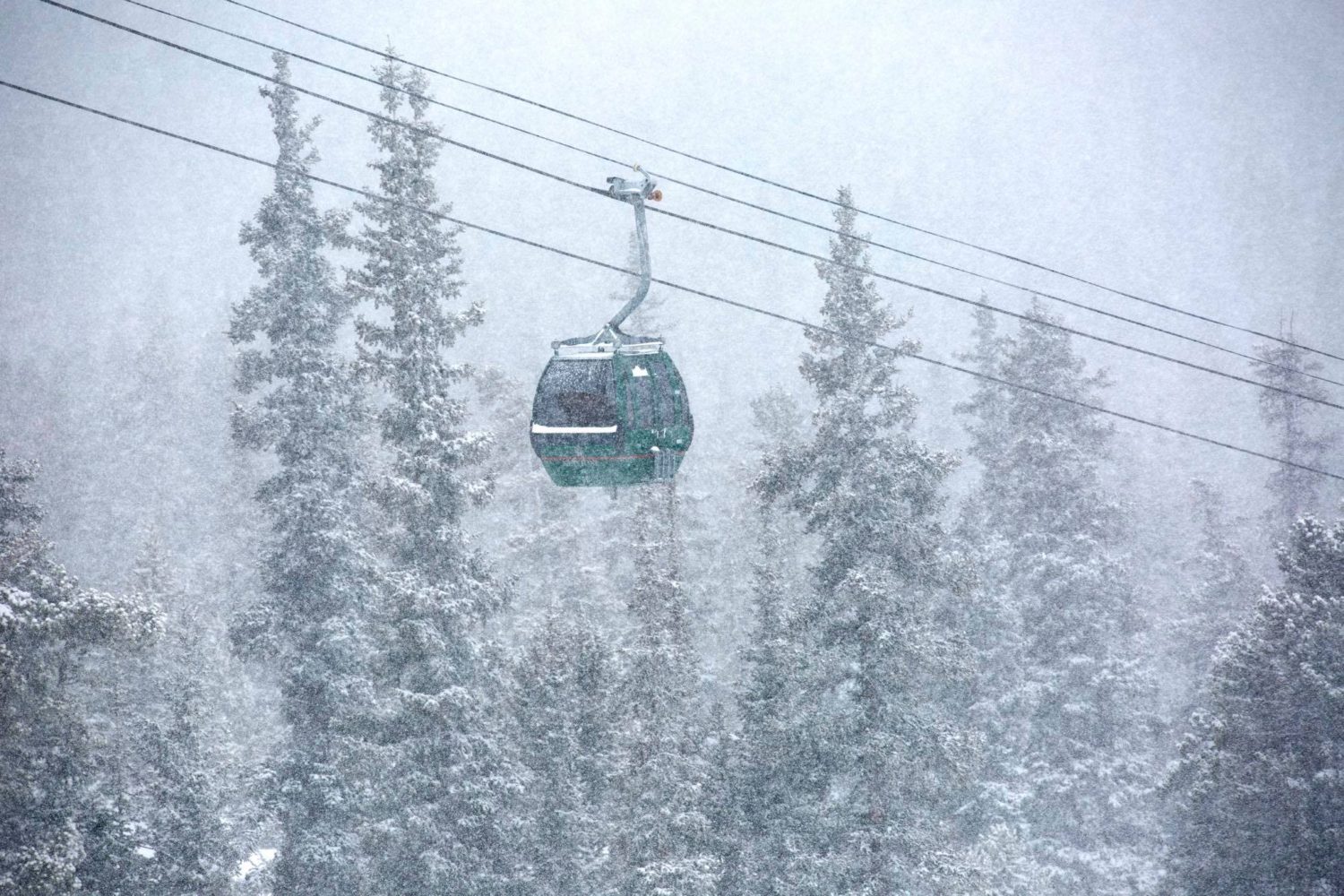
Heavy snow at Keystone Resort, CO. Image: Keystone Facebook Page