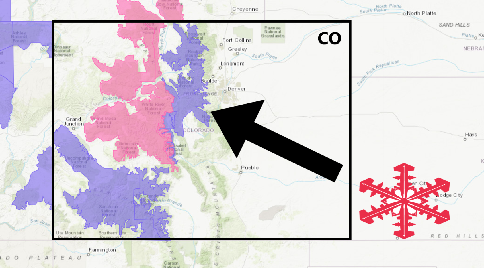
The National Weather Service has issued a Winter Weather Advisory for Colorado. It’s in effect until 5:00pm Friday evening.
High winds and heavy snowfall are forecasted to impact the area throughout that time.
Colorado:
- 7-15″ of Snow Today – Friday Evening
“Planning travel in the mountains? Conditions deteriorate today with periods of snow, but warmer temperatures will help road conditions. That changes dramatically this evening as a cold front brings a burst of heavy snow, strong winds, poor visibility, and hazardous travel. The brunt of this storm likely reaches the I-70 Mountain Corridor and Summit County 8 to 11 PM. On the plains, cold air will hold over most of the northeast plains, but warmer temperatures will occur from the southern Denver suburbs into Douglas and Elbert counties where 50s can be expected.”
– NOAA Denver, CO
If you haven’t already, get your hands on an Ikon Pass, so you don’t miss out on any of these POW days in Colorado next season.
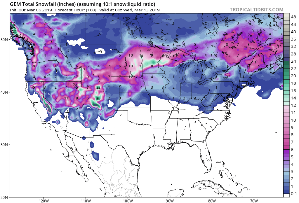
Snow levels will fluctuate between 6,000ft and 8,000ft throughout the storm.
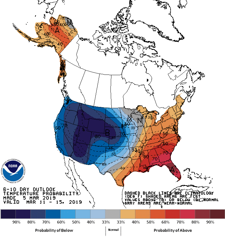
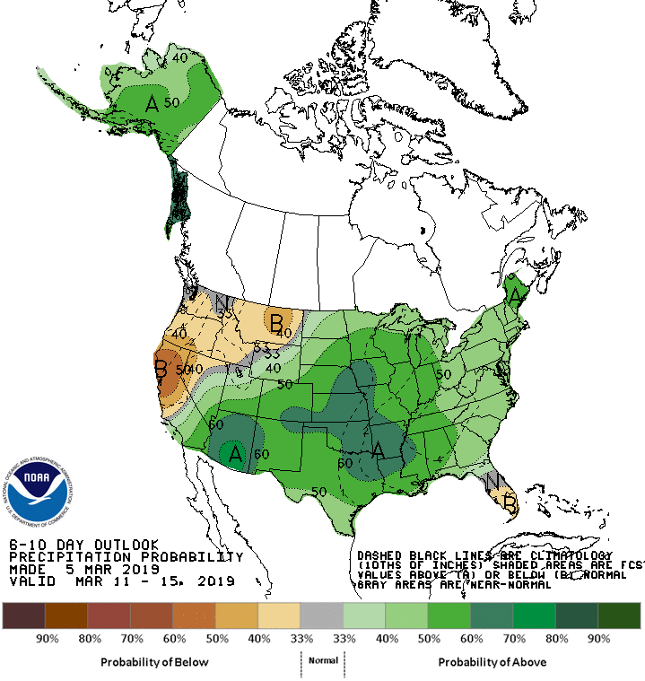
The 6-10 day outlook calls for above average precipitation and below average temperatures in Colorado.
Additional Storm Info:
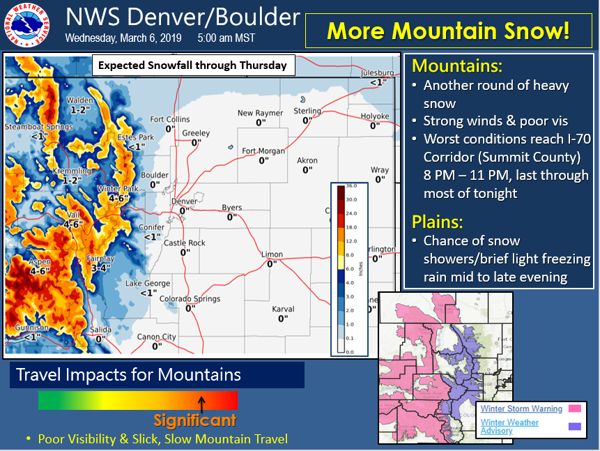
Colorado: 7-15″ of Snow Today – Friday Evening
* Snow, heavy at times from mid evening through the
  midnight hour. Total snow accumulations 7 to 15 inches.
- NOAA Denver, CO
Winter Weather Advisory:
URGENT - WINTER WEATHER MESSAGE
National Weather Service Denver CO
522 AM MST Wed Mar 6 2019

...MORE SNOW FOR THE NORTH CENTRAL COLORADO MOUNTAINS...WITH
CONDITIONS DETERIORATING THIS EVENING...

.Periods of snow will continue across the mountains today, and
some rain will likely mix in with the snow in lower elevations as
warm Pacific moisture spread across the state. Travel conditions
will deteriorate quickly this evening as a band of heavy snow
spread east across the Colorado Mountains. This band will likely
reach the I-70 Corridor including Summit County by mid evening. A
burst of heavy snow with snowfall rates upwards of 2 inches per
hour can be expected as this wave arrives. The snow will gradually
taper off in intensity overnight, but snow and additional
accumulations will occur through Thursday.

Rocky Mountain National Park and the Medicine Bow Range-
The Mountains of Summit County, the Mosquito Range, and the
Indian Peaks-
Including the cities of Cameron Pass,
Laramie and Medicine Bow Mountains, Rabbit Ears Range,
Rocky Mountain National Park, Willow Creek Pass, Berthoud Pass,
Breckenridge, East Slopes Mosquito Range,
East Slopes Southern Gore Range, Eisenhower Tunnel, Indian Peaks,
Kenosha Mountains, Mount Evans, Williams Fork Mountains,
and Winter Park

...WINTER WEATHER ADVISORY REMAINS IN EFFECT UNTIL 5 PM MST
THURSDAY...

* WHAT...Snow, heavy at times from mid evening through the
  midnight hour. Total snow accumulations 7 to 15 inches. Winds
  gusting as high as 55 mph with blowing snow.

* WHERE...The Mountains of Summit County, the Mosquito Range,
  and the Indian Peaks and Rocky Mountain National Park and the
  Medicine Bow Range.

* WHEN...Until 5 PM MST Thursday.

* ADDITIONAL DETAILS...Travel could be very difficult. Road
  closures are possible. Areas of blowing snow could
  significantly reduce visibility.