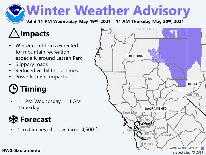
A Winter Weather Advisory has been issued for the Northern Sierra at elevations above 4,500 feet beginning at 11 pm this evening to 11 am Thursday. Campers and hikers, especially around Lassen National Park, should prepare for winter conditions. Mountain travel impacts are also possible.
URGENT - WINTER WEATHER MESSAGE
National Weather Service Sacramento CA
215 AM PDT Wed May 19 2021

...Late season snow will impact mountain travel and recreation...

.A cold late season weather system will bring a quick period of
snow to the southern Cascades and northern Sierra Nevada late
tonight into Thursday evening. The heaviest snow is expected for
elevations above 5000 feet near Mt Lassen, and above 6500 feet
across the northern Sierra. Lighter accumulations will be possible
down to 3500 to 5000 feet.

Campers and hikers, especially around Lassen Volcanic National
Park and along the Sierra crest, should prepare for winter
conditions. Mountain travel impacts are possible, including chain
controls, travel delays and lower visibility.

CAZ014-068-192300-
/O.EXT.KSTO.WW.Y.0017.210520T0700Z-210521T0100Z/
Burney Basin / Eastern Shasta County-
Western Plumas County/Lassen Park-
215 AM PDT Wed May 19 2021

...WINTER WEATHER ADVISORY NOW IN EFFECT FROM MIDNIGHT TONIGHT TO
6 PM PDT THURSDAY ABOVE 5000 FEET...

* WHAT...Snow expected. Plan on slippery road conditions. Total
  snow accumulations of 2 to 4 inches are expected.

* WHERE...Mountains of southeastern Shasta County, Lassen Volcanic
  National Park and Western Plumas County. Includes portions of
  Highways 36, 44 and 89 near Lassen Park.

* WHEN...Midnight to 6 PM Thursday.

* ADDITIONAL DETAILS...Campers and hikers should prepare for
  winter conditions. Do not venture into the back country without
  winter gear this week. Be prepared for reduced visibilities at
  times.
NOAA forecast discussion says:
Precipitation could begin as early as tomorrow evening for Shasta County, spreading south into the southern Cascades and western Plumas County mountains overnight and early Thursday morning. Precipitation will continue spreading south into the northern Sierra and Coastal Range by midday Thursday with showers and thunderstorms possible through the evening. Another couple of rounds of showers and afternoon thunderstorms are possible Friday and Saturday, mainly in the late morning through evening hours.
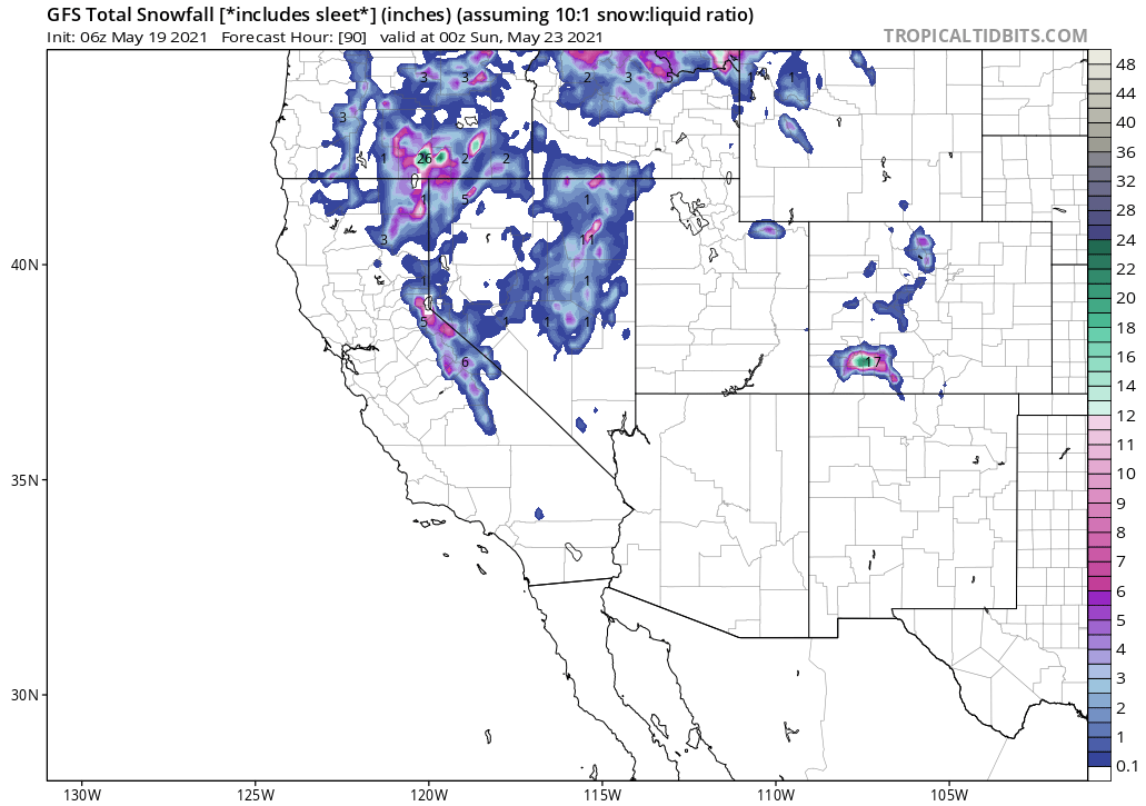
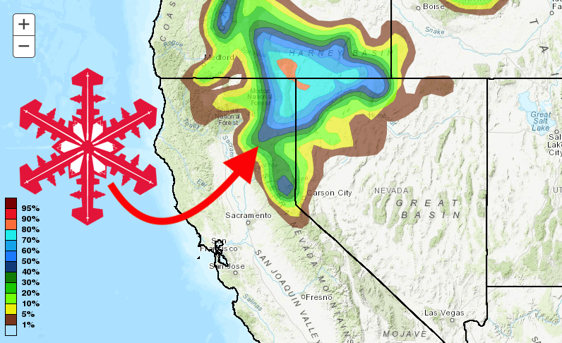
This will be a colder system, so snow showers are forecast for elevations above 4500-5500 feet with lighter flurries possible down to 3500 feet north of Plumas County. Late Wednesday through Thursday, around half an inch to 5 inches is forecast, with another 1 to 3 inches forecast on Friday for areas south of Plumas County. A quick burst of 2-4 inches is possible late Wednesday through Thursday morning for the eastern Shasta County mountains and far northern Plumas County mountains, mostly around Lassen National Park. As this is a late-season event, a Winter Weather Advisory has been issued for 11 pm Wednesday through 11 am Thursday for this area for elevations above 4500-5000 feet. For mountain areas in the northern Sierra, since the bulk of snow is expected to fall during the daytime hours on Thursday, snow is not expected to stick to the roads except for potentially near the crest where temperatures are the coolest.