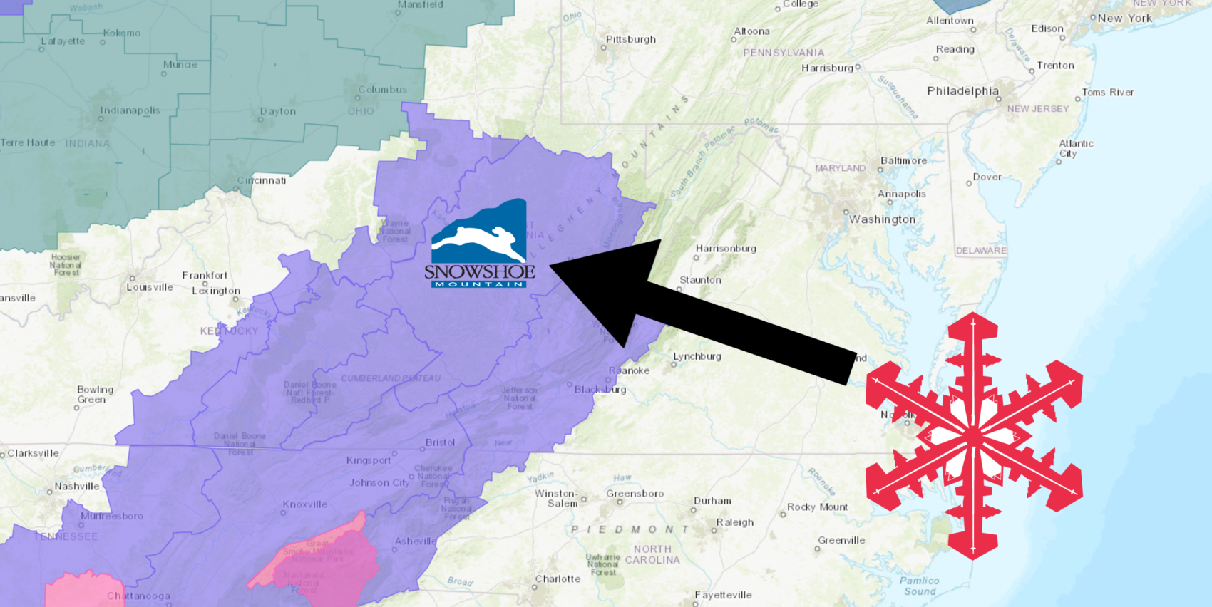
The National Weather Service has issued a Winter Weather Advisory for Showshoe Mountain Resort, WV. It’s in effect from 3:00am Tuesday morning – 8:00pm Tuesday evening. Snow showers are forecasted to impact the area throughout that time.
Snowshoe Mountain Resort, WV:
- 2-4″ of Snow On Tuesday
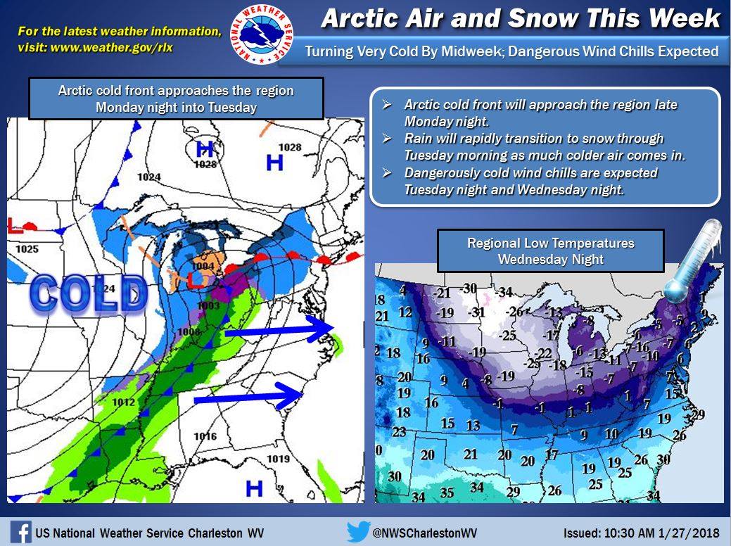
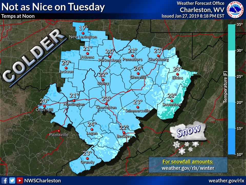
“Bitterly cold temperatures will arrive this week in the wake of a strong arctic cold front that will push across the region late on Monday night. Rain will occur just ahead of the front Monday night but precipitation will rapidly transition to snow from west to east across the area as arctic air comes crashing in. Temperatures may fall below zero Wednesday night for most or all of our forecast area and wind chill values will be much colder. Thus, be prepared for major cold this week and wintry travel conditions on Tuesday. Stay tuned to the latest forecast information in the coming days as we monitor this very carefully.”
– NOAA Charleston, WV
Snowfall totals are forecasted to be higher in the mountains.
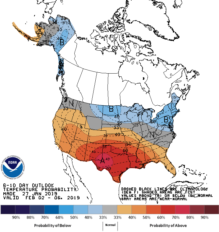
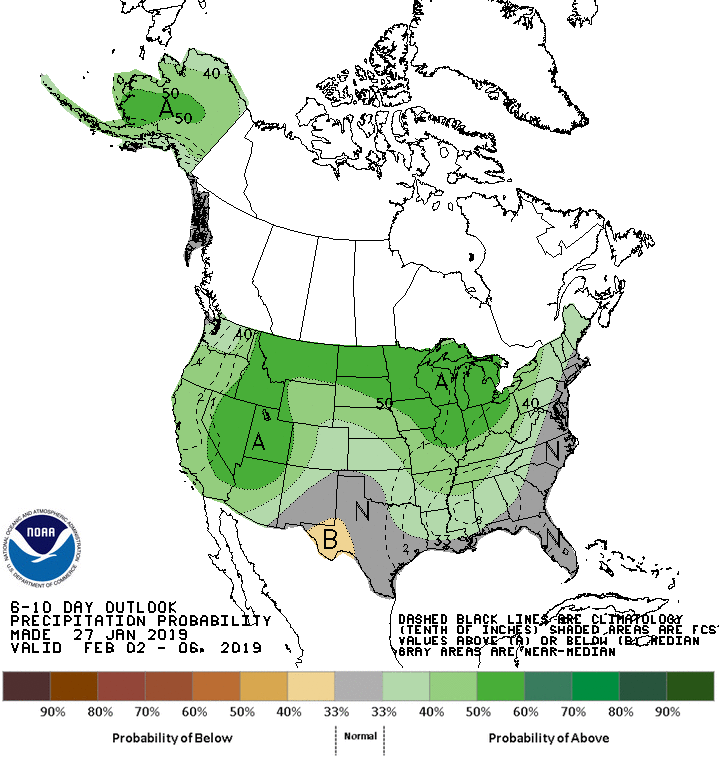
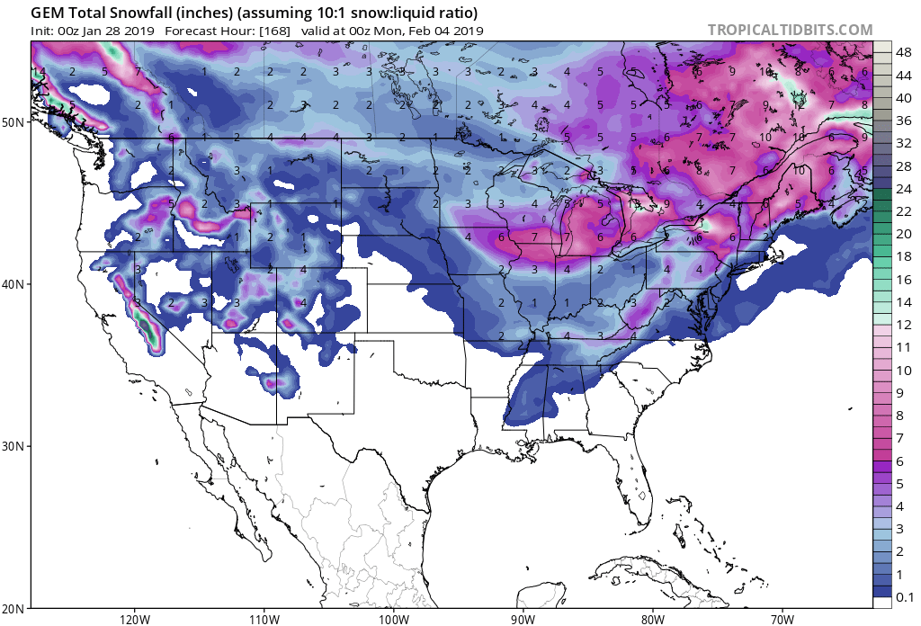
The 6-10 day outlook calls for above average precipitation and below average temperatures in West Virginia.
Additional Storm Info:
West Virginia: 2-4″ of Snow On Tuesday
* Snow expected. Total snow accumulations of 1 to 3 inches
  in the lowlands, and 2 to 4 inches in the mountains.
- NOAA Charleston, WV
Winter Weather Advisory:
URGENT - WINTER WEATHER MESSAGE
National Weather Service Charleston WV
414 AM EST Mon Jan 28 2019

...Strong cold front to impact the region...

...WINTER WEATHER ADVISORY IN EFFECT FROM 3 AM TO 8 PM EST
TUESDAY...

* WHAT...Snow expected. Total snow accumulations of 1 to 3 inches
  in the lowlands, and 2 to 4 inches in the mountains.
  Precipitation may fall briefly as rain at first, and with
  rapidly falling temperatures, could create flash freeze
  conditions.

* WHERE...Portions of southwest Virginia, northeast Kentucky and
  central, northeast, northern, southeast, southern and western
  West Virginia.

* WHEN...From 3 AM to 8 PM EST Tuesday.

* ADDITIONAL DETAILS...Plan on slippery road conditions. The
  hazardous conditions could impact the morning and evening
  commute.