The National Weather Service has issued a Winter Weather Advisory for Sun Valley Resort, ID. It’s in effect from 5:00pm Today – 11:00am Wednesday morning. Moderate snowfall and substantial winds are forecasted to impact the area throughout this time.
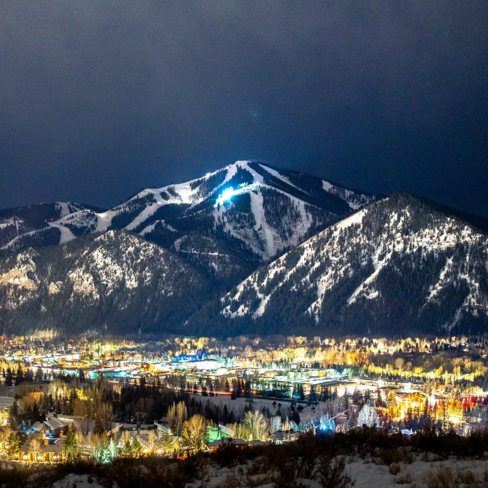
Sun Valley:
- Up To 14″ of Snow Today – Wednesday Morning
Sun Valley Resort is currently holding a 28″ base up top and 25″ at the base, so this storm should add to their solid coverage.
Snow levels are expected to hover around 2,500ft throughout the storm.
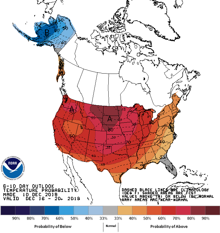
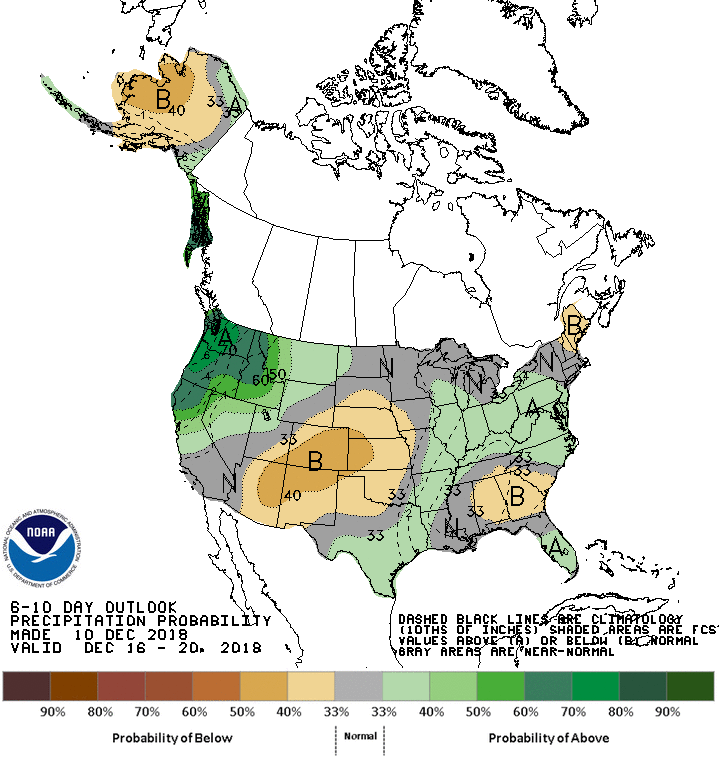
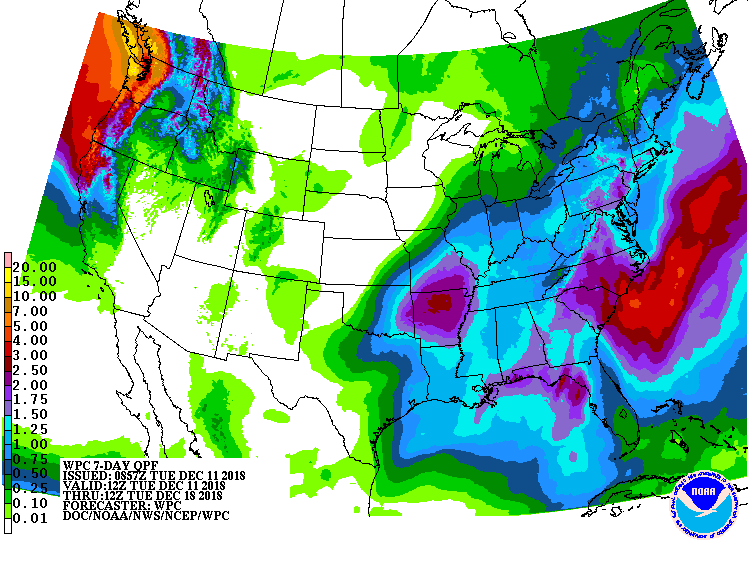
The 6-10 day outlook calls for above average temperatures and above average precipitation in Idaho.
Additional Storm Info:
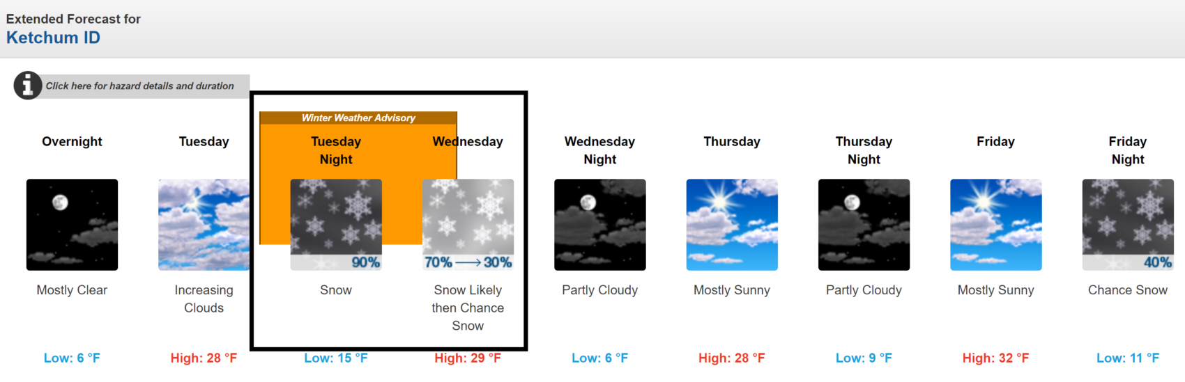
Sun Valley: Up To 14″ of Snow Today – Wednesday Morning
* Total snow accumulations of 4 to 7 inches, with
  localized amounts up to 14 inches, are expected.
- NOAA Pocatello, ID
Winter Weather Advisory:
URGENT - WINTER WEATHER MESSAGE
National Weather Service Pocatello ID
251 AM MST Tue Dec 11 2018

...Moderate to Strong Winter Storm Arrives this Evening...

.A winter storm moving in from the Pacific Northwest during the
evening hours tonight will spread light to moderate snow
throughout central and eastern Idaho. Behind the cold front
portion of the storm, which passes through early in the morning on
Wednesday, strong winds will develop in all but the most wind-
sheltered locations. This will cause low visibility in blowing
snow and heavy drifting of snow, which could easily impede efforts
to keep snow clear from roads. The winds and snow will continue
through Wednesday early evening, then subside for a quiet
Thursday.

Frank Church Wilderness-Sawtooth/Stanley Basin-Sun Valley Region-
Including the cities of Clayton, Stanley, Ketchum, Sun Valley,
and Galena

...WINTER WEATHER ADVISORY REMAINS IN EFFECT FROM 5 PM THIS
AFTERNOON TO 11 AM MST WEDNESDAY...

* WHAT...Snow and blowing snow expected. Plan on difficult
  travel conditions. Total snow accumulations of 4 to 7 inches,
  with localized amounts up to 14 inches, are expected.

* WHERE...Sawtooth Basin, Galena Summit, Stanley, Sun Valley,
  Ketchum.

* WHEN...From 5 PM Tuesday to 11 AM MST Wednesday.

* ADDITIONAL DETAILS...Areas of blowing and drifting snow will be
  possible, especially at higher elevations. West and northwest
  wind of 30 to 40 mph with higher gusts are possible on ridges.