The National Weather Service has issued a Winter Weather Advisory for Tahoe.
It’s in effect from 6:00pm this evening – 10:00am Friday morning.
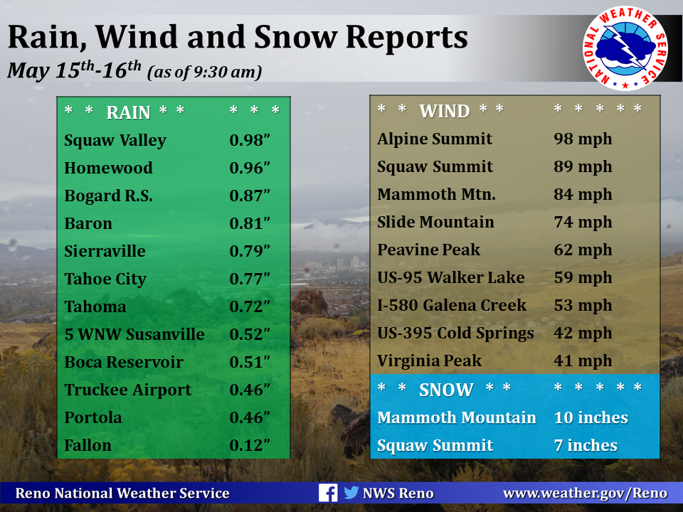
High winds and heavy snowfall are expected to impact the area throughout that time.
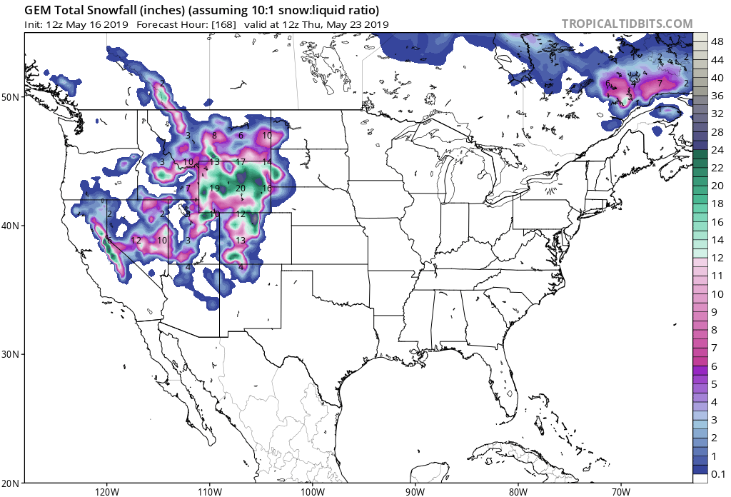
Tahoe Storm Summary:
- 5-10+” of Snow Tonight Above 7,000 Feet
- Ridge Winds Gusting To 85 MPH
“Make sure to keep up to date with the forecast as the active weather pattern is likely to continue well into next week with chilly temperatures, gusty winds, and chances for precipitation.”
– NOAA Reno, NV
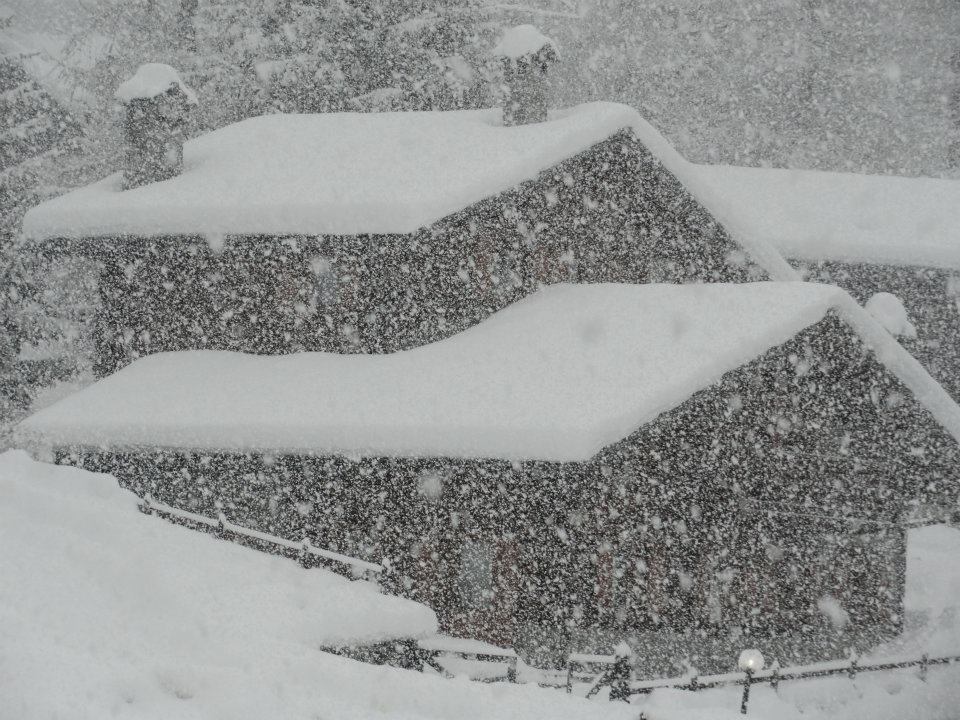
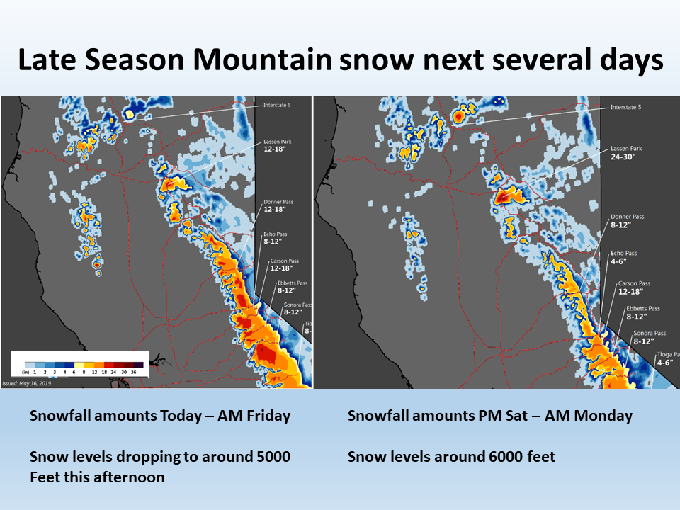
Squaw Valley Alpine Meadows, CA is open and in for some snow tonight.
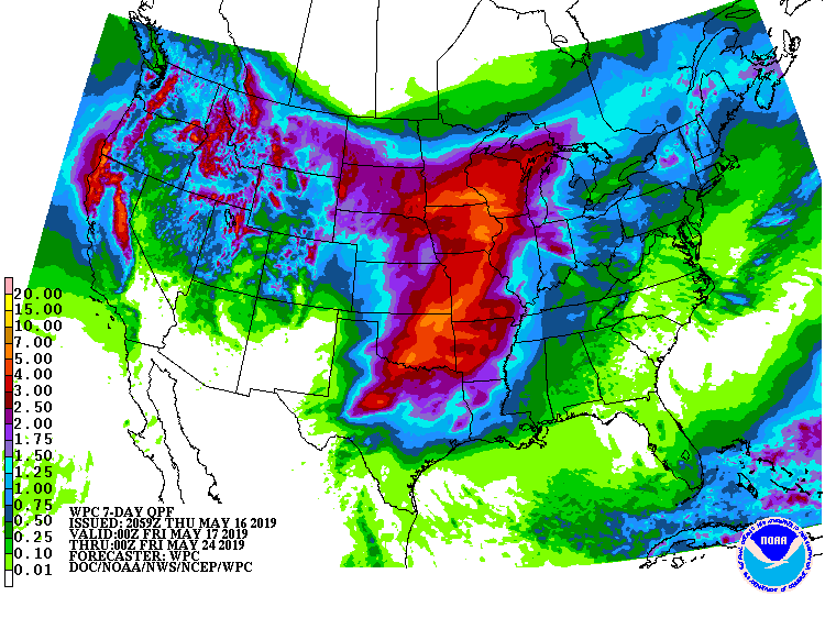
More snow is expected to hit the Tahoe area over the weekend and into early next week.
Accumulating snowfall is likely at Lake Level.
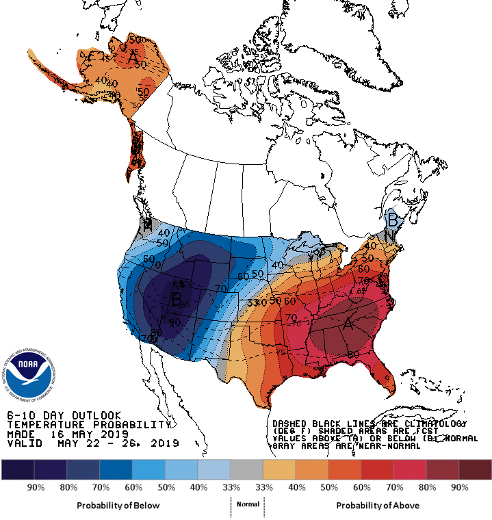
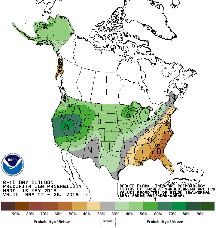
The 6-10 day outlook calls for above average precipitation and below average temperatures in Tahoe.
Additional Storm Info:
Tahoe: 5-10+” of Snow Tonight Above 7,000 Feet
* Total accumulations of 5 to 10 inches above 7000 feet with
  locally higher amounts up to 16 inches possible above 8000
  feet. Accumulations of 1 to 3 inches possible at lake level
  with amounts up to 5 inches possible along and west of highway 89.
- NOAA Reno, NV
Winter Weather Advisory:
URGENT - WINTER WEATHER MESSAGE
National Weather Service Reno NV
255 PM PDT Thu May 16 2019

Greater Lake Tahoe Area-
Including the cities of South Lake Tahoe, Truckee, Stateline,
and Incline Village

...WINTER WEATHER ADVISORY IN EFFECT FROM 6 PM THIS EVENING TO
10 AM PDT FRIDAY...

* WHAT...Period of heavy snow along Sierra passes. Total
  accumulations of 5 to 10 inches above 7000 feet with locally
  higher amounts up to 16 inches possible above 8000 feet.
  Accumulations of 1 to 3 inches possible at lake level with
  amounts up to 5 inches possible along and west of highway 89.
  Ridge winds gusting to 85 mph.

* WHERE...Greater Lake Tahoe Area.

* WHEN...From 6 PM this evening to 10 AM PDT Friday.

* ADDITIONAL DETAILS...Plan on slippery road conditions. The
  hazardous conditions could impact the morning or evening
  commute.