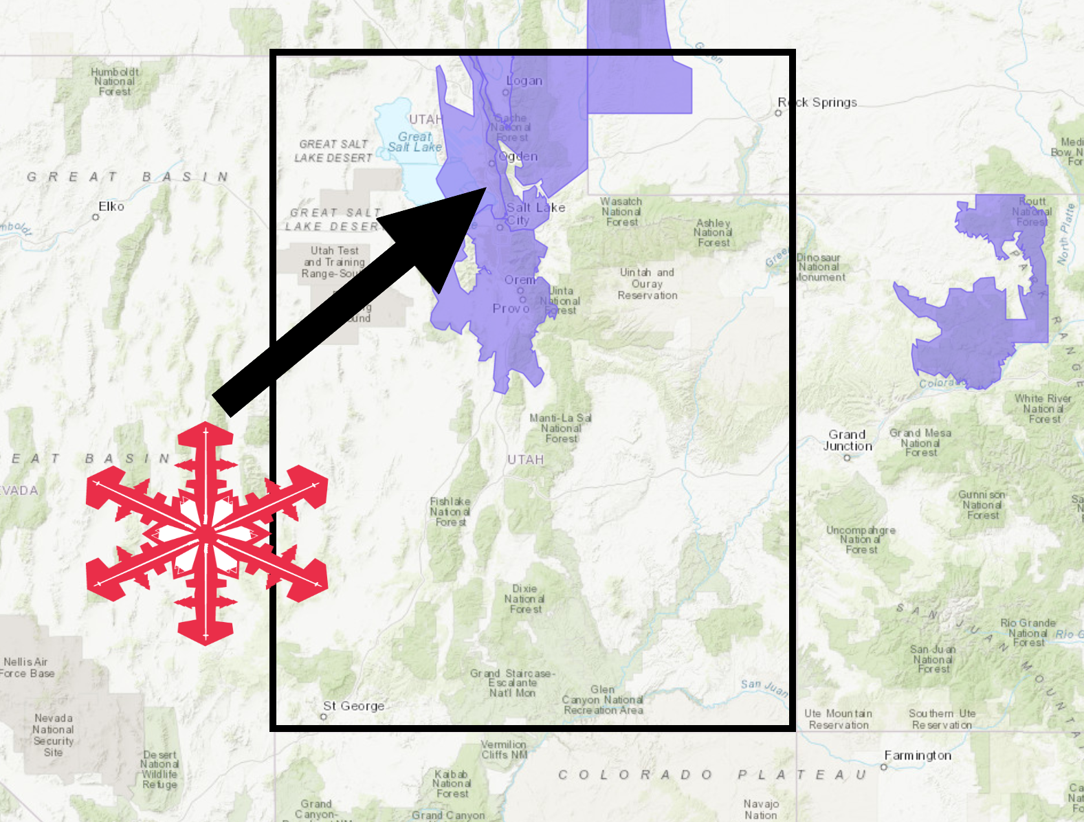
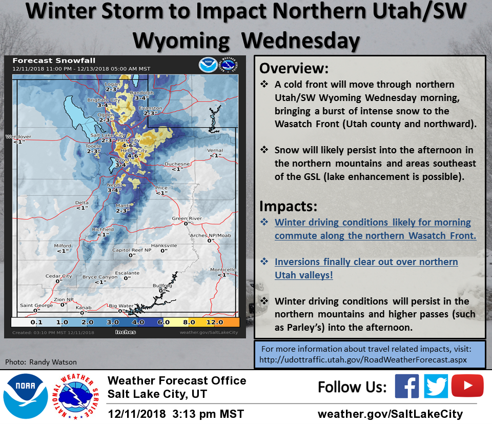
The National Weather Service has issued a Winter Weather Advisory for Utah. It’s in effect throughout the day today. A quick-hitting storm is expected to deliver heavy snow and high winds today.
Utah:
- 5-10+” of Snow Today
“Right now the heaviest snowfall looks likely to impact the morning commute in the Northern Wasatch Front with winter driving conditions expected. Snow will taper off in many locations by Wed. afternoon. However snow will likely linger in the mountains, and there will also be the potential for lingering snow in areas southeast of the GSL.”
– NOAA Salt Lake City, UT
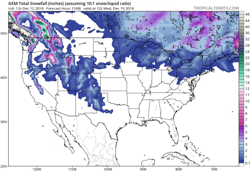
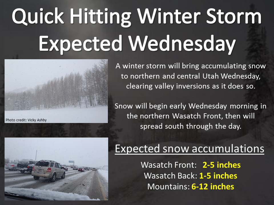
Snow levels are forecasted to hover around 3,000ft today, before dropping tonight.
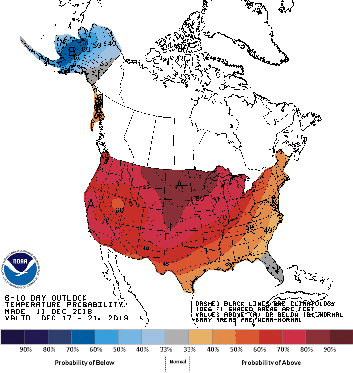
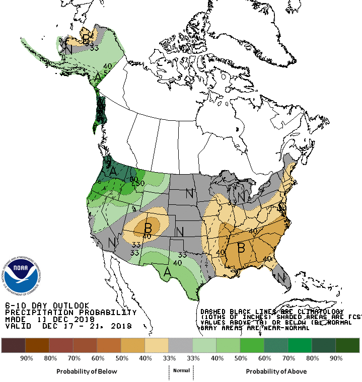
The 6-10 day outlook calls for above average temperatures and below average precipitation in Utah.
Additional Storm Info:
Utah: 5-10+” of Snow Today
* Snow expected. Total snow accumulations of 5 to 10 inches
  expected with locally higher amounts possible.
- NOAA Salt Lake City, UT
Winter Weather Advisory:
URGENT - WINTER WEATHER MESSAGE
National Weather Service Salt Lake City UT
343 AM MST Wed Dec 12 2018

...Fast Moving Winter Storm to Impact Northern Utah Today...

.A storm system moving southeast from the Pacific Northwest will
reach northern Utah early this morning. The associated cold front
will sweep south across the state bringing strong northerly
winds, colder temperatures and snow to northern Utah through
this evening.

Wasatch Mountains South of I-80-
Including the cities of Alta and Brighton

...WINTER WEATHER ADVISORY REMAINS IN EFFECT UNTIL 9 PM MST THIS
EVENING...

* WHAT...Snow expected. Total snow accumulations of 5 to 10 inches
  expected with locally higher amounts possible. Winds gusting as
  high as 45 mph in exposed areas.

* WHERE...Wasatch Mountains South of I-80.

* WHEN...From 6 AM to 9 PM MST today.

* ADDITIONAL DETAILS...Plan on snow packed and slippery road
  conditions. Gusty winds could create areas of blowing and
  drifting snow.