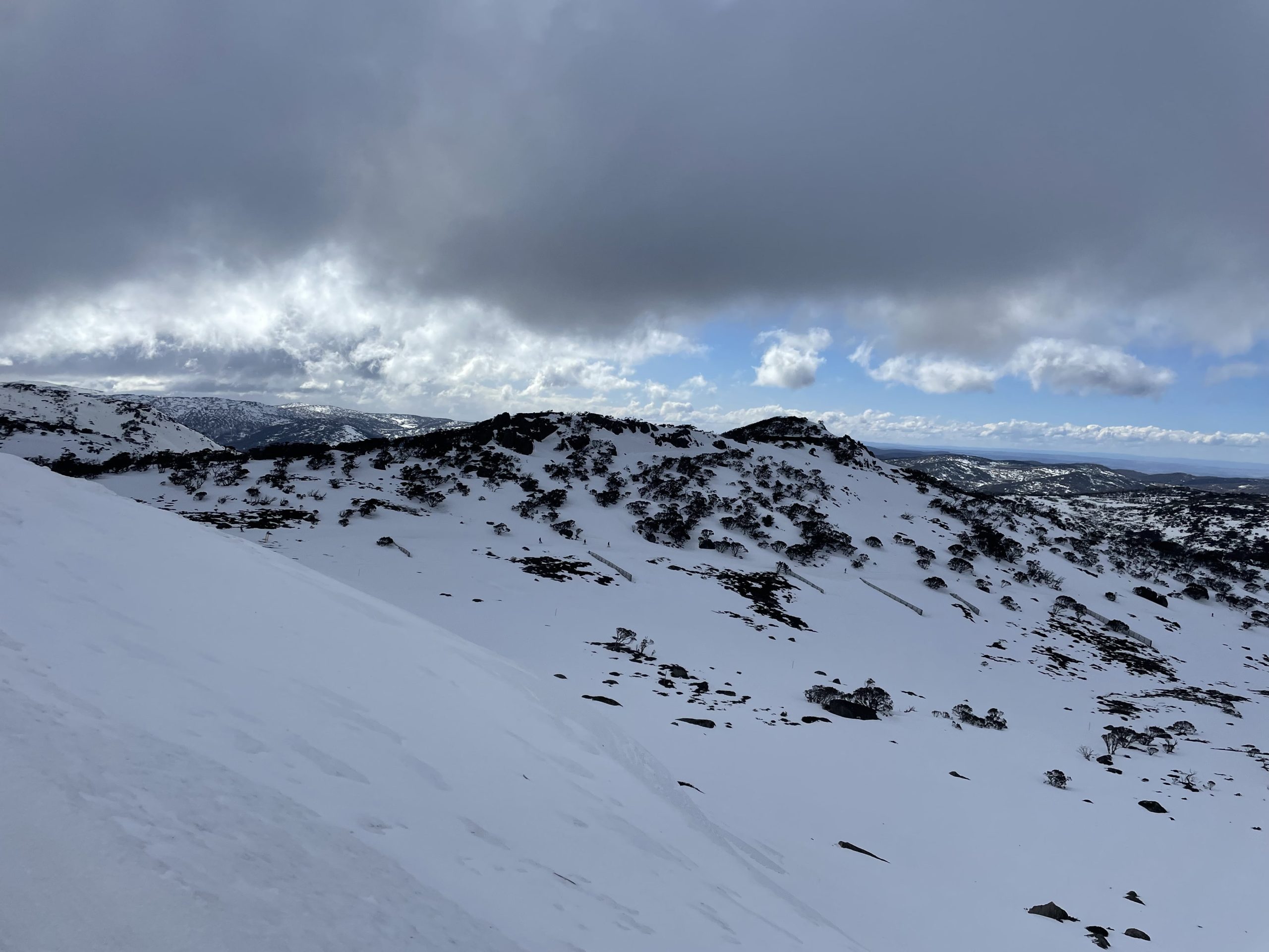
The Snowy Mountains were hit by a complex low pressure system dropping approximately 175mm (7 in) of rain in the snow fields on Wednesday and Thursday, resulting in a closure of the Thredbo Ski resort yesterday. You may have seen some scary footage from the Perisher skitube yesterday looking more like the Niagra Falls, so you will be pleased to hear that the worst of the storm has passed and the damage is not as bad as anticipated. Top to bottom cover remains in place everywhere on the mountain and ski conditions remain excellent.
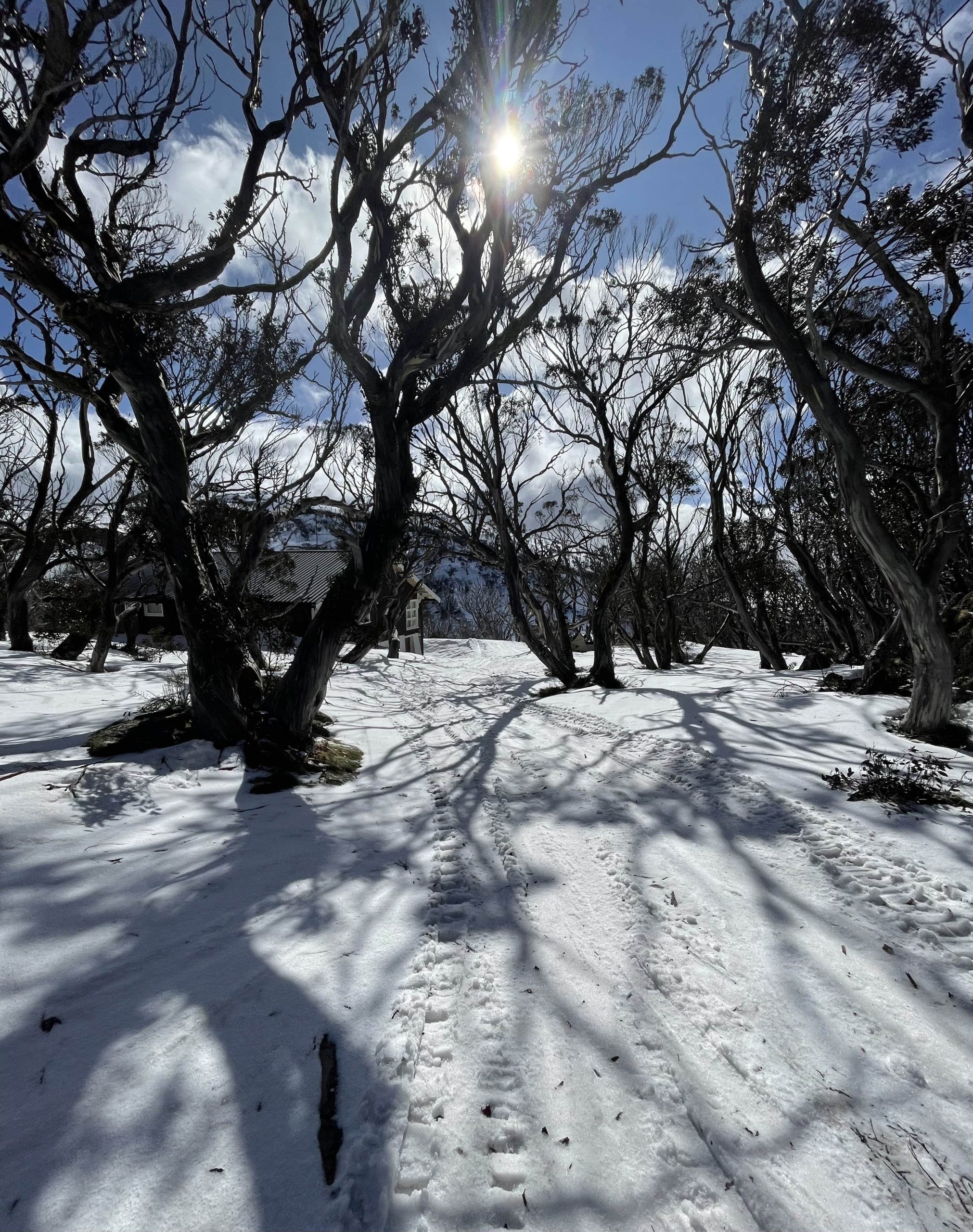
Snow is sugary and soft as last night did not reach the freezing point, so despite still being winter, it felt like spring skiing. All in all the cover has held up everywhere. Amongst the trees you will find shreds of bark and leaves ripped off the snowgum trees by the wind. All runs were open this morning with the exception of Olympic. Even the Excellerator run, which goes down to 1,605 (5,266 ft) making it the lowest point in the resort, held up nicely all the way to the bottom. I had some lovely turns down Kamikaze before moving on from Blue Cow to Perisher As the day progressed, chair after chair went on wind-hold but there was excellent skiing to be had in the morning. Throughout the day precipitation came down in the form of sago. Not pleasant but at least it wasn’t rain.
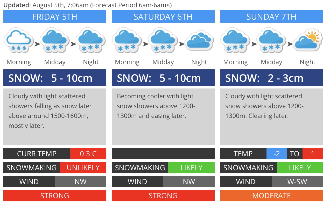
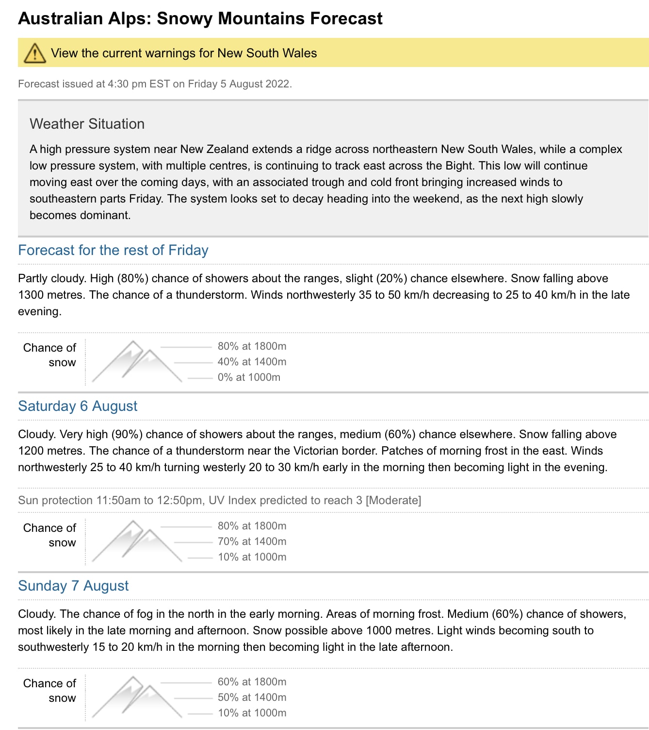
A severe weather warning remains in place by the Australian Bureau of Meteorology (“BOM”) for damaging winds as the low pressure system keeps moving east across the Bight. Luckily a cold front is on its way, dropping temperatures so we can expect some snow in the next 2-3 days down to 1,100-1,200m (3,609-3,937ft). This should help top up the current natural snow height which still measures 103cm (40.5in) at Spencer’s Creek. Forecasts for the weekend range from 15 to 30cm (6-12 in) of snow.