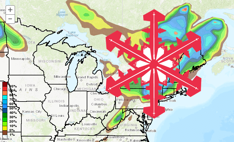
A large area of the Northeast is bracing for an unusually late-season blast of Arctic air courtesy of the polar vortex this weekend. Over 6″ of fresh snow could hit higher elevations of New England over the weekend, a rarity for this time of year.
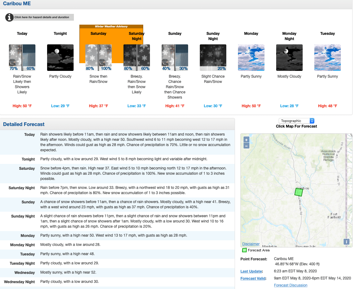
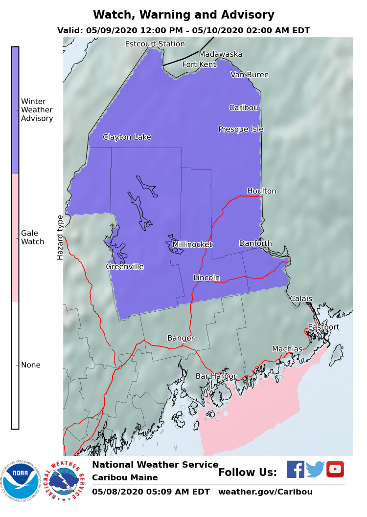
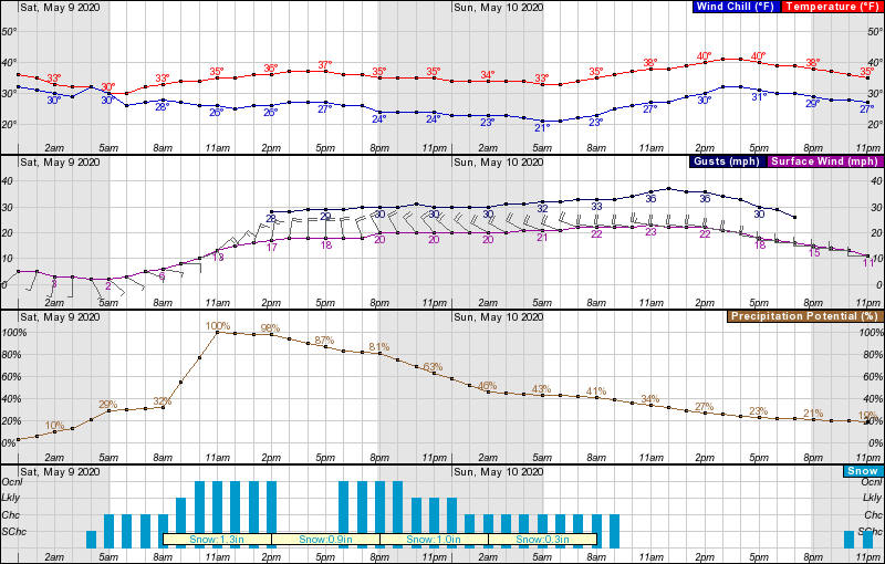
A winter weather advisory will be in effect throughout Saturday, with cold, wind, and snow expected for Mother’s Day weekend. Temperatures are expected to drop to the mid-40s, with some areas possibly going as low as the mid-20s by Sunday
...WINTER WEATHER ADVISORY IN EFFECT FROM 6 AM SATURDAY TO 2 AM
EDT SUNDAY...
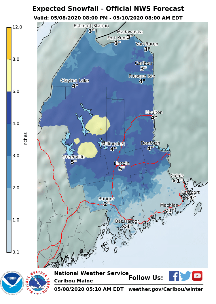
* WHAT...Snow expected. Total snow accumulations of 3 to 5 inches
expected. Winds gusting as high as 35 mph.
* WHERE...Northwest Aroostook and Northeast Aroostook Counties.
* WHEN...From 6 AM Saturday to 2 AM EDT Sunday.
* ADDITIONAL DETAILS...Plan on slippery road conditions. Heavy wet
snow on trees and power lines along with the gusty winds could
lead to possible power outages later Saturday into Sunday.
PRECAUTIONARY/PREPAREDNESS ACTIONS...
A Winter Weather Advisory for snow means periods of snow will
cause primarily travel difficulties. Expect snow covered roads
and limited visibilities, and use caution while driving.
The latest road conditions for Maine can be obtained by going to
newengland511.org.
As well as Maine, from Atlanta to Detroit to New York to Boston will be colder than parts of Alaska this weekend. Pittsburgh, Detroit, Washington, DC, and Buffalo will challenge low-temperature records, reports AccuWeather.
The NOAA forecast discussion states:
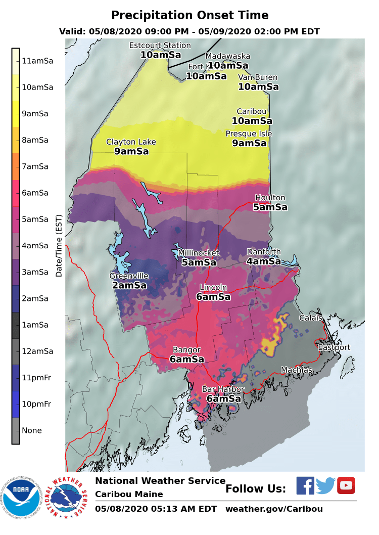
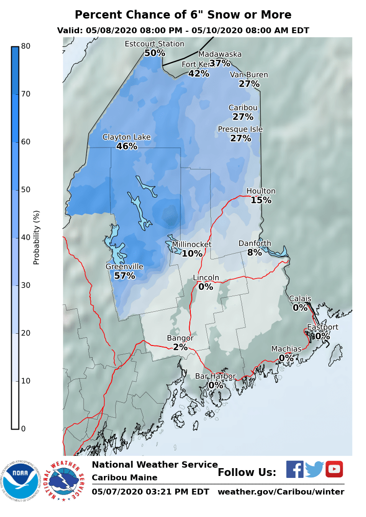
Snow accumulations
will occur Saturday. Gusty winds will also occur Saturday into
Saturday night. Heavy wet snow on trees and power lines along
with the gusty winds will lead to the risk of power outages.
The surface/upper low then lift across the Gulf of Saint
Lawrence Saturday night. Snow will persist across
northern/central portions of the forecast area early Saturday
night then taper to snow showers overnight, with additional
light snow accumulation possible. Across Downeast areas, expect
the rain will transition back to snow early Saturday night
before tapering to snow showers with little accumulation. Storm
total snow accumulations within the advisory area are generally
expected to range from 3 to 6 inches. though locally greater
accumulations are possible particularly across higher terrain
areas.
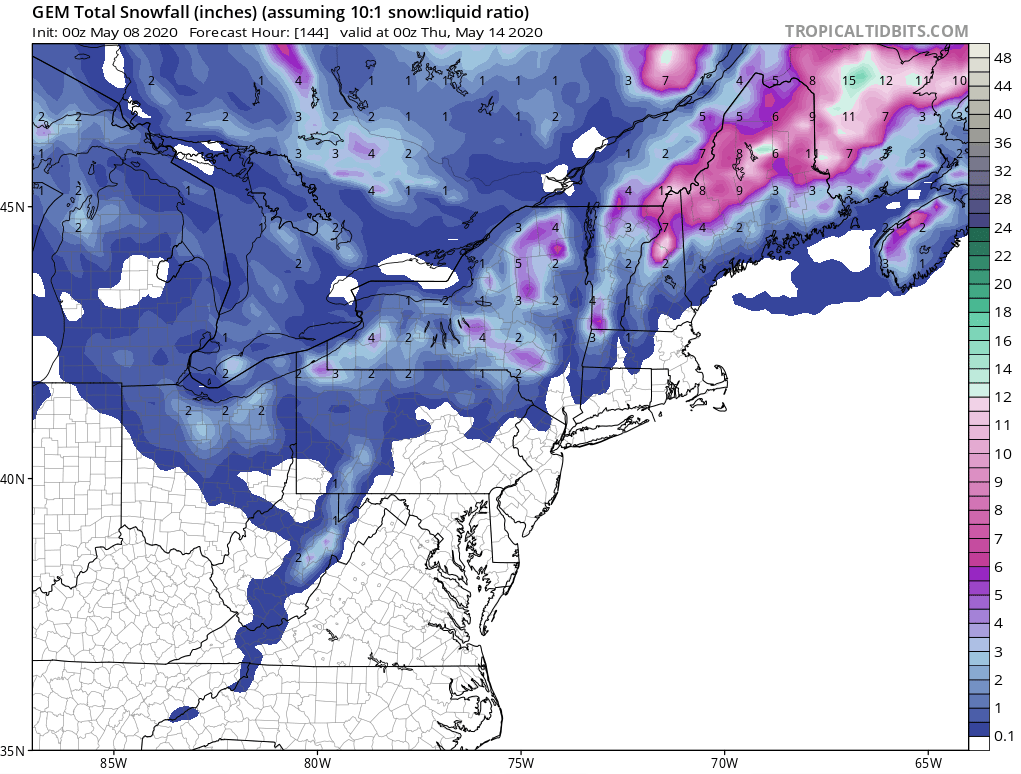
GEM Snowfall Totals Forecast:
Other Info: