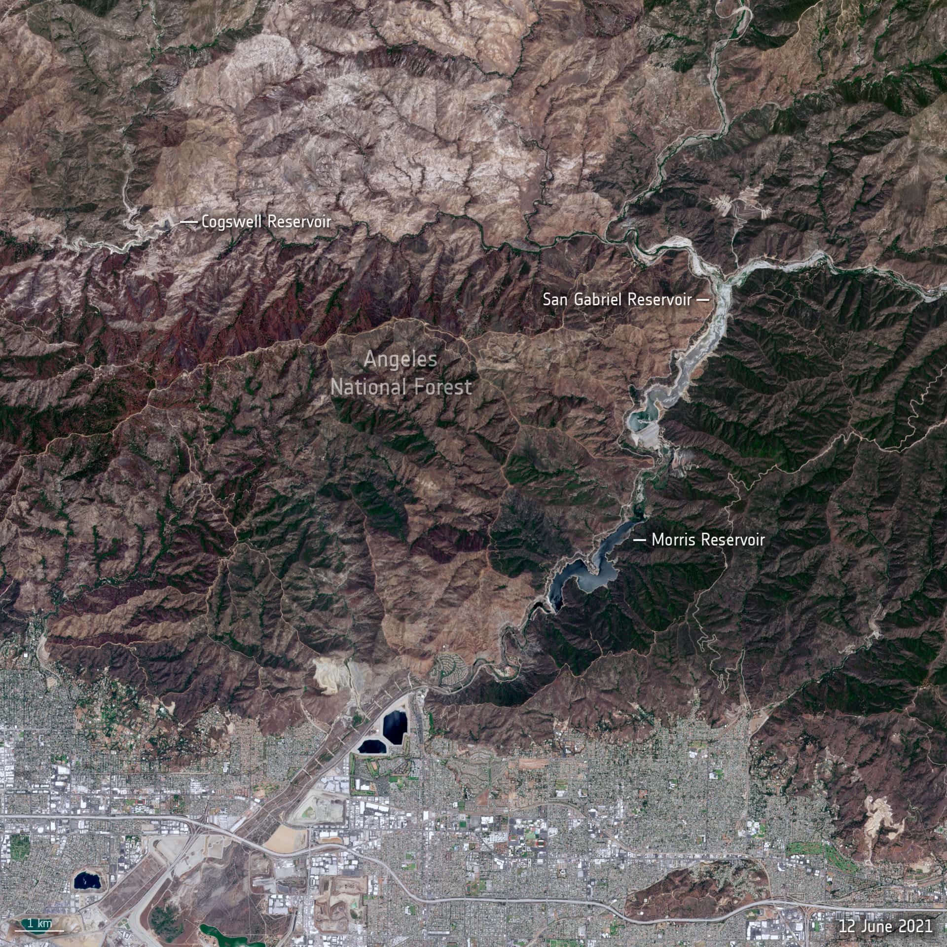
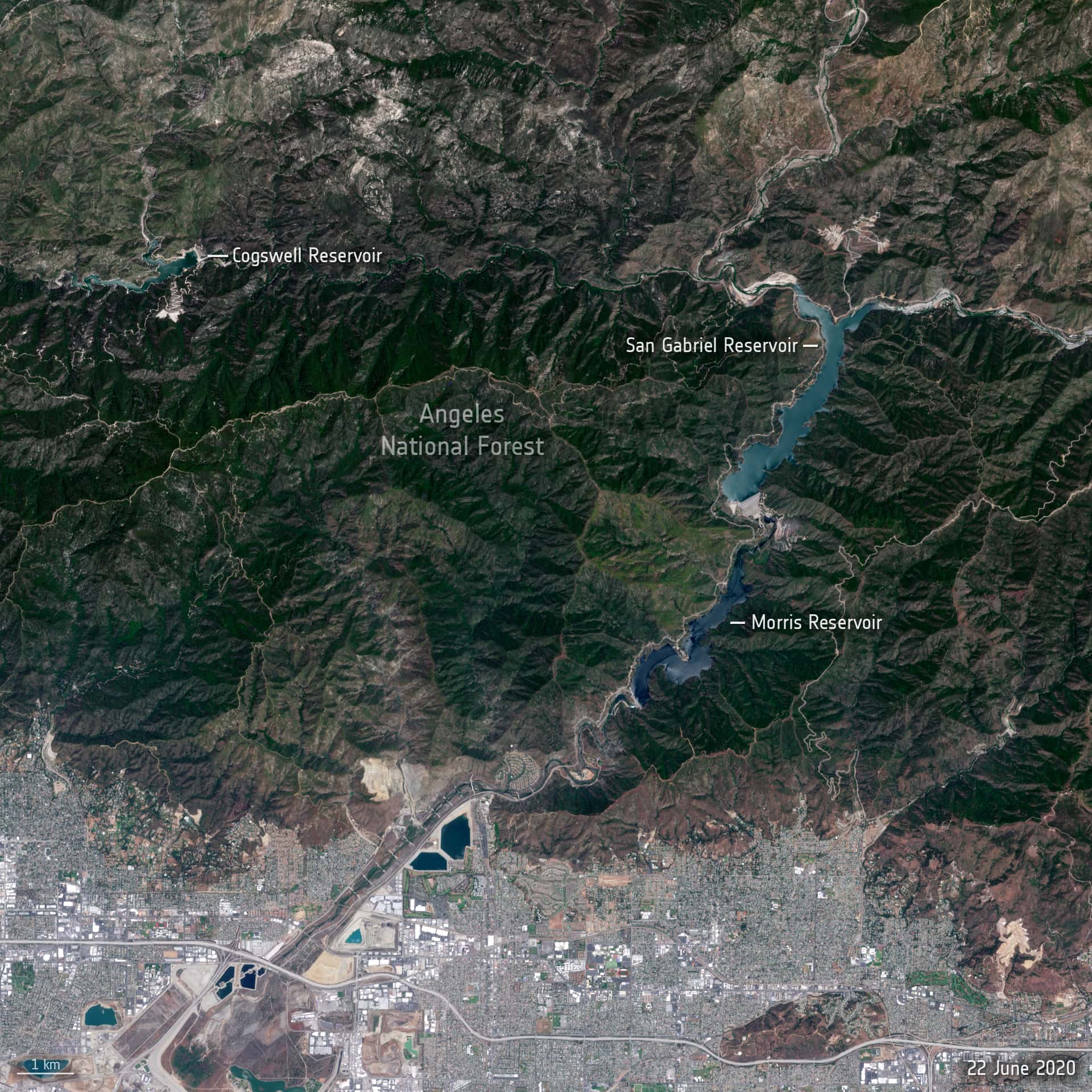
While you can never draw any conclusions about trends or the effects of climate change by comparing the weather in one year to another year, these two images, just one year apart, certainly offer a shocking view of the relentless drought that is gripping California. California is no stranger to heat and water shortages, but vast swathes of western U.S. are experiencing extremely dry conditions, the likes of which haven’t been seen there since 1977.
The two images were captured by the Copernicus Sentinel-2 mission. The image above is from 12 June 2021 and the image below is from 22 June 2020. The difference is clear to see, not only is the Angeles National Forest brown and at high risk of fire compared to the lush green of last year, but water in the reservoirs is severely depleted. In fact, the reservoirs are about 50% lower than they should be at this time of year, and the San Gabriel reservoir is almost dry. California is reported to have recorded its driest February in 150 years and 95% of the state is now a victim of ‘severe drought’, which, unfortunately, can only be bad news for the rest of the summer.
im sure removing dams will help the state’s water crisis
https://www.bbc.com/future/article/20201110-the-largest-dam-removal-project-in-american-history
Here’s a link to actions taken by the government to release additional water during drought to protect endangered fish: https://wildlife.ca.gov/Drought/Projects
Your statement about not having any sites left for new damns is incredibly ignorant. Not sure where you came up with that. New damns aren’t build because environmentalists sue the government and utility companies to prevent them.
Vegas just outlawed decorative grass lawns to help conserve water. Maybe California should do the same.
Satellite photos show how California’s population has tripled over the last 60 years, but for some reason they have not built any new water storage in the state. I wonder why they haven’t built any new water storage in the state?
Short answer, all the best dam sites in the state are taken. They were all built in the 1940s, 50s and 60s when we needed dams to prevent catastrophic local flooding.
The modern strategy is to invest more in below ground storage and off stream reservoirs.
But I think you already blamed it on the endangered species act or something.
The dams and entire irrigation network of California was built for farming and to retain and distribute water to growing cities like LA. Please do yourself a favor and open up a few history books. Ones with lots of pictures will help you out.
https://www.ppic.org/publication/dams-in-california/
Oh wow look. Look there’s still dam sites.