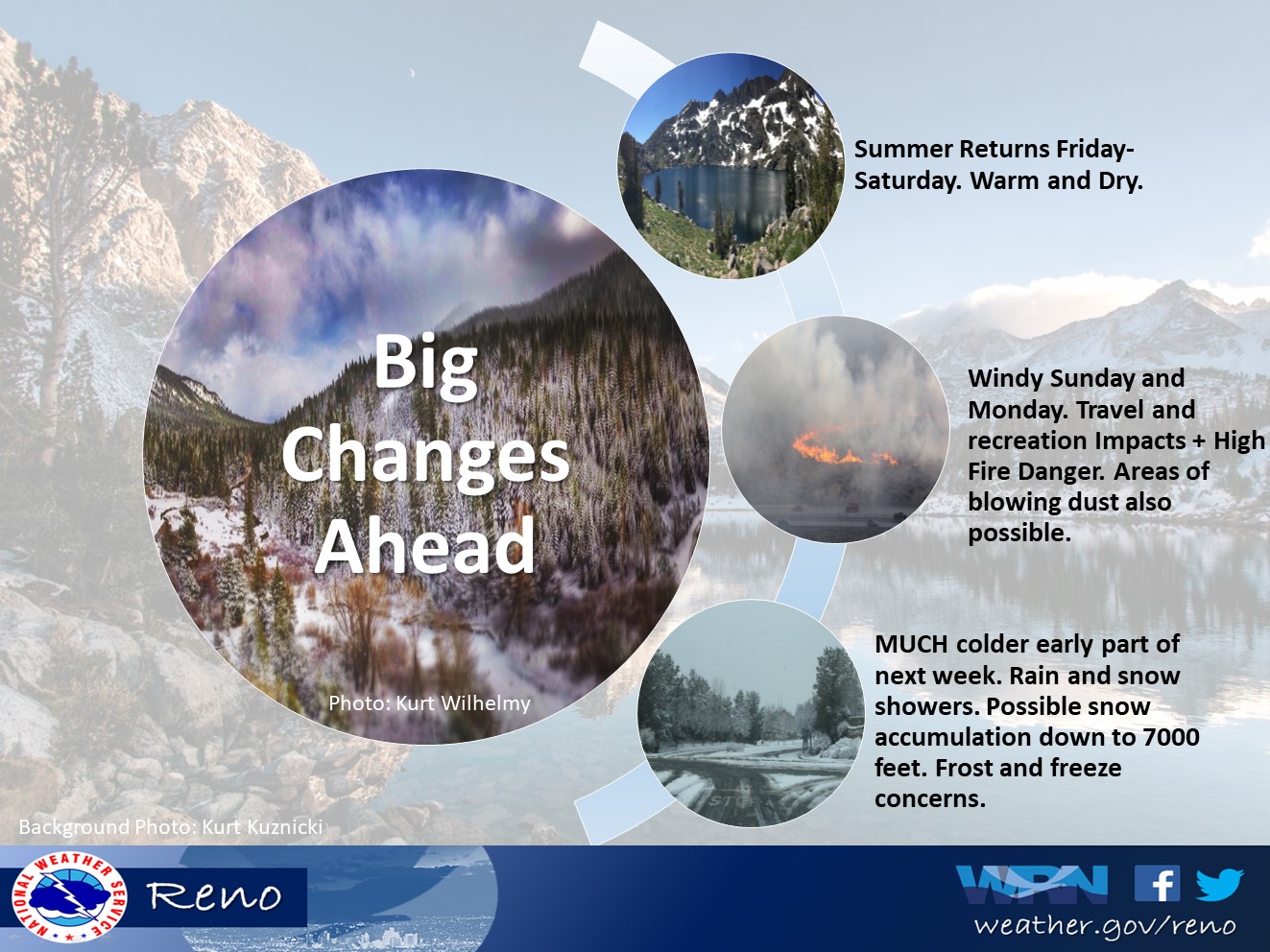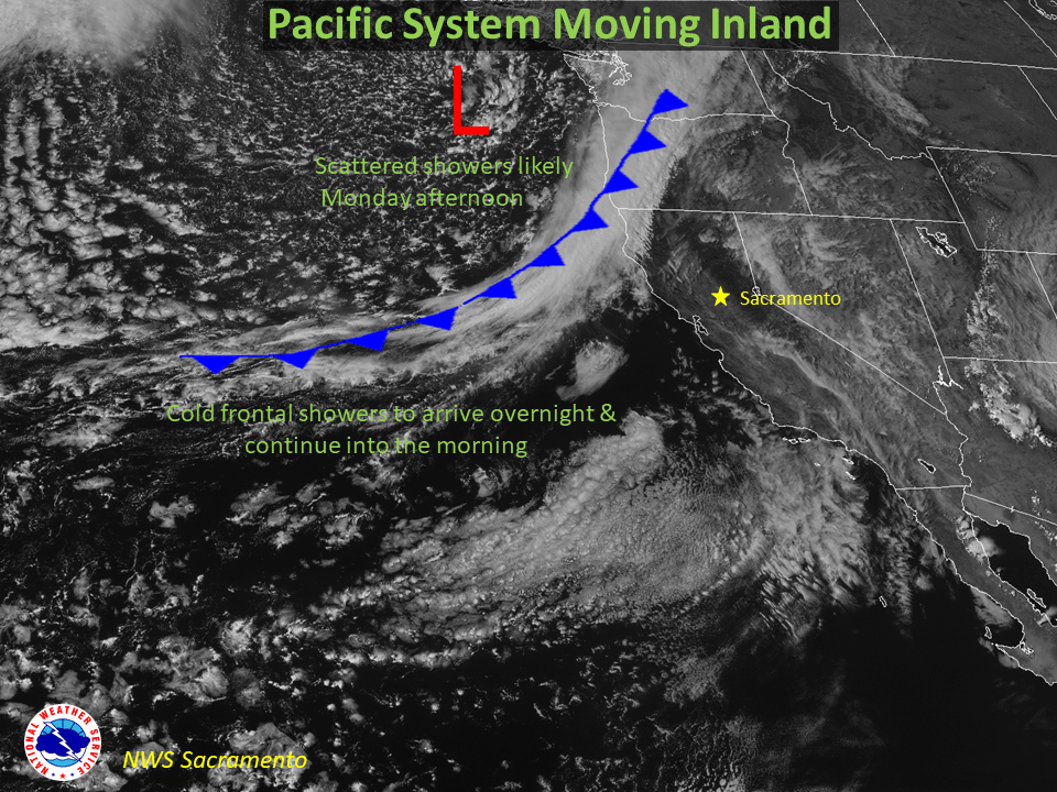
Northern California might start to experience what feels like winter early this week, as a strong cold front makes its way through the Sierra and western Nevada. High elevation snow is possible through Monday afternoon.
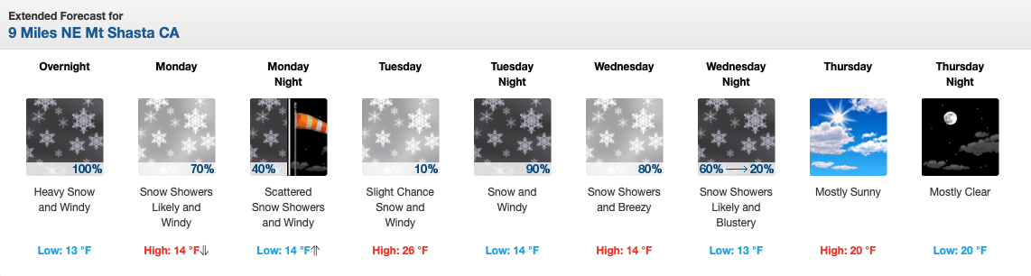
Mount Shasta could see up to a FOOT of fresh snow early Monday morning and the potential for yet another 12″ Tuesday night through Thursday morning.
Much cooler temperatures will prevail Monday with frosts and freezes possible in outlying and rural lower elevation areas Tuesday morning, with freezes expected for Sierra valleys. Another storm system is possible Wednesday into Thursday with more showers and breezy winds.
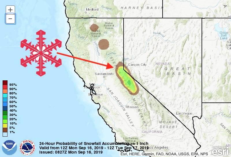
High elevation snowfall will move through the Tahoe Basin and the Reno, Carson City, Carson Valley corridor around noon. As far south as Tioga Pass might see a couple of inches, but it looks like Mammoth Mountain will just miss out.
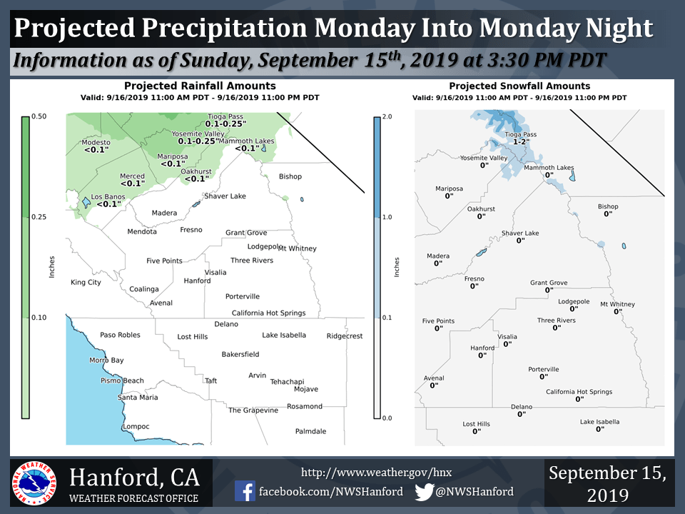
Light snow accumulations will also be possible mainly above 8,000-8,500` but not looking much for than an inch or two. Any snow that falls on roadways will be short-lived and quick to melt due to time of year and relatively warm ground.