This post first appeared on NASA Earth Observatory and was written by Adam Voiland.
Smoke from fires raging in central and western North America has spread widely across the continent. Skies have turned hazy in cities ranging from Boston to Washington, D.C., as smoke from fires in Canada’s Manitoba and Ontario provinces poured into the U.S. Northeast.
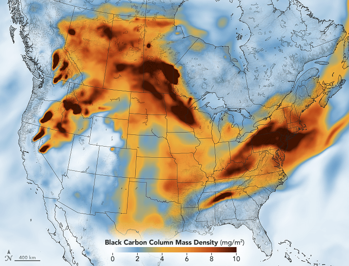
This map shows the concentration of black carbon particulates—commonly called soot—over North America on July 21, 2021. The black carbon data come from the GEOS forward processing (GEOS-FP) model, which assimilates data from satellite, aircraft, and ground-based observing systems. To simulate black carbon, modelers include satellite observations of aerosols and fires. GEOS-FP also ingests meteorological data like air temperature, moisture, and winds to simulate the plume’s behavior.
Dense plumes of black carbon are also visible, streaming from fires in British Columbia, Oregon, Washington, and California.
NASA Earth Observatory image by Joshua Stevens, using GEOS-5 data from the Global Modeling and Assimilation Office at NASA GSFC.