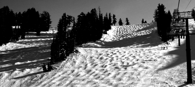
With the winds picking up as the storm approaches Tahoe, Squaw saw some chalky goodness today which has been conspicuously absent thus far in the season. In particular, the top half of Shirley Lake was harboring some sweet and smooth turns in places (while in other places she was harboring some sporadic and rather icy bumps). Lift Maintenance has also begun stringing the chairs on KT, a sign that they are making moves to get The Mothership back online!
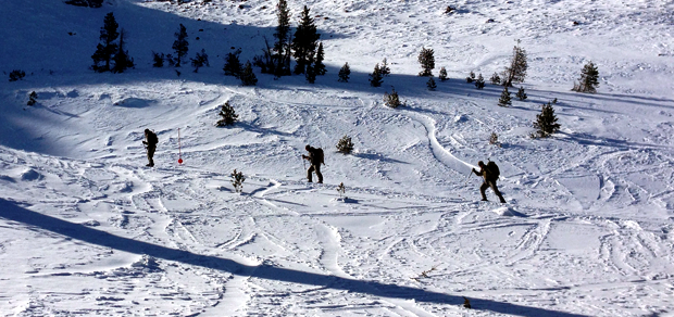
Hiking along Siberia Ridge was also closed today, which was somewhat unfortunate as the wind had buffed and smoothed things out. However, the Pocket did remain open today and was harboring some of the best turns on the mountain. With a strong West wind, the snow was pouring off the ridge and making for some powder like turns at squaw. You can see some of the goodness to be had in Mainline Pocket in the video above.
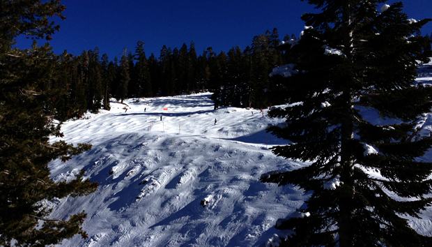
Overall Squaw was skiing quite fun, and it’s about to get a lot more fun as we move into the weekend. The models are finally in agreement, and things are about to get snowy in Tahoe.
Here’s what NOAA has to say about the upcoming storm:
THE NATIONAL WEATHER SERVICE IN RENO HAS ISSUED A WINTER WEATHER
ADVISORY FOR SNOW...WHICH IS IN EFFECT FROM 4 AM TO 10 PM PST
THURSDAY.

* TIMING: SNOW WILL DEVELOP THURSDAY MORNING ACROSS THE TAHOE
  BASIN AND CONTINUE INTO THE EVENING BEFORE ENDING.

* SNOW ACCUMULATIONS: 2 TO 6 INCHES AT LAKE LEVEL WITH 5 TO 10
  INCHES ABOVE 7000 FEET.

* IMPACTS: SNOW WILL CREATE SLICK DRIVING CONDITIONS ON AREA
  HIGHWAYS THURSDAY. ROADS AFFECTED INCLUDE INTERSTATE 80...U.S.
  50 AND CALIFORNIA 88.

And here’s the forecast for the top of Granite Chief Peak through Saturday night:
- Tonight: A 30 percent chance of snow showers after 10pm. Mostly cloudy, with a low around 20. Southwest wind 11 to 15 mph, with gusts as high as 23 mph. Total nighttime snow accumulation of 1 to 3 inches possible.
- Thursday: Snow showers. High near 26. Southwest wind 15 to 18 mph, with gusts as high as 28 mph. Chance of precipitation is 100%. New snow accumulation of 4 to 8 inches possible.
- Thursday Night: Snow showers likely, mainly before 10pm. Mostly cloudy, with a low around 21. Breezy, with a southwest wind 20 to 24 mph, with gusts as high as 37 mph. Chance of precipitation is 70%. New snow accumulation of 1 to 2 inches possible.
- Friday: Snow showers likely. Cloudy, with a high near 29. Windy, with a southwest wind around 31 mph, with gusts as high as 47 mph. Chance of precipitation is 60%. New snow accumulation of 3 to 5 inches possible.
- Friday Night: Snow. Low around 27. Windy, with a southwest wind 34 to 37 mph, with gusts as high as 55 mph. Chance of precipitation is 100%. New snow accumulation of 7 to 11 inches possible.
- Saturday: Snow. High near 33. Windy. Chance of precipitation is 90%. New snow accumulation of 5 to 9 inches possible.
- Saturday Night: Snow. Low around 30. Windy. Chance of precipitation is 80%. New snow accumulation of 3 to 5 inches possible.
If we get the upper end of NOAA’s prediction, we’re looking at over 40″ of new snow for the upper mountain by Saturday night. Stay tuned, things are about to get good folks!