Forecast By Eric McNamee 3/19/2020 3:00 PM
Summary:
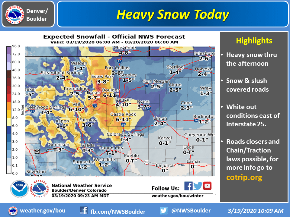
Places like Winter Park, Loveland Ski Area, and Arapahoe Basin will see snowfall totals of 12-18″, with most of that falling today.
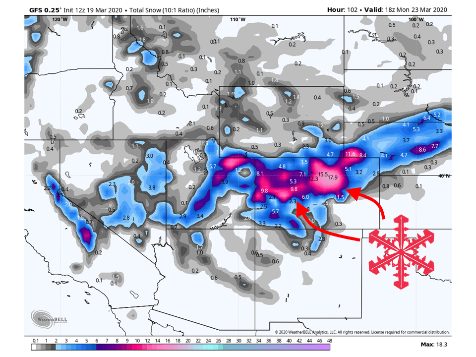
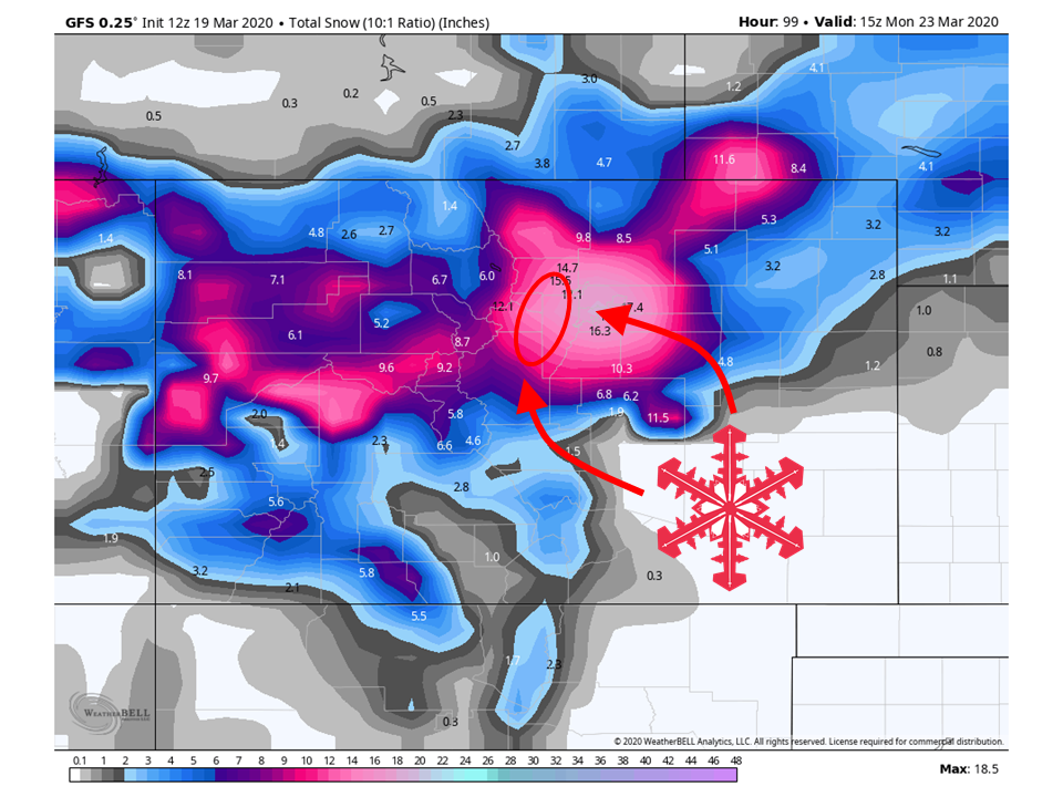
Mountains across Colorado are going to get SLAMMED by a classic Front Range winter storm today and linger through the weekend.
Travel will be dicey so make sure to drive with caution.
Forecast:
Areas like Winter Park, Loveland Ski Area, and Arapahoe Basin will see snowfall totals in the 12-18″ range.
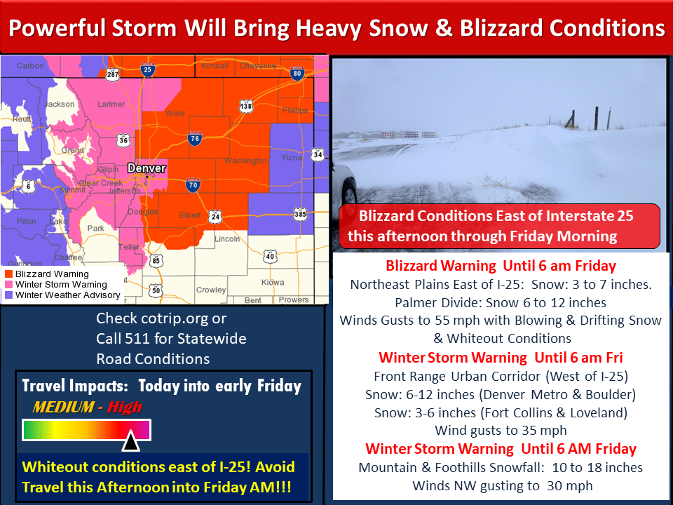
A strong surface low has formed along the front range and will bring HEAVY Snow and strong winds, with most of that snow falling today.
Where this low has developed, the closer you are to the Front Range, the higher the snowfall totals will be.
Because of this, Winter Storm Warnings are out for most mountains along the Front Range, with Blizzard Warnings out towards the plains.
Once this low moves off to the east, snowfall rates will lighten up quite a bit.
However, with instability around and a weak shortwave trough making its way through the state, showers will linger through the weekend.
Conditions are going to be pretty dicey so make sure to drive with caution if you do go up.
Avalanche Forecast:
Avalanche conditions will be heightened through the weekend. The Colorado Avalanche Center currently has ‘considerable‘ avalanche conditions for most mountains across the state. Please make sure to monitor the conditions and stay posted for avalanche forecasts.