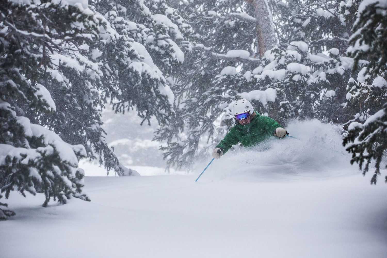
There is only one ski area that is still open in Colorado and they are going to get pummeled with snow through Friday. Arapahoe Basin is getting the best of both worlds, a cold front and a very potent winter storm. If you’re looking for powder late this week and into the weekend, you know where to go.
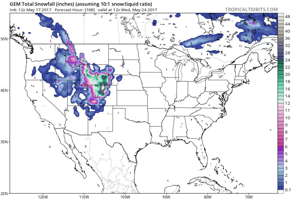
Over 3 FEET of snow is possible at Arapahoe Basin Ski Area, CO.
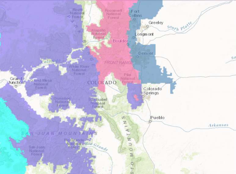
Snow levels are expected to begin around 9000ft and drop down to the valley floors Thursday as the Denver area could see accumulating snowfall.
Additional Storm Information:
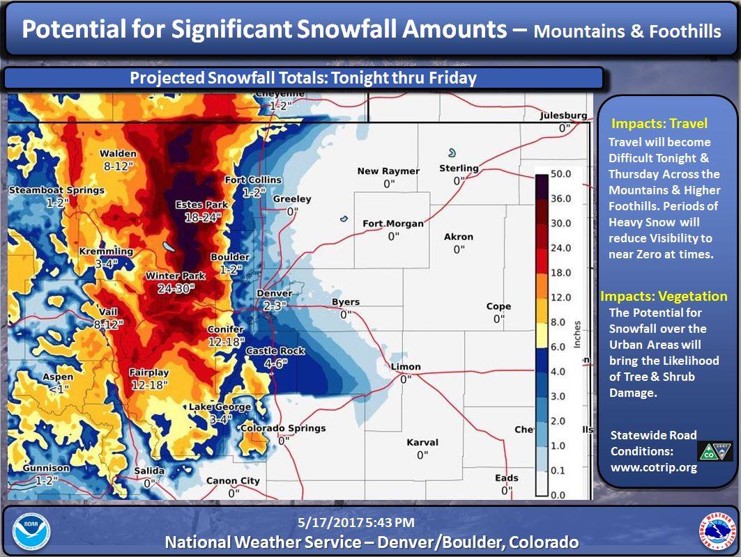
Arapahoe Basin, CO: Up To 3 FEET of Snow Through Friday
* SNOW ACCUMULATIONS...12 to 24 inches of snow expected with up
  to 36 inches on favored east slopes, including Rocky Mountain
  National Park.
- NOAA Denver, CO


Arapahoe Basin Winter Storm Warning:
URGENT - WINTER WEATHER MESSAGE
National Weather Service Denver/Boulder CO
713 PM MDT Wed May 17 2017

...HEAVY SNOW EXPECTED FOR THE MOUNTAINS AND NORTHERN FRONT RANGE
FOOTHILLS THROUGH FRIDAY...

A strong spring storm will drop south across the Great Basin
tonight and Thursday. It then moves slowly east across Colorado
Thursday night through Friday evening. Significant snow is
expected with this storm if it continues on the current forecasted
track. If the storm track moves further north, then the Southern
Front Range Foothills may receive much less snowfall.

This storm is expected to bring rain and possibly snow to the
Urban Corridor including the Denver Metro area. The coldest air
and best chance for snow is expected to be Thursday night and
Friday for the Denver area. Significant snow for the Denver area
is possible.

South and East Jackson/Larimer/North and Northeast Grand/
Northwest Boulder Counties Above 9000 Feet-
South and Southeast Grand/West Central and Southwest Boulder/
Gilpin/Clear Creek/Summit/North and West Park Counties Above
9000 Feet-

...WINTER STORM WARNING REMAINS IN EFFECT UNTIL 6 PM MDT FRIDAY...

* TIMING...snow will become widespread tonight and is expected to
  to continue through Friday afternoon.

* SNOW ACCUMULATIONS...12 to 24 inches of snow expected with up
  to 36 inches on favored east slopes, including Rocky Mountain
  National Park.

* WIND/VISIBILITY...Visibility will fall below a quarter mile in
  heavy snow.

* IMPACTS...Roads will become snow and slush covered. Wet snow
  may accumulate on leafed out trees, resulting in broken tree
  limbs and power outages.