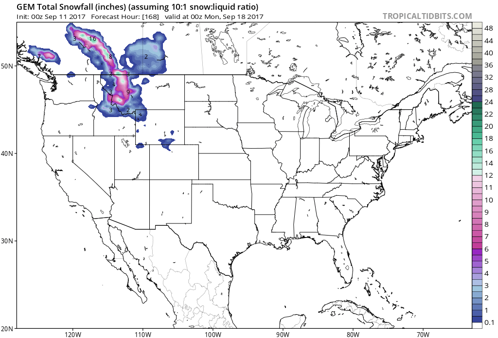
It’s only the beginning of September and the forecasts are calling for substantial snow in the Western half of the US. Snow levels are expected to be around 11,000ft in Colorado and relatively high in the other states as well. Montana could see up to 1 foot of snow in the next 7 days.
State By State Forecasts:
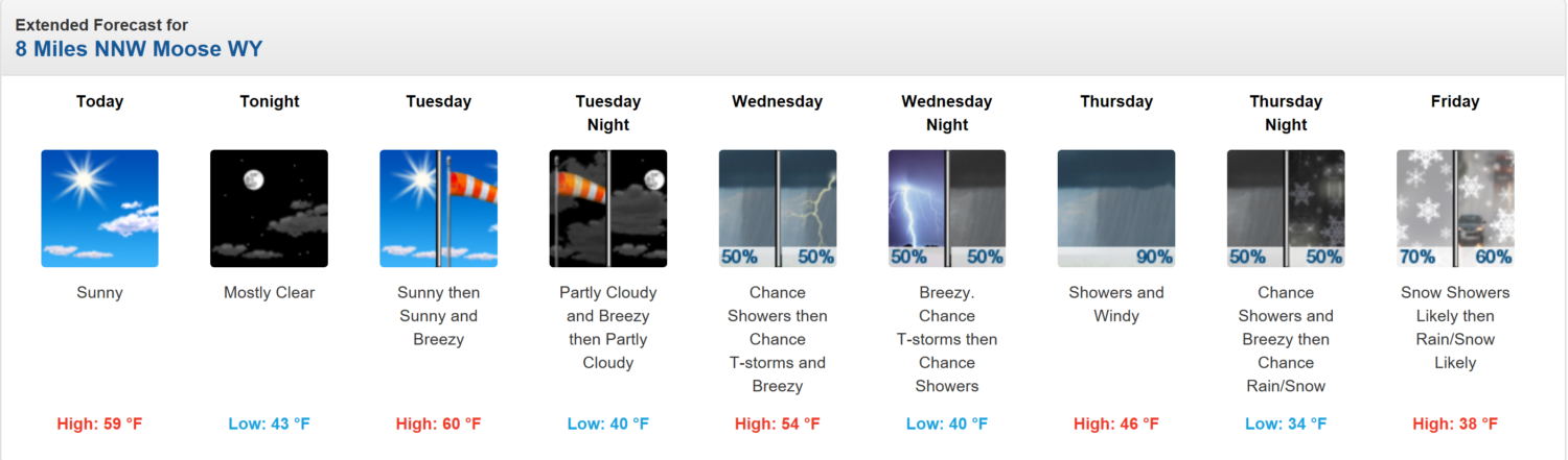
Granite Peak, MT Forecast. Image: NOAA
Granite Peak, MT: Up To 1 Foot of Snow In The Next 7 Days
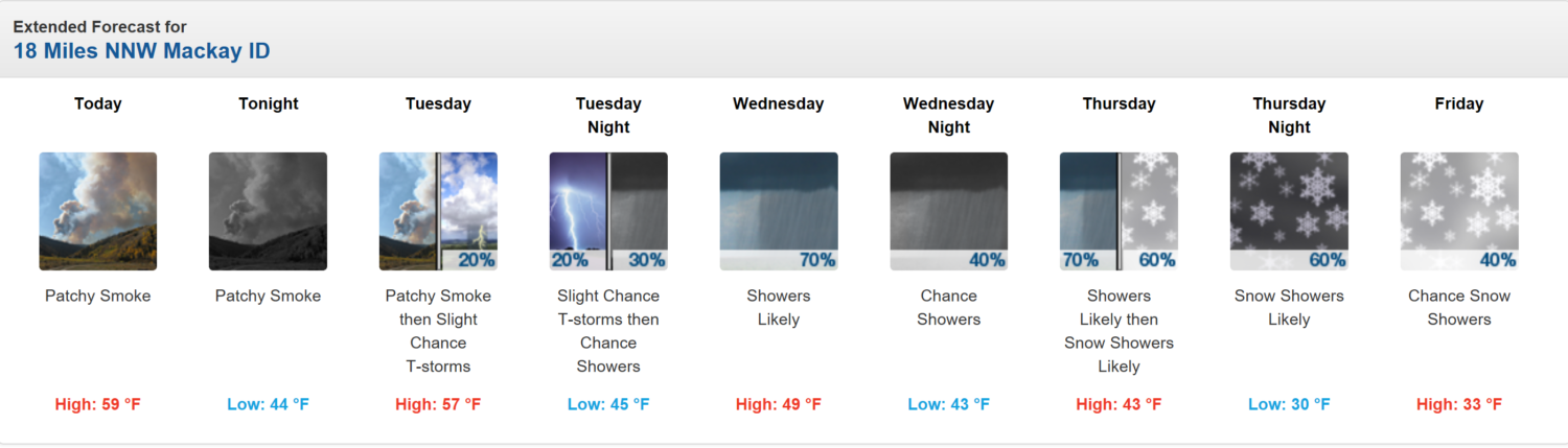
Borah Peak, ID Forecast. Image: NOAA
Borah Peak, ID: Up To 5″ of Snow In The Next 7 Days
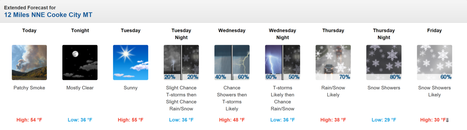
Grand Teton, WY Forecast. Image: NOAA
Grand Teton, WY: Up To 3″ of Snow In The Next 7 Days
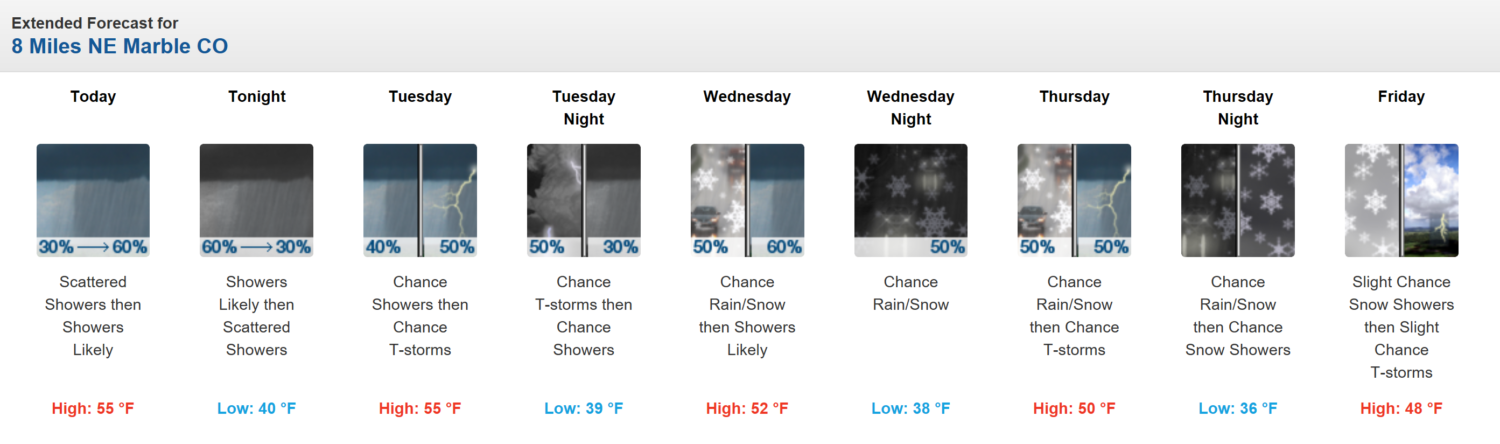
Capitol Peak, CO Forecast. Image: NOAA
Capitol Peak, CO: Up To 2″ of Snow In The Next 7 Days
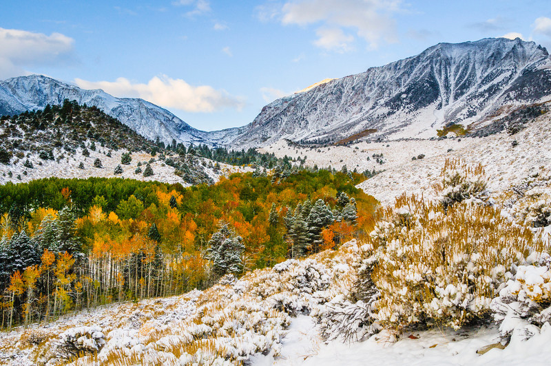
Sierra Snow in the fall. Image: jharrison photo
Montana Hazardous Weather Outlook:
Hazardous Weather Outlook
National Weather Service Billings MT
340 AM MDT Mon Sep 11 2017

This Hazardous Weather Outlook is for portions of central
Montana...south central Montana...southeast Montana and north
central Wyoming.

* Potential Impacts:  Significant Weather Change.

* Timing: Wednesday night through Saturday.

* Rainfall: Shower chances will increase Wednesday night with rain
  becoming likely Thursday through Friday for a large part of
  southern Montana and northern Wyoming. At this time, it appears
  the best chance of rainfall amounts exceeding an inch are
  locations west of a line from Forsyth to Sheridan. Rain chances
  will continue on Saturday.

* Temperatures: High temperatures will be limited to the upper 60s
  to mid 70s on Thursday, with only mid 50s to mid 60s likely
  Friday and Saturday.

* Mountain snowfall: Light mountain snowfall is possible Thursday
  night and again Friday night, which could impact the Beartooth
  Pass.