Forecast By SnowBrains Chief Meteorologist – Eric McNamee
11:20 PM MST, 4/21/2022
Forecast Summary:
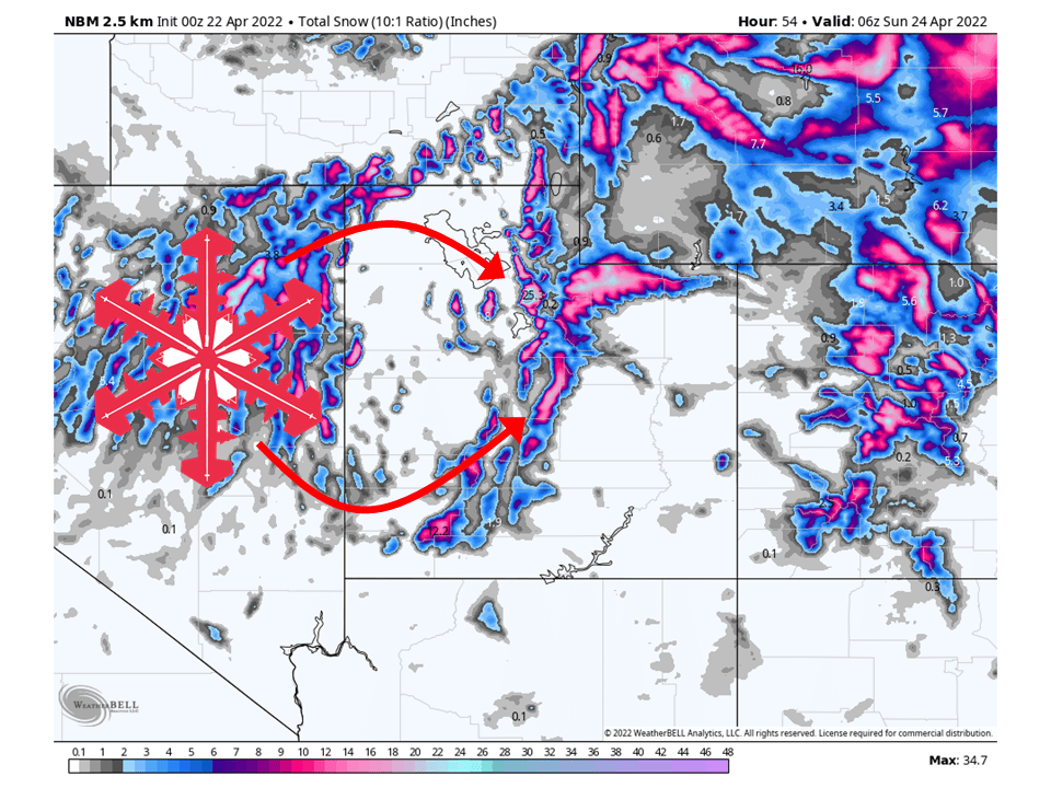
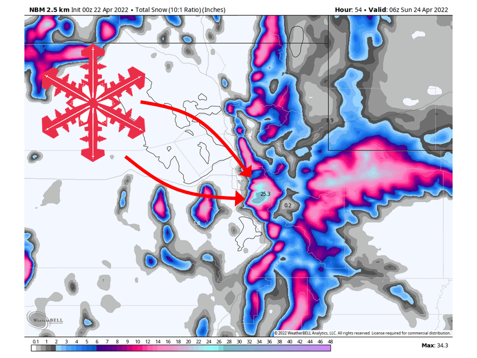
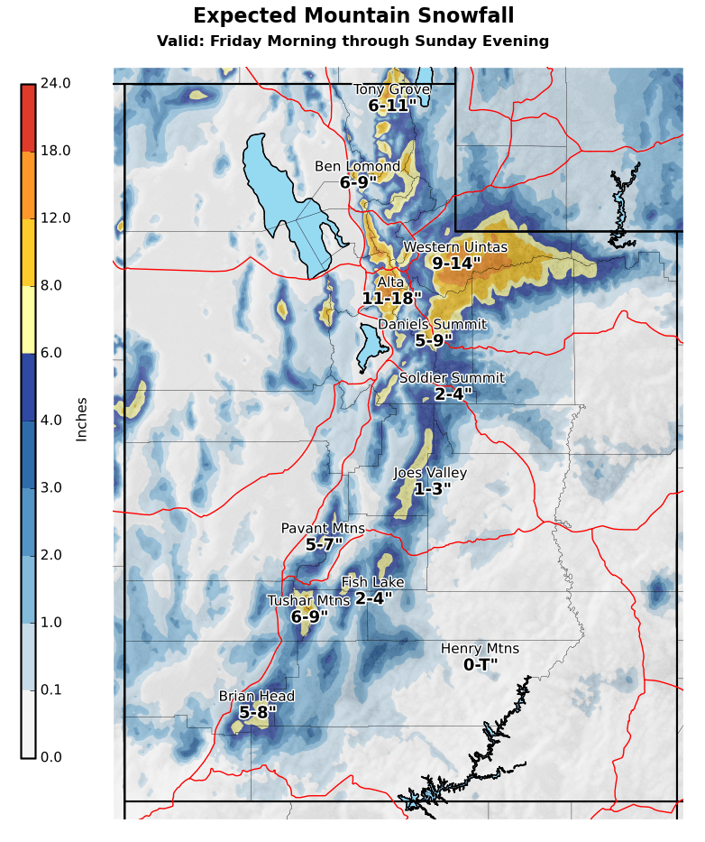
A trough will move through Utah this weekend and bring 1-2 FEET of snow to the Cottonwoods through Thursday.
Snow will develop Friday morning as the cold front associated trough moves through.
The heaviest snow comes Friday afternoon/evening.
Conditions then dry out Sunday as the trough moves off to the east.
Resorts that will see the most snow are Alta and Snowbird.
Short-Term Forecast:
Friday-Sunday:
A trough will move through Utah this weekend and bring 1-2 FEET of snow to the Cottonwoods through Thursday.
Snow will start late Friday morning and fill in through the day Friday.
The highest snowfall rates will come Friday afternoon/evening as snow becomes convention during the afternoon.
Snow will then continue into Saturday morning before becoming more showery Saturday afternoon.
Snow will end for the most part by Sunday as the trough moves off to the east.
Winter Weather Advisories have been issued by the National Weather Service in anticipation of this.
Long-Term Forecast:
Friday-Sunday:
Dry conditions are then expected heading into next week as high pressure builds over the region.
The next possible storm moves in late next week.
Extended Forecast:
Sunday and Beyond:
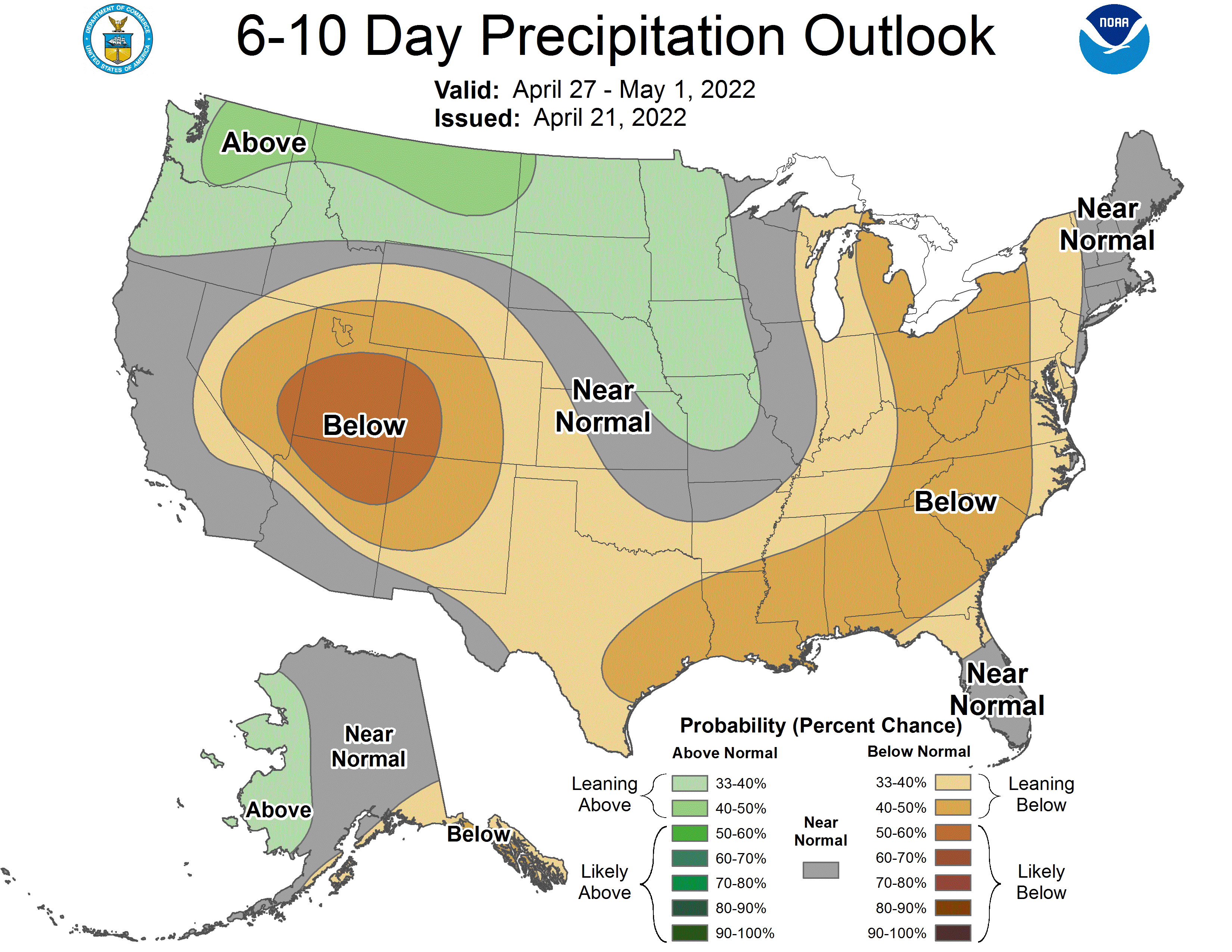
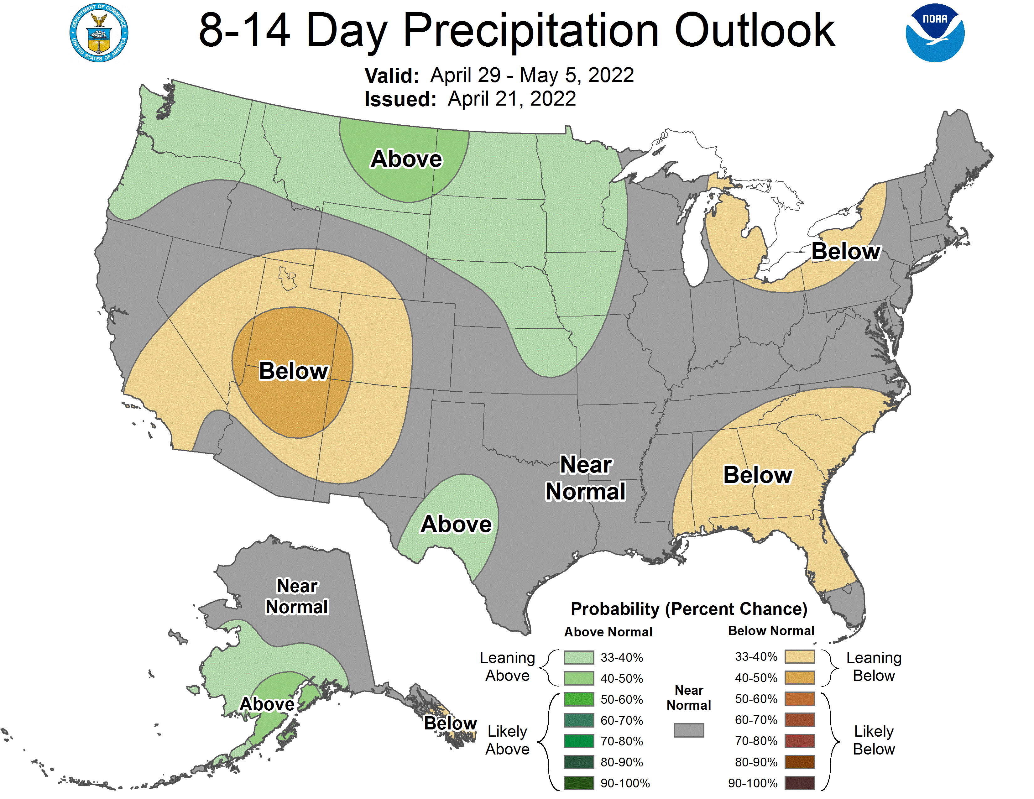
Global ensembles indicate below-average precipitation and below-average temperature across Utah throughout the extended.