Forecast written at 4:30 pm PST on Wednesday, February 22nd, 2023, by Clay Malott
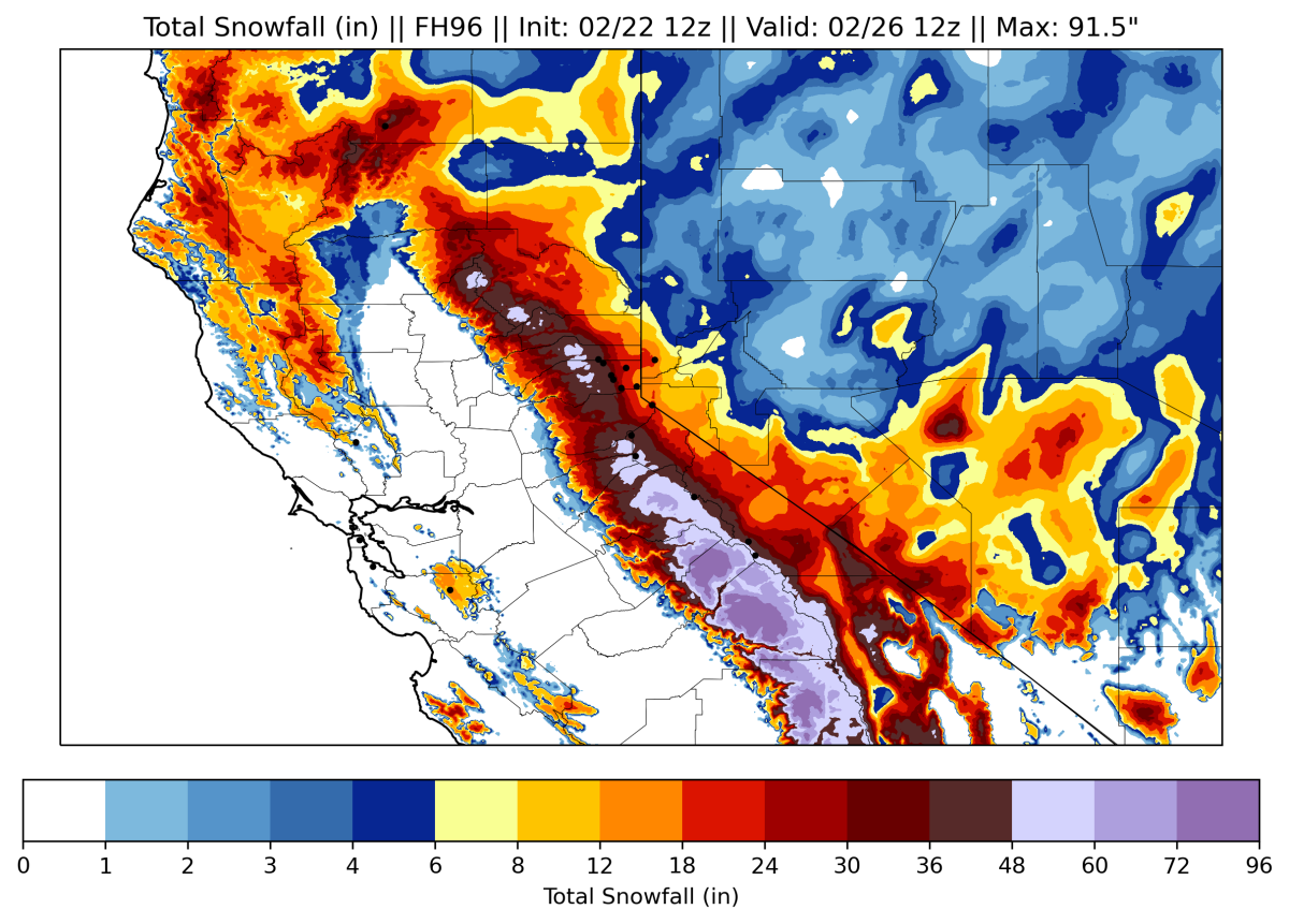
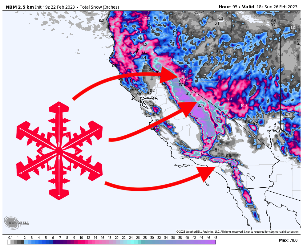
After a fairly dry end to January and early February, California is in for another massive storm. Between Wednesday and Sunday, most resorts in Northern California will see 2-4 FEET of fresh snow, and resorts in Southern California will see 3-8 FEET of snow. Temperatures will be unusually cold with this storm, so the snow quality will be excellent, and snow levels will not be a concern.
A fairly dry trough is currently digging into the West, however, a smaller, more intense shortwave trough will split off the main storm system on Wednesday, accelerating moisture and storm energy into the mountains. Tonight (Wednesday night), most of the flakes will remain mainly relegated to the northern Sierra. By the time lifts start spinning on Thursday morning, here are some plausible totals (including accumulations during the day on Wednesday):
- Western Tahoe basin (Palisades, Sugar Bowl, Kirkwood): 7-10″
- Central Tahoe basin (Northstar, Homewood): 4-8″
- Eastern Tahoe basin (Mt. Rose, Heavenly): 1-3″
- Mammoth: 5-8″
Snow will continue throughout Thursday and should bring free refills all day. During the ski day on Thursday, I see an additional 2-5″ inches for Western and Central Tahoe resorts, with 1-2 inches for Eastern Tahoe resorts and Mammoth.
Friday will be the best day for powder hounds during this storm. Thursday night will see precipitation rates ramp up through the morning. By the time the lifts begin spinning at about 8 am, we should see some very respectable overnight totals:
- Western Tahoe basin: 10-15″
- Central Tahoe basin: 7-11″
- Eastern Tahoe basin: 4-6″
- Mammoth: 10-14″
Thursday night will bring very cold conditions all over California; peaks in the SF Bay Area could see up to a foot of fresh snow by Friday morning! That’s certainly not something you see every day…
Snowfall will be heaviest in the morning and gradually decrease throughout the day. However, there will still be significant accumulating snow during the day, so tracks should be getting refilled, and the ski quality will stay excellent! During the ski day on Friday (8 am-4 pm), here are what I see as realistic numbers:
- Western Tahoe basin: 5-9″
- Central Tahoe basin: 4-6″
- Eastern Tahoe basin: 4-7″
- Mammoth: 12-16″
Snow will also ramp up in Southern California during the day on Friday:
- Mt. Baldy: 16-22″
- Mountain High: 10-14″
- Snow Summit: 1-4″
Snowfall rates will continue to decrease, but snow will still linger through Saturday afternoon. Resorts in western and central Tahoe will see 1-3″ between Friday night and Saturday day, with eastern Tahoe resorts seeing a trace to an inch. Mammoth may see a bit more, mainly on Friday evening, between 4 and 6 inches.
Southern California will get absolutely SLAMMED on Friday night. These are overnight totals that will absolutely close roads and even resorts, so keep in mind that it may not be possible to ski on Saturday:
- Mt. Baldy: 40-55″
- Mountain High: 35-45″
- Snow Summit: 15-22″
Another storm that looks even stronger this weekend will begin on Sunday night. I’m reluctant to forecast exact totals this far out since there is a lot of time for the models to shift before this system rolls through. However, between Sunday night and Wednesday, it’s looking like some western Tahoe resorts should score 40-80″… Southern California will not get the brunt of the storm but should still pick up decent totals. Stay tuned for another forecast later this week with updated details about this system!