Forecast By SnowBrains Chief Meteorologist – Eric McNamee
10:05 pm MST, 1/6/2022
Forecast Summary:
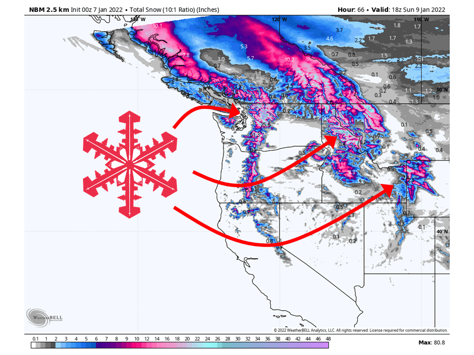
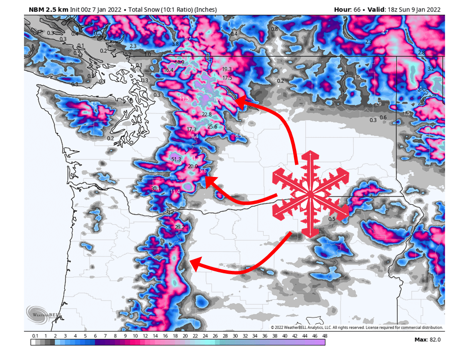
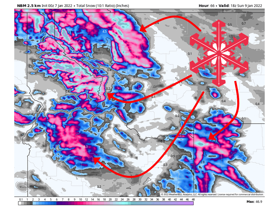
An atmospheric river will bring 2-5 Feet of snow to the PNW and 1-3 Feet of snow to the Northern Rockies through Sunday morning.
Ongoing snow will continue through Friday and Saturday as moisture is drawn into the region.
By Sunday, snow will taper off as the moisture tap is cut off.
Resorts that will see the most snow are The Summit at Snoqualmie, Stevens Pass, Mount Crystal, Mount Baker, Timberline Lodge, Mount Hood Meadows, Grand Targhee, Jackson Hole, and Bridger Bowl.
Short-Term Forecast:
Thursday night-Sunday:
As mentioned, an atmospheric river will bring 2-5 Feet of snow to the PNW and 1-3 Feet of snow to the Northern Rockies through Sunday morning.
Ongoing snow will continue tonight across the PNW, heavy at times.
By early tomorrow, this heavier snow will spill over into the Northern Rockies.
Snow will then continue over both regions Friday and Saturday, heavy at times.
Getting into Sunday, snow will start to wind down in the morning as the moisture tap begins to cut off.
Snow will then taper off by Sunday afternoon.
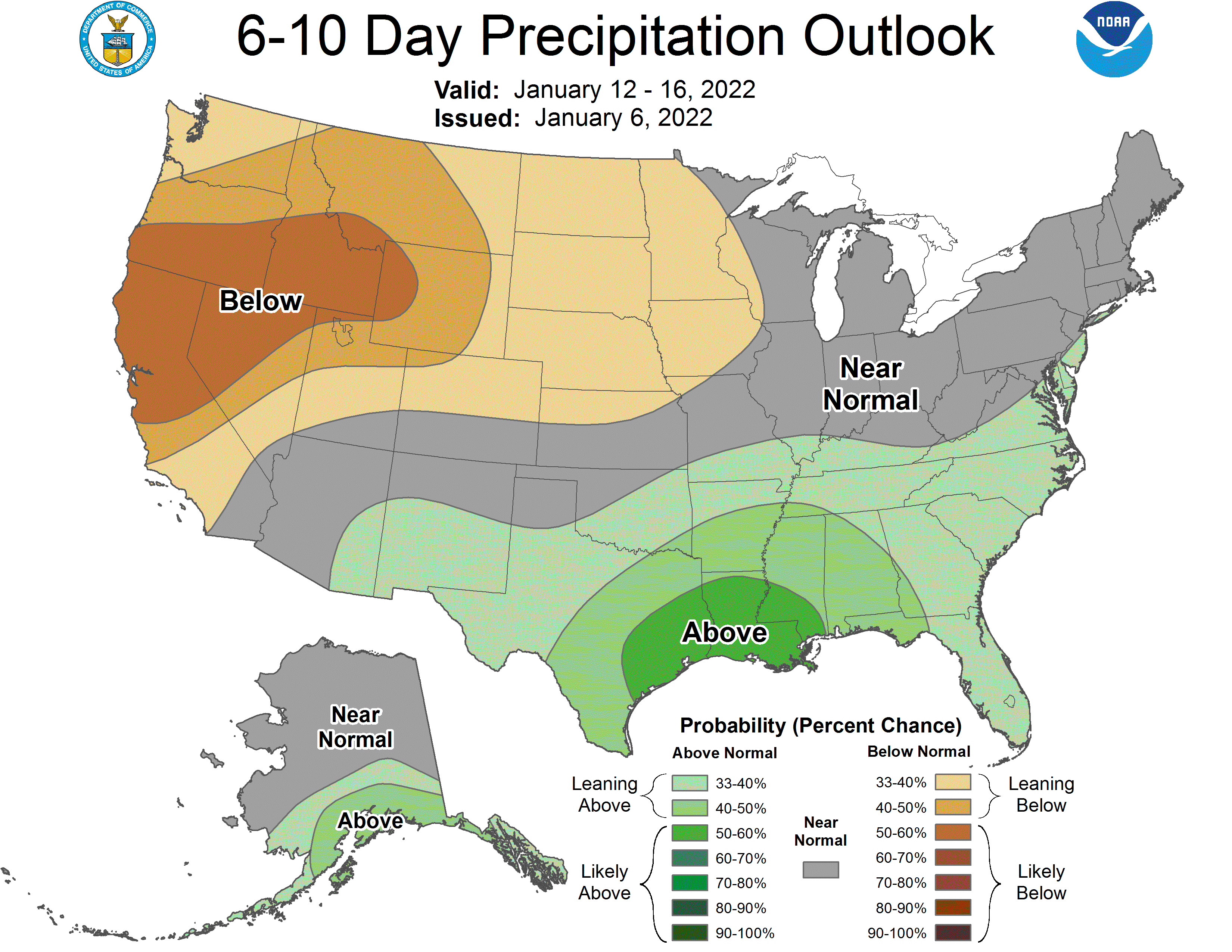
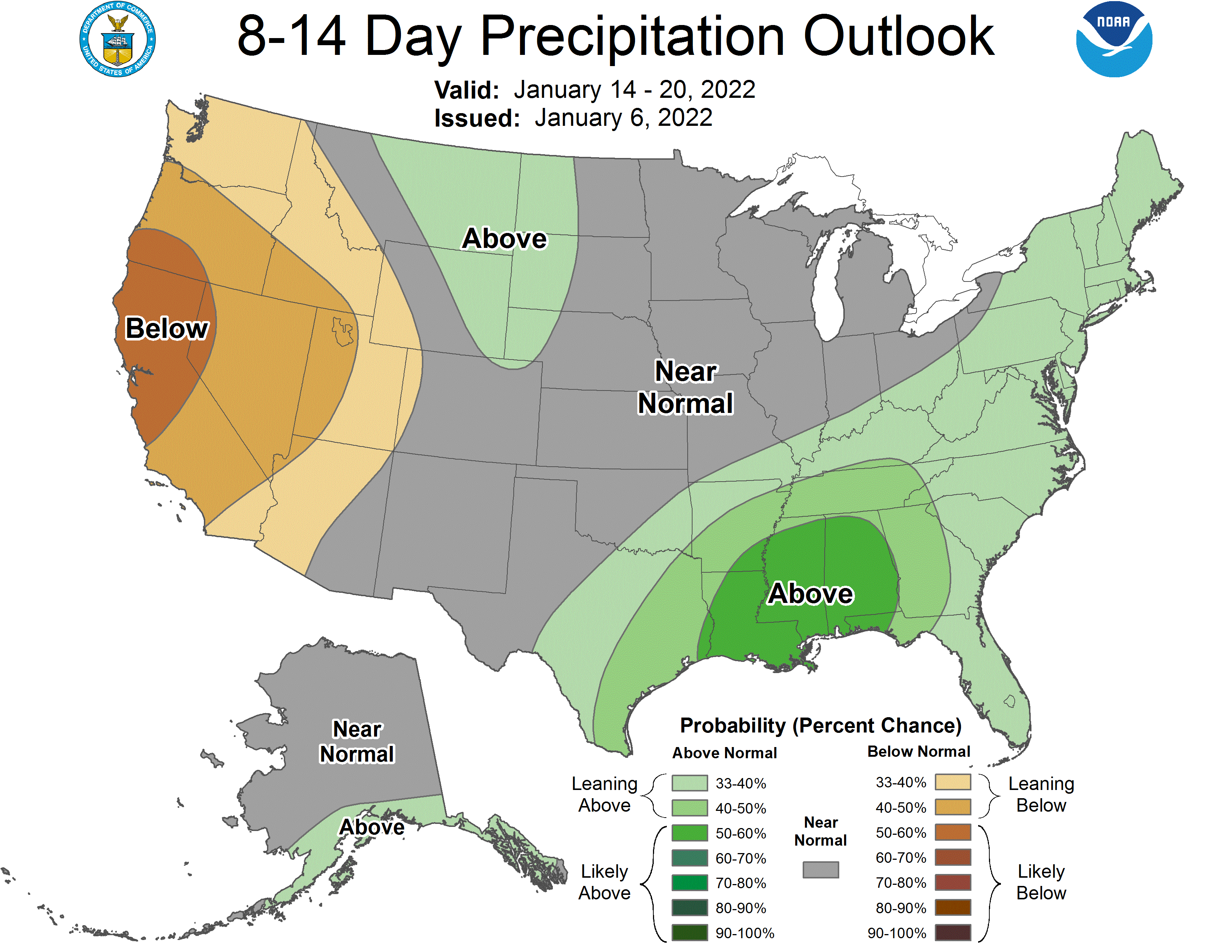
Long-Term Forecast:
Monday-Wednesday:
Conditions remain dry through Monday, with another system moving through the PNW Tuesday.
Snowfall totals are uncertain at this time.
Extended Forecast:
Wednesday and Beyond:
Global ensembles are indicating below-average precipitation across the region in the extended.