Forecast By SnowBrains Meteorologist – Eric McNamee
3:30 PM MST, Dec. 30, 2020
Forecast Summary:
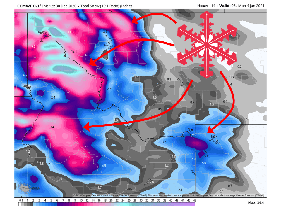
An active pattern will remain in place for the northwestern US through Sunday, bringing 2-5 FEET snow.
This will come in three waves through the weekend and more next week.
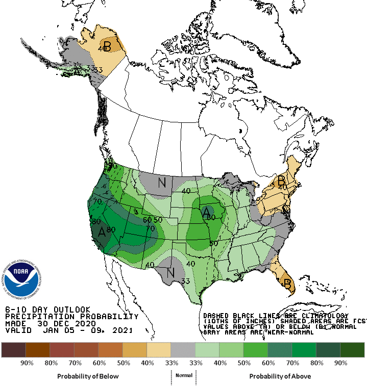
Conditions will remain wet in the extended as an active pattern persists over the Western US.
Short-Term Forecast:
Wednesday-Friday:
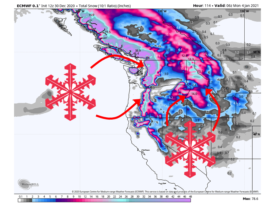
A shortwave trough will move into the region today and tomorrow, bringing 8-24″ of snow to the Cascades.
Snow levels will rise to near pass level by this afternoon before falling back down behind the cold fornt.
This same shortwave will move through the Northern Rockies and bring 8-16″ of snow to Northern Idaho and Western Montana.
The next shortwave trough looks to move in late Friday and bring snowfall through the weekend.
Long-Term Forecast:
Saturday-Tuesday:
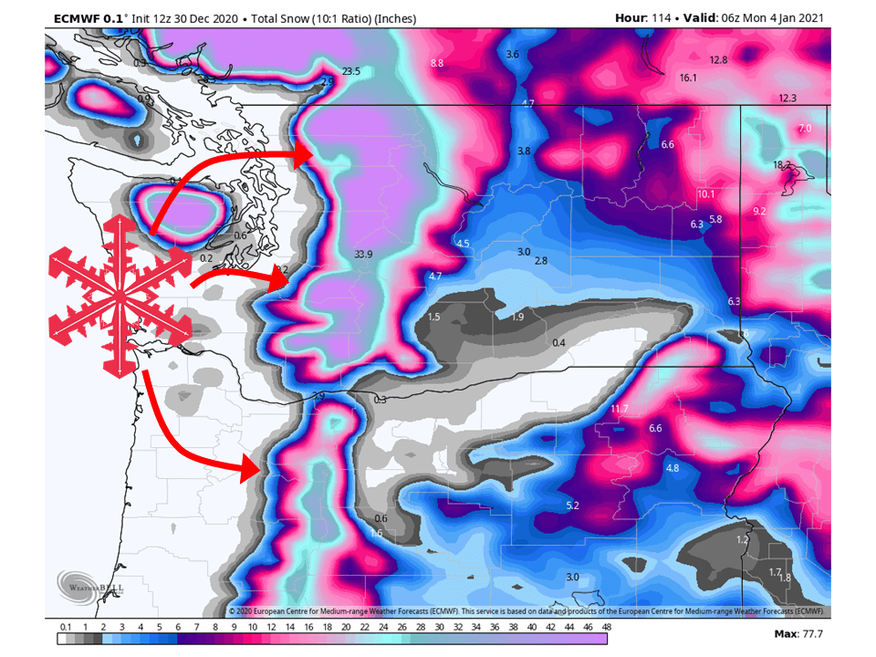
The shortwave mentioned above will move through Saturday, bringing an additional 8-12″ to the Washington Cascades and 6-10″ to the Northern Idaho/Western Montana.
The next shortwave trough will move in right behind the Friday/Saturday trough, bringing 12-24″ to the Cascades and 12-18″ to the Northern Rockies.
The active looks to continue past Sunday as additional shortwave troughs move into the Western US.
Extended Forecast:
Tuesday and Beyond:
Global ensembles indicate a pretty active pattern will continue over the Western US through next week.
Pacific Northwest:
The Pacific Northwest looks to fair pretty well with 2-5 FEET of snow falling through Tuesday.
Resorts that look to see the most snow are Mt. Bachelor, Mt. Hood, Timberline Lodge, Crystal Mountain, Alpental, and Mt Baker.
Northern Rockies:
Like the Pacific Northwest, the Northern Rockies will fair pretty well through Tuesday with 2-3 FEET of snow falling.
Resorts that look to see the most snow are Whitefish Mountain, McCall, Tamarack, and Schweitzer.
USA:
Global ensembles indicate a pretty active pattern will continue over the Western US through next week.
This means above-average precipitation across most of the Western US in the extended.