Brought to you by HAKUBAVALLEY
Summary
A cold, moisture-laden storm system will sweep through central Japan this week, dumping two or more feet of fresh snow on the HAKUBAVALLEY region and its nine resorts. The snow will begin on Wednesday evening before gradually ramping up and peaking by Thursday evening. Snowfall rates will then begin to decrease and taper off by Friday afternoon.
Wednesday-Thursday
With the exception of a few flurries in the afternoon and evening, things will be fairly quiet in terms of snowfall on Wednesday. Overnight between Wednesday and Thursday, orographic snow being forced into the mountains will gradually ramp up before hitting the 1″ per hour mark sometime Thursday morning. Temperatures overnight should hover at about 15F, which will allow snow-to-liquid ratios to remain between 16 and 18:1. Super light snow, which will make skiing and riding conditions absolutely effortless and excellent!
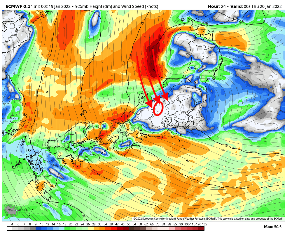
The biggest uncertainty in my mind with this storm is what will happen on Thursday morning. On Thursday morning, the winds will be coming out of the West, which is not the ideal storm flow direction for HAKUBAVALLEY, since the tall Japanese Alps block lots of the moisture from falling as snow on the resorts. However, as the storm passes from West to East on Thursday morning, I see an opportunity for these resorts to potentially outperform the forecast by quite a bit. There are two factors that are lining up to exceed the model outputs for this storm:
1.) On Thursday morning and early afternoon, the primary chunk of upper-level storm energy passes over the region, with HAKUBAVALLEY practically in the bullseye. This means lots of rising air, which means lots of precipitation, and when coupled with the low temperatures both at the surface and aloft, this means lots of snow.

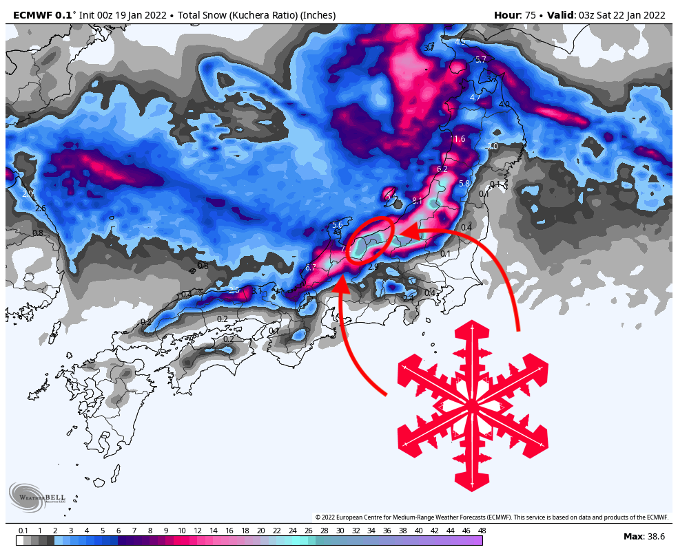
2.) The winds will shift to come from the north-northwest, which means less orographic blocking from the taller mountains to the west of the HAKUBAVALLEY resorts. While this is still not an ideal wind direction, it will certainly allow much more abundant moisture into the valley to fall as snow.
If both of these factors line up the way I think they will on Thursday morning and afternoon, I wouldn’t be surprised if Hakuba ended up picking up an additional 6-12″ on top of an already deep 20-25″ forecast.
Thursday afternoon-Friday
Snowfall rates will top out at 1-1.5″ per hour on Thursday afternoon before beginning a gradual descent. The good news is that this descent will be very gradual indeed, allowing flurries to continue accumulating snow into Friday morning.
The best skiing and riding conditions will likely be Thursday afternoon and Friday morning. But keep your eye on Saturday as a sleeper bluebird powder day, where 2+ feet of fresh snow and parting cloud cover may make for an incredible day of skiing.
uh, they’re not letting us into japan dude.