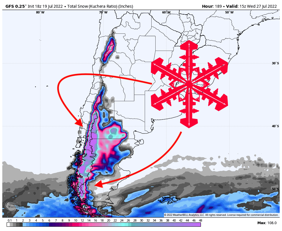
A powerful winter storm is currently hammering South America. By early next week, most resorts should have totals ranging between 20 and 40 inches, building on what has already been an impressive start to their season.
An exceptionally strong low-pressure system is sitting just off the southern tip of Argentina, allowing cold air to pool in Chile and Argentina and sucking tropical moisture all the way from the Pitcairn Islands several thousand miles away! Check out the map of the moisture anomaly from the European model:

The storm system will continue to push to the northeast, which will gradually push the moisture plume further north. This plume of moisture will create a band of moisture that is very thin yet quite intense. Throughout the day on Wednesday, precipitation will continue to linger in the southern Andes. It’s important to note that resorts far north will miss out on nearly all of this precipitation. Resorts like Portillo and Valle Nevado will likely not see any snow at all.
The next wave of moisture arrives early Thursday afternoon. The energy source for this surge will actually come from a protruding lobe of the same storm system. This surge will start further north than the previous plume. Putting all the pieces together, this means that there will be a more robust pocket of cold air over the mountains from a deeper trough, and the snow from the second storm will be much lighter and ultimately make for better skiing conditions. This plume of moisture is also more significant both in magnitude and duration compared to the first storm, so things could get really deep really quick.
All four major global deterministic models – the ECMWF, GFS, GDPS, and ICON – and their ensemble counterparts are putting the precipitation bullseye just to the northeast of Ancud Gulf.
Great options for scoring deep snow this week:
- Cerro Catedral
- Cerro Bayo
- Chapelco
- Perito Moreno
- Antillanca

A third surge of moisture will hit the region from Saturday night through Monday afternoon. This precipitation will be mainly focused on the same area to the northeast of Ancud Gulf, so the same resorts listed above are excellent choices for powder hunting well into next week. Another 15-20″ could be in this additional wave.
Another storm arrives in the Andes sometime later next week on Wednesday/Thursday. This storm will be largely relegated to the south, but don’t rule out a sleeper powder day further north quite yet! Stay tuned for another forecast with updated information about this storm after the weekend.
Let it snow!