Forecast By SnowBrains Chief Meteorologist – Eric McNamee
9:10 pm MST, 10/25/2021
Forecast Summary:
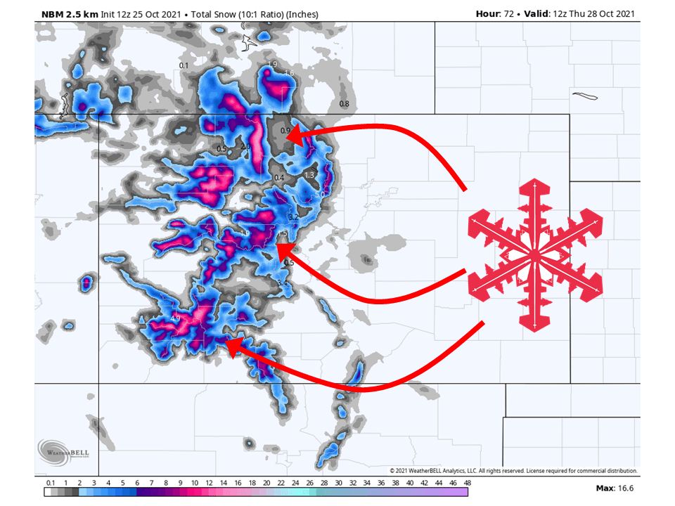
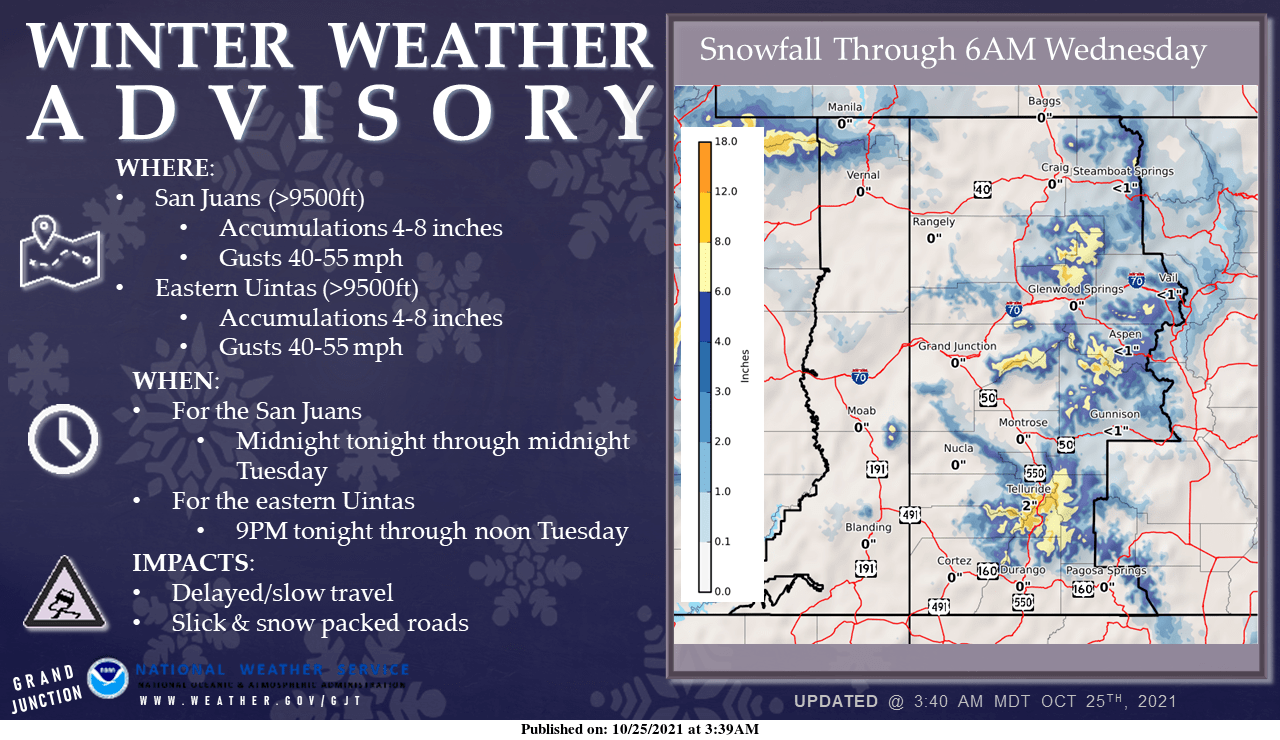
Two troughs of low pressure will move through Colorado and bring 6-12″ of snow to the mountains through Thursday.
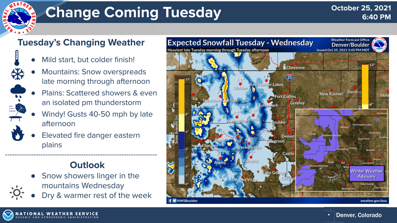
Snow from the first system will begin Tuesday morning and continue into Wednesday.
The second system will brush by Wednesday night and keep showers going into Thursday morning.
A dry pattern looks to develop in the long term and continue through the extended.
Short-Term Forecast:
Tuesday-Thursday:
A couple of troughs will move through Colorado and bring 6-12″ of snow to the mountains through Thursday.
The remnants of the atmospheric river hitting California will move into Colorado Tuesday morning and bring snow for most mountain locations.
This will continue through Wednesday, with a secondary system moving in Wednesday evening, keeping snow going through Tuesday morning.
Conditions will dry out Thursday afternoon as high pressure begins to build.
Long-Term Forecast:
Friday-Monday:
By this weekend, high pressure will build over the west and dry out conditions in Colorado.
Mild weather will continue through the weekend.
Extended Forecast:
Sunday and Beyond:
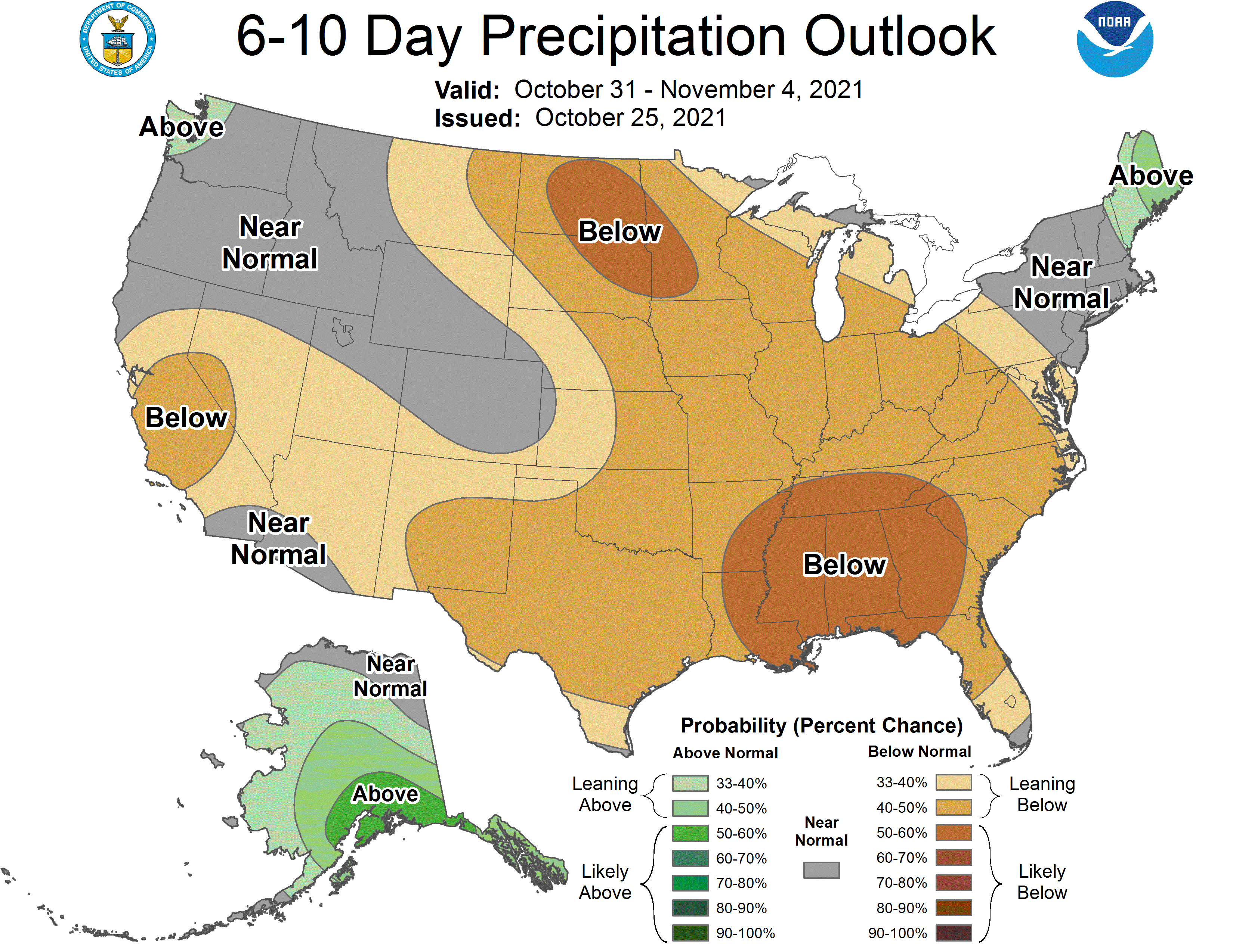
Global ensembles are indicating near to below-average precipitation across Colorado through the extended.