Forecast By SnowBrains Chief Meteorologist – Eric McNamee
5:00 PM MST, 11/08/2021
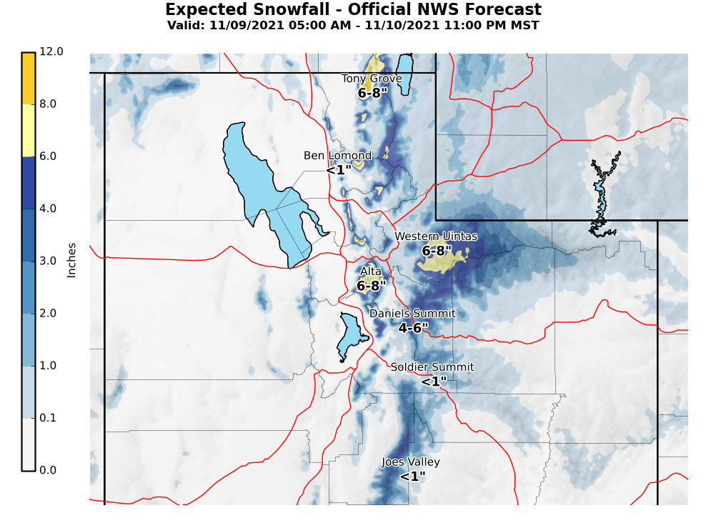
Forecast Summary:
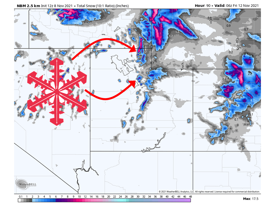
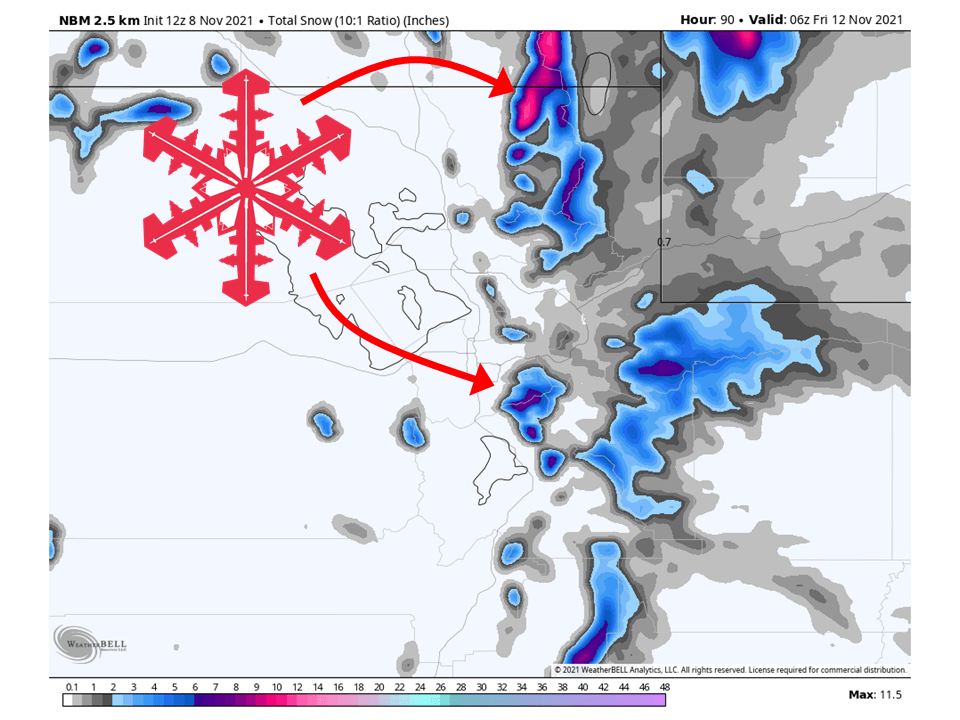
A shortwave trough will move through Utah Tuesday/Wednesday and bring 6-12″ of snow to Utah’s Wasatch.
Snow will initially start Tuesday and continue through the day Wednesday.
Showers will taper off during the day Thursday as the trough moves east.
Dry and quiet conditions look to be in place during the long-term and extended.
Resorts that will see the most snow are Alta, Snowbird, Brighton, Solitude, Deer Valley, Park City, Canyons, and Beaver Mountain.
Short-Term Forecast:
Tuesday-Thursday:
A shortwave trough will move through Utah Tuesday/Wednesday and bring 6-12″ of snow to Utah’s Wasatch.
This trough will interact with remnants of an atmospheric river that will hit the West Coast.
Because of this, temperatures will be relatively mild and snow levels will be high, to begin with.
Snow levels will initially start out around 8000′-7500′ Tuesday afternoon before dropping to around 6500′ as colder air moves into the area Wednesday evening.
SLRs (snow liquid ratio) will also be close to 8:1 to begin the event, lower than the climatological average of 13:1 for the region.
These will eventually get closer to the climatological average by Wednesday evening.
Unstable northwest flow will keep snow showers going Thursday in places favored in this flow regime, but overall snow will taper off through the day Thursday.
Long-Term Forecast:
Friday-Monday:
High pressure will build over the western US heading into the weekend.
This will dry out conditions across Utah and all for temperatures to warm up to slightly above average.
Extended Forecast:
Sunday and Beyond:
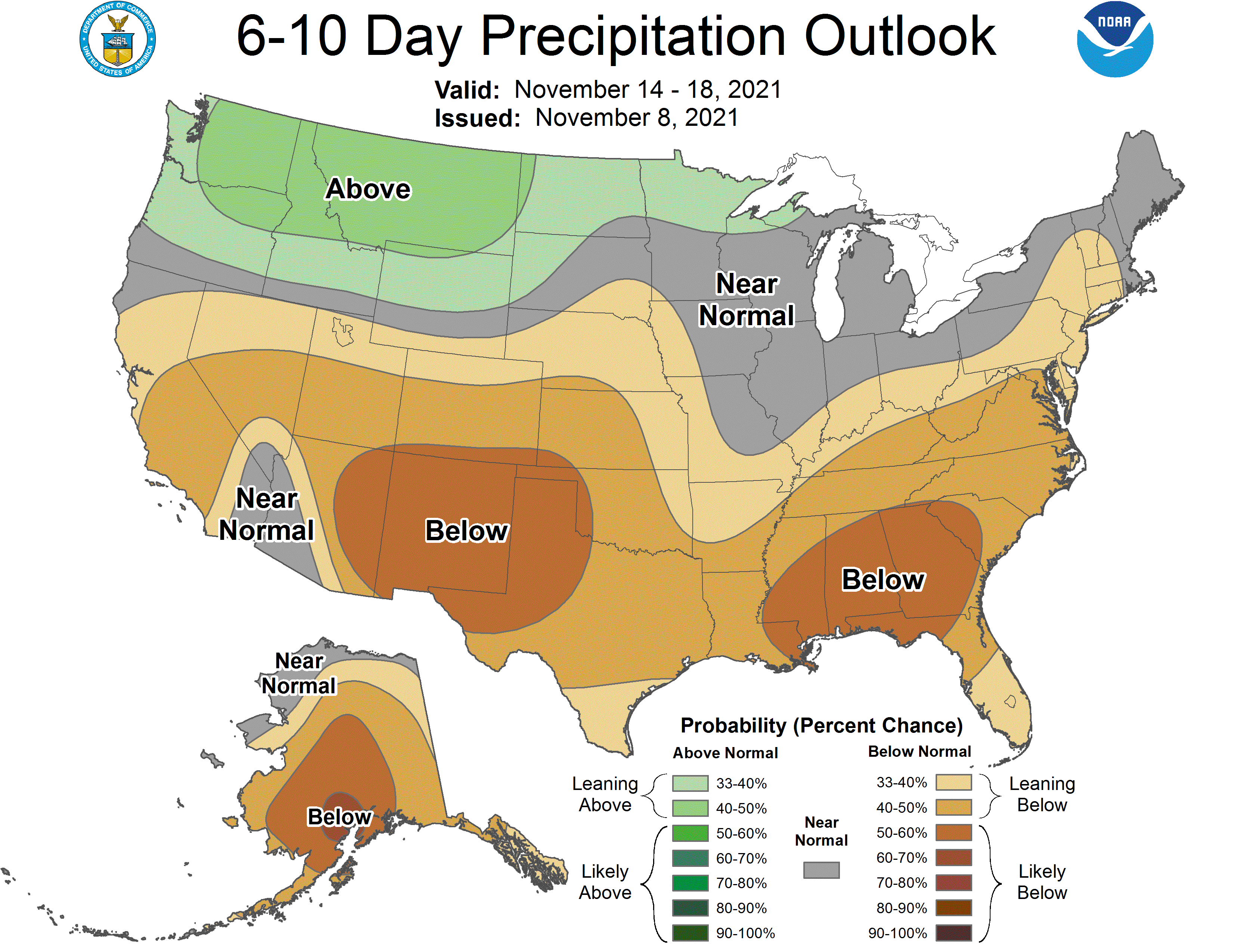
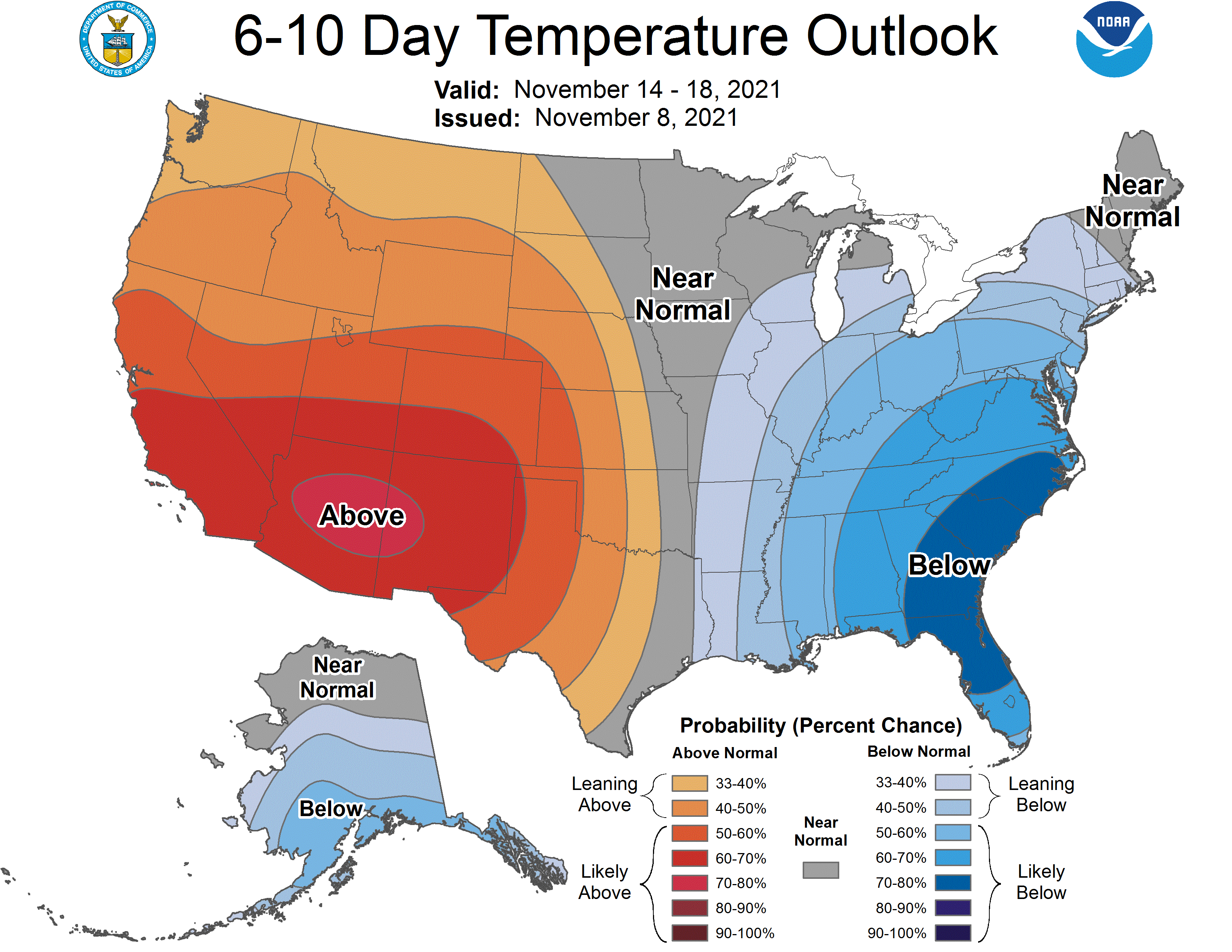
Global ensembles are indicating below-average precipitation and above-average temperature across the region in the extended.