Forecast By SnowBrains Meteorologist – Eric McNamee
1:30 PM MST, 3/17/2021
Brought to you by Grand Targhee
Forecast Summary:
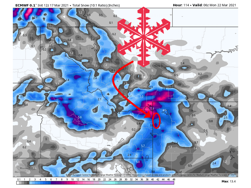
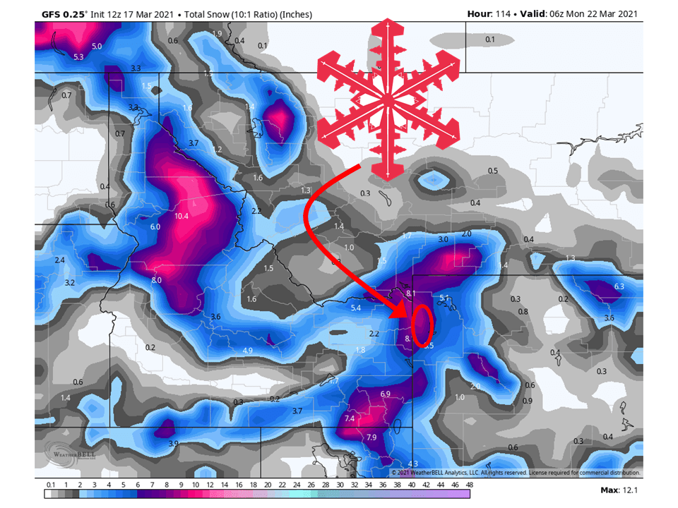
A shortwave trough will move through the Northern Rockies this weekend, possibly bringing 6-12″ of snow to the Tetons, WY.
This will lead to heavy snowfall at times for Grand Targhee this weekend.
Another system is possible early next week before conditions dry out in the extended.
Short-Term Forecast:
Wednesday-Friday:
Pretty quiet weather is expected in the short-term as high pressure dominates the overall pattern.
The is a slight chance for some showers today, but these will be pretty light if they do form.
Long-Term Forecast:
Saturday-Tuesday:
Through the weekend a shortwave trough will move through the northern Rockies, possibly bringing 6-12″ of snow to the Tetons, WY.
This will be due to a moist southwest flow that will develop, slamming into the Teton Range and Grand Targhee.
Snow will develop very late Friday night and continue through the weekend.
By Monday, conditions will generally clear out before another system will move through Tuesday.
Snowfall totals are not certain at this time for that system.
Extended Forecast:
Sunday and Beyond:
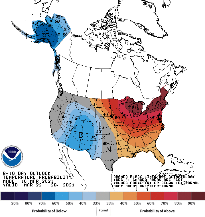
Global ensembles are indicating below-average precipitation and temperatures in the extended.