Forecast By SnowBrains Chief Meteorologist – Eric McNamee
1:50 PM MST, 11/22/2021
Forecast Summary:
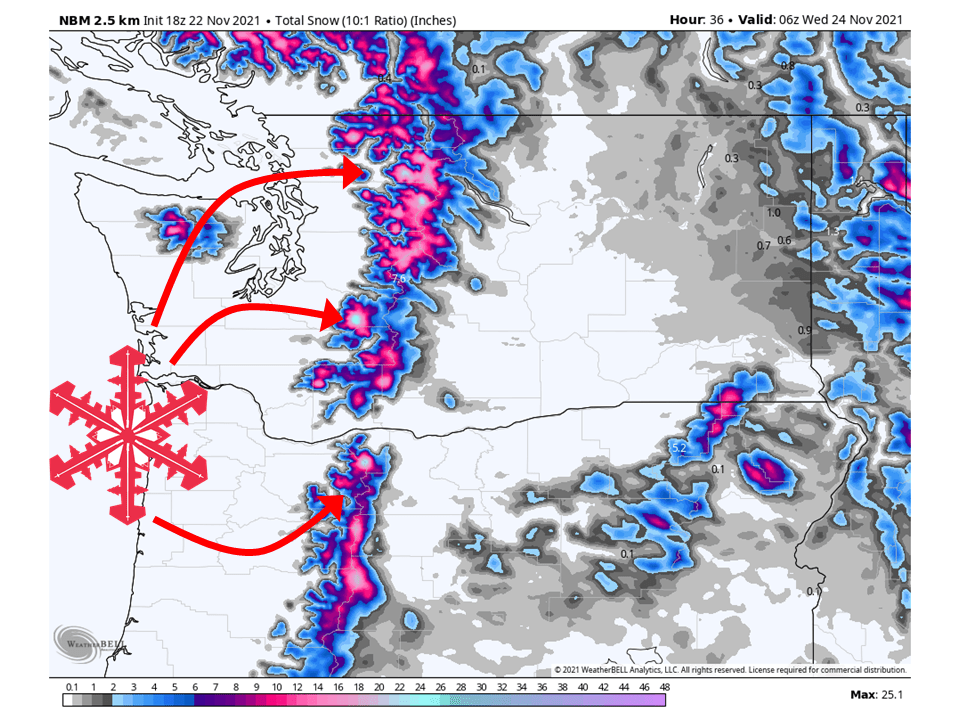
A shortwave trough will move through the Pacific Northwest Monday/Tuesday and bring 6-8″ of snow to most resorts, with deeper totals higher in elevation.
Snow will initially start falling Monday afternoon as colder air moves into the region and continue through Tuesday.
Showers will taper off Tuesday night, with more chances of snow later this week.
Resorts that will see the most snow are The Summit at Snoqualmie, Stevens Pass, Mount Crystal, Mount Baker, Timberline Lodge, and Mount Hood Meadows.
Short-Term Forecast:
Tuesday-Thursday:
A system will move through the Pacific Northwest Monday/Tuesday and bring 6-8″ of snow to most resorts, with deeper totals higher in elevation.
As mentioned snow will really start to get going Monday night as colder air moves into the region.
Ahead of this cold air, snow levels will be quite high so there is likely to be rain on snow for some resorts, before turning to all snow Monday night.
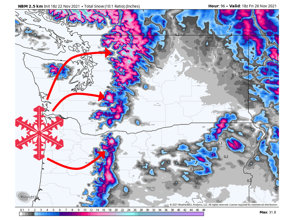
This snow will continue on and off through Tuesday before tapering off Tuesday night.
Conditions will then dry out Wednesday before the next system moves in Wednesday night.
Only lighter showers are expected from this system during the short term.
A system will move onshore late Monday morning and slide into the
interior late Monday into Monday night for lowland rain. Snow for
the mountains, including the Passes, with this front, with the
heaviest snow Tuesday morning. 6 to 8 inches of snow will be
possible for Snoqualmie and Stevens Pass from Monday night through
Tuesday. Some rain showers are expected for Tuesday across the
lowlands, but drier weather into Tuesday evening. A brief warm up
into the low 50s for Monday, cooler in the 40s into Tuesday.
-NWS Seattle 11/22/2021
Long-Term Forecast:
Friday-Monday:
As mentioned another system moves in Wednesday night and will continue through Thursday.
Totals from this system will be fairly light with up to 5″ of additional snow primarily along the Washington/Canada border.
Another system might be possible heading into the weekend, but snow totals are uncertain at this time.
Extended Forecast:
Sunday and Beyond:
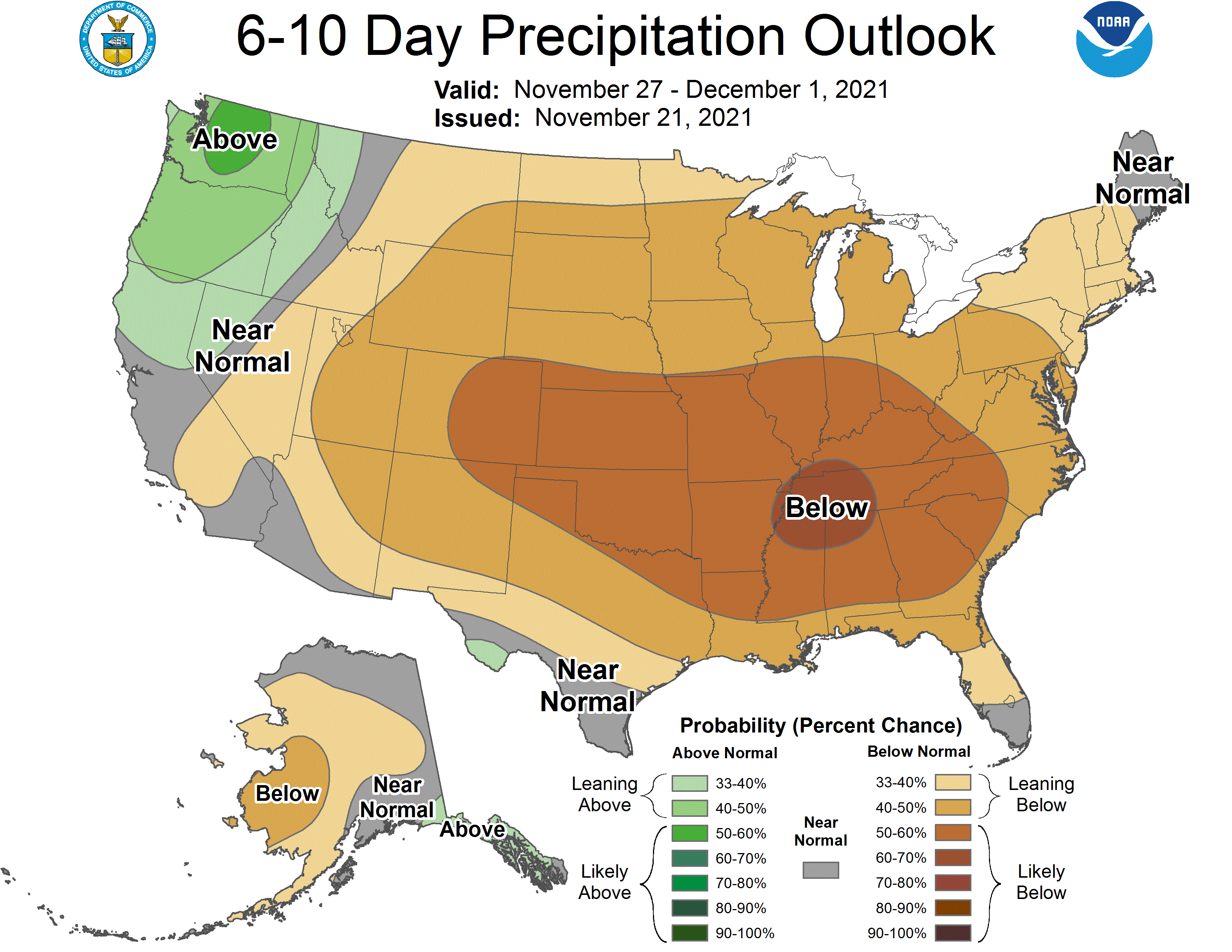
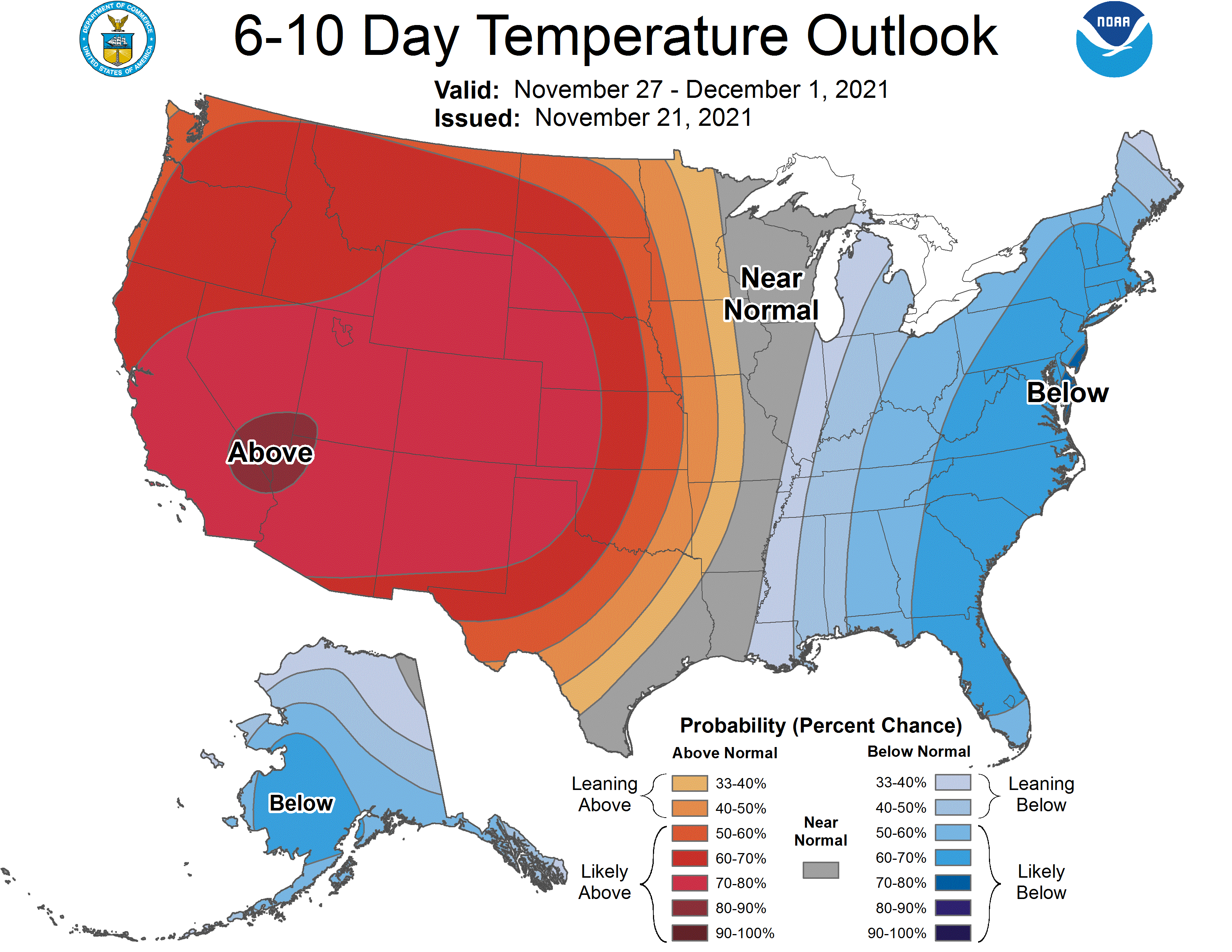
Global ensembles are indicating above-average precipitation and above-average temperatures across the region in the extended.