Forecast By SnowBrains Meteorologist – Eric McNamee
Brought to you by Alta Ski Area
6:45 PM MST, 2/10/2021
Forecast Summary:
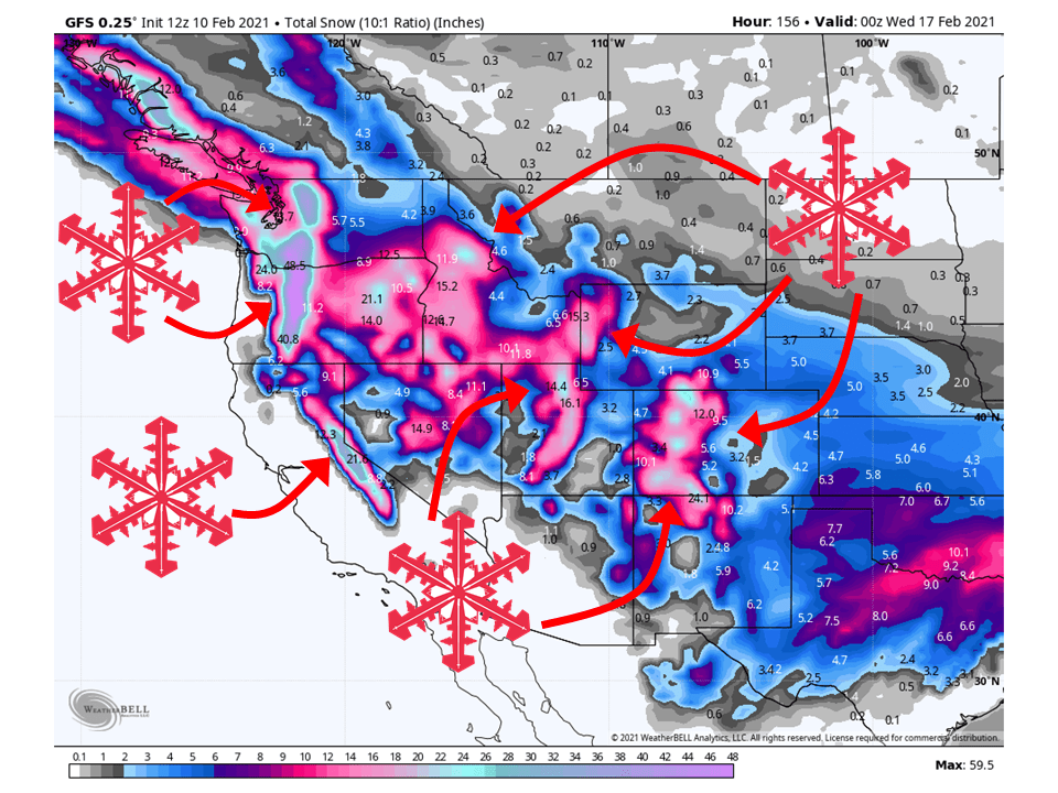
1-6 FEET of snow is expected across the West through the next seven days as a series of storms make their way through the region.
Snow will get going tomorrow morning as the first shortwave trough moves into the West Coast.
This shortwave trough will track across the West through Friday before another shortwave trough moves into the Pacific Northwest.
This will cross the West in a similar path as its predecessor this weekend, with another shortwave trough moving Monday, taking the same track.
Active weather looks to continue through the extended period of the forecast.
Short-Term Forecast:
Thursday-Saturday:
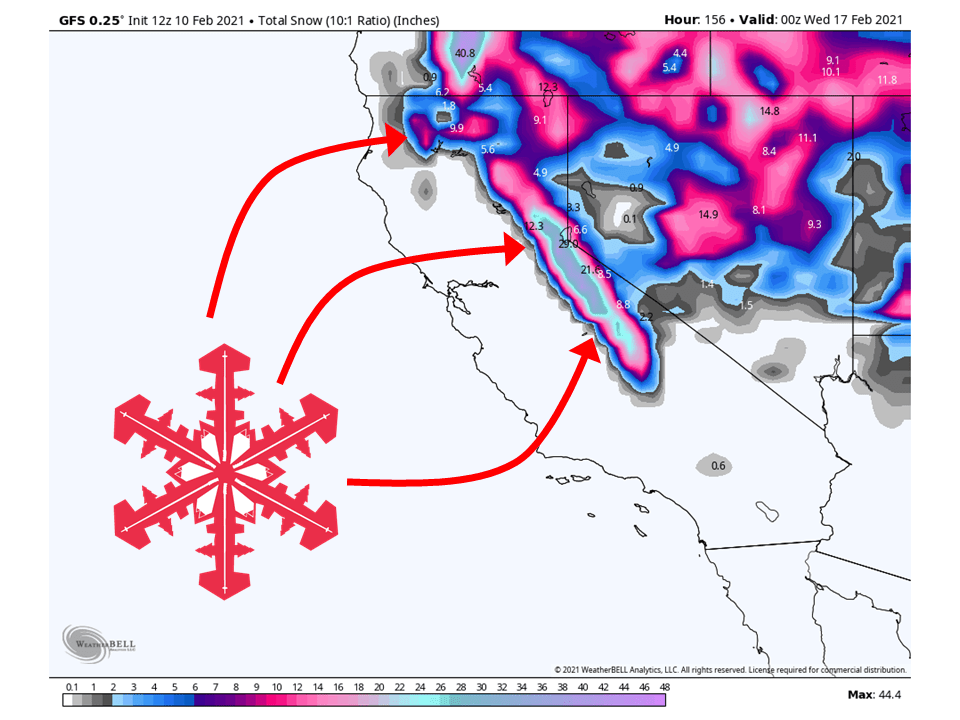
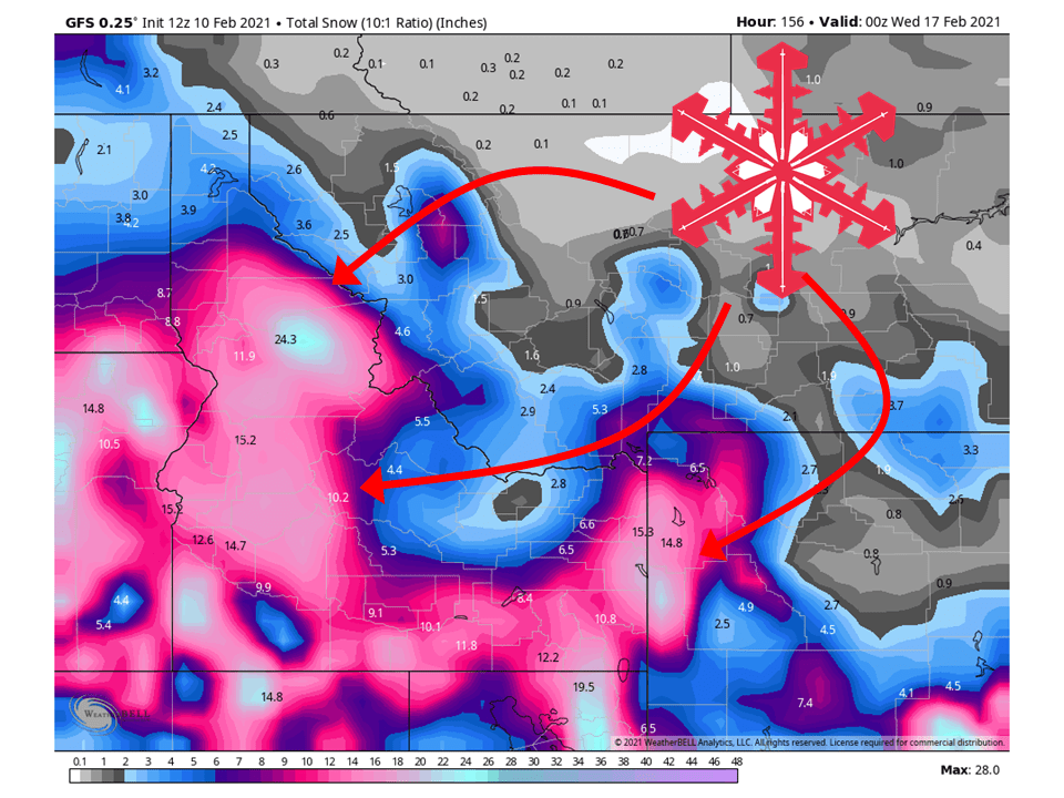
A shortwave trough located off the US West Coast will move inland tomorrow morning, bringing 1-3 FEET of snow to the Cascades through Friday.
1-3 FEET can be expected in parts of the Northern Rockies through Saturday.
This same shortwave trough will also bring 6-14″ of snow to parts of the Sierra through Friday as well.
This shortwave trough will continue to move inland, bringing 6-16″ of snow to Utah mountains through Saturday.
Similar amounts as Utah are expected in Colorado’s mountains.
By Saturday, the next shortwave trough will move into the Pacific Northwest.
Long-Term Forecast:
Sunday-Wednesday:
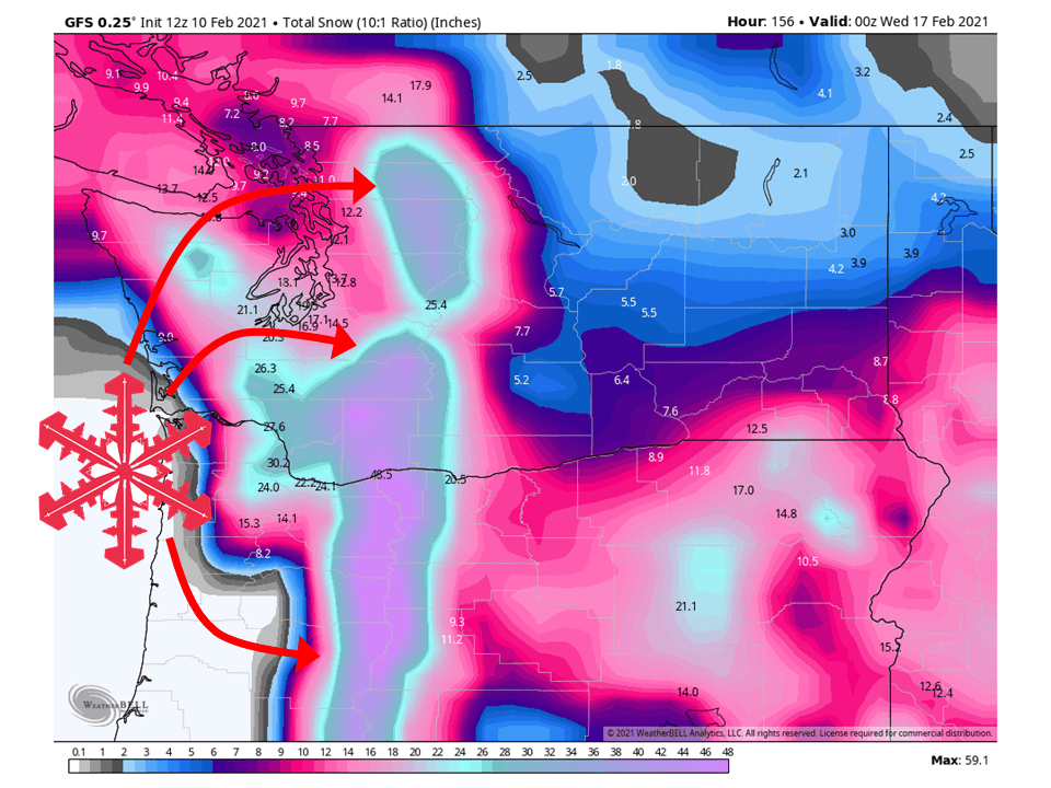
This next shortwave trough will take a fairly similar track to the first shortwave and bring similar amounts to the same locations, with lighter amounts for California.
There won’t much of a break in between storms for the Pacific Northwest as snow looks to fall continuously as moisture streams in from the Pacific.
As that shortwave moves through the West, another will be right on the doorstep and will move in Sunday night.
Like the previous shortwave, this will take a similar track and bring another round of heavy snow to the same locations.
Over the next seven days, A LOT of snow looks to pile up across these locations in the Western US.
Extended Forecast:
Sunday and Beyond:
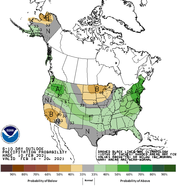
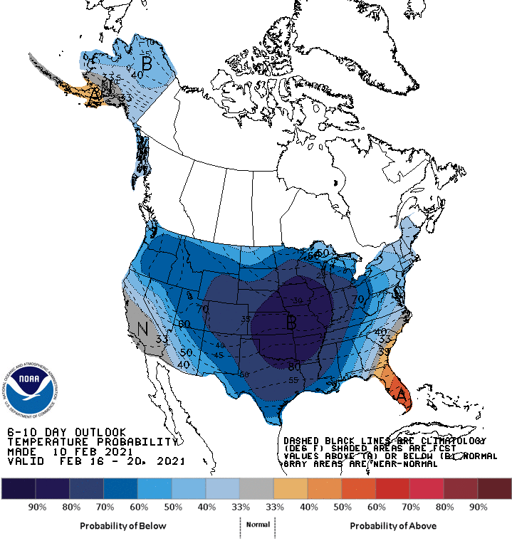
Global ensembles are indicating the pattern to remain active with above-average precipitation and below-average temperatures across the West, except California.
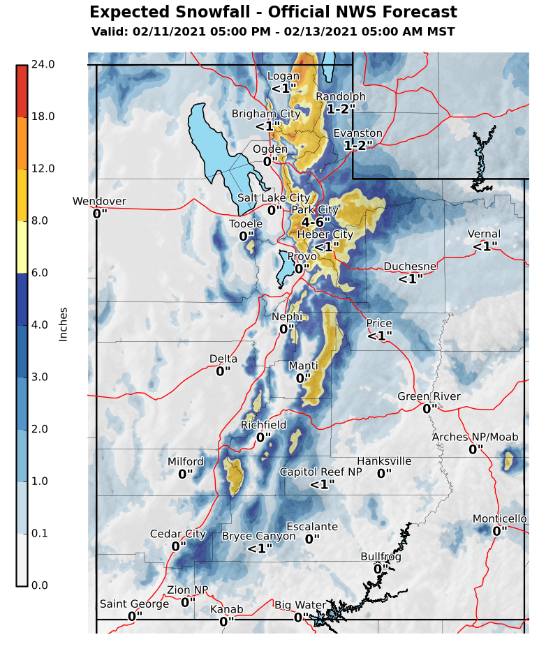
Utah:
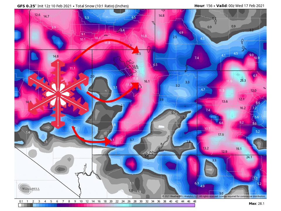
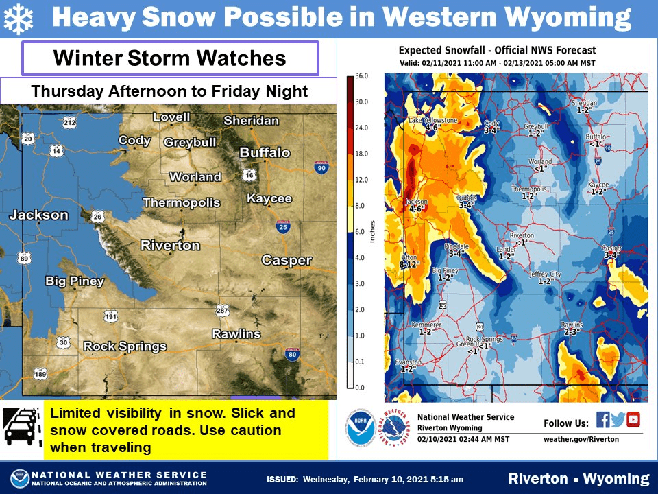
The first of three shortwaves will move into the state Thursday evening, bringing 6-16″ of snow to the mountains, with more in the Cottonwoods.
Another robust and deeper trough will dig into the region Saturday, bringing 6-12″ of snow to most mountain locations, with more in the Cottonwoods again.
Another trough will move through the state early next week and bring another round of HEAVY mountain snow.
Resorts that look to be favored are Alta, Snowbird, Brighton, Solitude, Park City, Canyons, Deer Valley, Snowbasin, Powder Mountain, Beaver Mountain, and Brianhead.
**Alta Forecast**
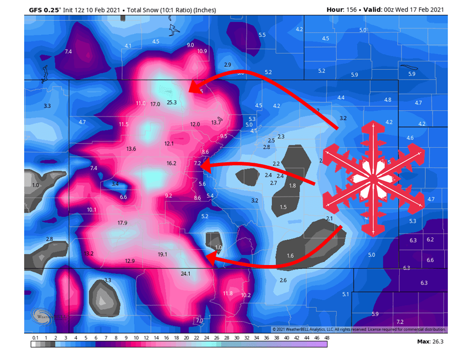
Snow will begin up at Alta on Thursday with the first shortwave trough moving into the state, dropping 12-18″ of snow through Saturday morning.
Another trough will move through Saturday and Sunday, bringing another round of snow with similar amounts.
The third shortwave trough will move through early next week and bring more HEAVY snow.
At the moment, ensembles are showing an average of 75″ INCHES OF SNOW through the next seven days.
The pattern looks to stay active through the extended.
California:
California will remain relatively compare to other places in the west, but will still see 6-14″ of snow from the first shortwave trough.
The second shortwave will miss the state for the most part, but the third shortwave trough looks like it could bring similar amounts as the first shortwave trough.
The state looks to see more actions in the extended.
Resorts likely to get the most snow are Boreal, Kirkwood, Sugar Bowl, Squaw, Alpine, Northstar, Homewood, Heavenly, and Mammoth.
Pacific Northwest:
The Pacific Northwest will do really well over the next seven days, with 1-3 FEET to start the cycle.
The next two shortwave troughs look to bring similar snowfall amounts, with snow falling nearly continuously.
Resorts that look to see the most snow are Mt. Bachelor, Mt. Hood Meadows, Timberline Lodge, Crystal Mountain, Alpental, and Mt Baker.
Northern Rockies:
The northern Rockies will fair pretty well the next seven days, with 1-2 FEET to start the cycle.
Snowfall will be slightly lower in the second shortwave but will be DEEP again the third shortwave.
Resorts that look to see the most snow are Jackson Hole, Targhee, Big Sky, Sun Valley, McCall, Tamarack, Whitefish Mountain, and Schweitzer.
Colorado:
Colorado will see 6-18″ of snow from this first shortwave trough, with snow starting late tomorrow.
Another robust and deeper trough will dig into the region Saturday, bringing 6-18″ of snow to most mountain locations.
Another trough will move through the state early next week and bring another round of HEAVY mountain snow.
Resorts that look to see the most snow are Aspen, Steamboat, Wolf Creek, Vail, Loveland, Breckenridge, Copper Mountain, Keystone, Arapahoe Basin, Telluride, Monarch, and Winter Park.
USA:
Global ensembles are indicating the pattern to remain active with above-average precipitation and below-average temperatures across the West, except California.