Forecast By SnowBrains Meteorologist – Eric McNamee
10:55 AM MST, 5/3/2021
Forecast Summary:
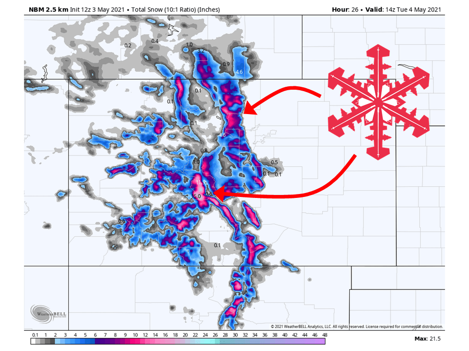
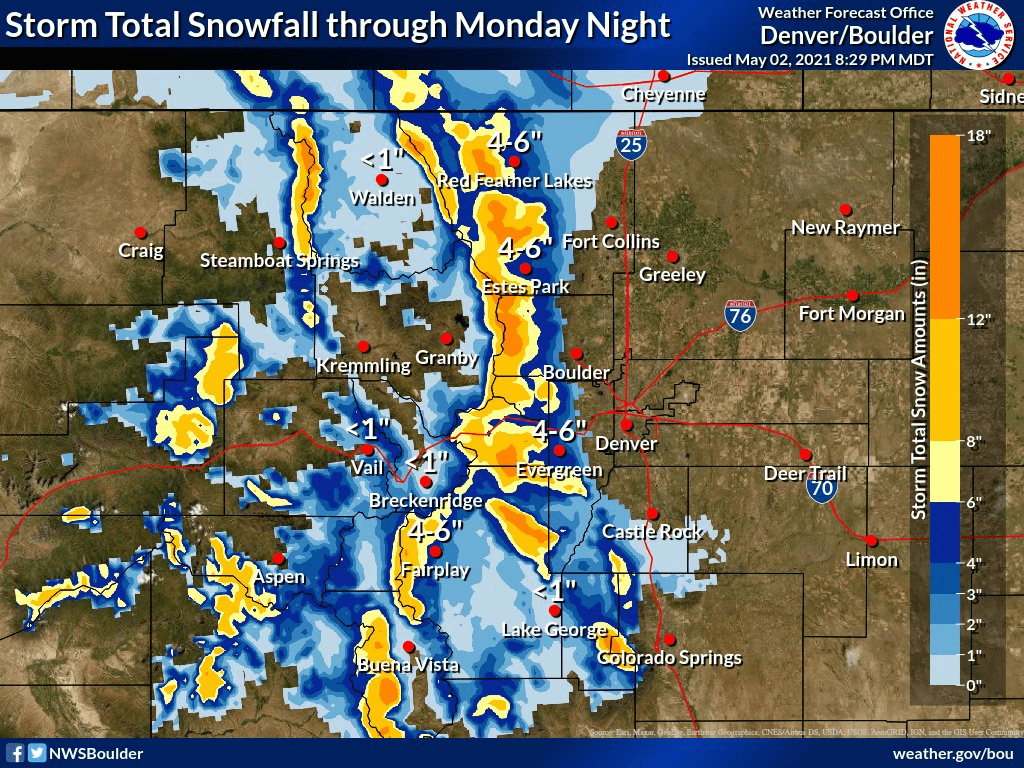
A trough moving through the state today will bring 6-12″ of additional snow to the mountains through tonight.
Snow has already been falling and will pick up across the higher elevations today and tonight
Things will taper off tomorrow afternoon as the trough moves off to the east.
Open resorts that look to see the most snow are Loveland, Arapahoe Basin, and Winter Park.
Short-Term Forecast:
Monday-Wednesday:
A trough moving through the state today will bring 6-12″ of additional snowfall to the mountains through tonight.
Snow has already been falling across the higher elevations and will continue through the day.
Daytime heating will allow for heavier bands to develop across parts of the state.
Snow will taper off later tonight and tomorrow morning as the trough moves off to the east.
Winter Storm Warnings and Winter Weather Advisories have been issued across the state because of this.
Some additional snow is possible Wednesday as another system brushes by.
Long-Term Forecast:
Thursday-Sunday:
Conditions will clear out Thursday as high pressure builds over the western US.
Another trough will move into the region this weekend, but snowfall totals are not certain at this time.
Extended Forecast:
Sunday and Beyond:
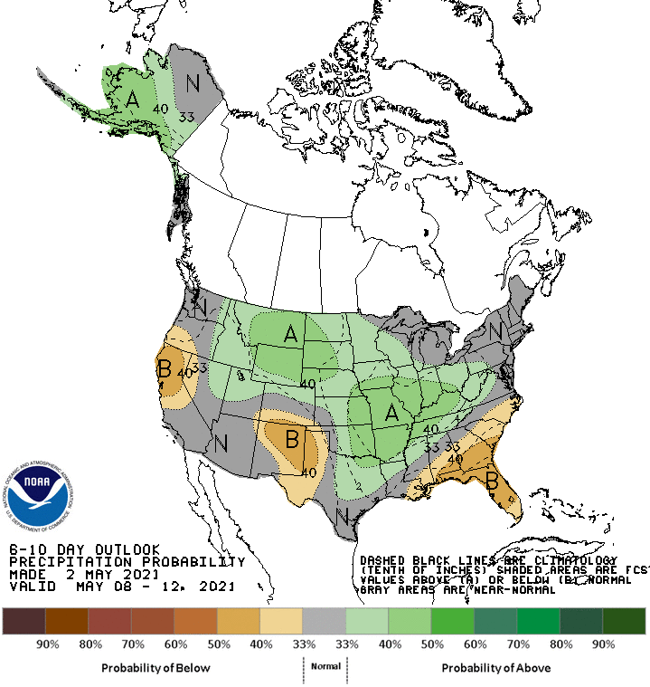
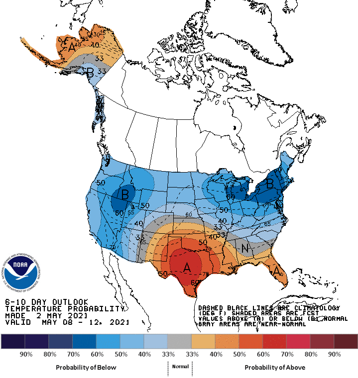
Global ensembles are indicating about average precipitation and about average temperatures across the region in the extended.