Forecast by SnowBrains Meteorologist Nathan Tarino
Most recent update: 6 AM MST March 16
Forecast Summary
After a fruitful week of stormy weather and new snow, Eaglecrest will already be skiing pretty well for Wednesday’s first chair. The mountain doesn’t spin lifts on Monday and Tuesday, so the fresh snow from earlier this week is sitting undisturbed, ready to be enjoyed.
More eventful weather is on tap for this week. A strong storm will begin today (Wednesday), bringing snow through Thursday afternoon. A second storm will keep snow showers falling into Friday and Saturday, making for excellent riding conditions into the weekend.
After a short lull, a chance for a big storm will arrive early next week. Some medium-range forecast guidance suggests the potential for an atmospheric river to bring very heavy rain and high elevation snow to portions of coastal British Columbia and southeastern Alaska. Uncertainty remains regarding specific snow levels and the exact placement of heavier precipitation.
Short and Medium Range
Webcams atop the Ptarmigan chairlift show settled powder from the past few days in the upper elevations of the resort:
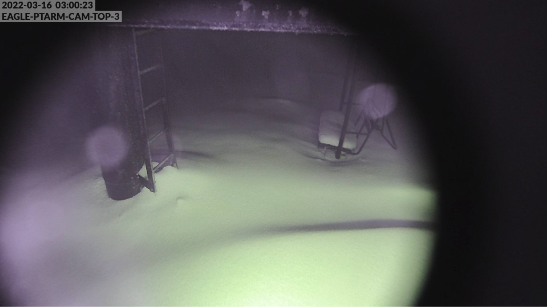
Data sources are a little sparse up in AK, but I think it’s safe to say ski conditions are already pretty good on the upper mountain, even ahead of this next storm.
Wednesday – Thursday night:
Snow begins Wednesday morning again. At least at the peak – some rain will mix in up to almost 2,000 ft to begin the day before snow levels fall close to the base (perched at about 1200′) by Wednesday evening. Still, steady snowfall can be expected for most of Wednesday above 1500′, meaning conditions will be fantastic on all but the lowest terrain on the hill.
Snow showers will continue after last chair Wednesday, lasting as long as Thursday evening. Thursday will ski even better than Wednesday, with showery snow continuing through most of the day and snow levels staying close to the resort base.
Snow will wind down late Thursday. By then, expect 7-13″ of snow close to the top of the resort and 2-5″ of concrete at the bottom of the resort, with the bulk of it falling Wednesday afternoon and evening and a few inches through the day Thursday. Both Wednesday and Thursday should ski great despite some early sloppiness near the base.
Friday – Saturday:
Another period of disturbed weather will begin on Friday. This storm will be less significant than the last, but enough for snow showers through the day on Friday and into Saturday.
Snow levels will generally stay below the base. However, rain could briefly mix in up to about 1500′ on Friday afternoon before quickly falling again through the evening. Saturday will feature the coolest weather yet and continued showery snow down to the base. Look for another 2-4″ of freshies from this round.
A few showers are likely Sunday, but additional accumulations are unlikely to exceed 1-2″.
Long-Range Outlook
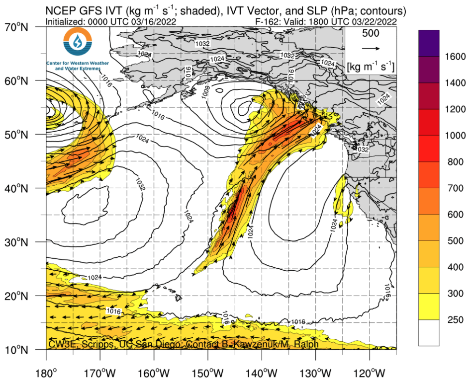
There are suggestions a significant storm could impact the area around the middle of next week, between the 21st and 23rd. Some model guidance suggests an atmospheric river could bring heavy rain and snow to portions of the Alaskan and BC coastline as a powerful cyclone over the Gulf of Alaska draws in subtropical moisture from near Hawaii (image below).
Details of snowfall amounts and snow levels remain ambiguous for now, but with the resort closed on Mondays and Tuesdays, there’s potential for deep snow to stack up before lifts spin next Wednesday.
In any case, the large-scale pattern remains favorable to continued active weather.