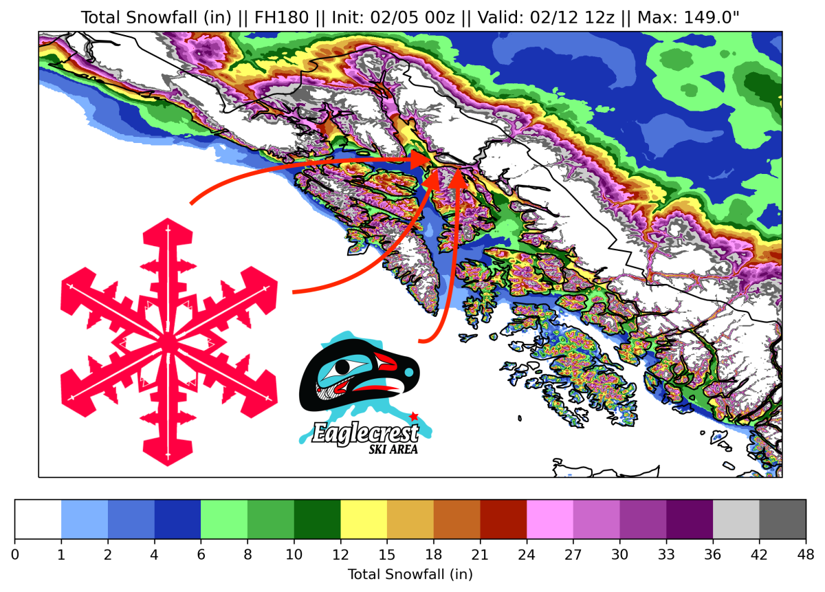
Eaglecrest Ski Area, Alaska, is in for an epic stretch of snowfall this week. 3-4 FEET of snow looks likely through next Friday, with no signs of slowing down beyond that.
The first wave of precipitation is already underway and will deliver around 4″ overnight. On Sunday, light snowfall will bring an additional inch or two, keeping conditions fresh all day.
Things really ramp up on Sunday night, with snowfall rates likely exceeding an inch per hour at points. By Monday morning, there should be 10-15″ of fresh snow, making for a great powder day.
This is a typical setup for southeast Alaska; an intense, wet initial wave with lingering cold showers trailing. Eaglecrest is in a perfect spot for this and scores again with this storm! For the next few days, lighter but consistent snowfall will bless Eaglecrest with additional pow. Snowfall rates will hover around a quarter of an inch per hour for days on end, allowing 3-6″ to fall each day. By Thursday morning, I anticipate the storm total approaching or exceeding 30″.
On Thursday morning, things begin to ramp up again as another system sweeps through the region. This storm will contain less moisture but should be a few degrees colder, allowing for fluffier snow. The details of this system are still very much in the air. Still, it’s looking like there could be around ~6″ during the ski day on Thursday plus another ~6″ on Thursday night, making conditions on Friday incredible.
Beyond that, the models are all over the place, but one thing is for sure: the snow won’t stop on Friday! Another storm next weekend looks fairly likely; beyond that, conditions still look favorable for more storms to track into the region.