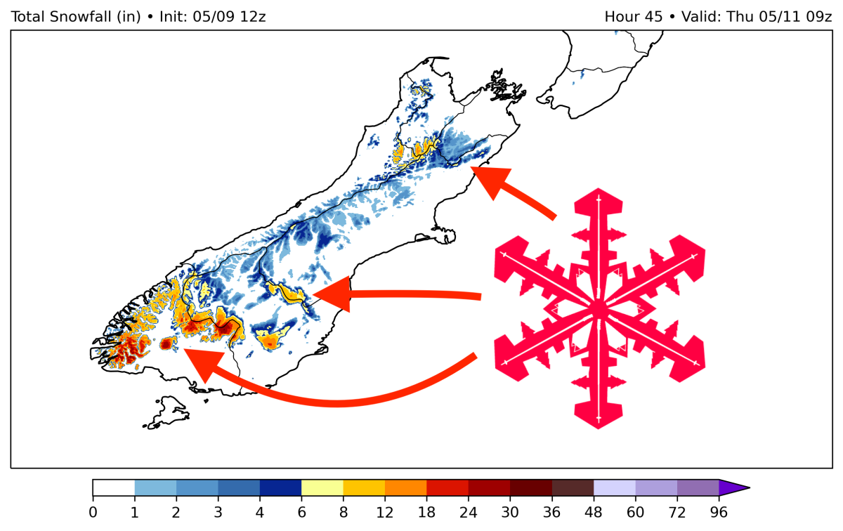
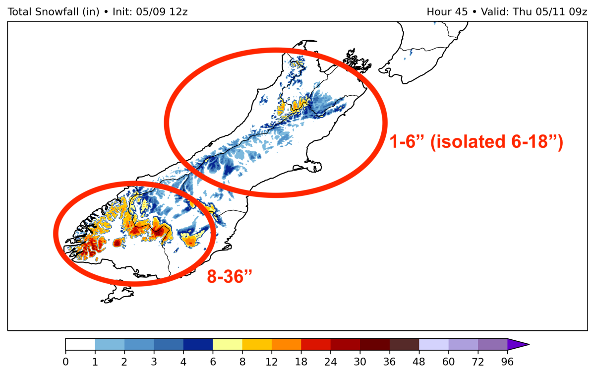
A major early-season trough is digging into New Zealand this week, bringing the first major accumulation of the season. This storm will last from Wednesday morning through Thursday afternoon and is expected to drop 1-3 FEET (30-90cm) in the southern mountains and up to 6″ (15cm) on high-elevation peaks to the north. Snow levels will hover below 1,000 meters during the most intense precipitation.
Snowfall rates will peak on Wednesday evening/night, with elevations above 1000-1500 meters clocking snowfall rates exceeding 2″ (5cm) per hour.
Most resorts will see a mix of rain, sleet, and snow throughout the storm, although the upper elevations could pick up decent accumulation. Here’s a list of resorts around the region and how much snow I’d expect them to pick up during this system:
- Remarkables – 6-8″ (15-20cm)
- Mt. Hutt – 2-4″ (5-10cm)
- Treble Cone – 0-2″ (0-5cm)
- Cardrona – 2-4″ (5-10cm)
- Coronet Peak – 4-6″ (10-15cm)
Keep in mind that slight temperature fluctuations during the precipitation could change these numbers quite a bit. Regardless of how the storm comes in, most resorts should see at least some flakes if not decent accumulation. Fingers crossed for a deep Kiwi season ahead!