Forecast By SnowBrains Chief Meteorologist – Eric McNamee
12:10 AM MST, 11/24/2022
Forecast Summary:
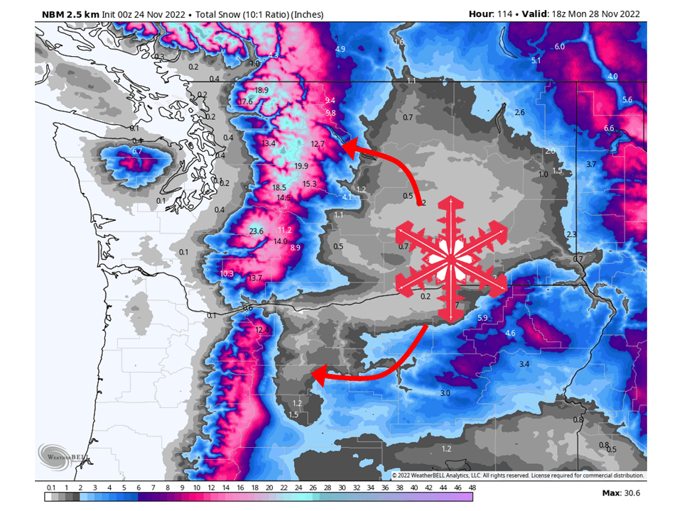
A series of troughs will move through the Pacific Northwest this weekend and early next week, possibly bringing 1-3 FEET of snow to the Cascades through Monday morning.
Snow will start Friday as the first shortwave trough pushes through.
A slight break is expected Saturday before the next shortwave moves into Sunday, bringing snow and much colder temperatures into Monday.
Resorts that will see the most snow are The Summit at Snoqualmie, Stevens Pass, Mount Crystal, Mount Baker, Timberline Lodge, and Mount Hood Meadows.
Short-Term Forecast:
Thursday-Sunday:
An active pattern is set to develop as a series of troughs will move through the Pacific Northwest this weekend and early next week, possibly bringing 1-3 FEET of Snow to the Cascades through Monday morning.
Dry weather is expected Thursday before the first shortwave moves through the region Friday.
Snow levels will initially be pretty high before falling to 3000-2500′ by Friday evening.
There will be a slight break in widespread snow Saturday with just some scattered snow showers before the next shortwave moves in Sunday.
Widespread snow is expected Sunday and Monday, with snow levels dropping to around 1500′ as much colder air moves in.
Snow will continue into Monday as moisture continues to be transported into the region.
Long-Term Forecast:
Monday-Wednesday:
Snow continues into Monday morning before drying out Monday night.
The active pattern will continue as another shortwave moves in Tuesday, bringing more snow to the Cascades.
This will continue into Wednesday as well.
Extended Forecast:
Wednesday and Beyond:
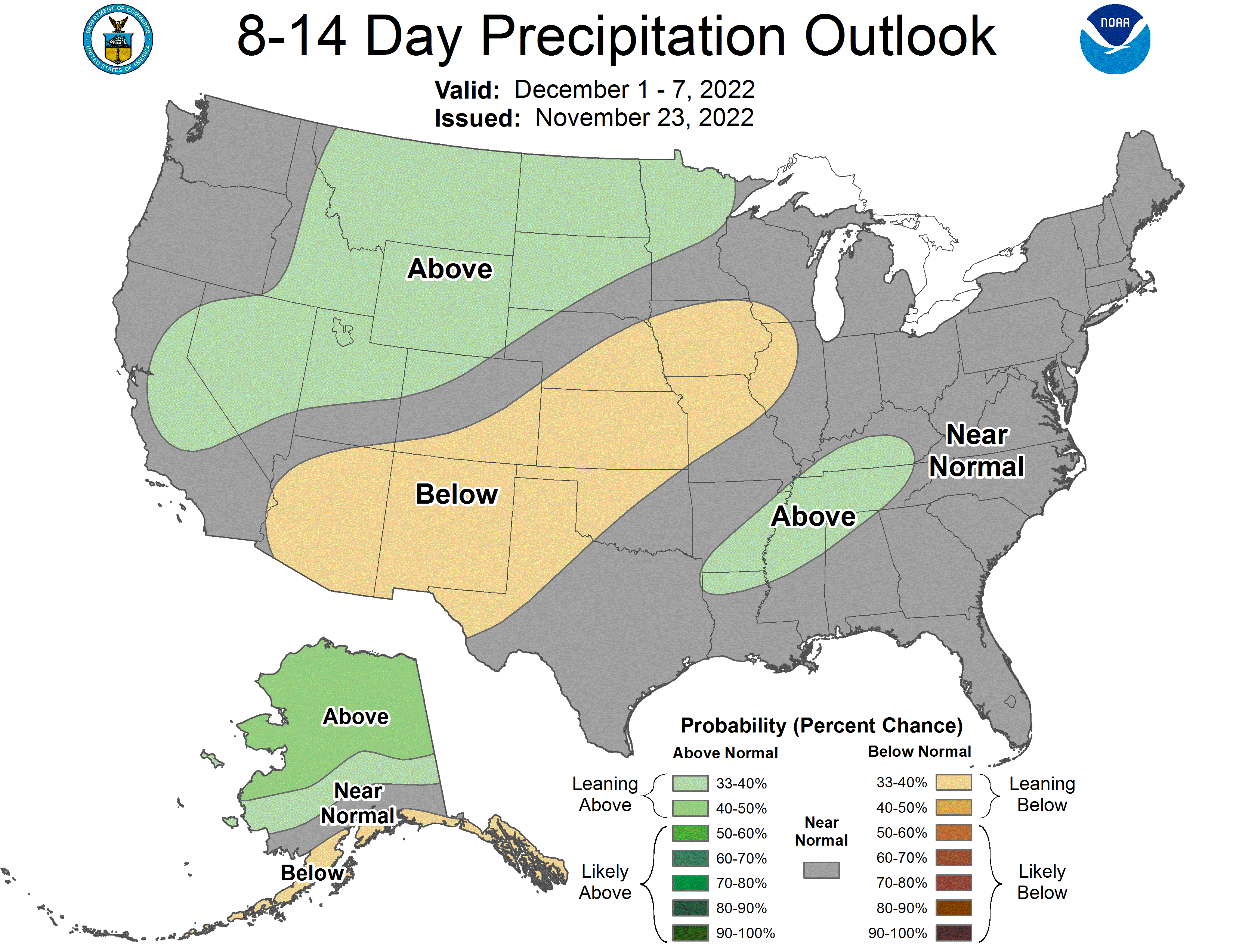
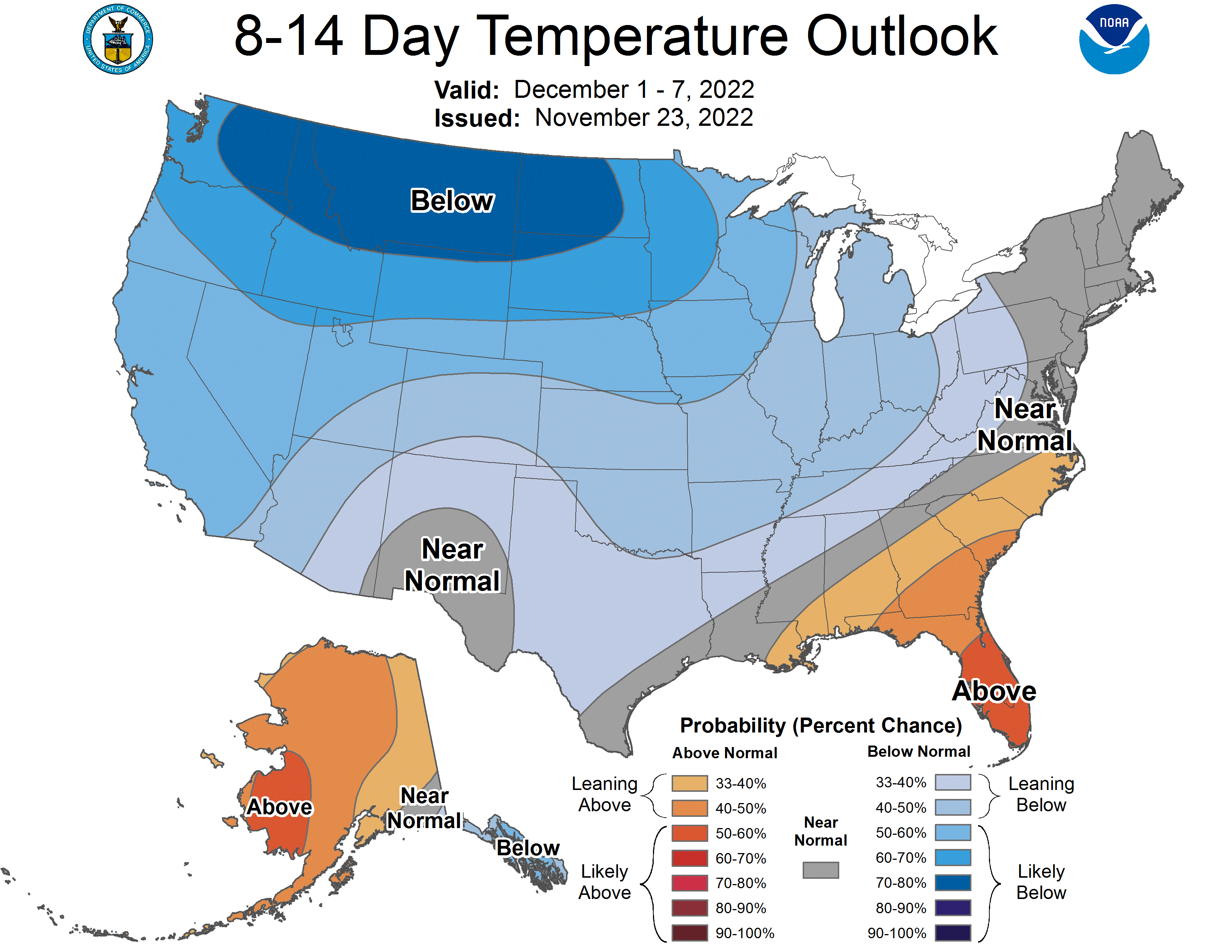
Global ensembles indicate average precipitation and below-average temperatures across the region in the extended period.