Forecast By SnowBrains Cheif Meteorologist – Eric McNamee
9:00 PM MST, 11/02/2021
Forecast Summary:
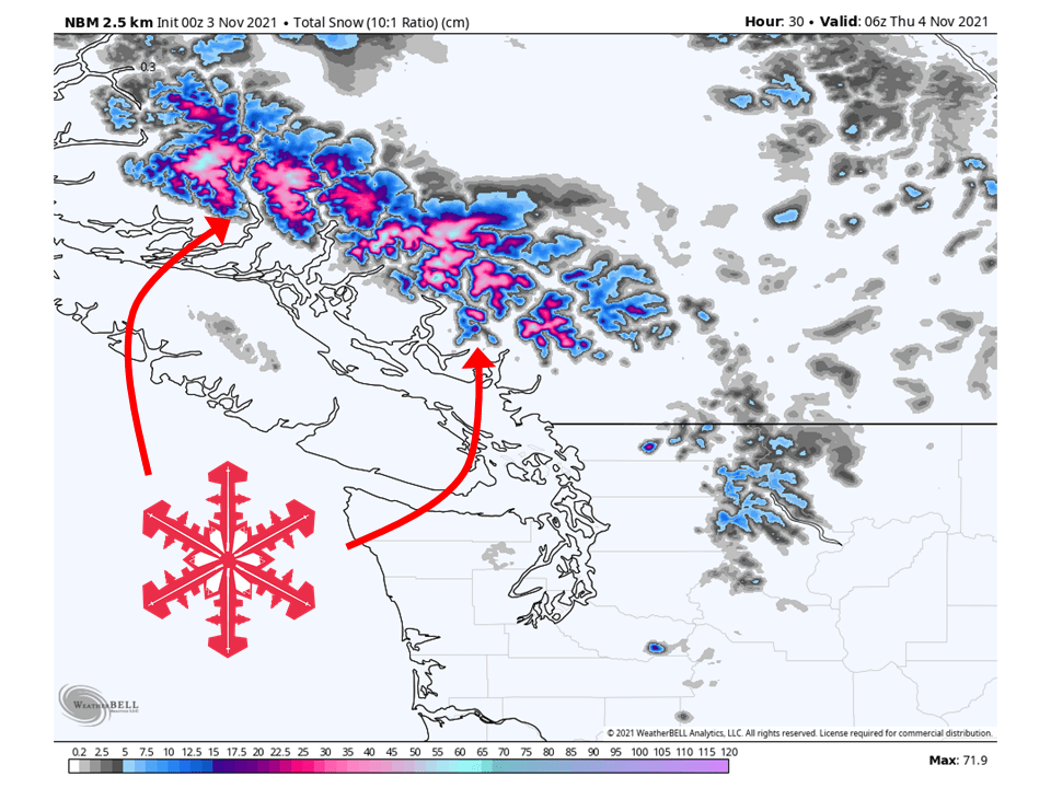
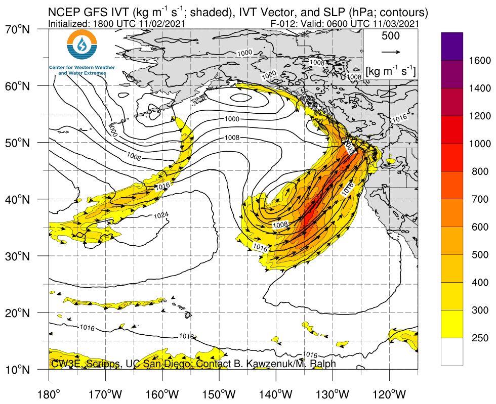
An atmospheric river will slam into coastal BC Tuesday night /Wednesday and bring over 2 feet of snow to the high elevations.
Snow will initially start Tuesday and continue through the day Wednesday.
A break in the action is expected Thursday before another atmospheric river slams the area Friday/Saturday.
An active pattern looks to continue in the long term.
Short-Term Forecast:
Tuesday-Thursday:
An atmospheric river will slam into the BC coast Tuesday night/Wednesday and bring over 2 feet of snow to the high elevations of coastal mountains.
Snow will begin Tuesday night as a trough of low pressure transports moisture into the coast.
This will continue through the day Wednesday before tapering off Wednesday night.
Some more light snowfall is possible during the day Thursday.
Long-Term Forecast:
Thursday-Sunday:
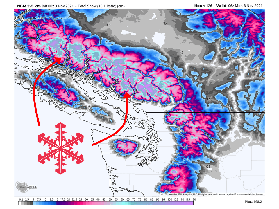
A much colder system will move through the region this weekend and possibly bring widespread significant snowfall totals.
This looks to be more potent than Tuesday/Wednesday’s system with higher snowfall totals.
There is still plenty of time for this to change but it is looking promising.
Extended Forecast:
Sunday and Beyond:
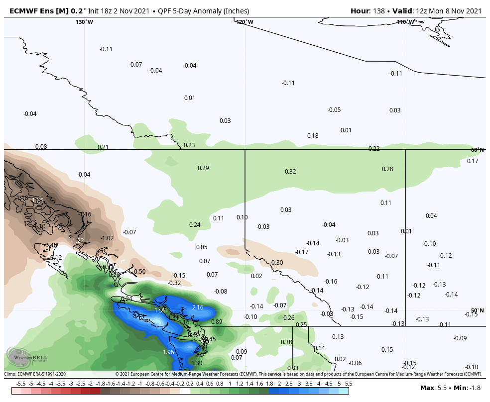
Global ensembles are indicating above-average precipitation across the area in the extended.