Forecast By SnowBrains Cheif Meteorologist – Eric McNamee
8:20 PM MST, 10/11/2021
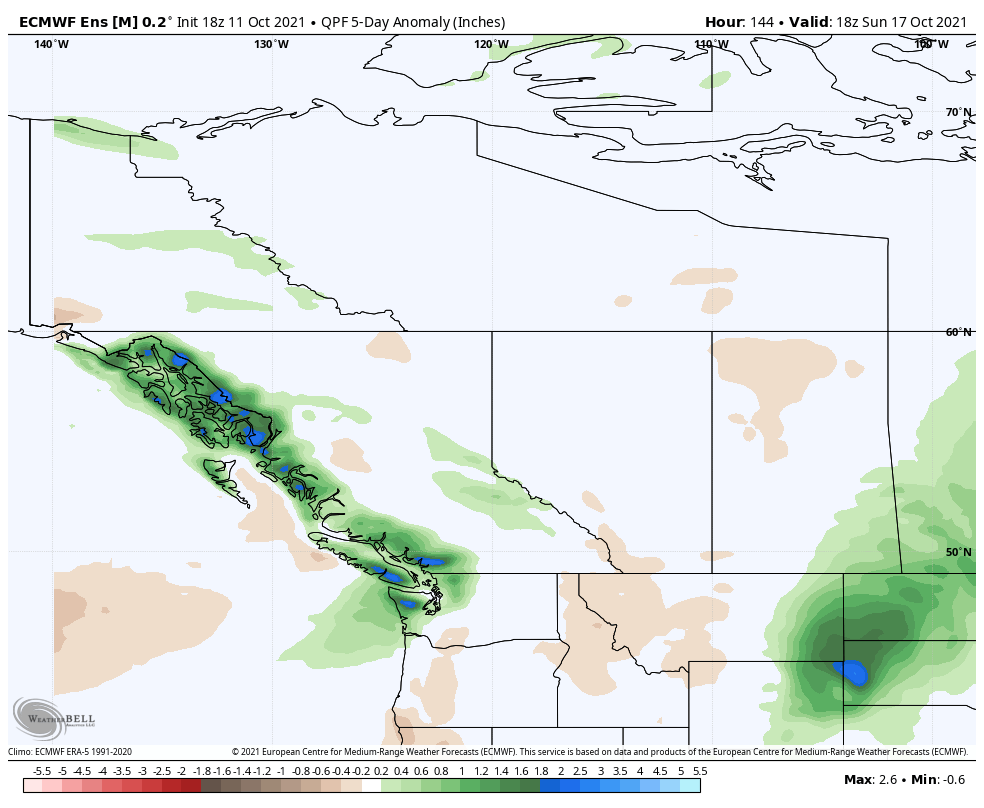
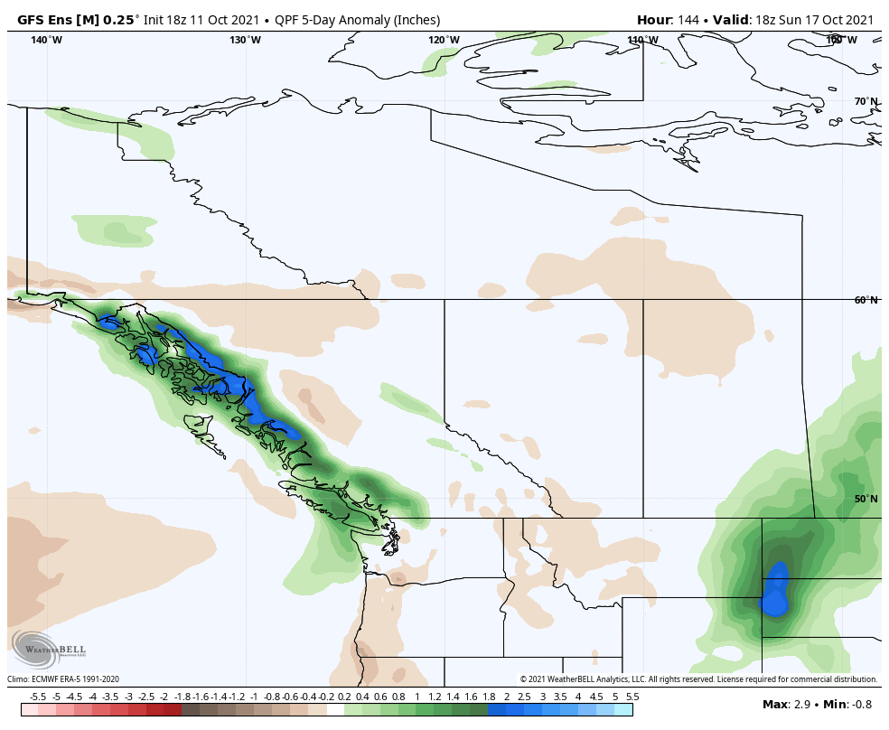
Forecast Summary:
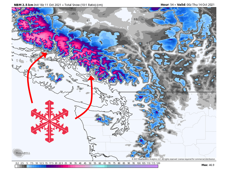
An atmospheric river will slam into coastal BC Tuesday/Wednesday and bring over a meter (3.2 feet) of snow to the mountains.
Snow will initially start Tuesday morning and continue through the day Wednesday, moving north to south.
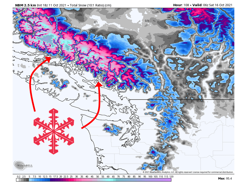
A break in the action is expected Thursday before another atmospheric river slams the area Friday/Saturday.
An active pattern looks to continue in the long term.
Short-Term Forecast:
Monday-Wednesday:
An atmospheric river will slam into the BC coast Tuesday/Wednesday and bring over a meter (3.2 feet) of snow to the coastal mountains.
Snow will begin Tuesday morning as a trough of low pressure transports moisture into the coast.
This will continue through the day Tuesday and into Wednesday, moving from north to south.
By Wednesday evening, snow will taper off as the transport of moisture moves south into the US.
Long-Term Forecast:
Thursday-Sunday:
Another atmospheric river will slam into the BC coast Friday/Saturday and have the potential of bringing 1-2 meters (3-6 feet) of additional snow.
A break in the action is expected Thursday before another atmospheric river hits the region.
This looks to be more potent and moisture-rich than Tuesday/Wednesday’s system with the potential of bringing more significant snowfall.
More snow is possible heading into Sunday.
Extended Forecast:
Sunday and Beyond:
Global ensembles are indicating above-average precipitation across the region in the extended.