Forecast By SnowBrains Meteorologist – Rowan Sullivan
10:00 PM MST – 11/23/2021
Forecast Summary:
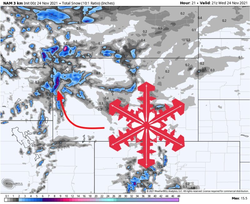
A shortwave trough is pushing eastward through the Northwestern US and will bring 4-8″ of snow to the Tetons overnight tonight into Wednesday.
Heavy snow will fall overnight as a cold front passes through, with postfrontal snow showers dropping bonus accumulations through mid-day Wednesday.
Plenty of cold air associated with this storm will bring light accumulations to valley floors, with as much as 2″ in the lower elevations.
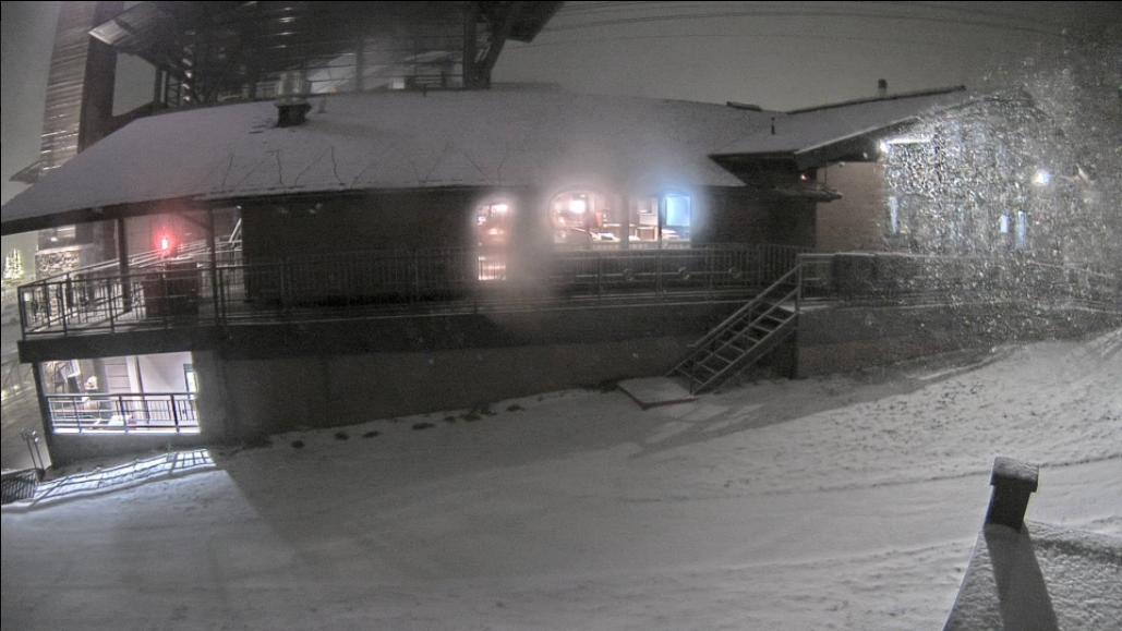
Grand Targhee is open for the season, so Wednesday should offer some good early season conditions. Jackson Hole will begin spinning lifts on November 25th.
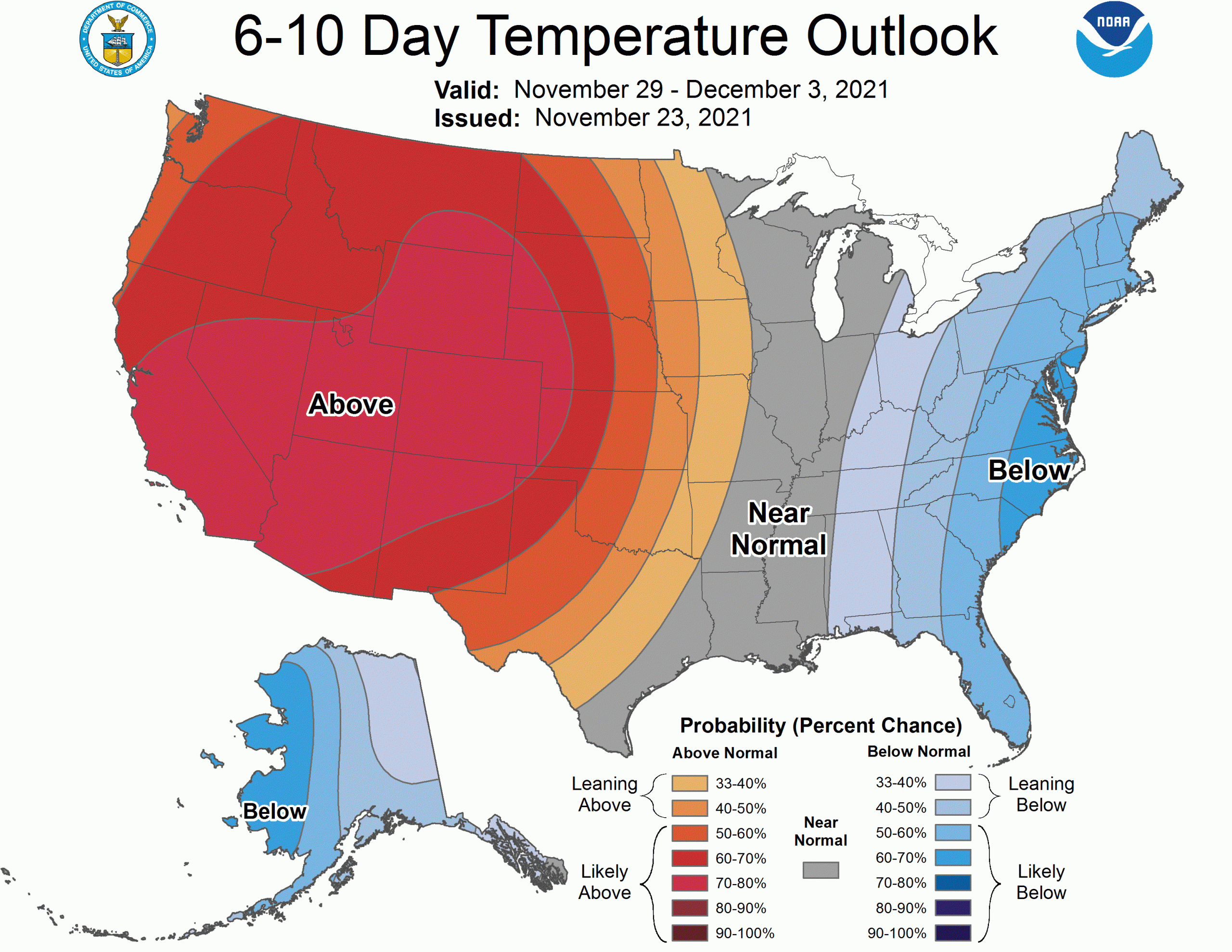
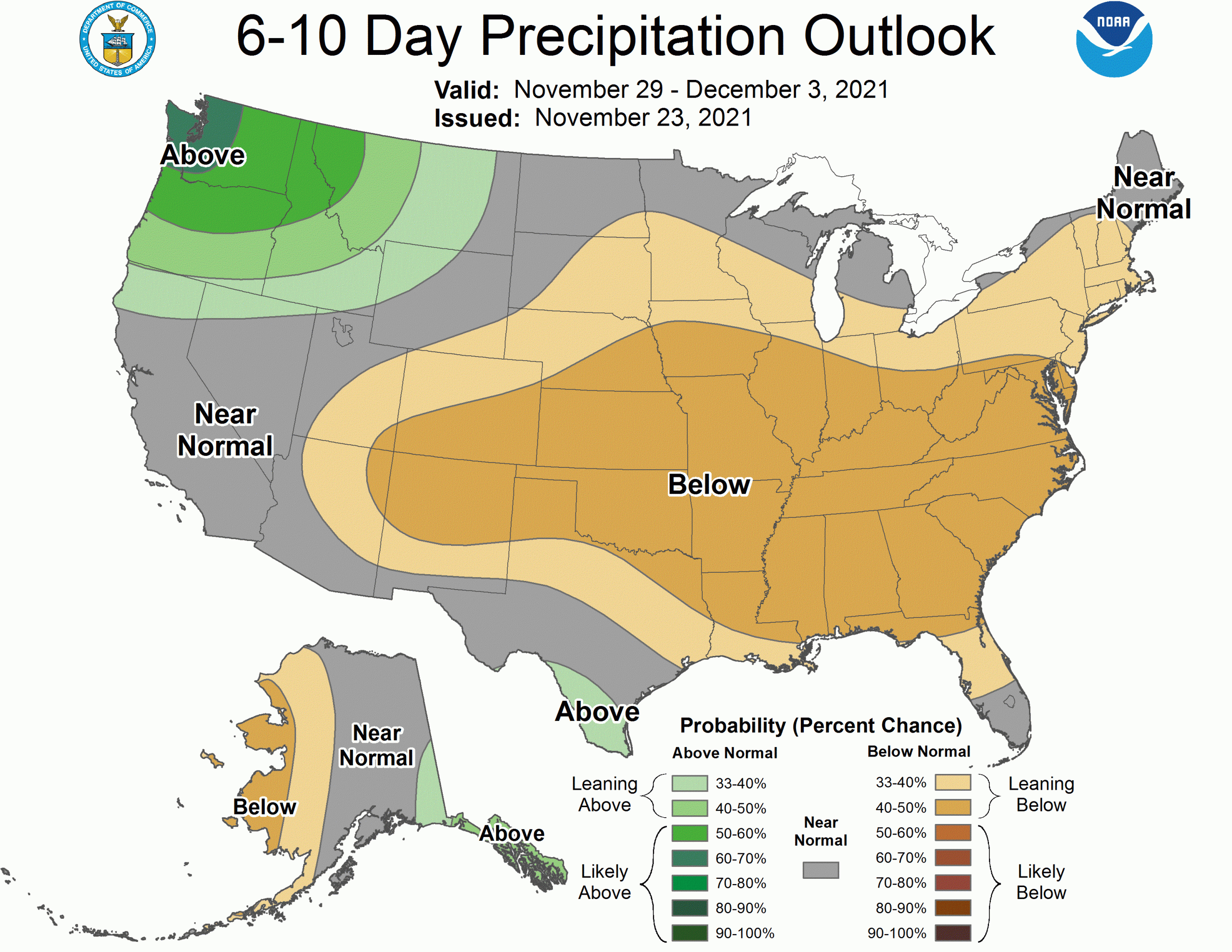
A blocking ridge is expected to build over the Western US behind this storm, bringing warmer than average weather in the long term. More snow seems unlikely before we close out November.
Short Term Forecast:
Tuesday – Wednesday:
A quick-hitting weather system is progressing southeastward out of the Pacific Northwest tonight.
The heaviest snow will fall overnight Tuesday into Wednesday as a band of heavy snow moves through along a cold front. Lighter snow will linger into mid-day Wednesday before things clear out through the afternoon.
4-8″ of snow is expected across the higher elevations in the Tetons, including Grand Targhee and Jackson Hole Mountain Resort. The heaviest totals are likely to fall on the western slope of the Tetons, and I won’t be shocked to see Grand Targhee near the higher end of the range.
Longer Range:
Thursday and Beyond:
A warming trend will set in as a strong upper-level ridge builds over the region late this week. The rest of the workweek will be dry and relatively warm in the mountains. A few pushes of Pacific moisture could bring some scraps to Wyoming, but significant snow is unlikely through the rest of November.
In response to this, the Climate Prediction Center’s long-range outlooks aggressively call for warmth.
However, there is some suggestion the ridge could break down through the first week of December. With any luck, this will open the door to more cold and snowy weather and maybe a couple of more significant storms.