Two powerful winter storms will push through Colorado early this week, bringing significant accumulations to upper elevations with good probabilities of small amounts of snow in Denver, Boulder, and Colorado Springs. The highest accumulations will be found in the San Juan mountains with between 12 and 15 inches, with localized amounts of up to 20″ possible by the end of the week.
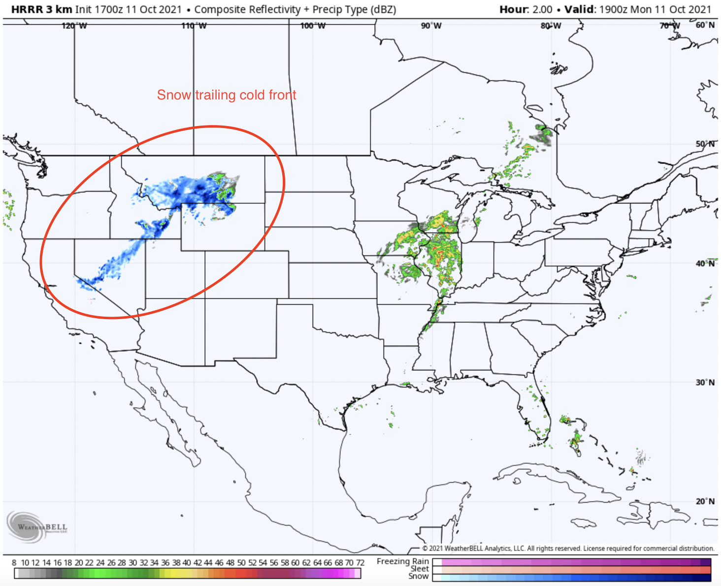
A cold front moved through the Pacific Northwest overnight and is currently pushing through the Intermountain West. Below is a look at the current modeled composite reflectivity, which is a good measure of the strength of precipitation.
Credit: WeatherBell. Model credit: NOAA
From the composite reflectivity, a strong band of snowfall can be seen pushing southeast into the Intermountain West. This front is particularly strong; precipitation is currently falling as snow even in the lower plain areas of Nevada, Idaho, and Montana.
This storm will continue to push towards Colorado, with the first moisture arriving from the Southeast due to the cyclonic rotation associated with low pressure. The exact timing of this is still slightly up in the air, but it looks like the San Juans could see the first flakes falling at about 6 pm MT on the 11th. Moisture will continue to spiral into the state, with most mountains in the state seeing snow by mid-morning to early afternoon on the 12th. Snow showers will linger in the mountains through mid-morning on the 13th.
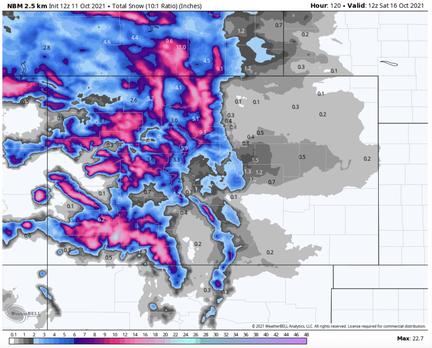
In terms of totals, the model guidance is indicating that this storm will favor the San Juan Mountains of southwest Colorado, dropping between 10 and 16 inches in most areas with localized totals up to 20″. However, I think that the potent southwesterly flow of the trough will favor the San Juans more than the models are picking up on. I wouldn’t be surprised by accumulations of 25″ in a few of the upper elevations of the region.
Other mountainous regions of the state should see totals of at least 6-8″ in the upper peaks with good odds of up to 12″ by Friday afternoon. The first storm will heavily favor the San Juans, as mentioned before, but the second, smaller storm, which will arrive in the early morning of the 14th, is tracking further North and should help balance out totals in the Central and Northern areas of Colorado.
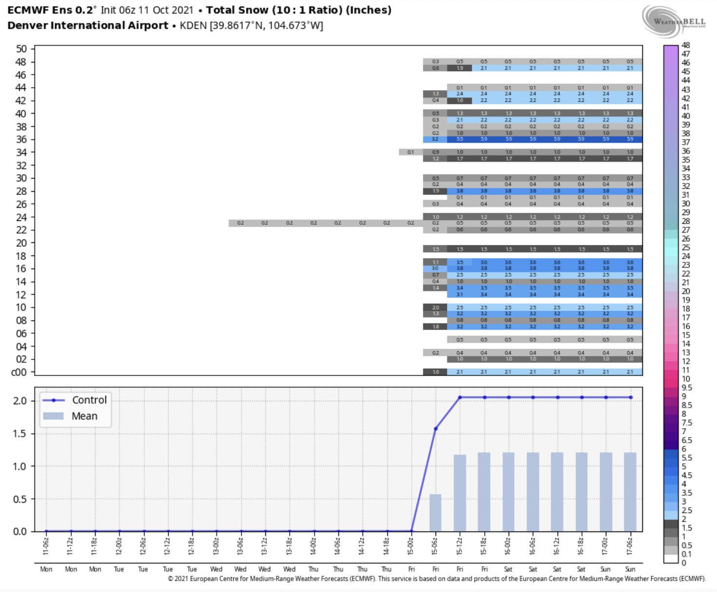
The big question mark for this storm is the potential for snow in the lower-elevation metro areas like Denver, Boulder, and Colorado Springs. Most members of the American, Canadian, and European ensemble forecasts are forecasting some snow for these areas, with a mean of about 1″ of snow in Denver, 1-2″ in Colorado Springs, and 2″ in Boulder. Below is the ensemble member view for the European ensemble forecast for Denver International Airport:
Fingers crossed for good snow accumulations, which should help to build a good early base with Colorado ski season right around the corner!