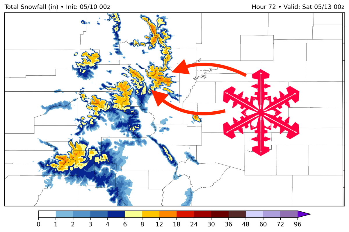
A messy late-season storm will bring as much as a foot of snow to Colorado resorts this week. Snowfall will last from early Thursday morning through early Friday morning, with the best day of skiing likely falling on Friday. This forecast will mainly focus on open resorts (Arapahoe Basin, Breckenridge, Winter Park). Higher elevations in the Front Range have huge upside and could score big. This storm is very warm and elevation-dependent (with snow levels hovering between 10,000 and 11,000 feet for most of the storm), so the higher you can go, the better, making A-Basin a good powder-chasing target this week.
Snowfall will begin trickling into the mountains early Thursday morning. Higher elevation slopes at Breck, A-Basin, and Winter Park should score a few inches by the time the lifts open, however, most mid and lower-elevation zones will see mostly sleet/rain. During the day on Thursday, most mid-mountain temperatures will be hovering in the mid-30s, bringing a messy mix of rain, sleet, and snow. This also makes the forecast difficult, as slight changes in the temperature and moisture of the lower atmosphere can mean the difference between rain and creamy powder.
Arapahoe Basin will lead the charge during the day on Thursday due to its high elevation. I see Arapahoe Basin picking up 3-5″ during the day and Winter Park & Breck picking up 0-3″, depending on elevation and the forecast uncertainty that I mentioned above.
Snowfall will continue into Thursday evening and night. Temperatures will cool off overnight, so this is the best chance for some lower-elevation snow for Friday morning. I could see Arapahoe Basin picking up another 3-5″ and Breck/WP picking up 1-4″ by the time the lifts are spinning on Friday morning.
Precipitation will wane on Friday morning, leaving just lingering showers in the high country by the time the ski day kicks off.
Afternoon convective bursts in the mountains could continue to bring very minor snow at high elevations throughout the rest of the week, though accumulations will not likely be significant.