Forecast By SnowBrains Chief Meteorologist – Eric McNamee
10:45 pm MDT, 8/10/2022
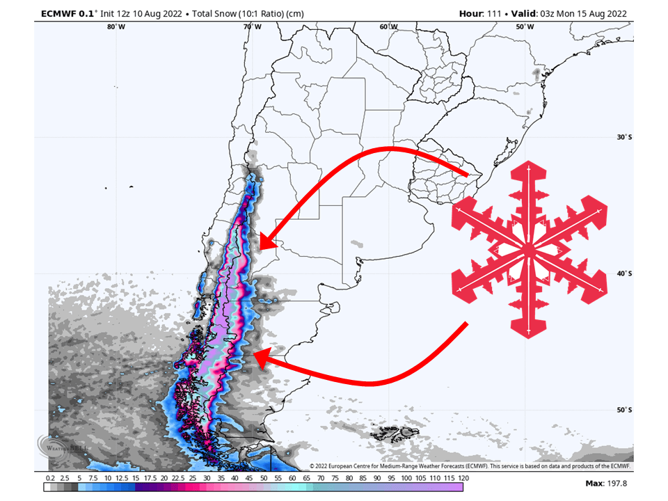
A powerful winter storm is on track to slam into the southern Andes tomorrow through early next week and bring DEEP snowfall to the region. By early next week, most resorts will likely see totals upwards of 40+ inches with some spots possibly seeing upwards of 60+ inches.
The cause of this is a substantially strong and deep trough that will rotate a series of shortwave troughs through the area. Each of these will be moisture rich with subtropical moisture and cold air pooling over the area. Each shortwave looks to have more moisture than its predecessor.
The first of said shortwaves will push into the region Thursday morning. The moisture stream will be narrow but intense and allow for fairly heavy precipitation rates. Some low elevations will see pretty dense snow before colder air pushes through by Friday morning. This cold airmass will stay in place through the rest of the weekend, allowing for a more light and powdery snow with the subsequent shortwave troughs.
The second shortwave will push through Thursday evening and into Friday night. A greater moisture surge is expected with this shortwave and should cover a larger area than the first shortwave. This will allow the opportunity for more widespread snowfall across the southern Andes. The next shortwave trough then moves through the region Saturday and lasts through Sunday. Again, more moisture and widespread heavy snowfall are likely over peaks and resorts.
The last shortwave will rotate through the region Monday. This looks to have the most moisture of the series of shortwaves, bringing the heaviest widespread snowfall.
All four major global deterministic models – the ECMWF, GFS, GDPS, and ICON – and their ensemble counterparts are putting the precipitation bullseye just to the northeast of Gulf de Ancud.
Great options for scoring deep snow this week:
- Cerro Catedral
- Cerro Bayo
- Chapelco
- Perito Moreno
- Antillanca
More snow looks likely next week as another trough will move into the region. Exact snowfall totals are uncertain but more heavy snow is very possible.
One thought on “SnowBrains Forecast: Upwards of 40+ Inches Possible For Parts of The Southern Andes Through Early Next Week”