Forecast By SnowBrains Meteorologist – Eric McNamee
11:10 AM MST, 2/22/2021
Forecast Summary:
An atmospheric river event will take place in the northwestern US through Wednesday, bringing 1-3 FEET snow, with higher amounts in the High Cascades.
Snow levels will start out at high elevations due to the warm air mass associated with the atmospheric river.
Once colder air moves in Tuesday, this will lower snow levels and increase SLR across the region.
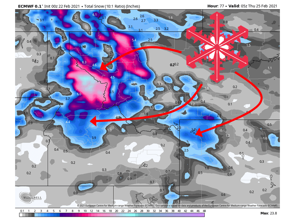
More snow will come in the second half of this week as another atmospheric river hits the region.
Short-Term Forecast:
Monday-Wednesday:
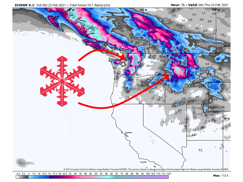
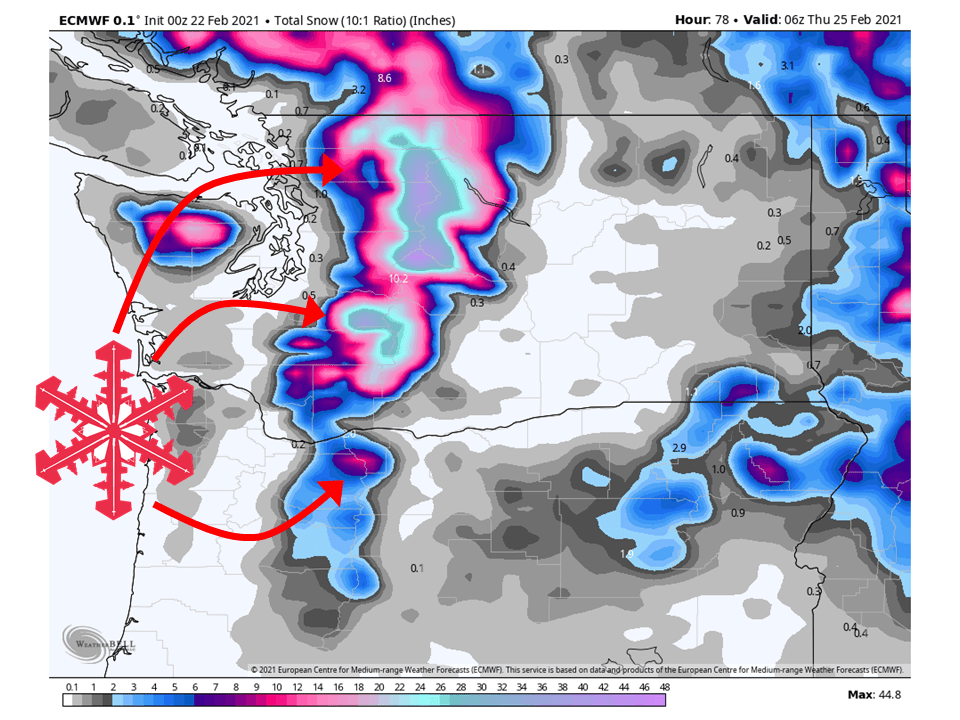
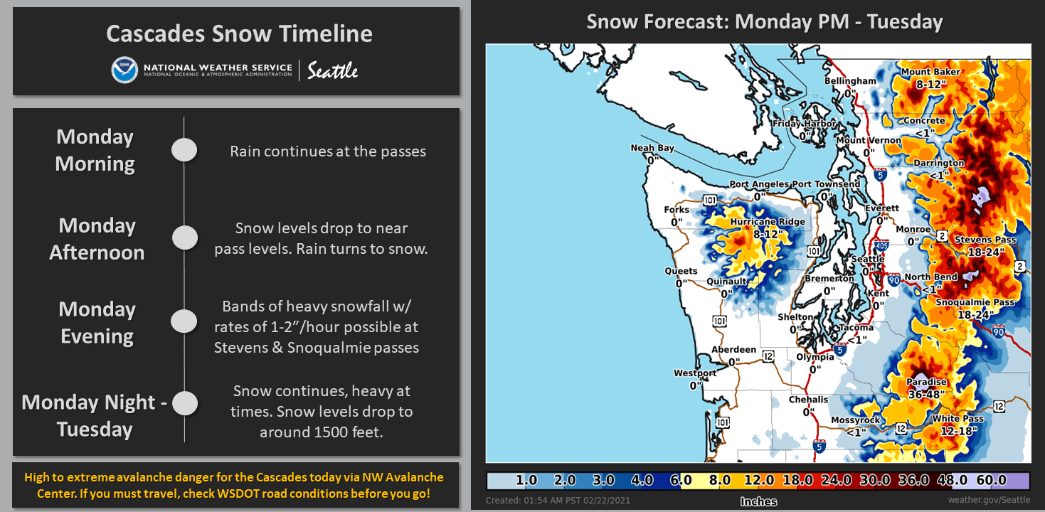
Moisture from the atmospheric river will continue to slam into the PNW, bringing 8-12″ of snow to the Washington Cascades through tonight.
This same wave of moisture will fill in across the Northern Rockies tonight and drop 8-12″ of snow to Northern Idaho and Western Montana.
During this same time, colder air will move into the PNW, dropping snow levels and bringing 1-2 FEET of snow to the Washington Cascades through Tuesday.
Higher snowfall amounts are likely the higher up you go in elevation, but this is what’s likely to fall at most resorts.
An additional 6-12″ of snow will fall in the Northern Rockies through Wednesday as the same colder air mass moves into the region.
The AR event is underway across the region as heavy precipitation
has set in across the region as the plume of moisture starts to
migrate southward. While still breezy in some areas, hazardous winds
have ceased across the region as the boundary layer in the
previously shadowed region have moistened over the past few hours.
Snow levels will remain elevated across the region through early
this afternoon with rain continuing across the region, including
across the Cascades. While rainfall rates look to remain low enough
to not yield a high urban flooding threat, rises on area rivers are
expected through Tuesday. See the hydrology section below for
flooding concerns. Continued rainfall in the Cascades this morning
will continue to yield very dangerous to extremely dangerous
avalanche conditions in the Cascades through at least this
afternoon. A quick moving cold front will push across the region and
bring snow levels down below pass level by this evening. There is
great agreement from the latest HREF members in heavy snow bands
setting up across Stevens and Snoqualmie Passes this evening.
Snowfall rates of 1 to 2"/hr will be common, with the potential for
2"+/hr rates not out of the question at times.
-NWS Seattle 2/22/2021
Long-Term Forecast:
Thursday-Sunday:
More snow will come in the latter part of the week as another atmospheric river takes aim at the region.
At the moment, similar snowfall amounts look to be possible with the influx of moisture.
Snow should taper off a bit heading into the weekend.
Extended Forecast:
Sunday and Beyond:
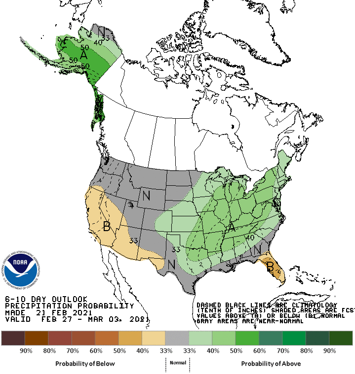
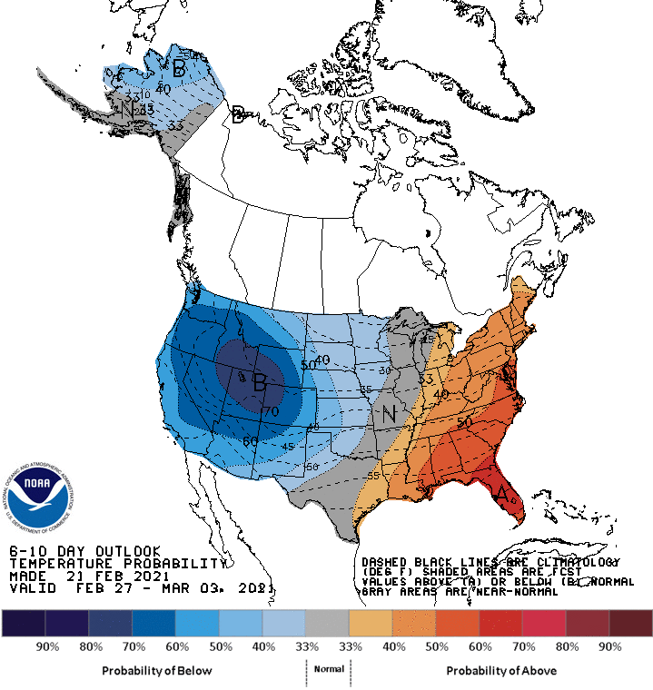
Global ensembles indicate below-average temperatures and near-average precipitation across the Northwest US through the extended period.
Pacific Northwest:
The Pacific Northwest looks to fair pretty well, primarily Washington, with 1-3 FEET of snow falling through Wednesday and more likely in the highest elevations
Resorts that look to see the most snow are Crystal Mountain, Alpental, Mt Baker, and Stevens Pass.
Northern Rockies:
Like the Pacific Northwest, the Northern Rockies will fair pretty well through Wednesday with 1-2 FEET of snow falling.
Resorts that look to see the most snow are Whitefish Mountain, McCall, Tamarack, Schweitzer, Grand Targhee, and Jackson Hole.
USA:
Global ensembles indicate below-average temperatures and near-average precipitation across the Northwest US through the extended period.