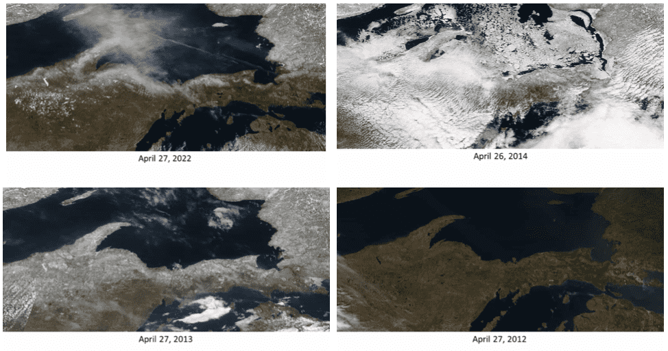
NWS Marquette, Michigan, shared these four images on Facebook yesterday of how the Upper Peninsula snowpack has varied on this day over the years. The stark differences are amazing, from totally bare to totally buried!
With mostly clear skies today, the NASA MODIS satellite got a great view of the Upper Peninsula! Here’s a selection of MODIS pictures from late April in recent memory:
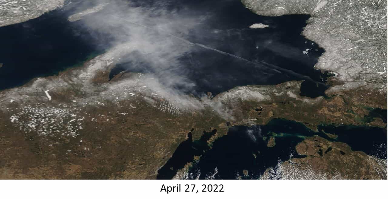
2022: There’s still visible snowpack in the Keweenaw Peninsula and the counties near the Lake Superior shoreline. For our office in Negaunee Township, the office had a snow depth of over an inch on April 27th for the 5th time in the past 10 years and the 10th time in the past 50 years.
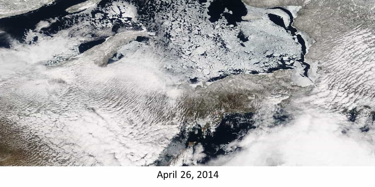
2014: After a record cold winter, Lake Superior is still riddled with lake ice, and snow is still clearly visible for large portions of the Upper Peninsula.
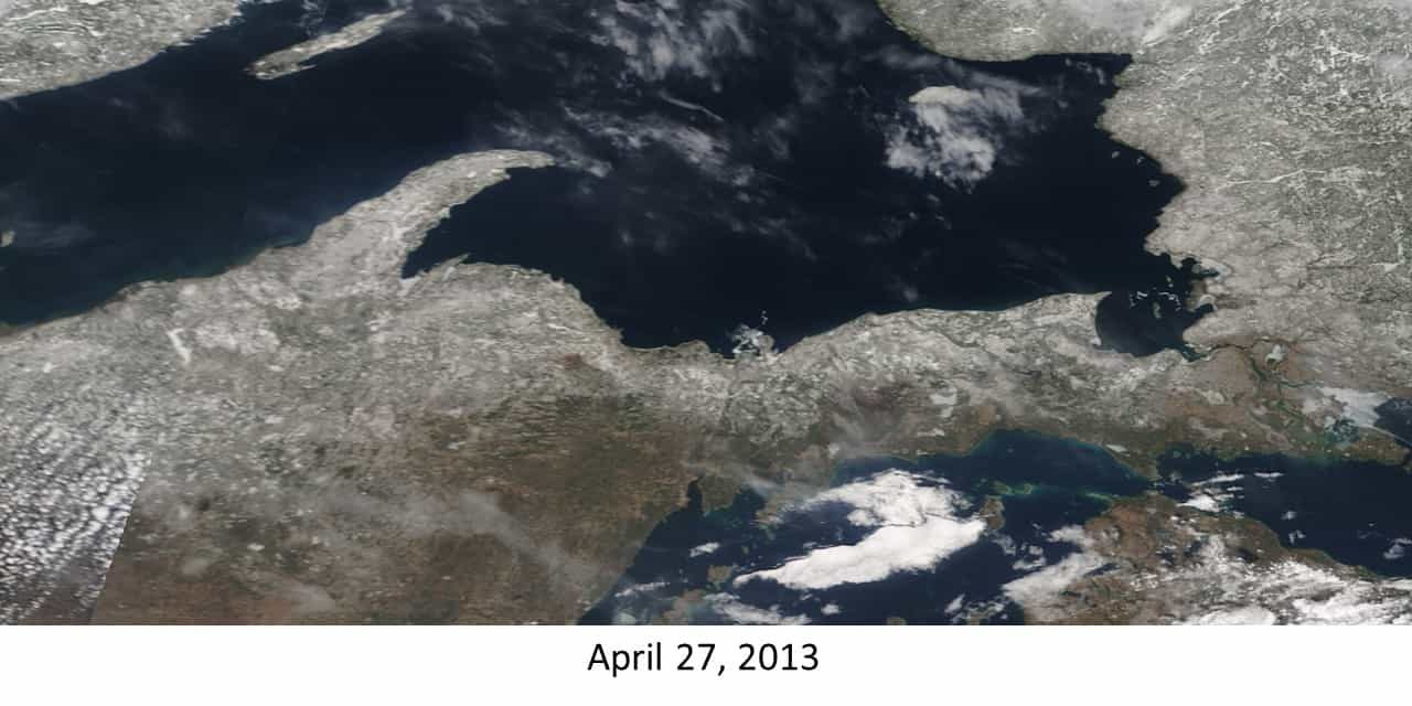
2013: The highest level of the snowpack at the Negaunee Township office since records began at 25.2 inches, with much of the Upper Peninsula still with snow on the ground.
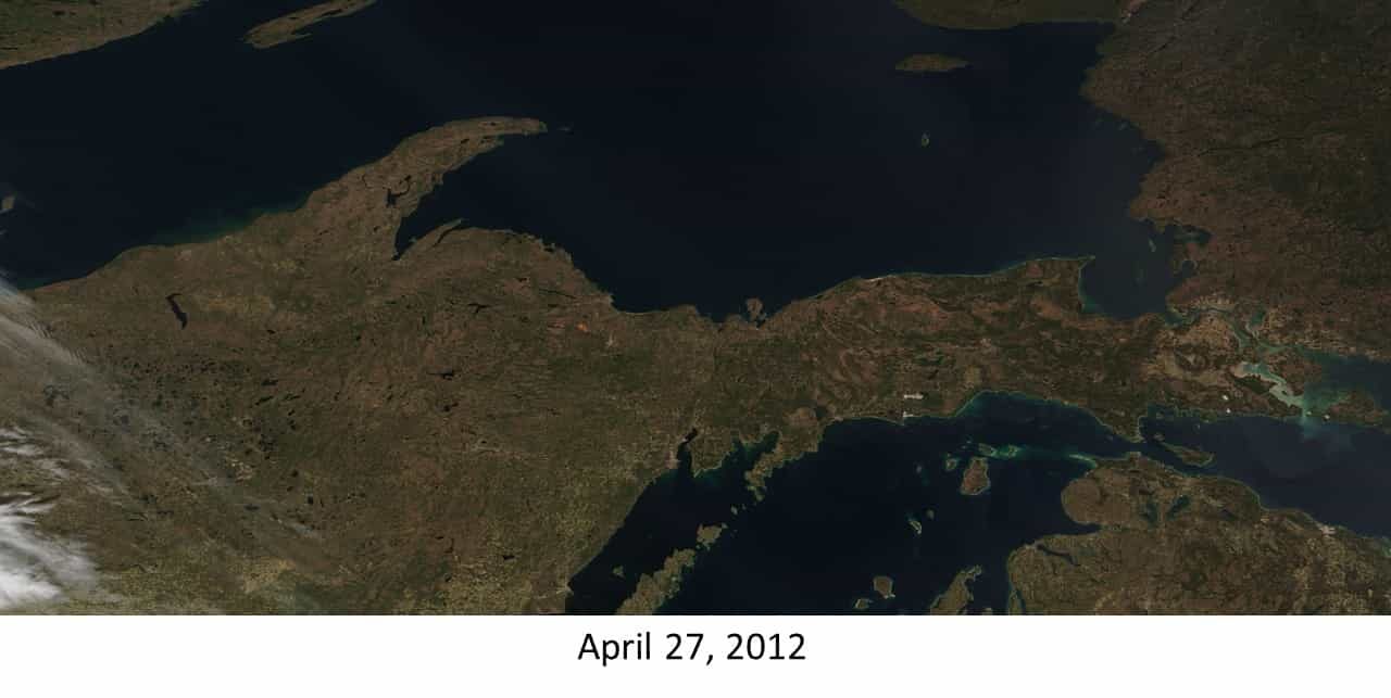
2012: The snowpack was gone by mid-March, and every single day in April 2012 reached above freezing in Negaunee Township, which kept the snow at bay.