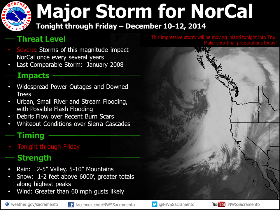
The strongest storm to hit Northern California since January 2008 is about to impact NorCal today through Friday. They’re also calling this the strongest wind event to hit Tahoe in over 2 years. NOAA is calling this a “Severe” storm and defines a severe storm as
“Storms of this magnitude impact NorCal every several years.” – NOAA
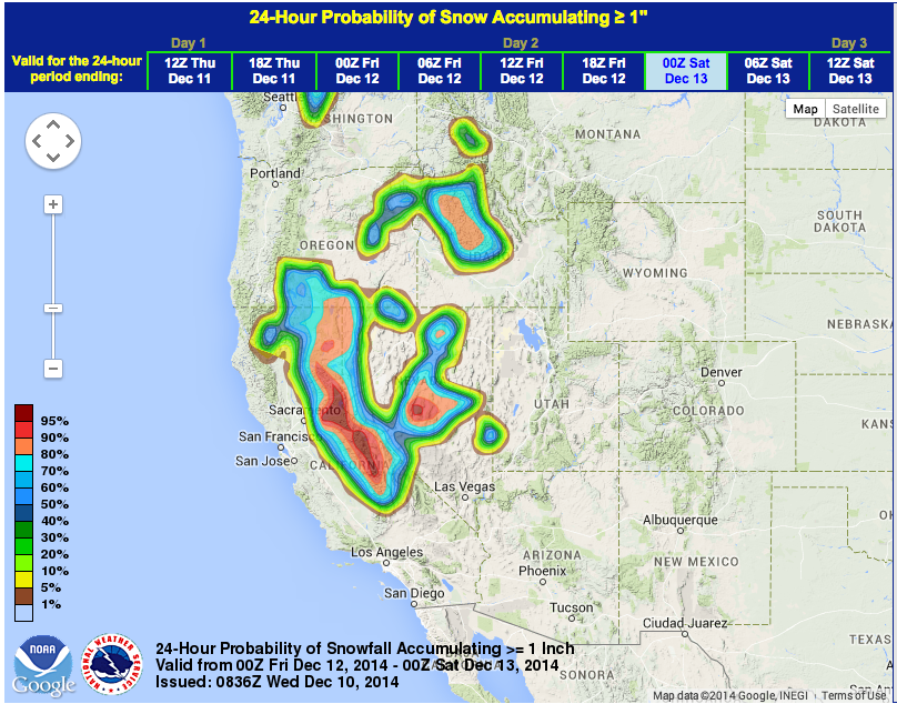
This storm is looking ferocious with 1-3 of snow forecast above 7,500-feet, 1-foot forecast at lake level, and up to 140mph winds on the ridge tops. Snow levels will most likely start around 8,000-feet on Thursday morning before dropping to lake level by Thursday evening when the heaviest precipitation is forecast to come through. Snow levels will drop as low as 4,500-feet by Friday.
In NorCal right now, NOAA has issued a Blizzard Warning, a Winter Storm Warning, High Wind Warning, Flood Warning, a High Surf Advisory, a Lake Wind Warning, and a Flash Flood Warning.
Storm Impacts This Week:
– Up to 3-feet of snow on the Sierra Crest of Tahoe
– Up to 13″ of snow at Lake Level
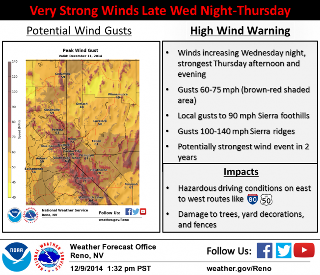
– 100-140mph winds on ridge tops in Tahoe
– Waves up to 7-feet on Lake Tahoe (surf’s up!)
– Waves up to 25-feet on the coast (stay away!)
– Up to 6″ of rain in the foothills
– Widespread flooding in the valleys and foothills
– Major wind damage with winds as high as 80 mph in the Bay Area
NOAA’s Blizzard Warning:
URGENT - WINTER WEATHER MESSAGE
NATIONAL WEATHER SERVICE SACRAMENTO CA
405 AM PST WED DEC 10 2014

...BLIZZARD WARNING NOW IN EFFECT FROM 7 AM THURSDAY TO 4 AM PST
FRIDAY ABOVE 6500 FEET...

* IMPACTS:EXTREMELY HAZARDOUS WHITEOUT CONDITIONS. PASSES MAY
  CLOSE FOR SEVERAL HOURS.

* SNOW ACCUMULATIONS: 6 TO 13 INCHES WITH 2 FEET OR MORE ALONG THE
  CREST.

* TIMING: SNOW WILL BEGIN LATE TONIGHT INTO THURSDAY MORNING AND
  CONTINUE LESS HEAVY INTO FRIDAY AFTERNOON. THE PERIOD OF
  HEAVIEST SNOW IS EXPECTED THURSDAY AFTERNOON AND THURSDAY NIGHT.
  THE STRONGEST WINDS ARE EXPECTED TONIGHT AND THURSDAY.

* SNOW LEVELS: SNOW LEVELS WILL INITIALLY BE ABOVE 6500 FEET LATE
  TONIGHT INTO THURSDAY...LOWERING TO 4500 TO 5500 FEET THURSDAY NIGHT
  INTO FRIDAY.

* WIND: SOUTHERLY WINDS 25 TO 50 MPH WITH GUSTS TO 80 MPH OR
  HIGHER WILL DEVELOP TONIGHT INTO THURSDAY. WINDS DECREASE BY
  FRIDAY MORNING.

* LOCATIONS INCLUDE: DONNER PASS...ECHO SUMMIT...CARSON PASS.