Brought to you by 10 Barrel Brewing
Report from February 10, 2021
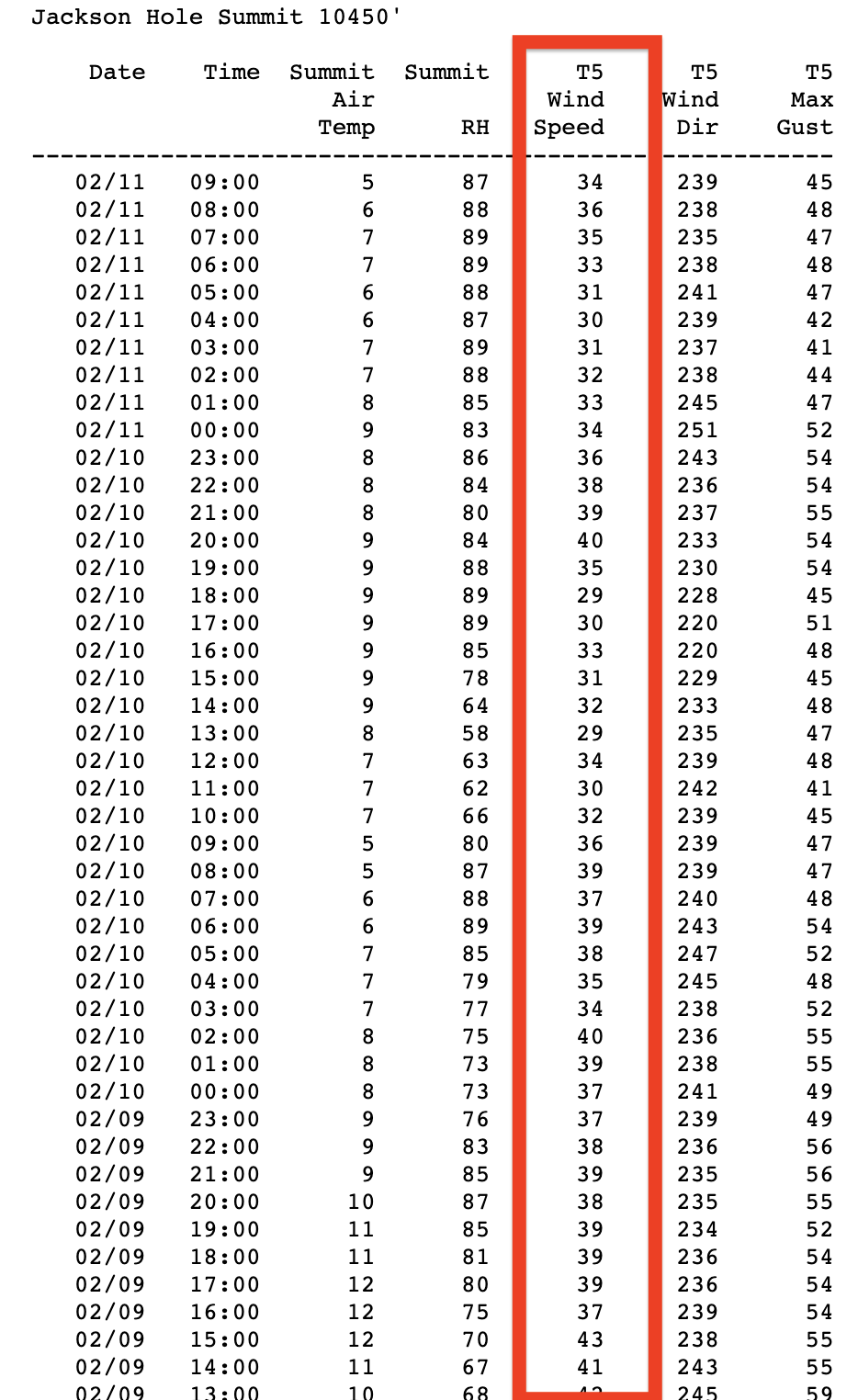
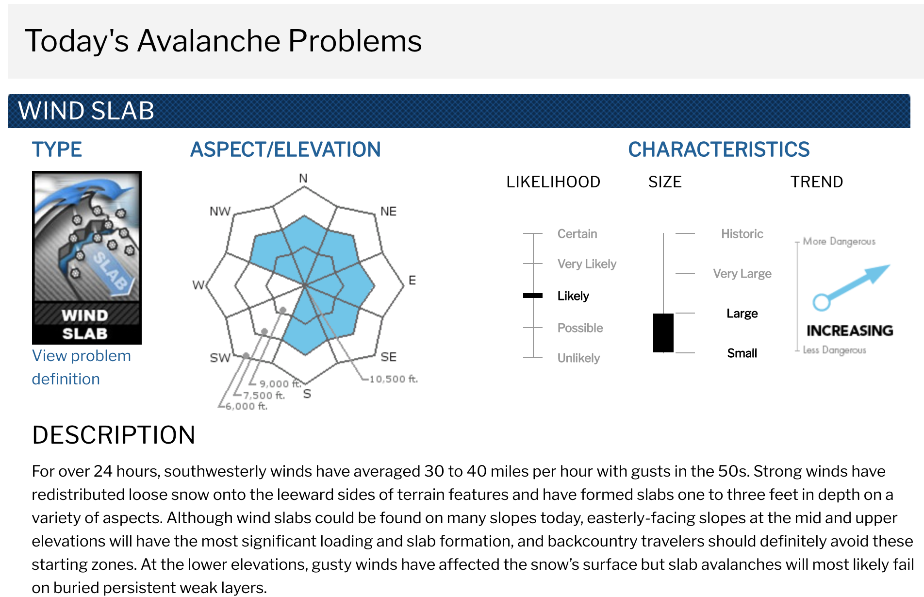
The wind has been absolutely howling here in the Tetons the past 3 days.
The wind has remarkably been steadily blowing at 30+mph on the high ridges for over 72-hours now.
That wind really changed the snow transforming it into a firm, punchy, funky, tricky animal that can hook a ski at any moment.
I did find one 4-turn patch of good pow down low and it warranted a little hoot.
The forecast looks good right now with a monster storm rolling in for the big Presidents Day Weekend.
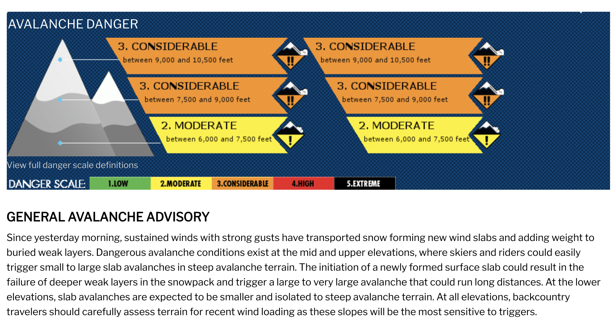
I didn’t see any avalanches nor signs of instability yesterday.
Be safe out there.
Avalanche Conditions:
Weather Forecast:
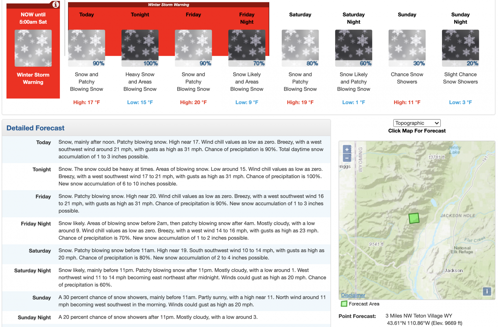
...WINTER STORM WARNING REMAINS IN EFFECT UNTIL 5 AM MST
SATURDAY...

* WHAT...Heavy snow expected. Total snow accumulations of 10 to
  20 inches, with locally higher amounts. Winds gusting as high
  as 35 mph.

* WHERE...Teton and Gros Ventre Mountains.

* WHEN...Until 5 AM MST Saturday. The heaviest snow is expected
  tonight.

* IMPACTS...Travel could be very difficult to impossible. The
  hazardous conditions could impact commutes, especially over
  Teton and Togwotee Passes.