Brought to you by 10 Barrel Brewing
Report from December 18, 2020
We went for a walk in the Teton Range, WY today.
We skied a long chute, the snow was a bit touchy, and the skiing was great.
At the 10-second mark in the above video, you can see that I trigger a small, shallow, avalanche that didn’t end up running very far.
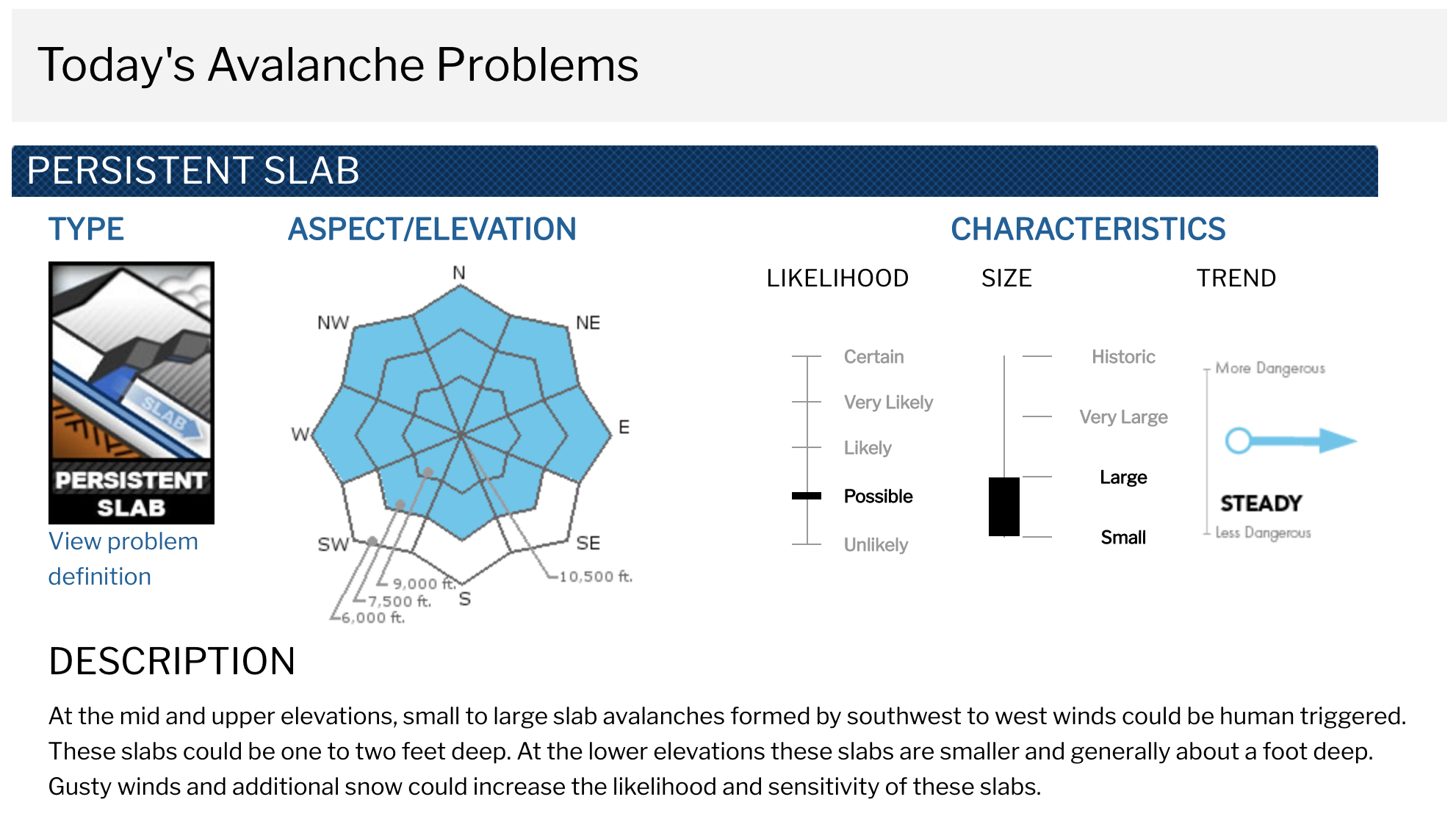
Our test pits showed a 6″ slab of snow moving on the new snow/old snow interface.
This instability will only increase and become more consequential as more snow and more wind-transported snow add up in the coming days.
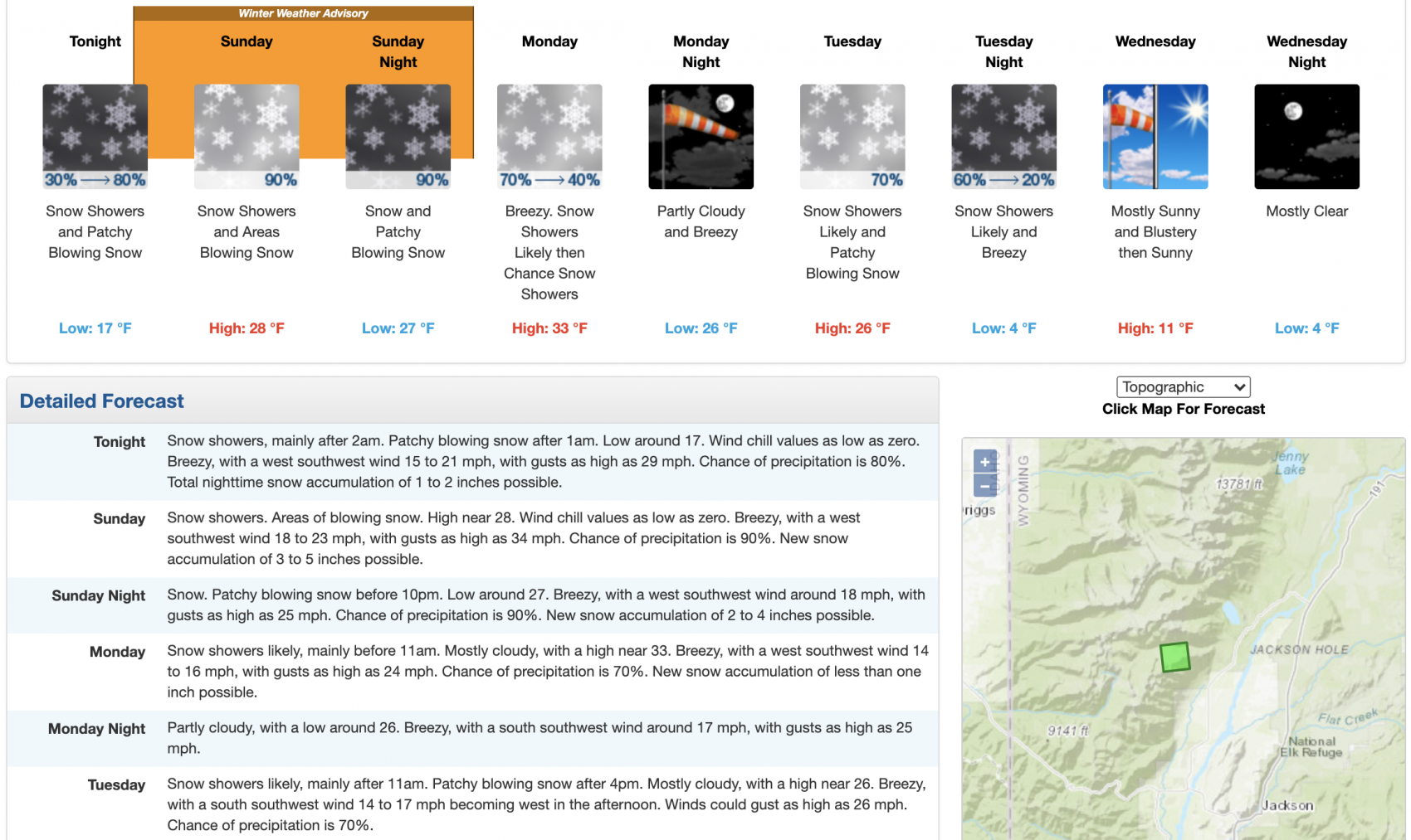
Meteorologist Chris Tomer is talking about 15-20″ of new snow in Jackson Hole in the next 5 days.
NOAA is talking about 12-15″ of new snow in Jackson Hole Sunday and Monday (see below).
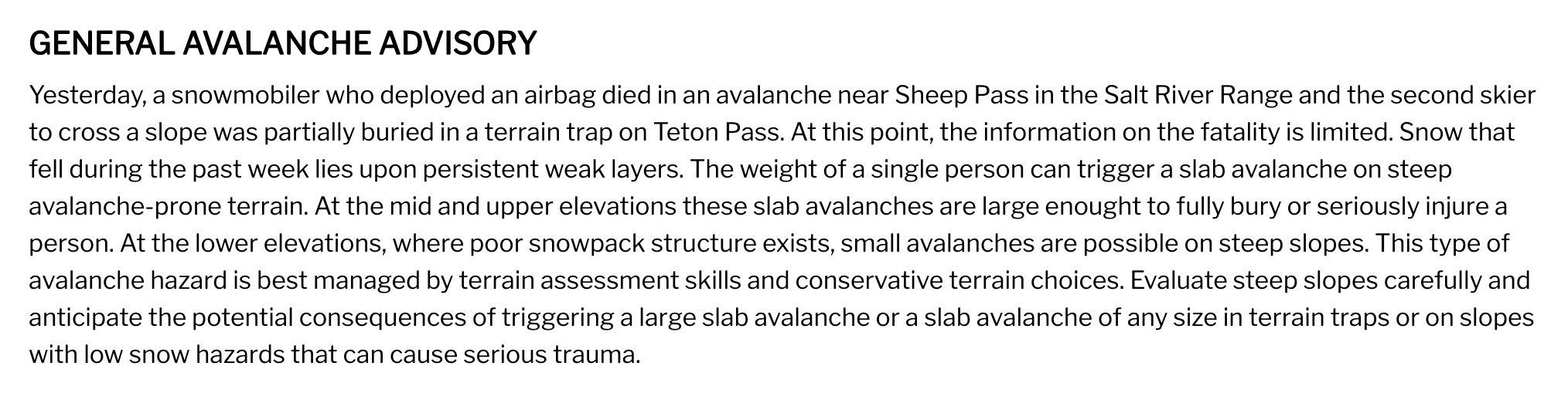
According to the Bridger-Teton Avalanche Center, a skier was partially buried off Teton Pass yesterday and a snowmobiler was killed in an avalanche in the nearby Salt River Range, WY yesterday.
Yesterday, a snowmobiler who deployed an airbag died in an avalanche near Sheep Pass in the Salt River Range and the second skier to cross a slope was partially buried in a terrain trap on Teton Pass. At this point, the information on the fatality is limited. Snow that fell during the past week lies upon persistent weak layers. The weight of a single person can trigger a slab avalanche on steep avalanche-prone terrain. At the mid and upper elevations these slab avalanches are large enought to fully bury or seriously injure a person. At the lower elevations, where poor snowpack structure exists, small avalanches are possible on steep slopes. This type of avalanche hazard is best managed by terrain assessment skills and conservative terrain choices. Evaluate steep slopes carefully and anticipate the potential consequences of triggering a large slab avalanche or a slab avalanche of any size in terrain traps or on slopes with low snow hazards that can cause serious trauma.
Avalanche Forecast:
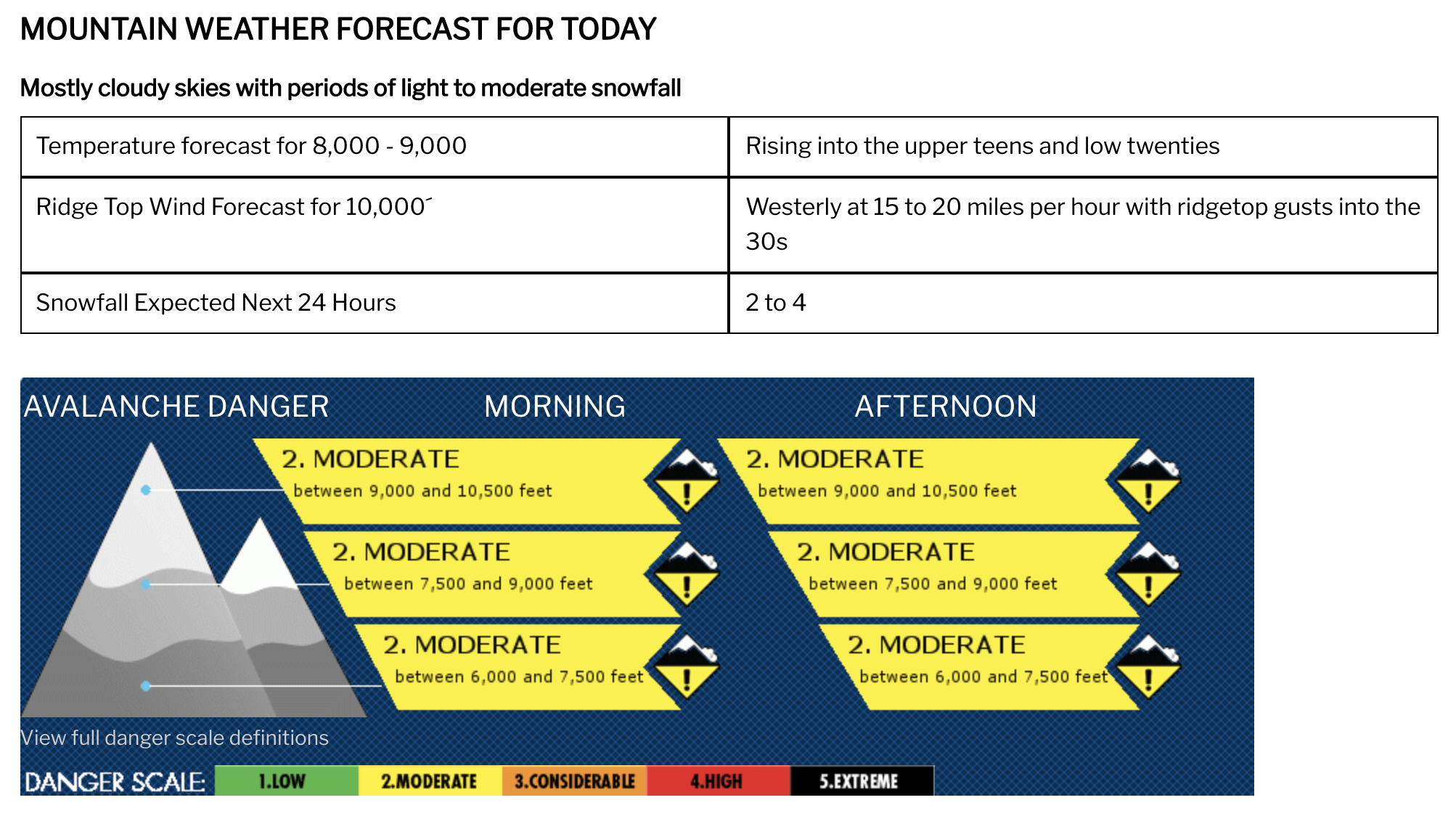
Weather Forecast:
Winter Weather Advisory
URGENT - WINTER WEATHER MESSAGE
National Weather Service Riverton WY
110 PM MST Sat Dec 19 2020

...Significant snow returns to the Tetons and portions of
Yellowstone late tonight through Sunday night...

.Light snow will continue across northwest Wyoming today. Light to
moderate snow will occur late tonight and continue through Sunday
night. Significant snowfall totals expected during this time.

Yellowstone National Park-Teton and Gros Ventre Mountains-
Including the cities of Lake, Mammoth, and Old Faithful

...WINTER WEATHER ADVISORY IN EFFECT FROM 3 AM SUNDAY TO 6 AM MST
MONDAY...

* WHAT...Snow expected. Total snow accumulations of 5 to 10
  inches, with locally higher amounts of 12 to 15 inches over the
  higher peaks of the Tetons. Snowfall accumulations of 3 to 6
  inches in the surrounding mountains. Winds gusting as high as
  45 mph.

* WHERE...Yellowstone National Park and Teton and Gros Ventre
  Mountains.

* WHEN...From 3 AM Sunday to 6 AM MST Monday.

* IMPACTS...Plan on slippery road conditions. The hazardous
  conditions will impact the morning and evening commutes over
  the mountain passes.

* ADDITIONAL DETAILS...Motorists should be alert for rapid
  changes in visibility in snow, as well as slick and snow
  covered roads, especially across Teton and Togwotee Passes.