Report from May 23, 2021.
My buddy Austin and I have had our sights on Lassen Peak for several weeks now. Standing at 10,463′, Lassen typically holds snow well into the summer, and despite the low snowfall this season, this year was no different. Lassen had continuous, skiable snow all the way down to about 8,000 feet, and we decided to give it a go this weekend.
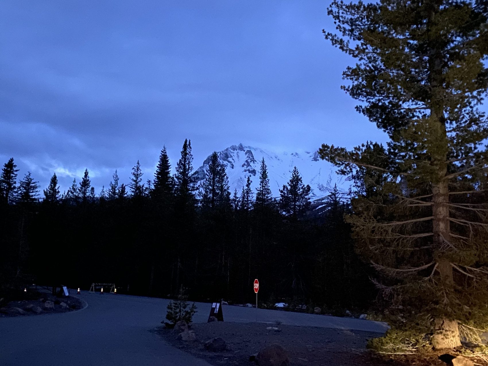
We departed from our hotel in Redding, CA at about 3:50am. The name of the game for today was to summit early so that we didn’t miss the corn window. After arriving at the Devastated Area parking lot at about 5am, we got going around 5:20. Despite the darkness, we could still see Lassen looming in the distance.
The first part of the climb was on foot in hiking shoes, as the trailhead starting elevation was at about 6,400′, so there wasn’t any climbable snow. The trees down low were extremely tight and made the first part of the climb very slow going. Eventually, we started to break out above the treeline, where we were greeted by a spectacular sunrise.
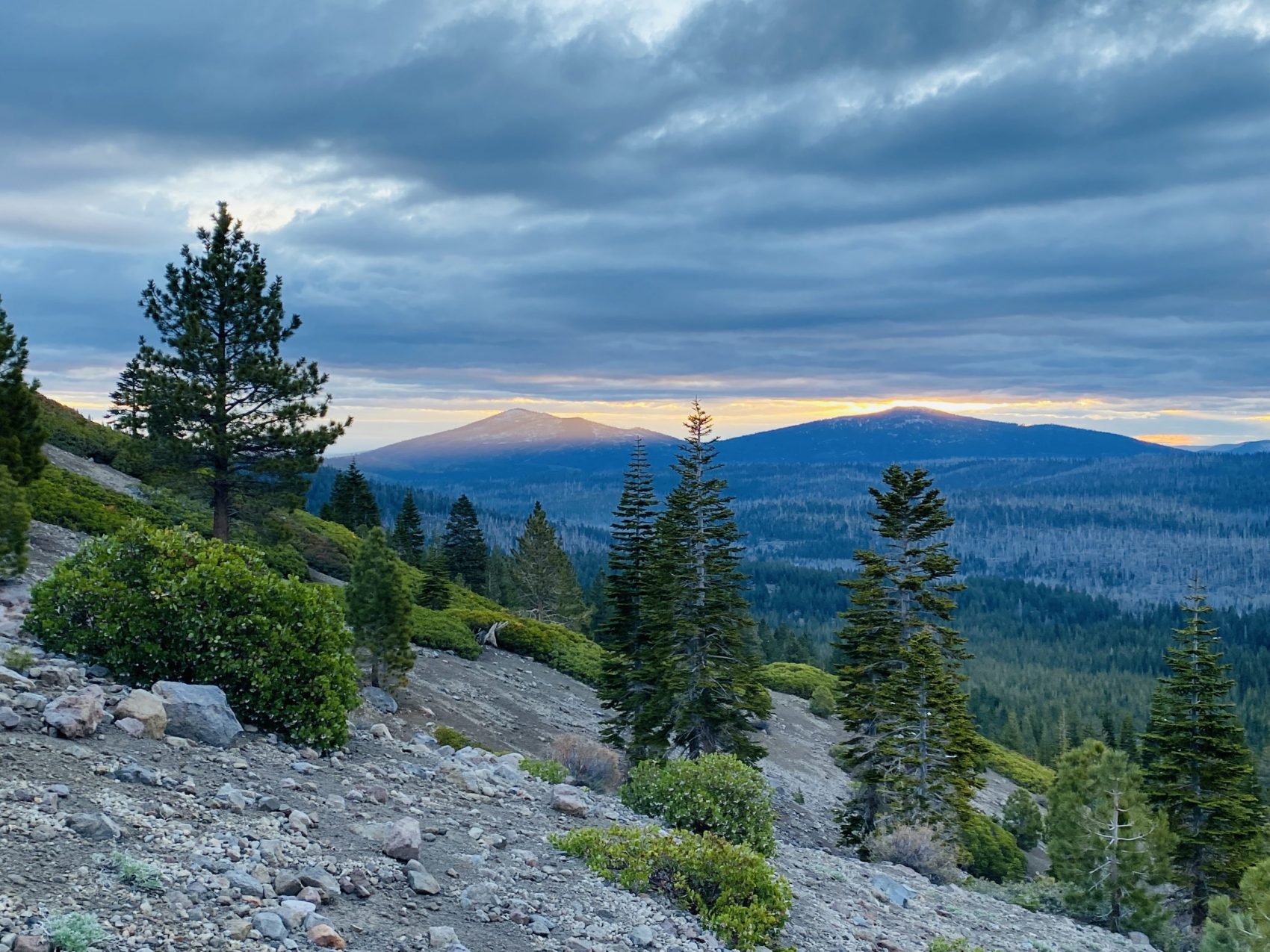
Above us, Mt. Lassen was cast in a dreamy orange glow through the fog.
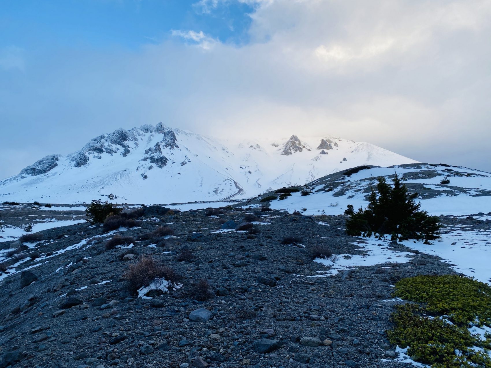
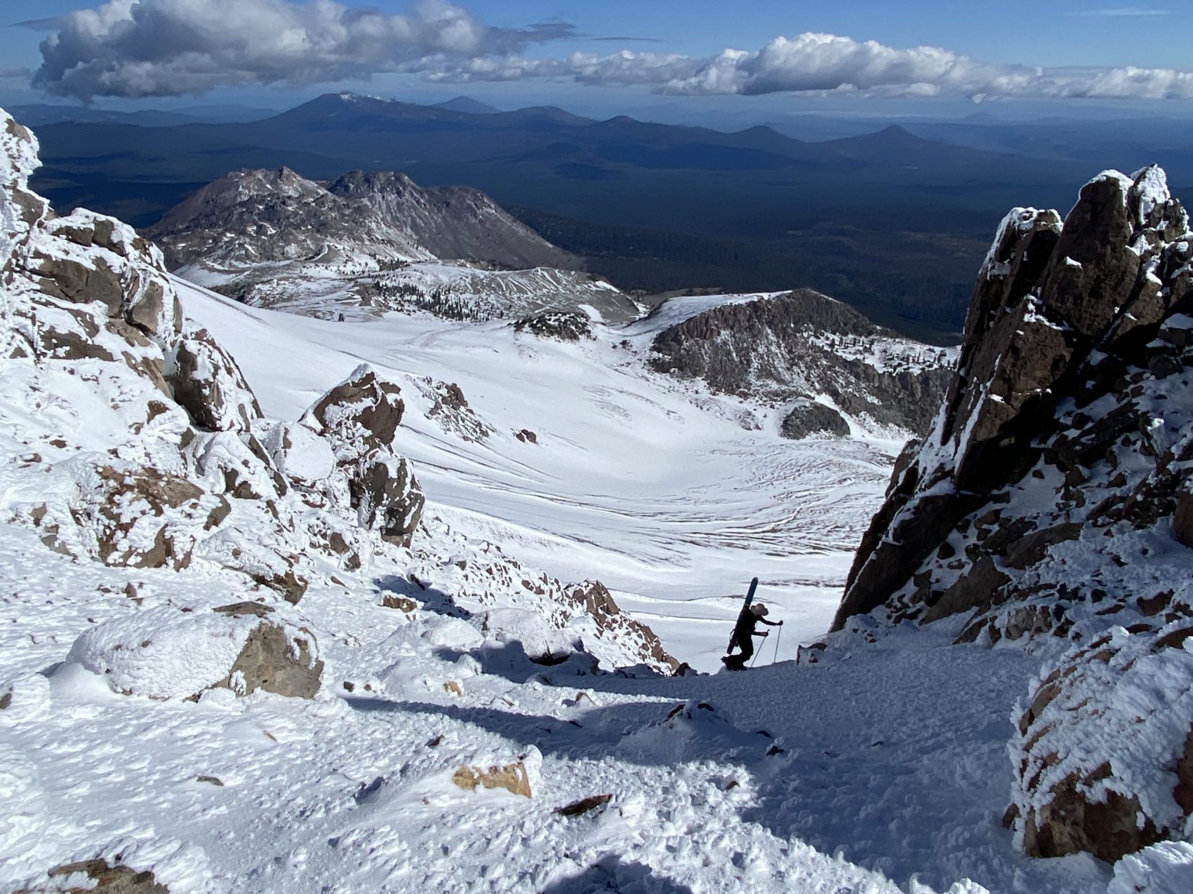
Eventually, we hit the snow and put on our boots, skis, and skins. We ascended up towards the center, main gully of the northeast face.
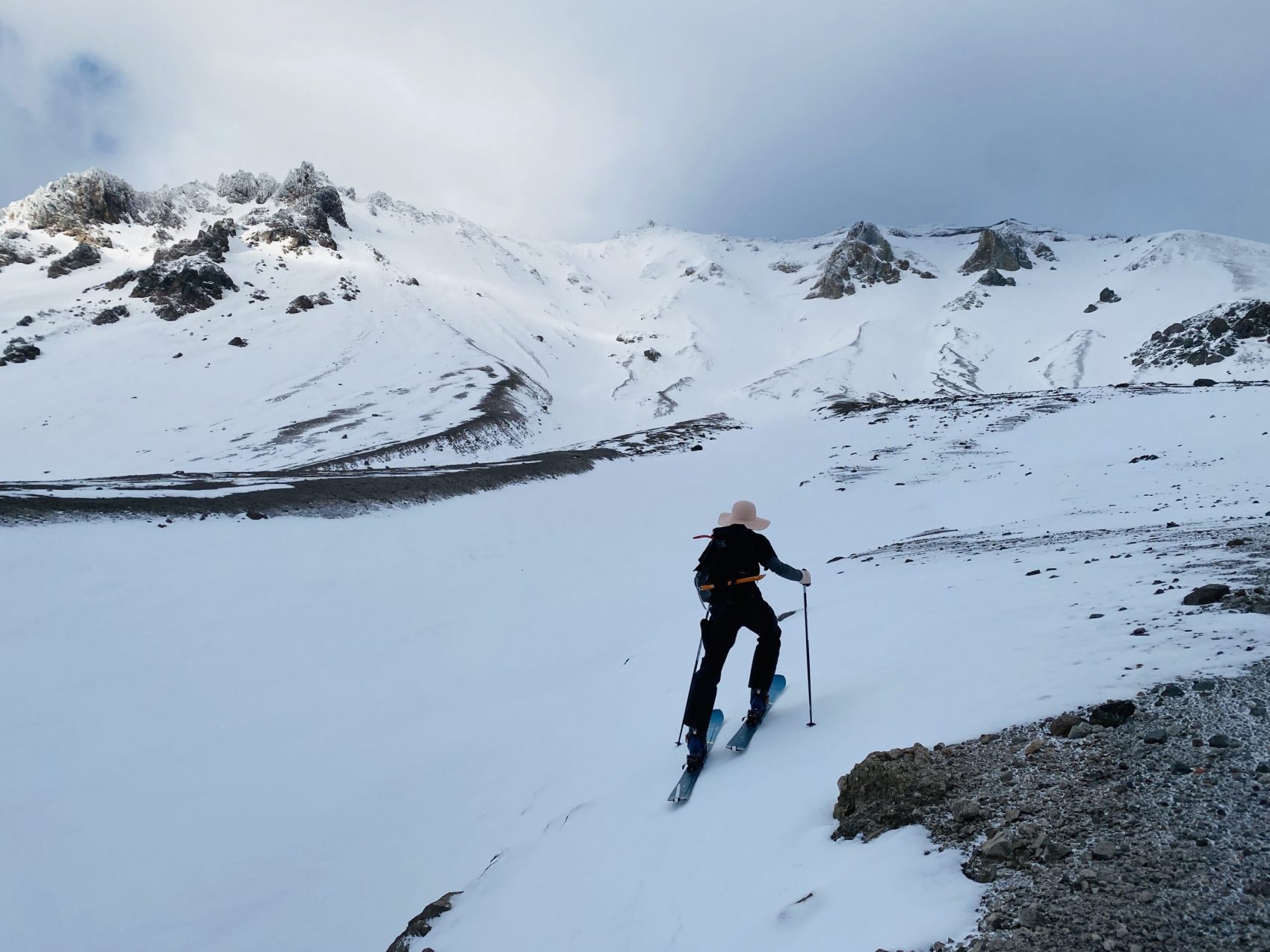
We decided to change plans. Looking up at the face, we realized that the center gully would deposit us directly into the caldera of the volcano, which sits right beneath the summit. We wanted to have as much fun as possible, so we decided to climb the most westerly facing slope up to the east ridge, then continue to ascend that to the summit.
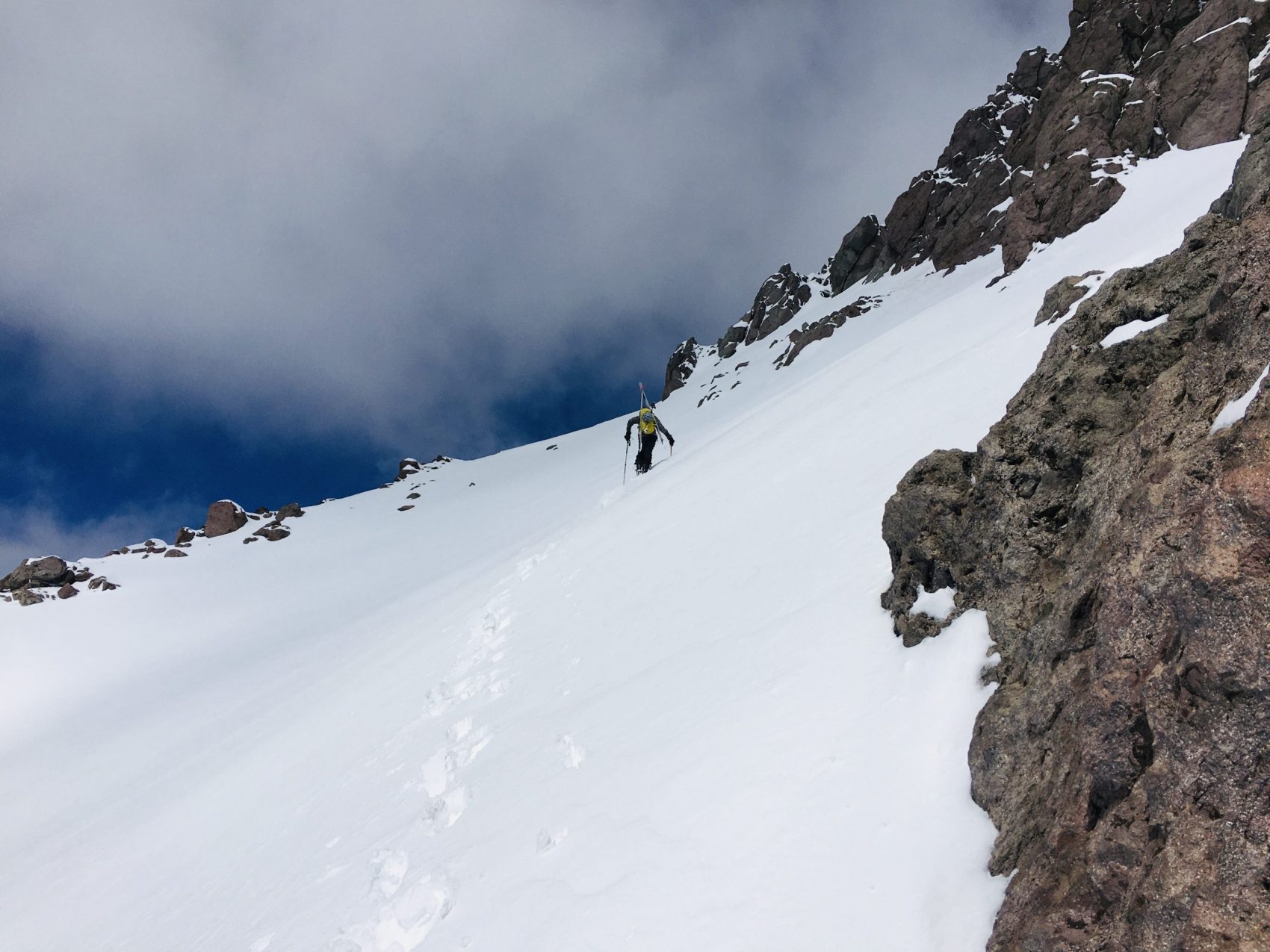
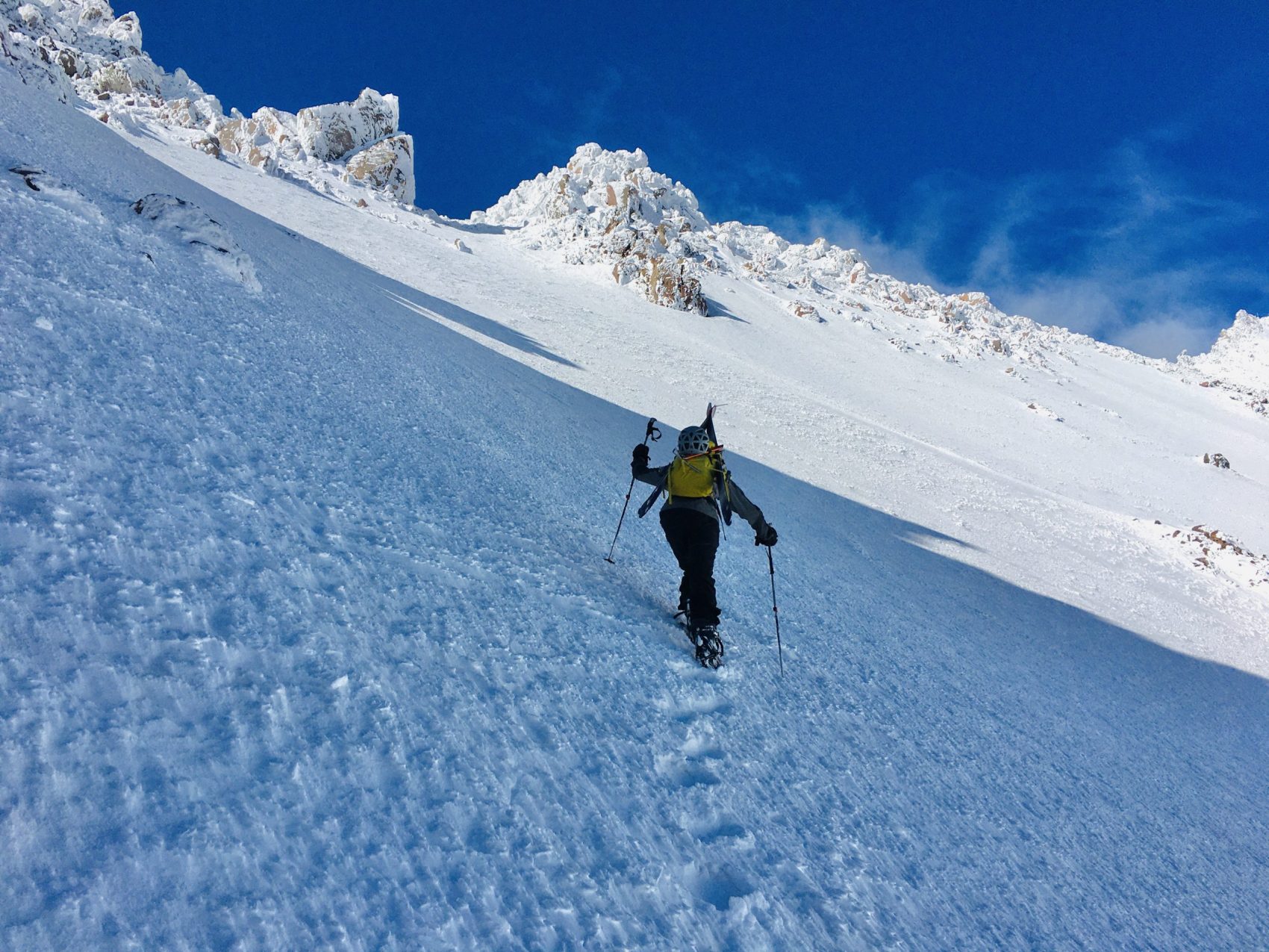
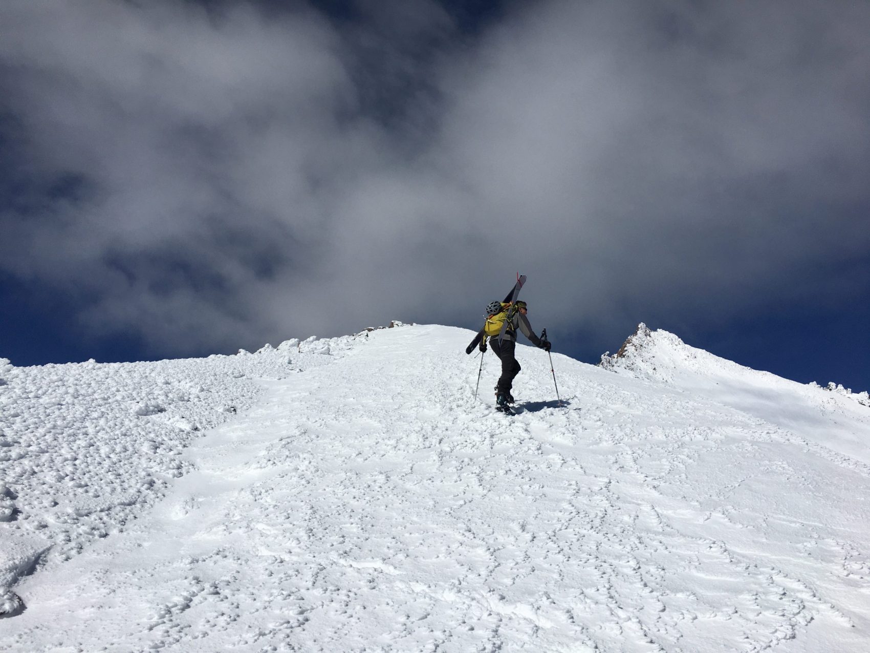
Once the slope got steep enough, we took off our skis, put on our crampons, and began ascending to the ridge.
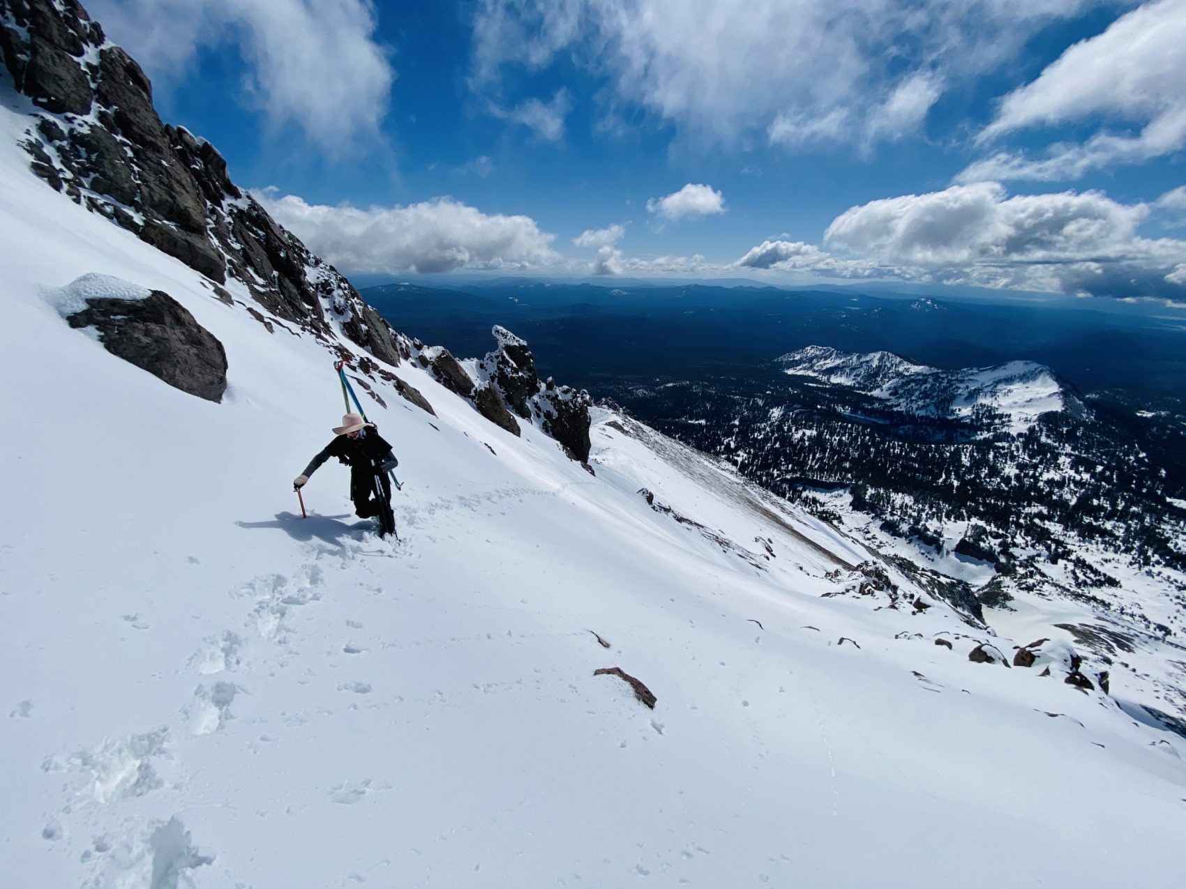
On the way up, the snow was interesting. Most areas had fresh snow that was about 8″ deep, which was very surprising. In other places, it was hardpack bulletproof rime. The deep new snow made breaking trail very difficult.
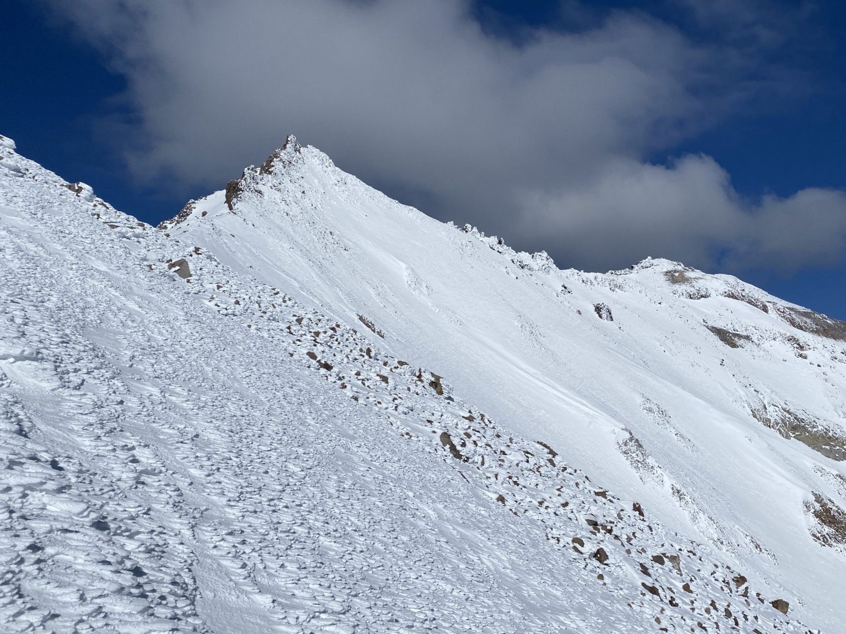
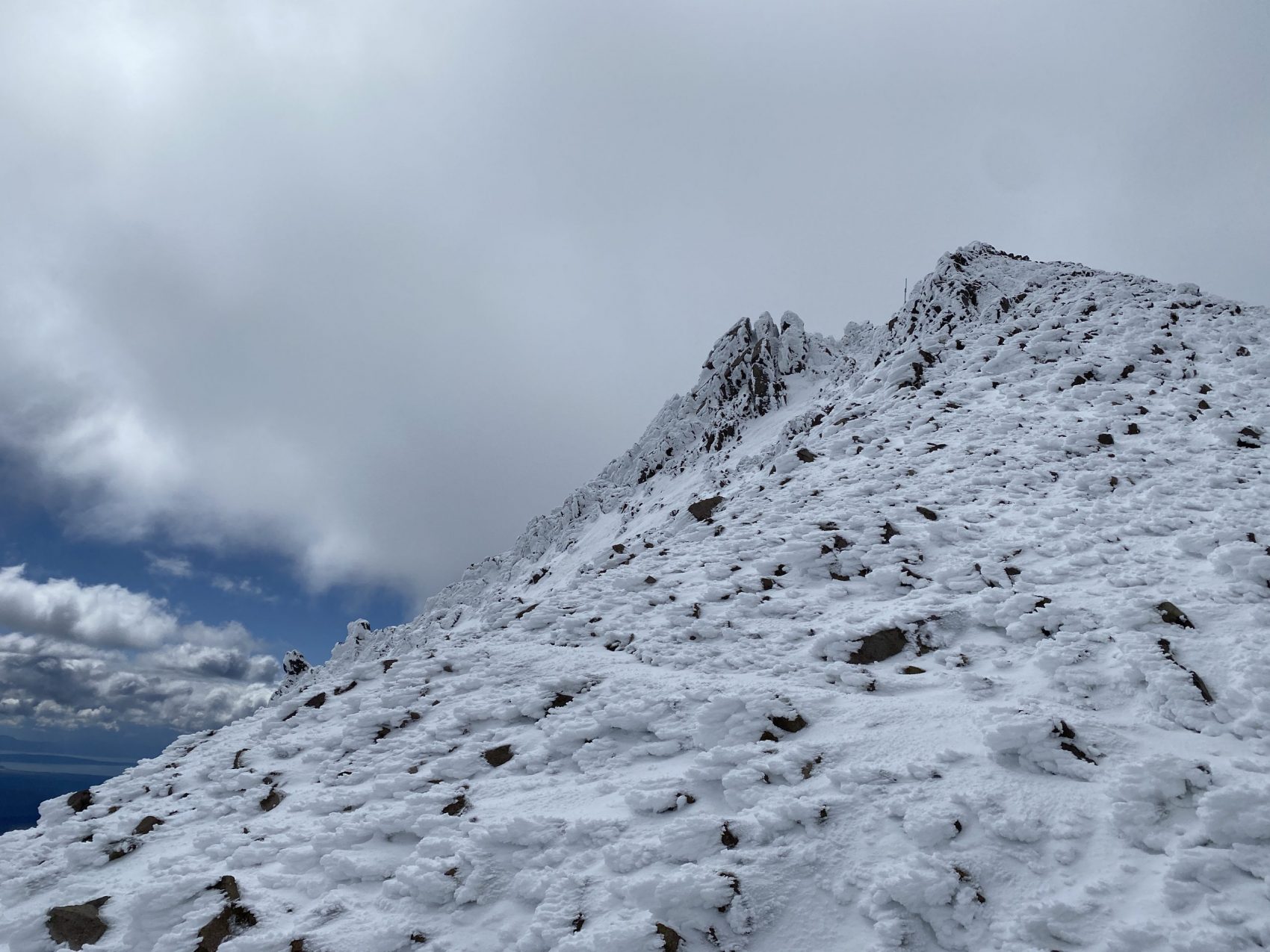
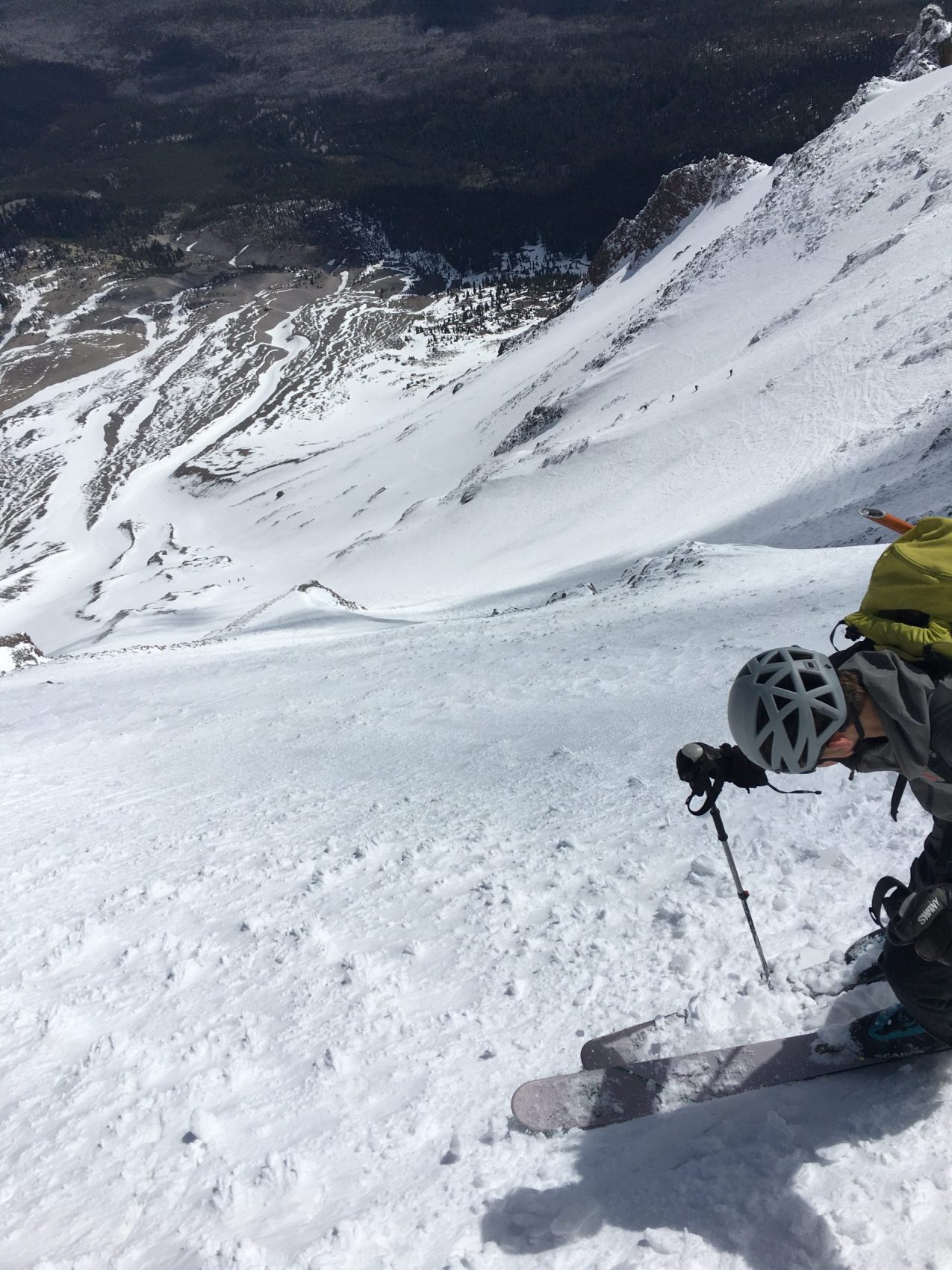
We climbed up through a small notch sandwiched between two rock pinnacles, which deposited us onto Lassen’s east ridge at about 9,800′.
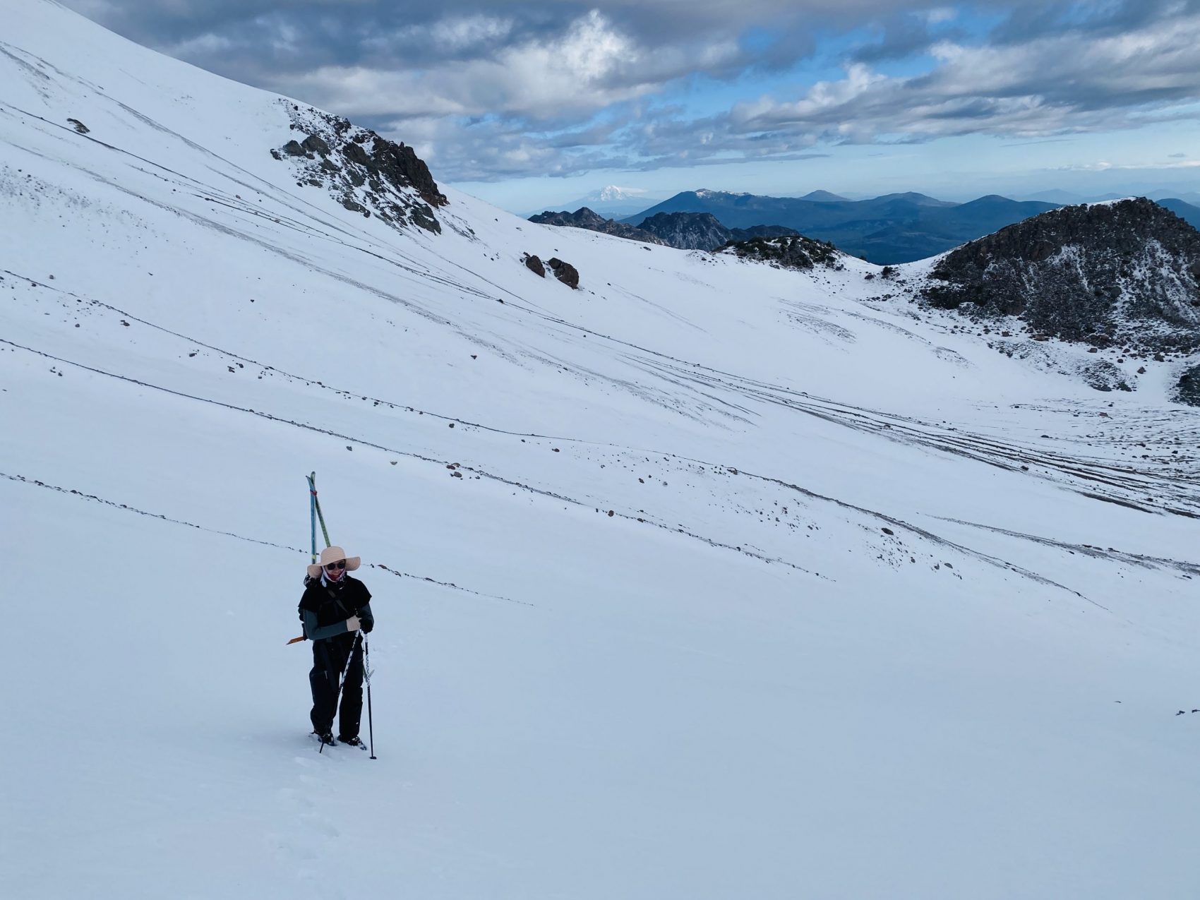
We began ascending the ridge towards the summit with our crampons still on. The ridge wasn’t too narrow, and we cruised up it at a pretty solid pace.
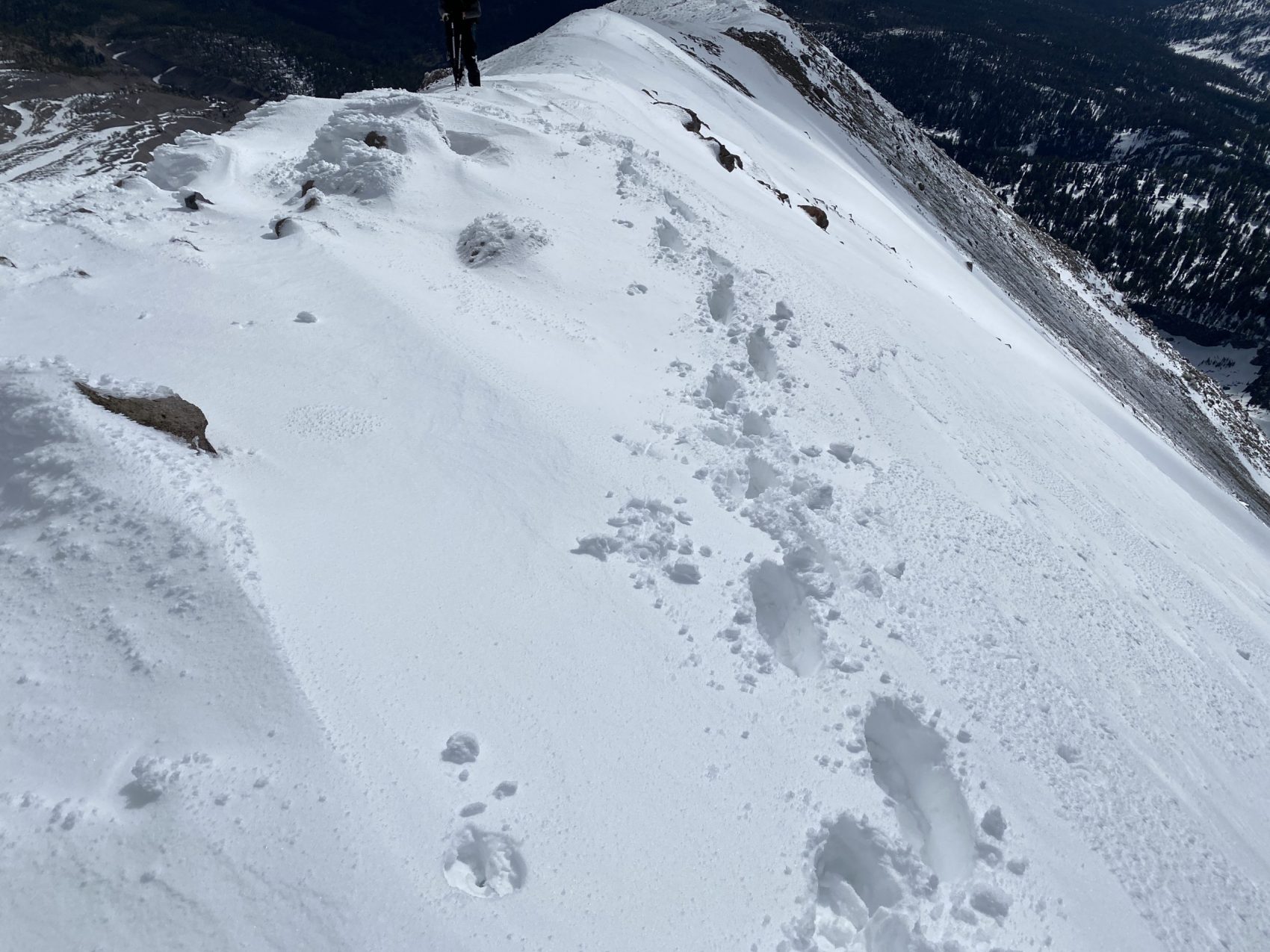
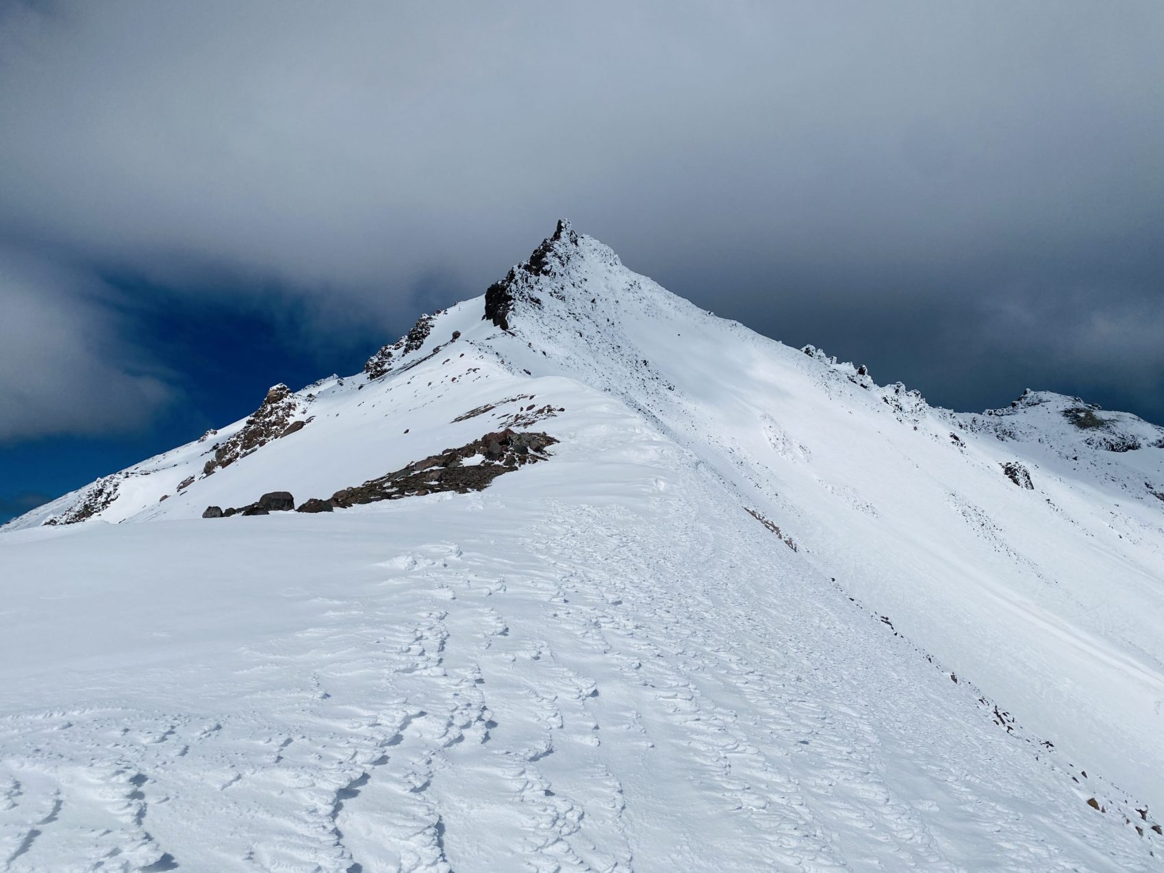
On the ridge, we realized that the summit pinnacle was simply rock and rime. We decided not to take that risk, considering we didn’t bring rope gear, so we identified a few slopes that wrapped around the south side and into the caldera.
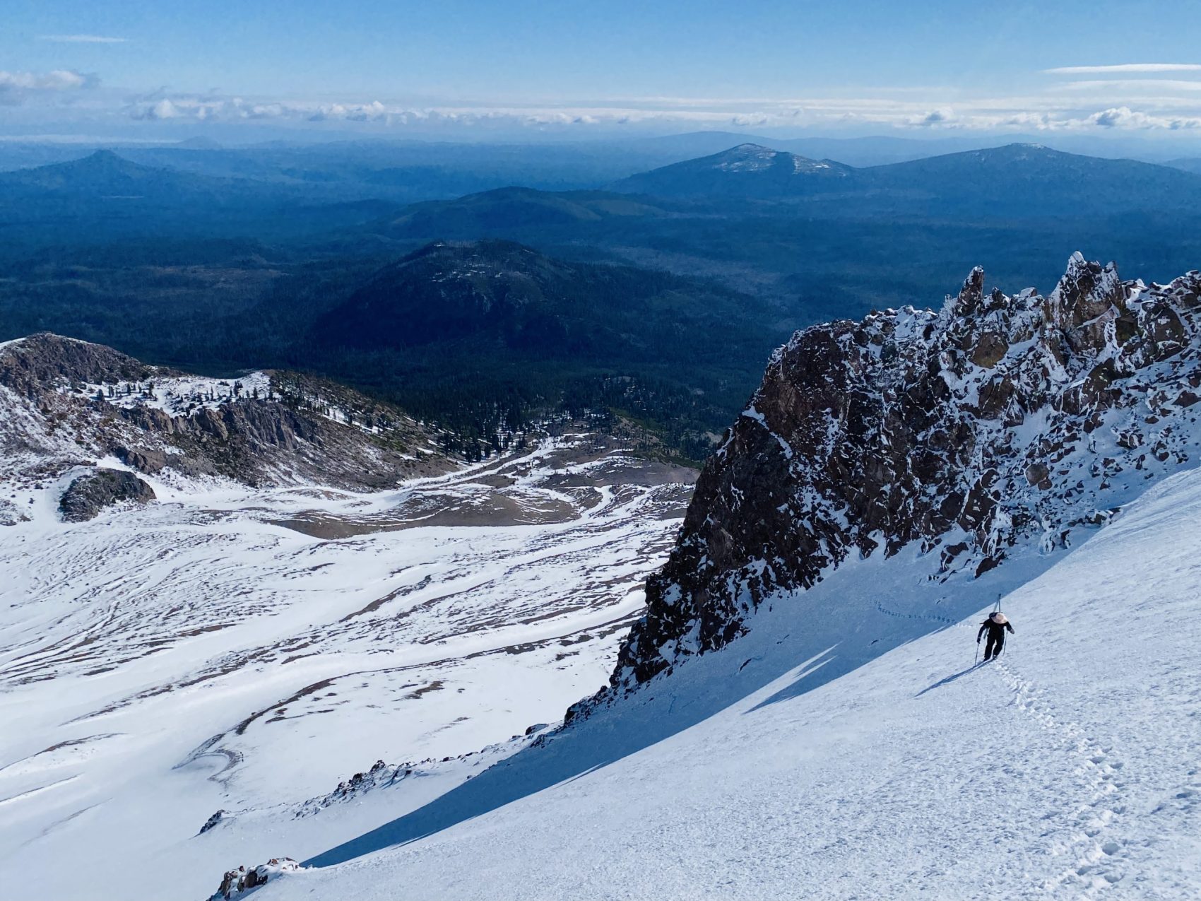
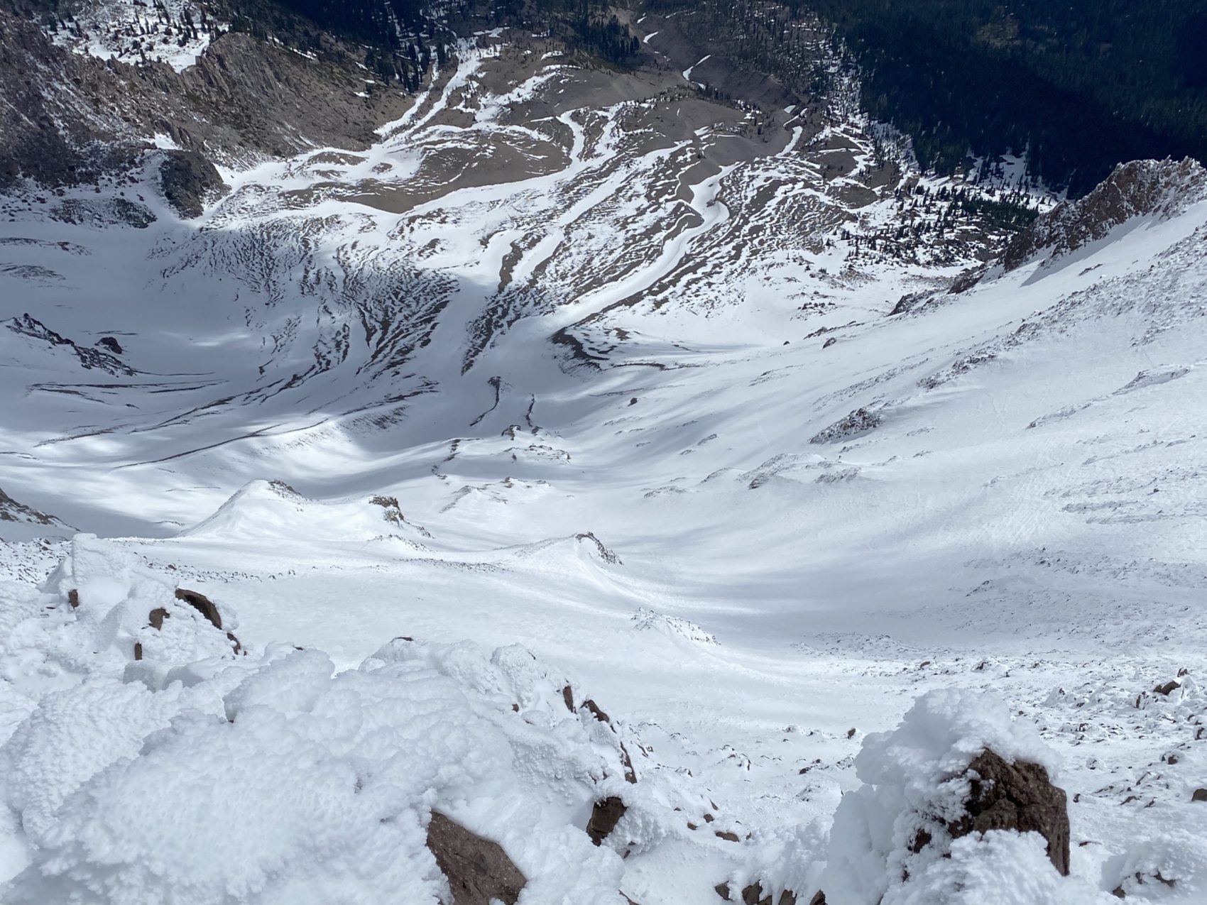
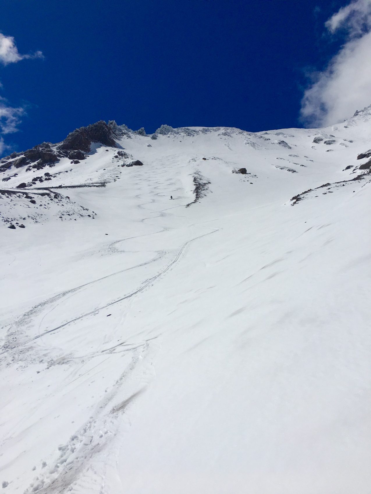
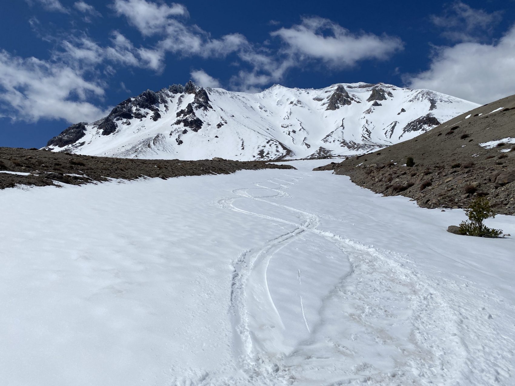
On the ridge, we had a spectacular view of our planned descent, which ran straight down the center gully that we initially planned to ascend.
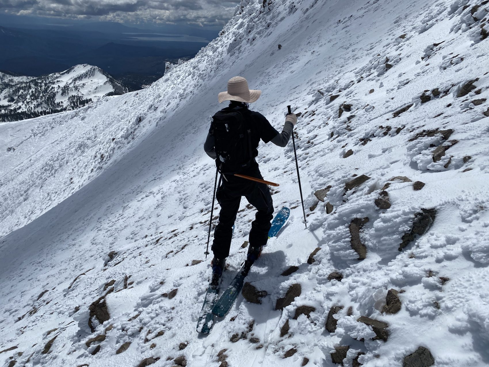
Once we reached the base of the summit pinnacle, we began skirting around it to the south via the faces that we had previously identified. The deep snow slowed down our pace, but we continued to chug up towards the summit.
We crested over the final ridge and into the caldera of the volcano. We dumped our stuff in the caldera and made the short trek up to the summit.
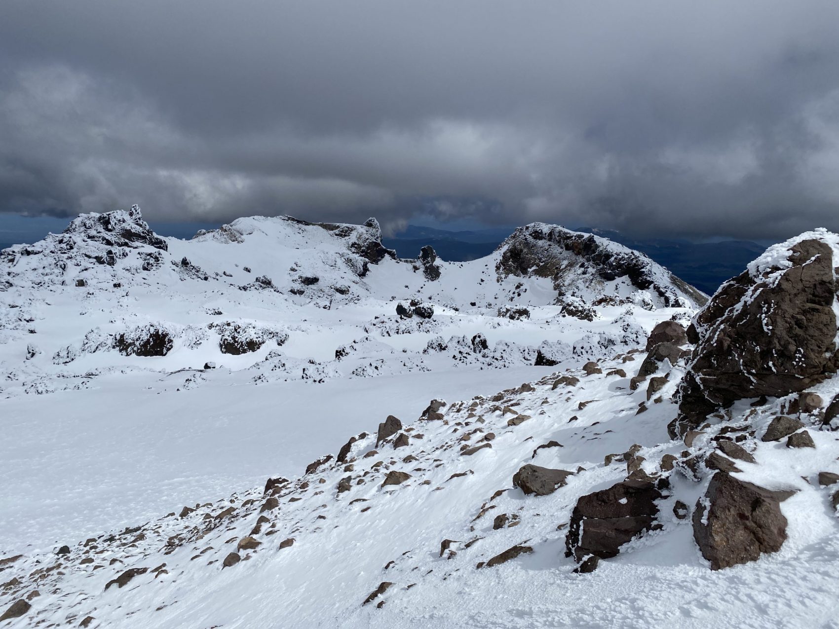
From the summit, our views were somewhat limited by low clouds, but the view was still superb. We had a particularly good view of our descent.
We descended from the summit back to our gear and transitioned from crampons to skis. We made our way over to the northeast side of the caldera to scout our descent.
Our ski descent started from about 10,400′. The top part was a bit weird, but the skiing was phenomenal after a few turns. Perfect hot pow!
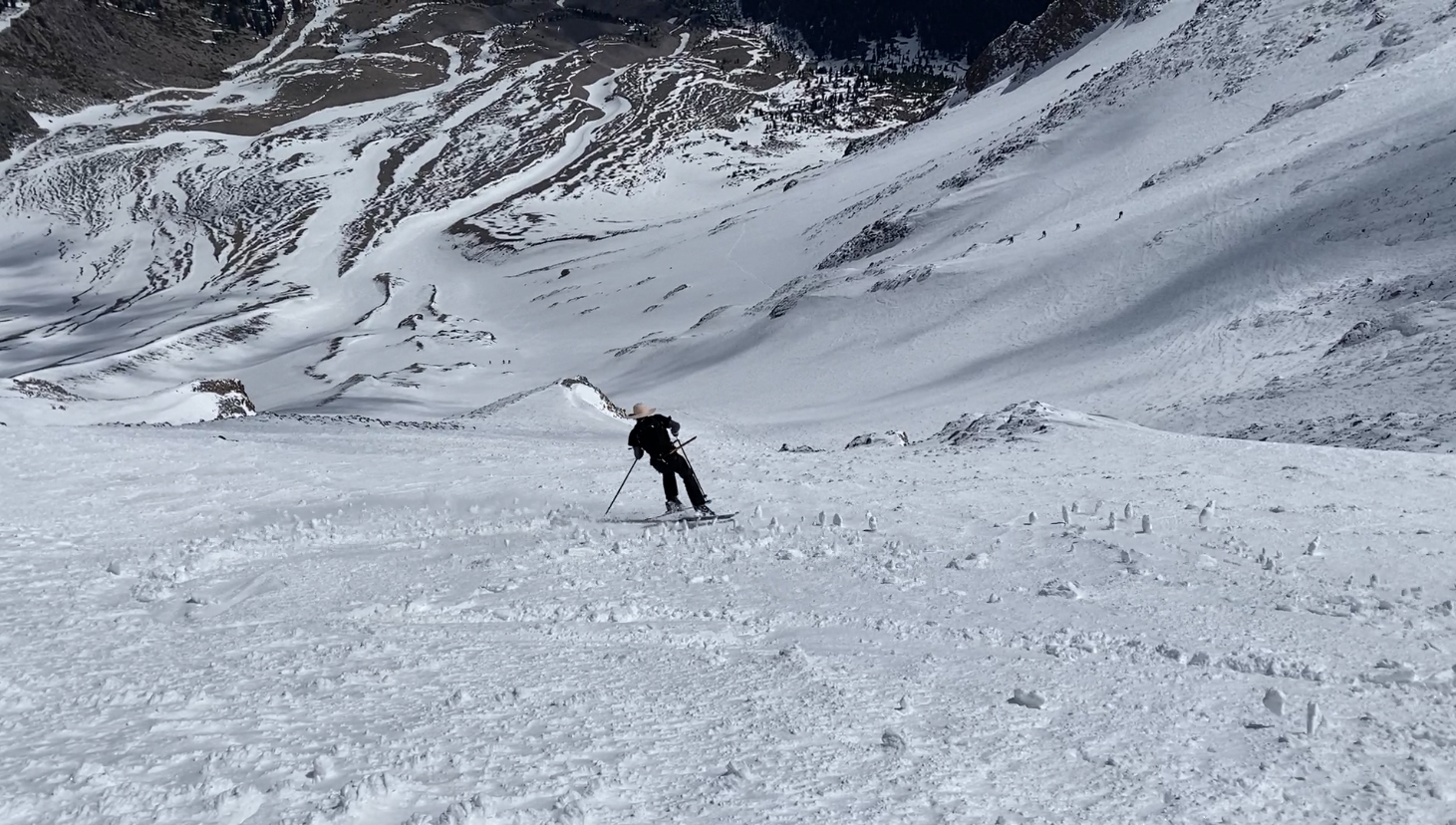
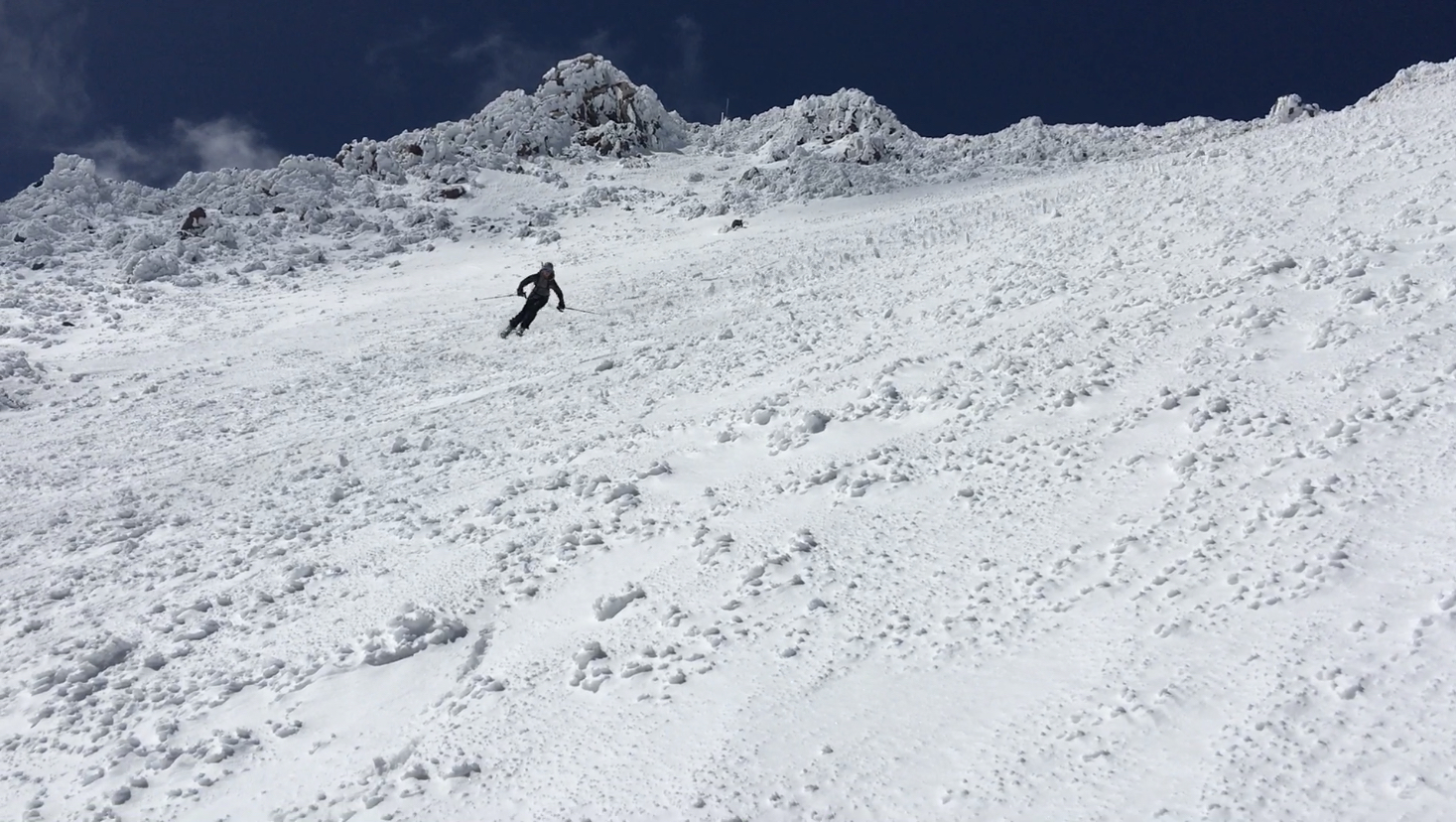
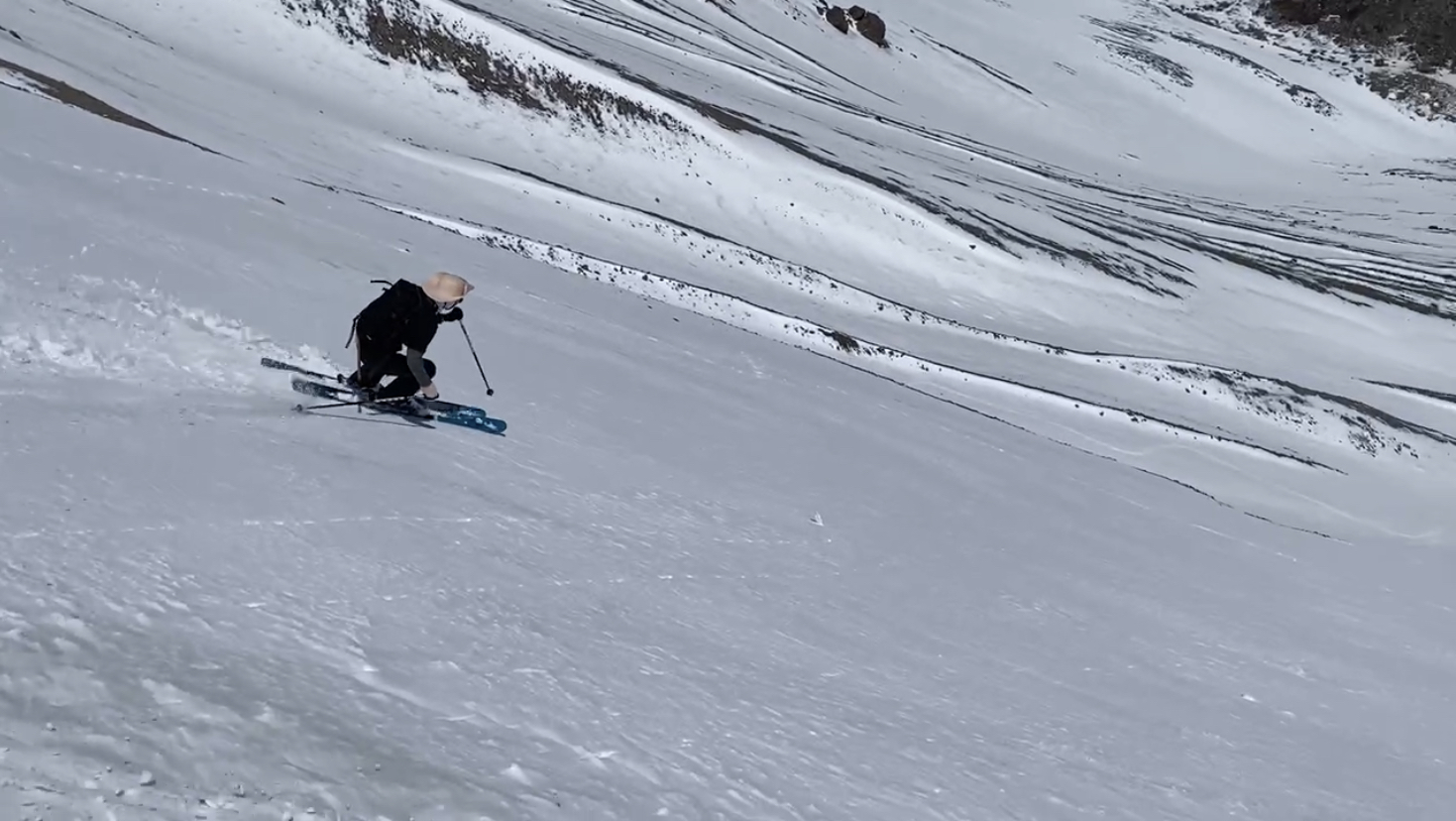
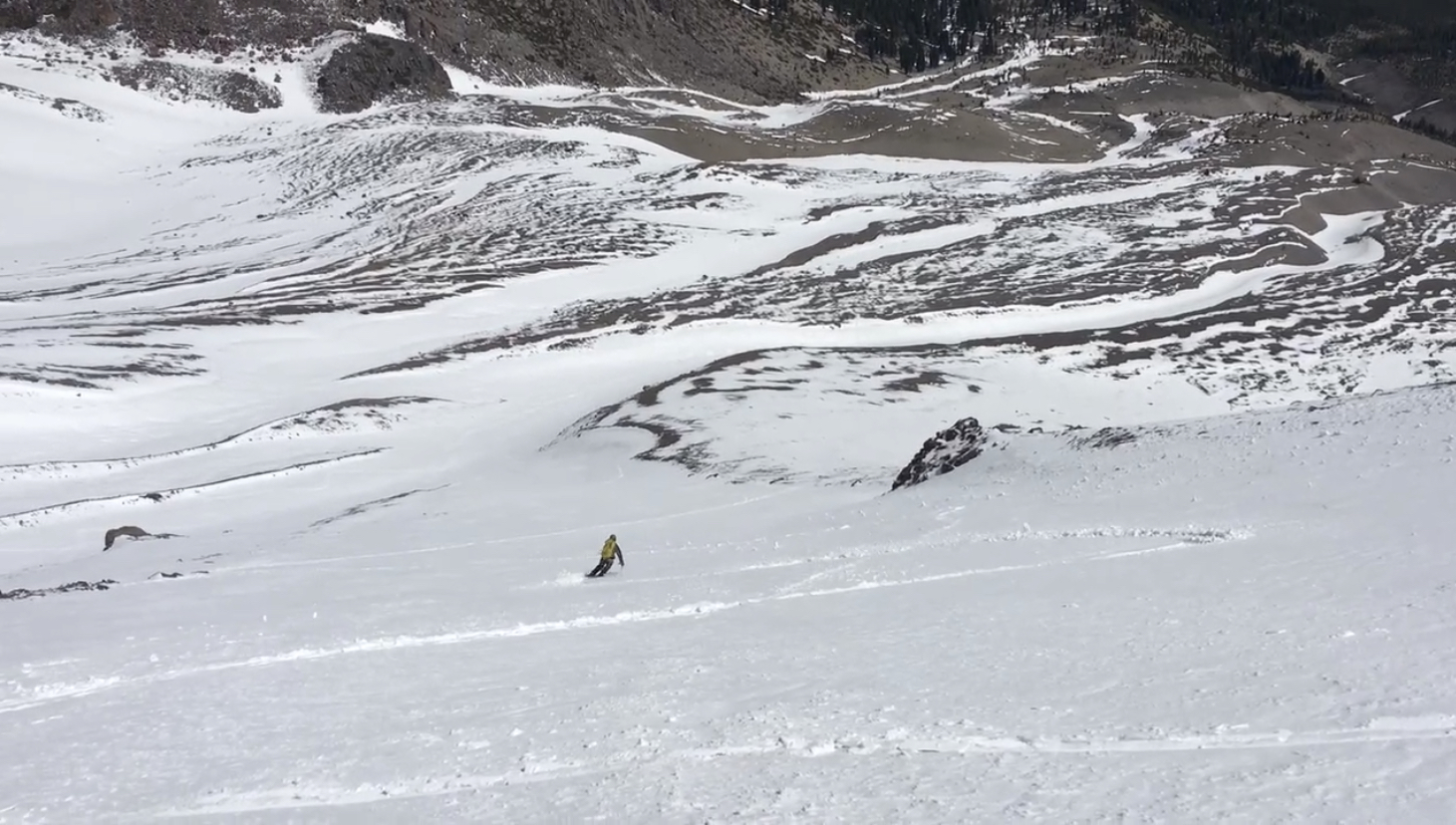
Towards the bottom, the snow got hot and sticky as we skied the drainage back to our shoes. We picked up our shoes and skied down with them in our hands.
We put our skis and boots back on our packs, and with our shoes back on our feet, we walked back down through the trees to the car.
Overall, we enjoyed a great day in the mountains with some solid ski mountaineering and a superb descent! Looking forward to continuing to milking the final few turns that California has to offer this season :).
Clay, hows it going, you planning on hitting lassen again this season? whats your forecast on the snowpack up there? based on NPS website numbers, looks like its holding a lot better this year.
Hey Clay, how was the coverage up there? U think the north face is holding enough to get some.turns in in coming weeks?
Hey Kyle. Just by looking at satellite imagery, it looks like you could certainly get some patch skiing in. There’s not much left on the face anymore to get continuous skiing. You could ski from patch to patch, just depends on how committed you are!
Thanks for the update Clay, what satellite tool/or site do you use? Google Satellite/Earth shows quite a bit of snow up there so i know its dated. Planning to head up tomorrow, hopefully their is something waiting for me.