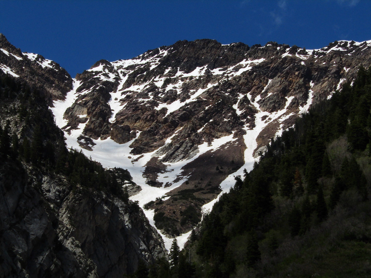
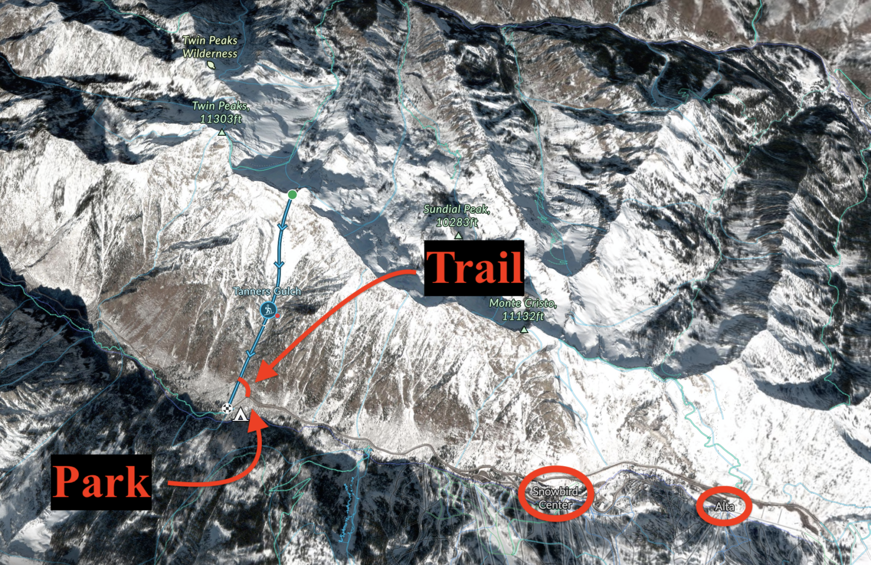
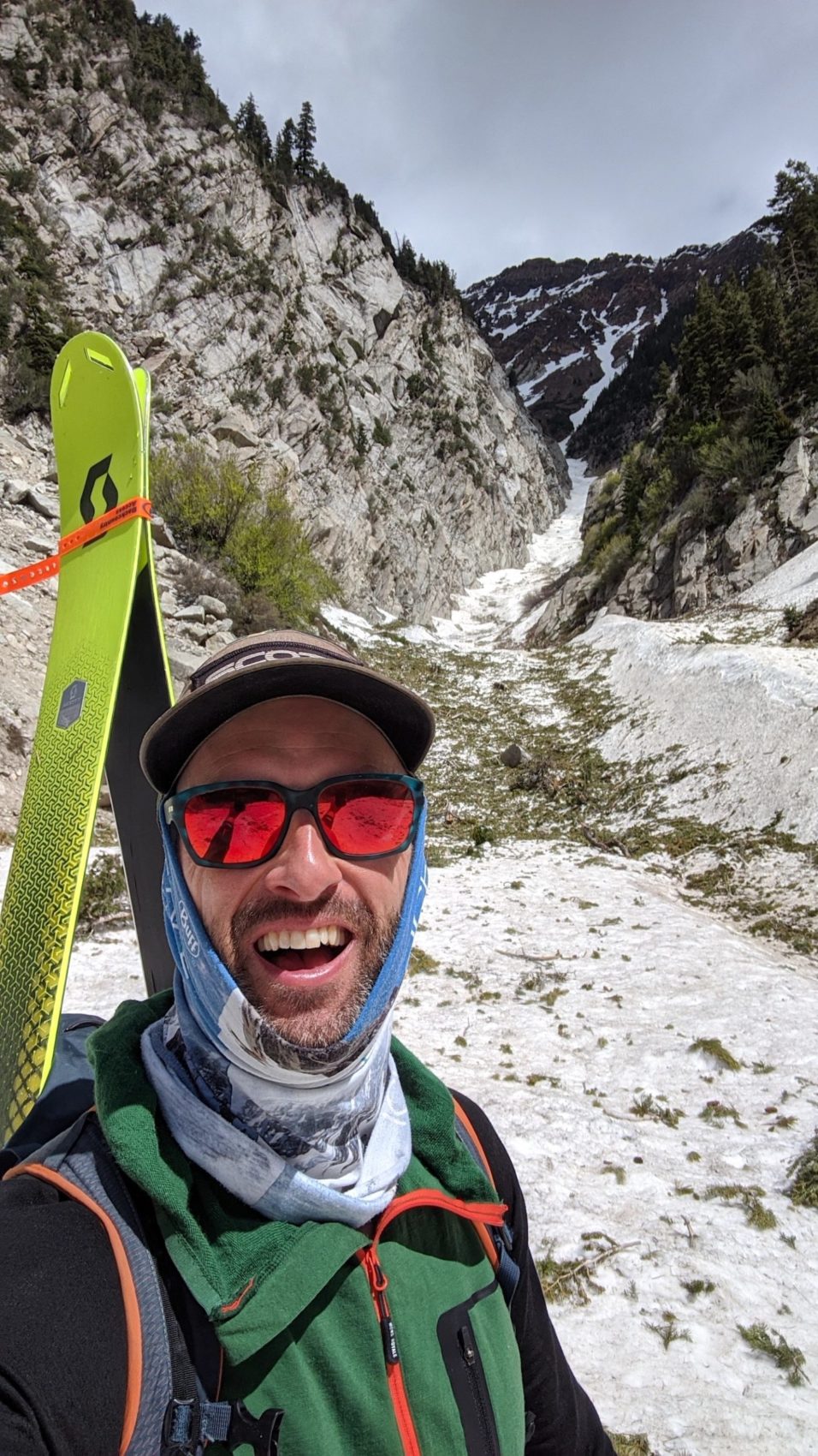
Today, May 21st 2020, I endlessly bootpacked my way up the north side of Little Cottonwood Canyon to ski down the legendary “Tanners Gulch”.
Tanners received Andrew McLean’s mythical “The Chuting Gallery“ guidebook’s highest rating: 3-stars.
I’d been eyeing this line all season long but I never quite understood what was going up there until I recently acquired Andrew’s book and read its killer description.
“With 3,500′ of fall-line skiing, Tanners is a tail twister in its own right, but also an excellent opening move to some of the incredible terrain that surrounds it. It’s a gateway drug to a ton of good terrain.” – Andrew McLean to SnowBrains, 5/21/20
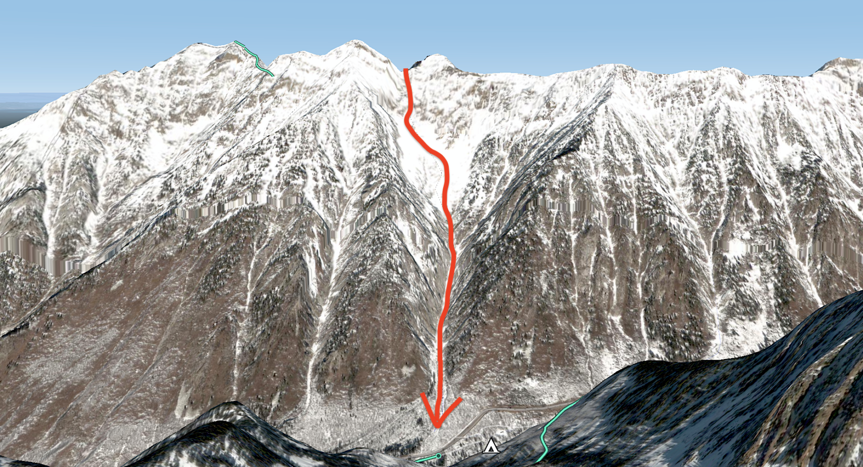
Tanners Gulch – Little Cottonwood Canyon, UT Details:
- Summit (actually a saddle): 10,800
- Vertical from car: 3,500′
- Vertical skied: 3,500′
- Pitch at steepest point: 40º
- Aspect: S, SE, SW
- Distance: 3.0-miles round trip
- Time from car to summit: 2 hrs 45 mins
- Car to car time: 3 hrs 30 mins
- Recommended Equipment: crampons, ice axe, no skins (all bootpacking)
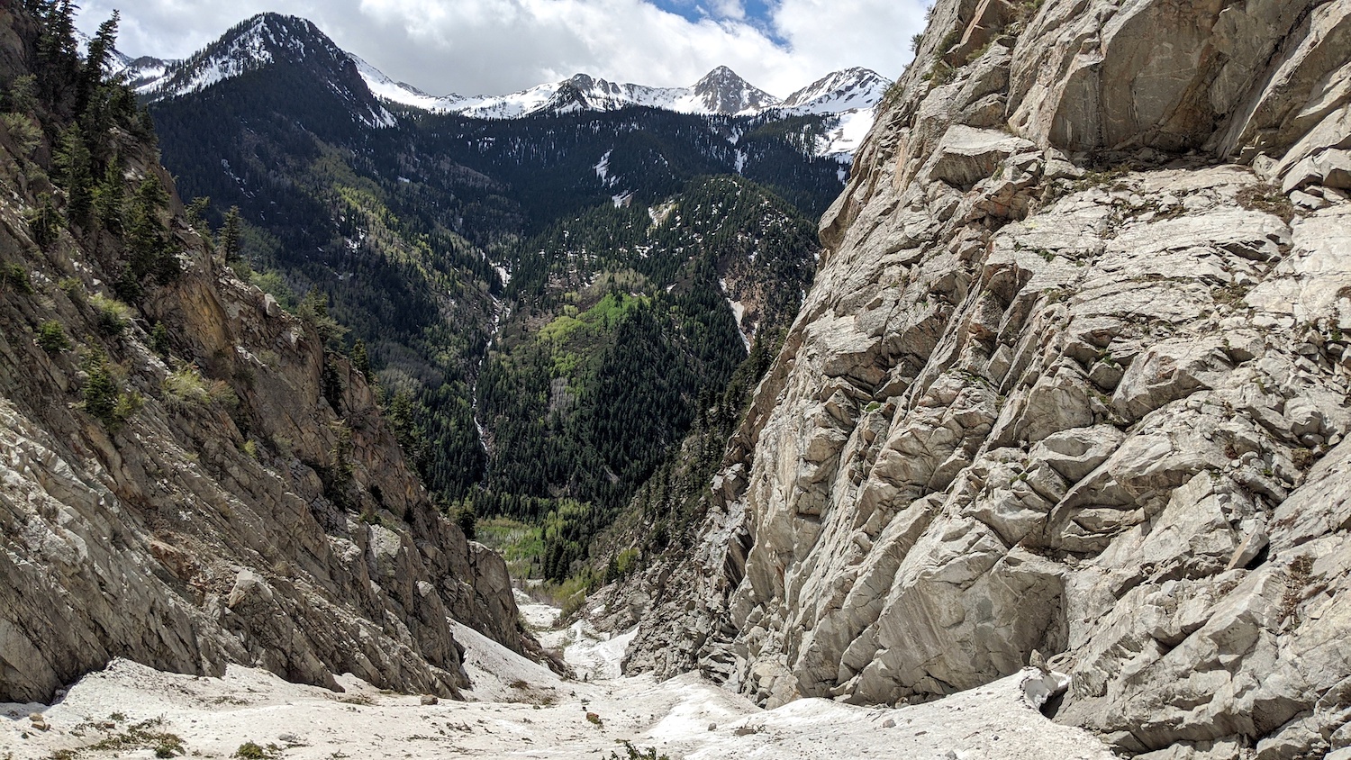
I started hiking from the pullout at the bottom of Tanners Gulch (see map way below) at 11am while looking straight up at 3,500-vertical-feet of bootpacking…
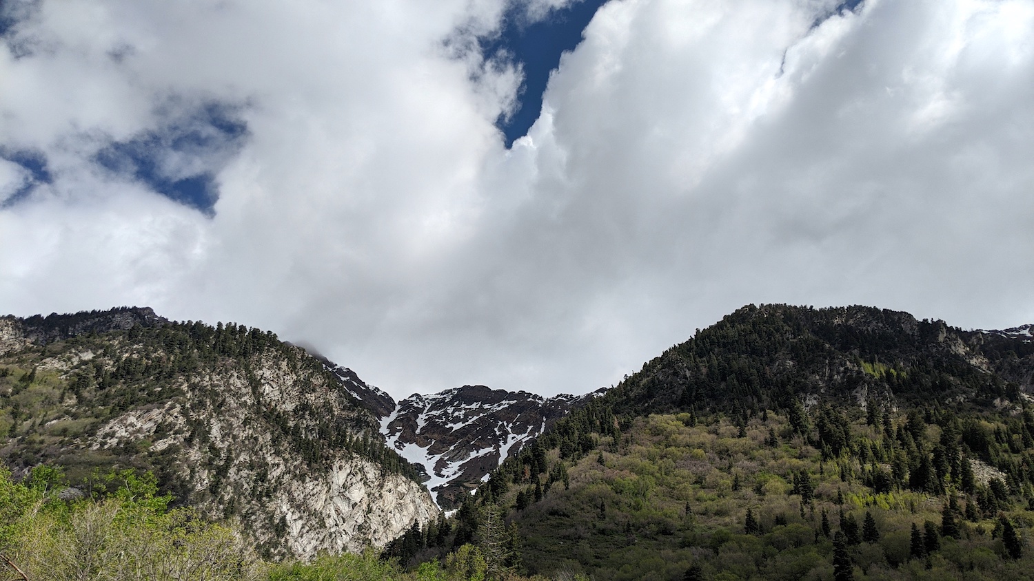
It had frozen hard the previous two nights and the morning was cloudy with a forecast of mid-day and afternoon sun so I was hoping to hit the heat of the day – forecast to be 46ºF at 10K’ at 2pm – to harvest the softest snow possible for my ski down.
I was also counting on this south-facing aspect gathering enough sun to turn the bulletproof chute to supple corn delight.
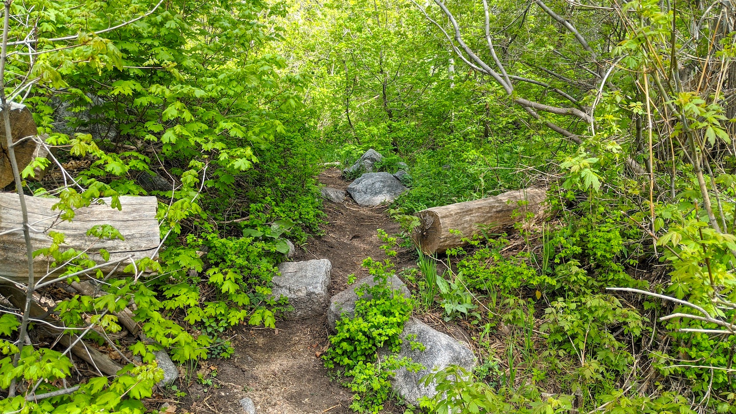
My first move was to find the 1/4-mile trail on the north side of Little Cottonwood Canyon road (SR-210) that leades to the entrance of Tanners Gulch.
The trail was short, easy, green, flowered, and lovey.
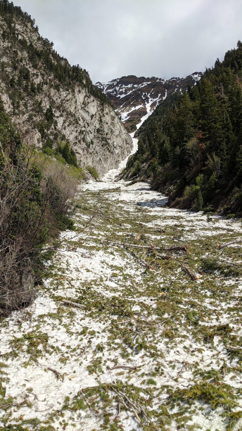
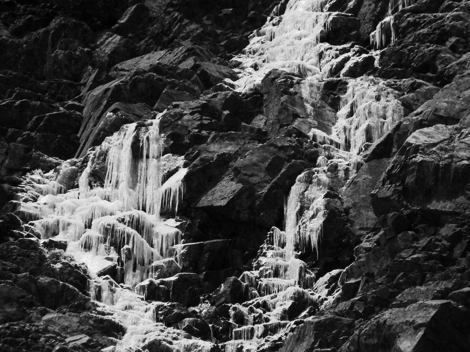
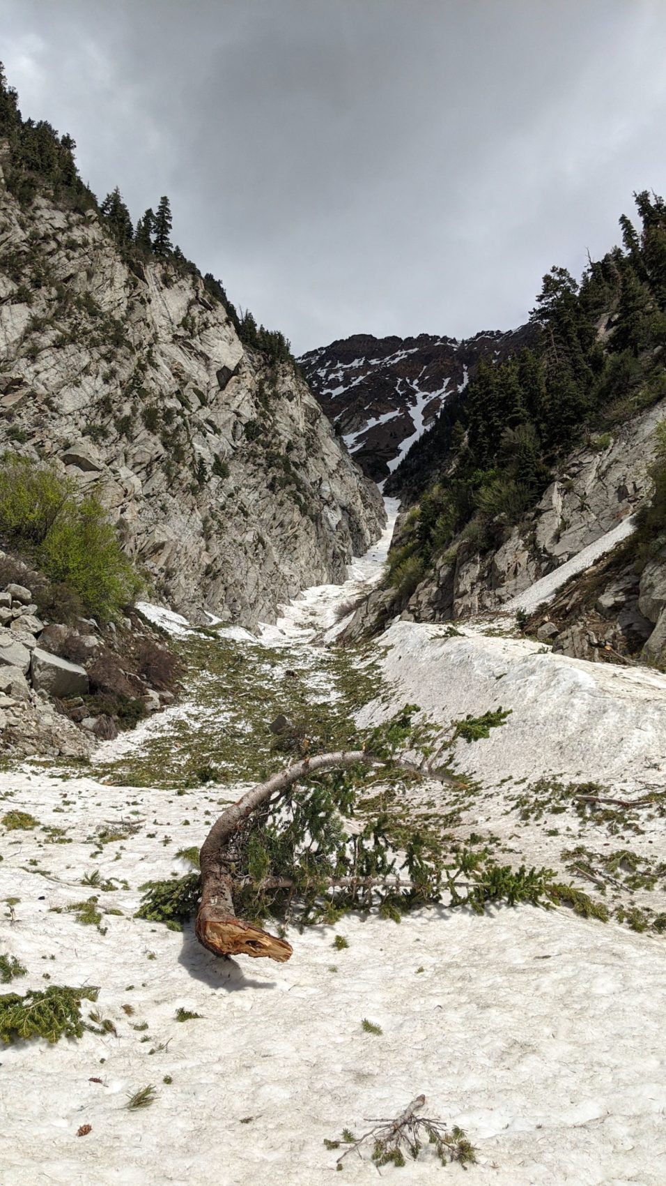
The base of the chute was riddled with dismembered tree bits and small rocks from the huge February 3rd, 2020 avalanche cycle where the Wasatch saw 48 avalanches in 72 hours.
It’s impressive to see how many trees got taken out and how they’ve been ground into perfectly preserved, still green carnage scattered all over the lower snowpack.
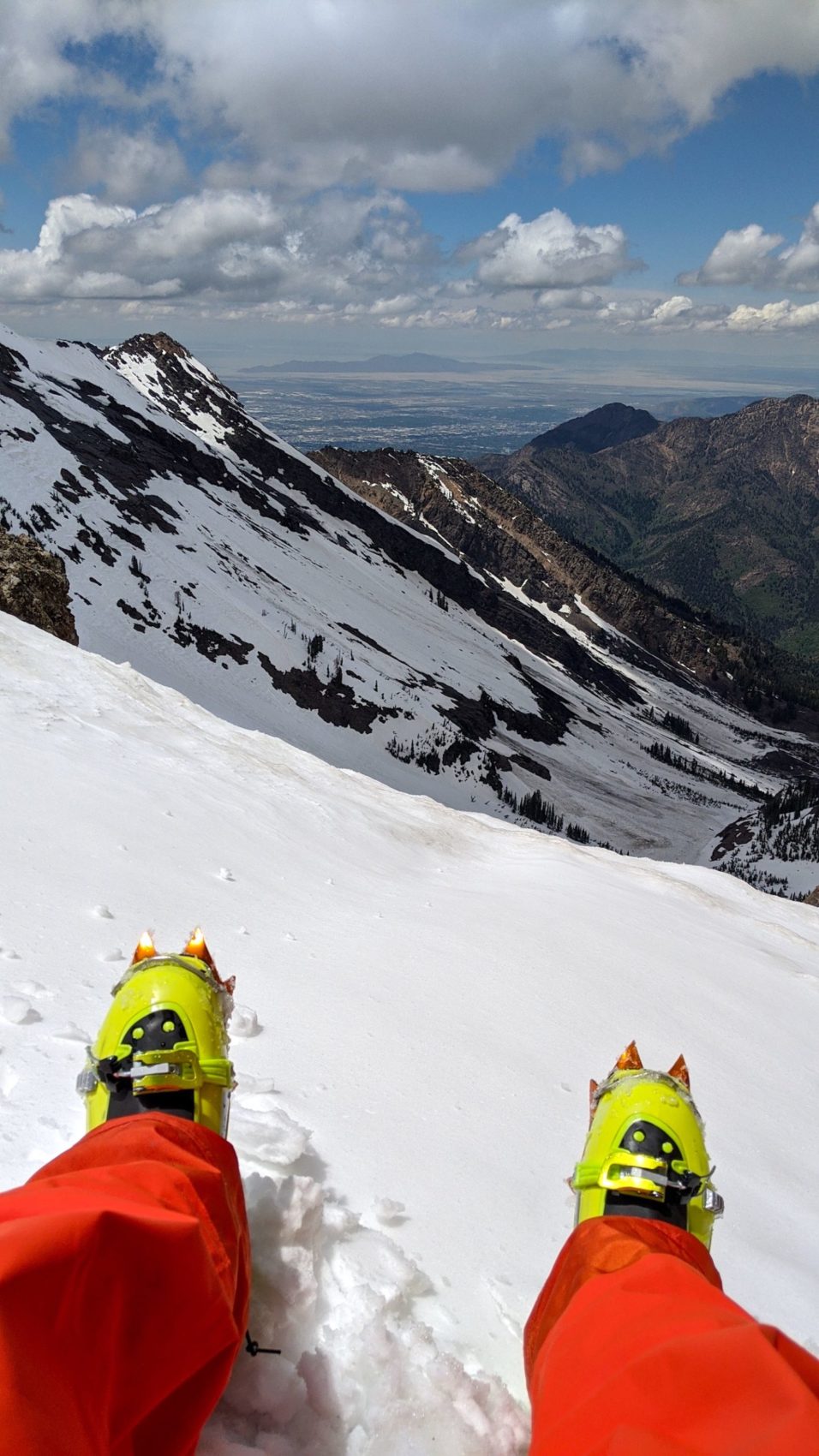
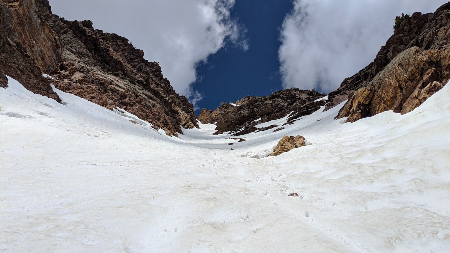
After hiking up the chute for about 10-minutes, the chute steepened and I stopped and put my crampons on.
I continued on with crampons and ski poles and didn’t use my ice-axe but had it ready in my pack.
The snow firm and perfect for cramponing.
At about 11:30am I met a skier coming down (only other person in the chute this day) named Hunter who was a cool cat and he let me know that his ski down was “spicy & icy”.
At about noon, a bowling ball-sized rock came slowly rolling down the chute 15-feet to my right.
I stopped and put my helmet on immediately…
As I climbed upwards, the snow gradually softened with the rising heat of the day and the more and more frequent rays of sunshine.
About 2/3s of the way up the chute, another bowling ball-sized rock came by me at moderate speed and missed me by only about 6-feet to my right.
The snow was softer at that point and this rock didn’t make much sound as it barreled down the mountain and I only saw it at the last moment.
Scary…
My eyes never left the chute above me for a moment after that close call.
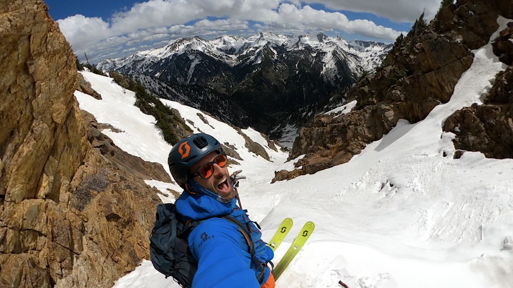
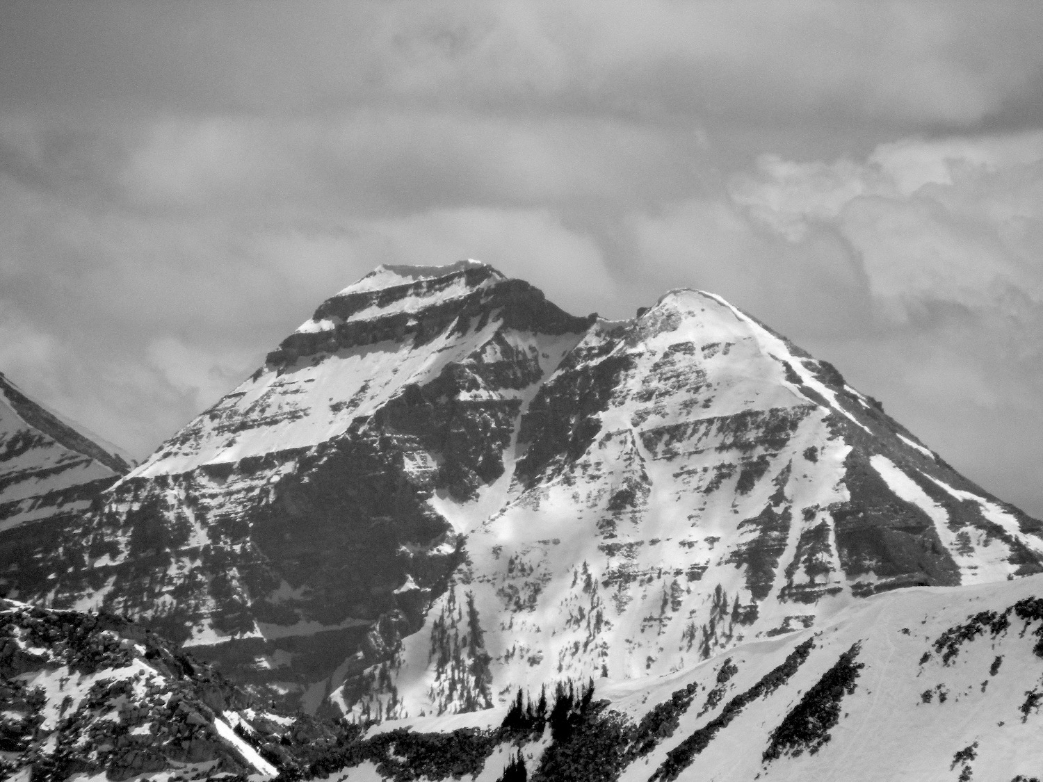
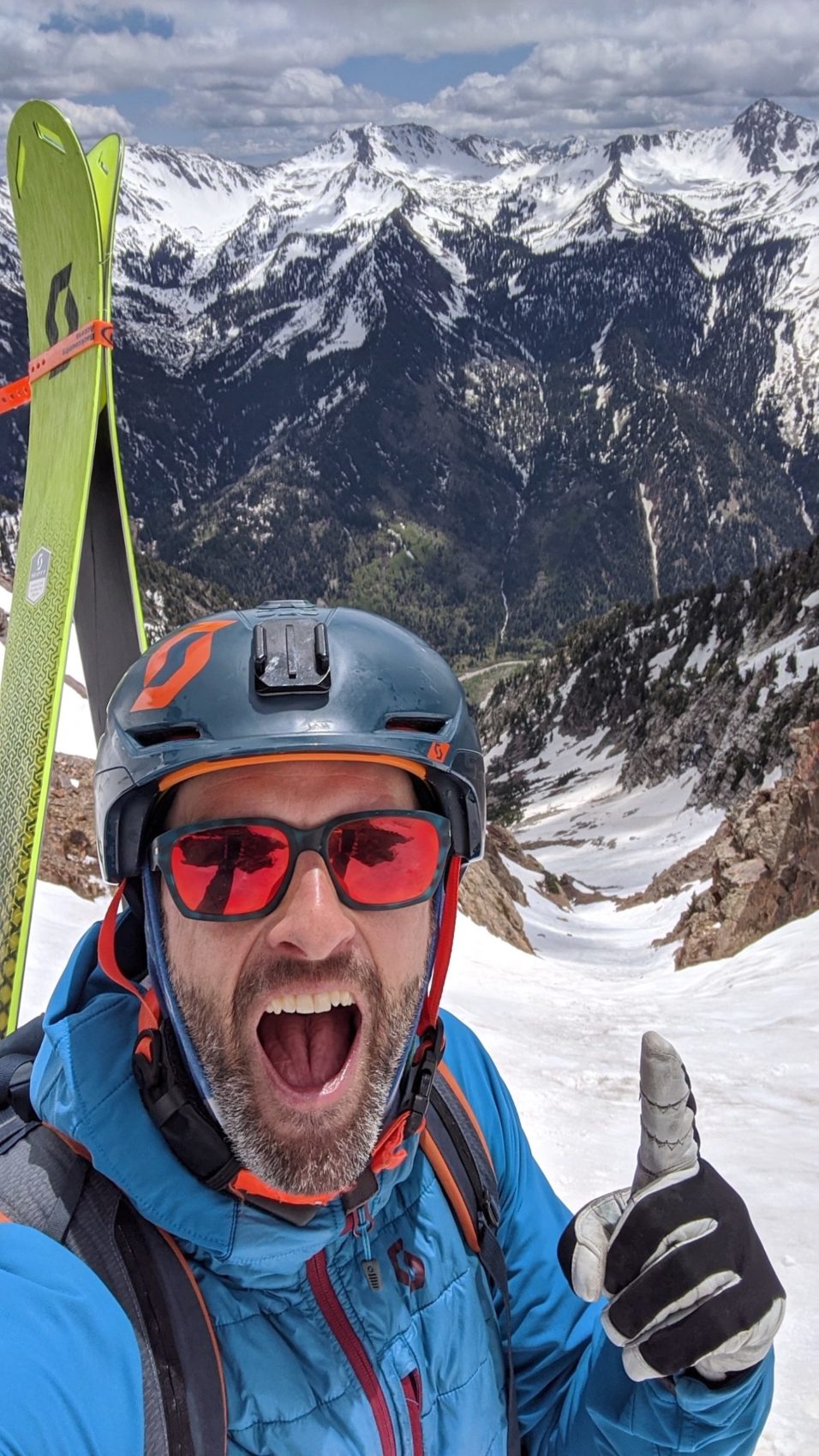
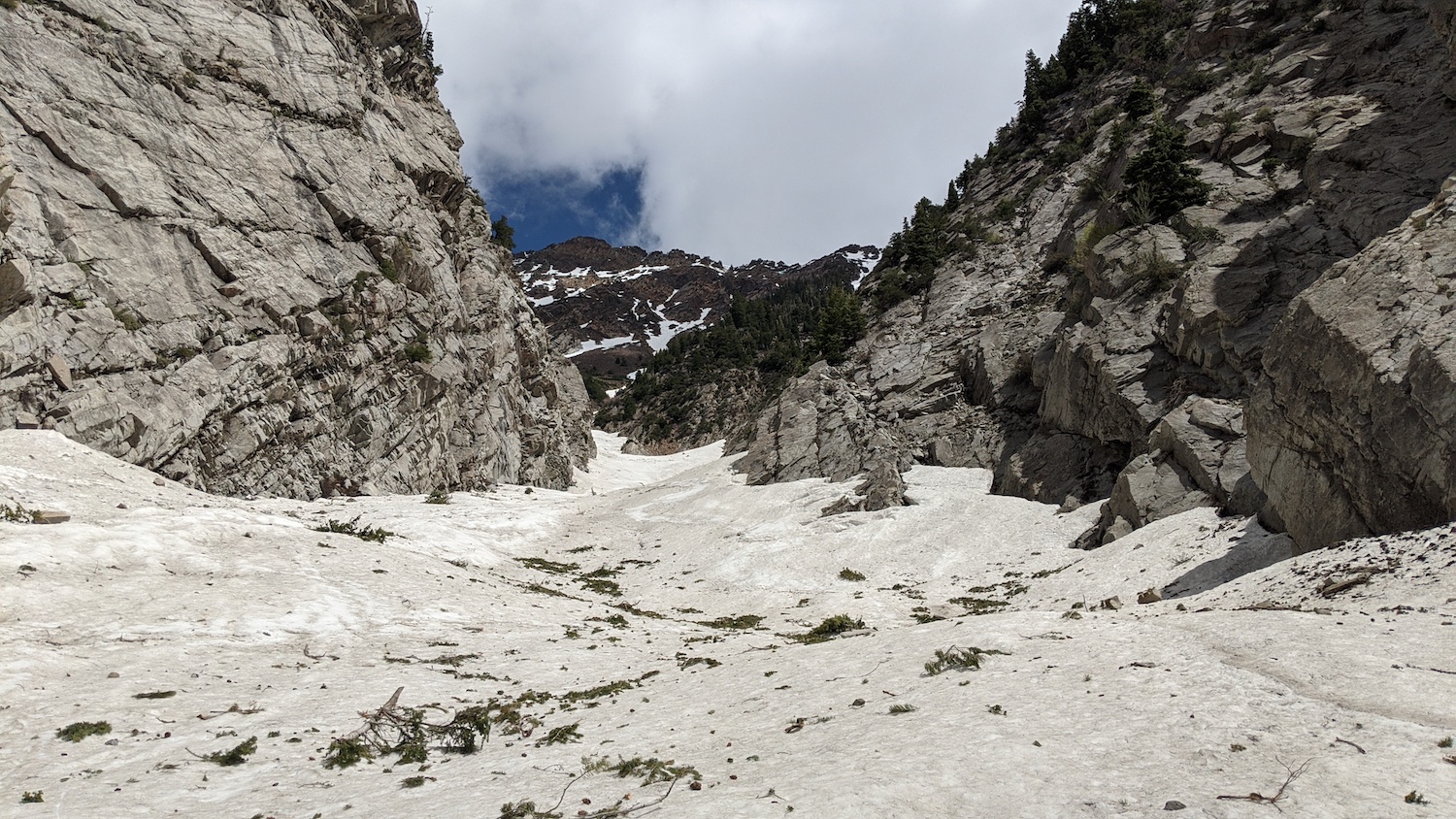
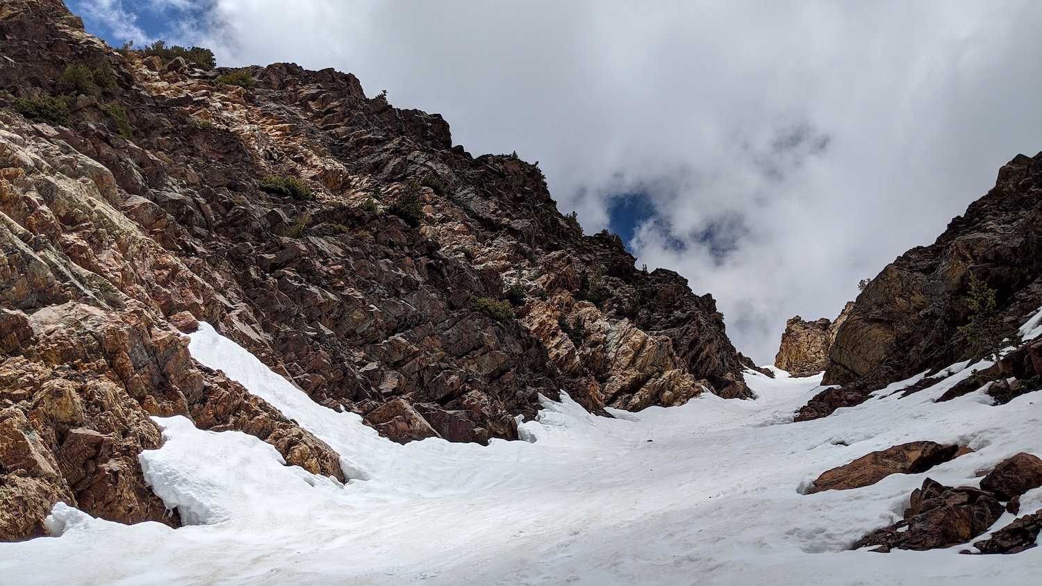
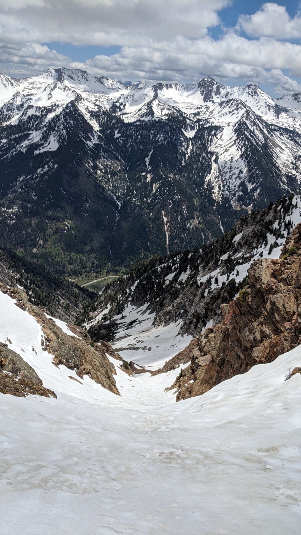
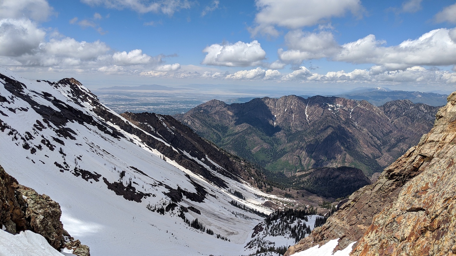
As I entered the upper chute, I began to see why Andrew rated Tanners a 3-star chute (his highest rating).
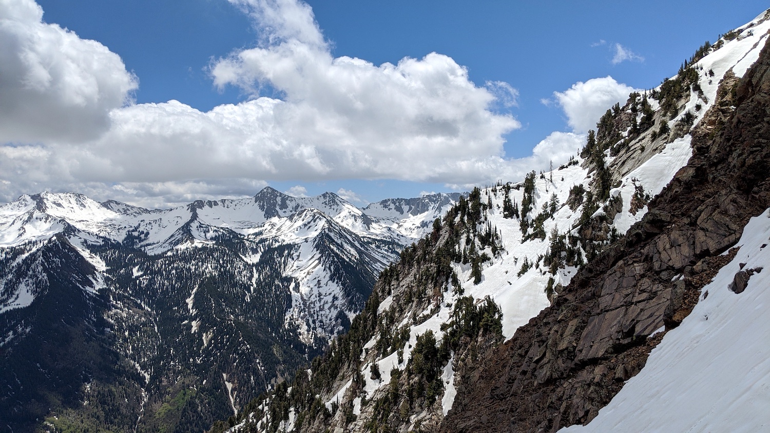
The chute is long with a consistent pitch, gorgeous rock walls, and a commanding view of both the valley bottom and the piercing peaks across the valley.
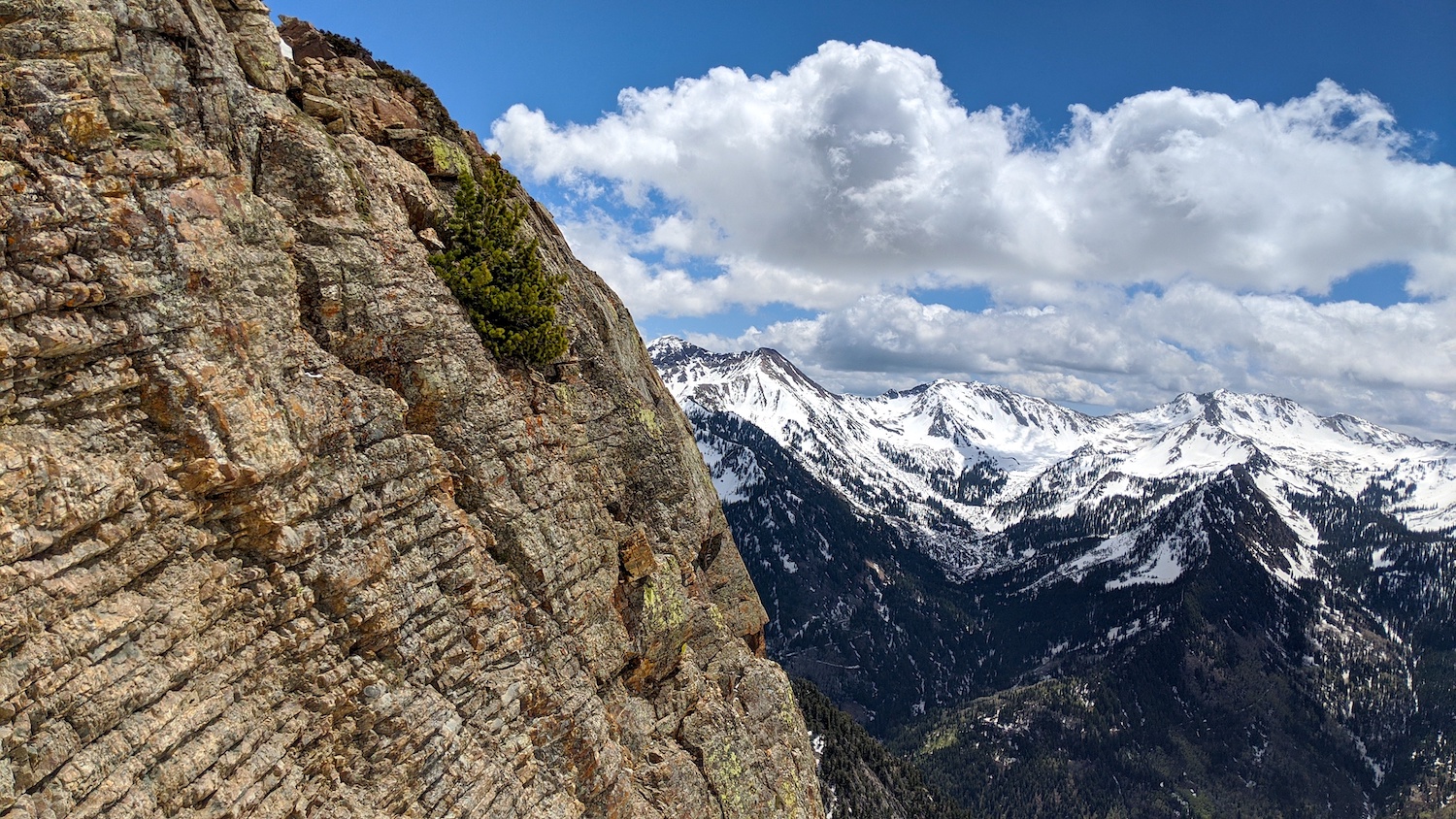
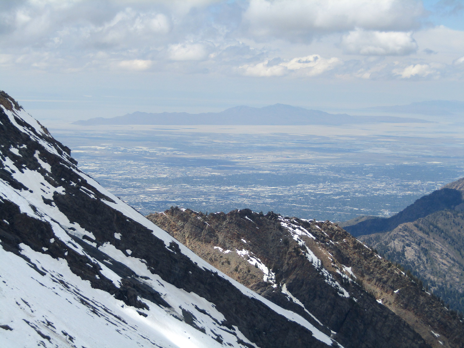
The views from the top of the chute were dazzling.
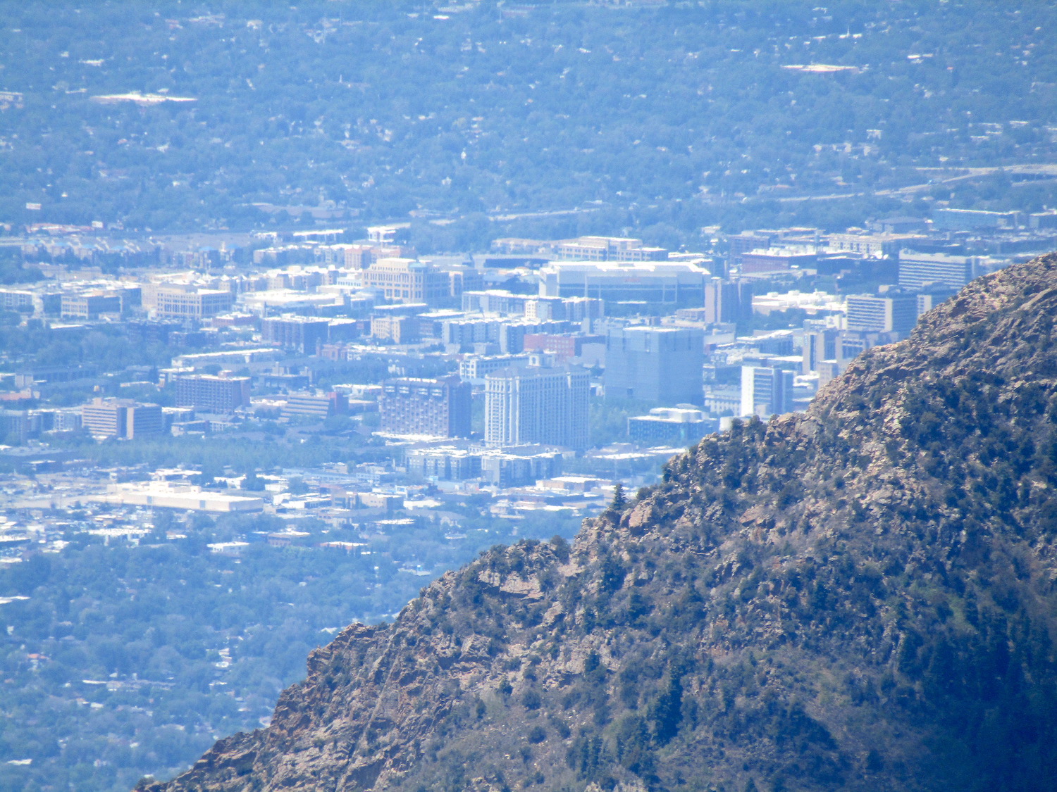
To the north, the Broad Fork of Big Cottonwood Canyon, Twin Peaks, Salt Lake City, the Great Salt Lake, & Antelope Island.
To the south, Alta, Snowbird, Little Cottonwood Canyon, Mt. Timpanogos, the Pfeiferhorn, & North Thunder Mountain.
I waited a bit for sunshine in the chute before dropping in.
I was fairly confident that the snow was going to be just about perfect corn before dropping but not 100% sure…
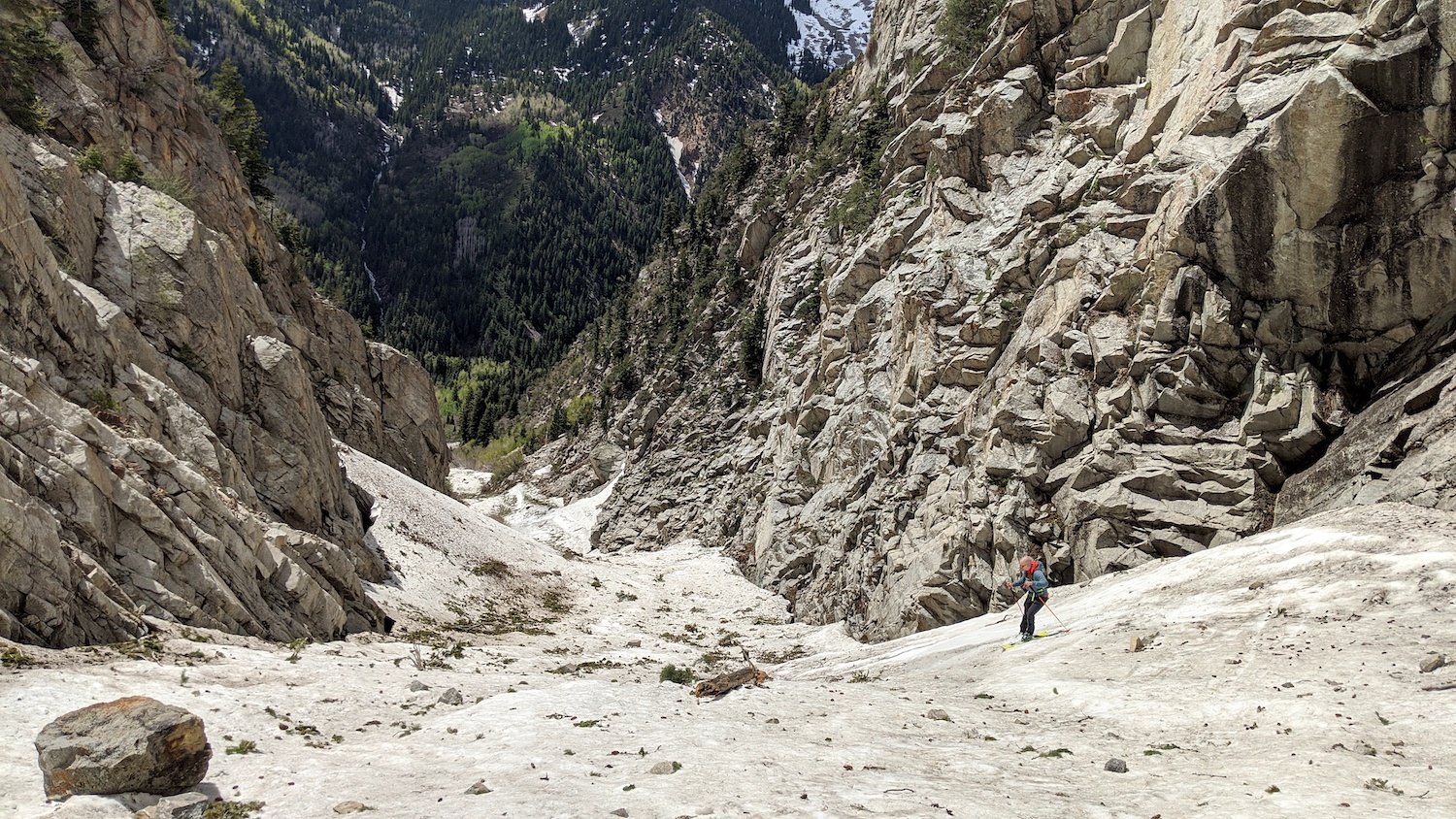
After my first 2-turns, I felt that it was not too firm, not too soft, but just right – so I let ‘er rip.
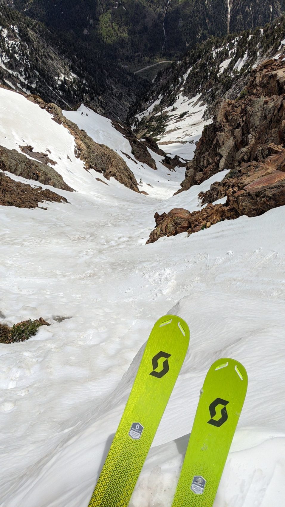
I elatedly burst down the chute, dodging rocks and glide cracks and having a blast.
The snow wasn’t exactly smooth in the upper chute, but it was pliable enough to be able to keep speed up and charge.
At the choke of the upper chute things got a bit bumpy and lumpy before smoothing out again in the open bowl section (apparently due to skiers skiing the same zone repeatedly).
The lower chute gradually began to be more and more choked with small rocks, pinecones, and mutilated trees.
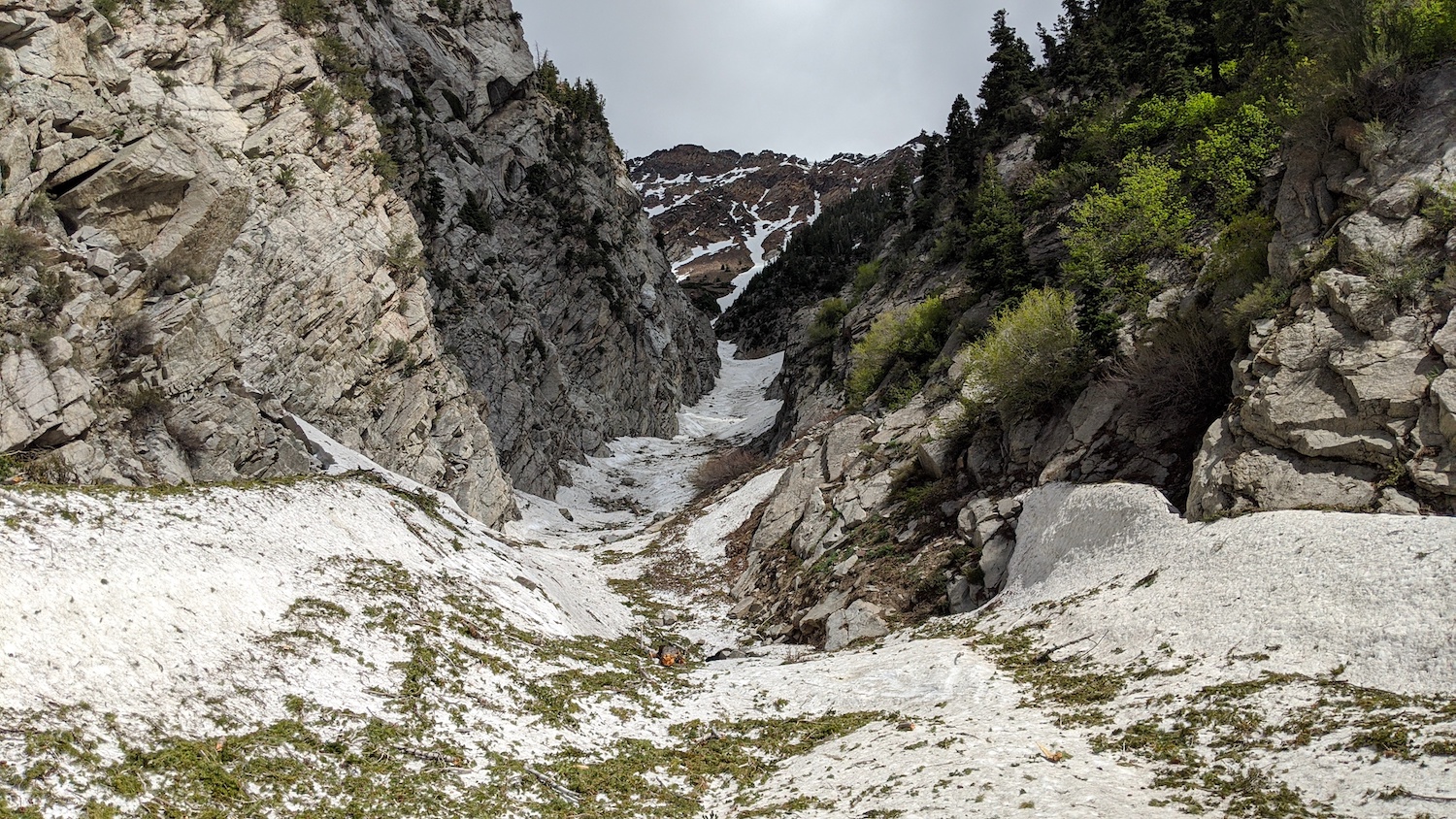
Near the bottom of the chute it seemed that there was less snow than tree on the surface.
You’d think that it wouldn’t be fun to ski over and through all these tree limbs, but it was a hoot.
They didn’t seem to redirect my skis at all as I slashed and sprayed through the overwhelming evidence of their maimed agony.
The only X-factor were the small rocks that hid in the scattered tree branches and made harsh clanking noises and agitatedly skittered off when my skis slapped them with force.
At the bottom of the chute, I was truly exhilarated.
I’d skied the chute top to bottom without stopping through what seemed to be 3 distinct environments:
- The upper chute steeps
- The open bowl smoothies
- The lower chute tree massacre
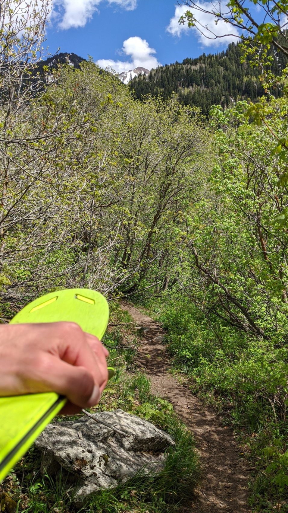
I took my skis off and walked the 5-minute trail back to the car with a shit-eating grin on my face.
I even saw a hummingbird and heard its wings thunderously buzzing like an overgrown honey bee in the forest just before reaching my car.
Today was an amazing day.
Tanners is one helluva run!
May/June 2020 Trip Reports:
- Trip Report: Tickle Mary’s Nipple, WY — Why Not?
- Trip Report: Bloody Mountain, CA – “Bloody Couloir”
- Trip Report: Sailing from San Francisco, CA to Angel Island
- Trip Report: Mt. Dana, CA – “Dana Couloir”
- Trip Report: Mt. Dana, CA – “Solstice Couloir”
- Trip Report: Mt. Timpanogos, UT – “Grunge Couloir”
- Trip Report: Mt. Timpanogos, UT – “Cold Fusion Couloir”
- Trip Report: Snowbird, UT – “Pipeline”
- Trip Report: Mt. Superior, UT | “South Face”
- Trip Report: Little Cottonwood Canyon, UT – “Tanners Gulch”
- Trip Report: Antelope Island/Great Salt Lake , UT | The Baja California of Utah… But With Buffalos
- Alta, UT Report: Little Chute Absolutely Firing in Spring Splashiness!
Photo Tour in Chronological Order:
Hello Richard, thanks for the kind words! This was the Scott Scrapper 105 in the 183cm length. I’m not sure of the exact profile but you might be able to look it up. Thank you
Nice Trip Report! I’ve been looking at that for a long time. What is the profile of the ski you were using?