Report from March 5th, 2019
Brought to you by Scott Sports
Skis Used: Scott Scrapper 115
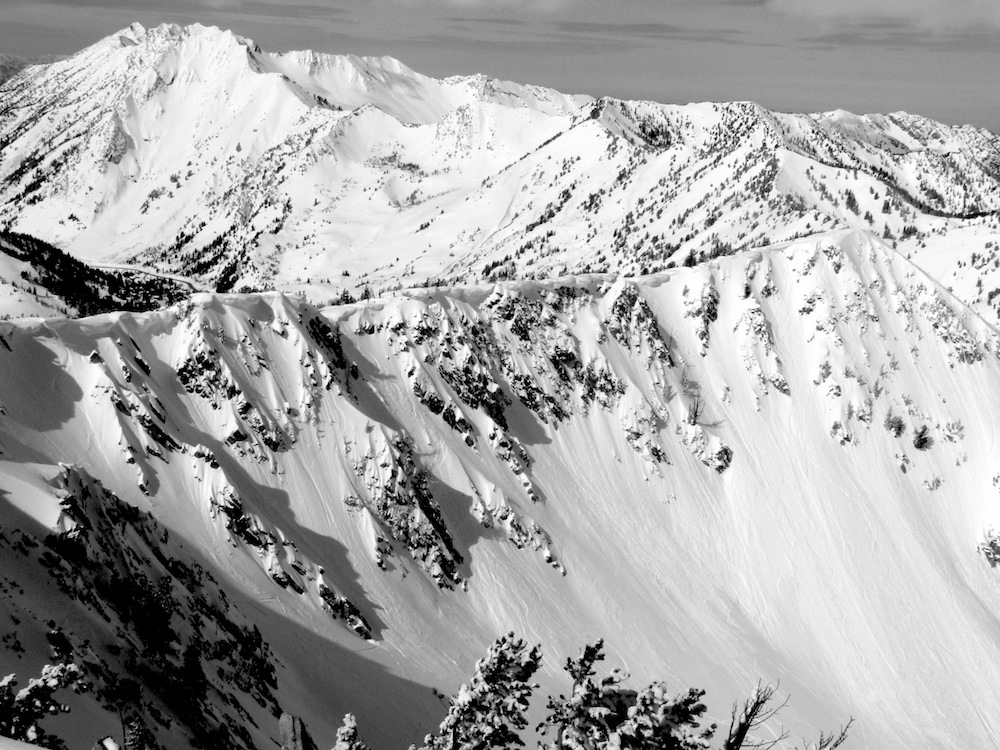
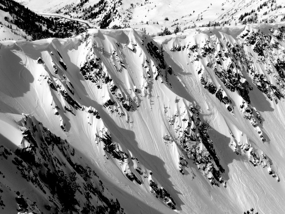
After skiing a couple of hours at Alta, UT today, we slipped into the backcountry with a plan.
A plan to ski a dynamic, steep, gorgeous zone in the blazing light.
We were very excited when we first saw the zone.
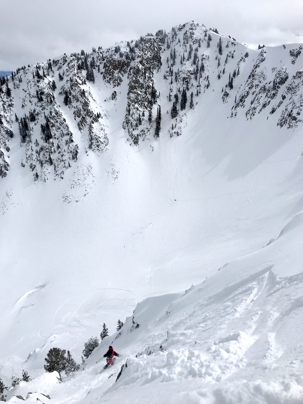
Then, after clicking in, we were gripped.
The snow wasn’t quite what we were hoping for, but was still damn fun.
That blazing light had done its work on the snow.
The skiing was short but intense.
Steep turns, sluff, peppery, funky snow, no-fall-zone-ish.
Big relief once you hit the apron and run out into the open flats.
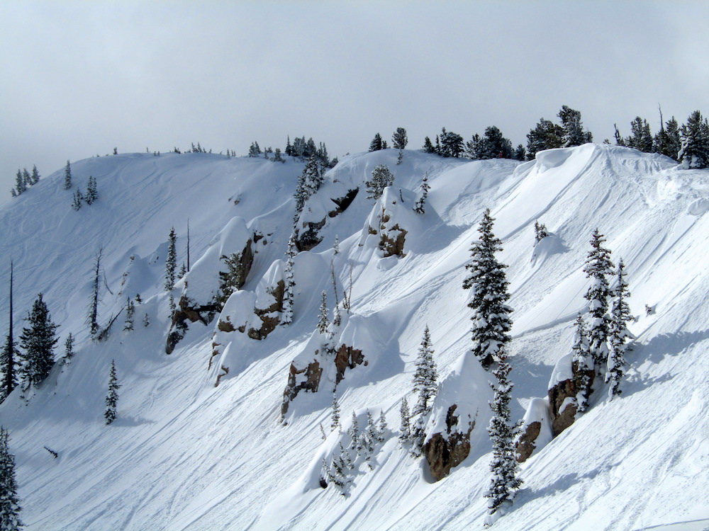
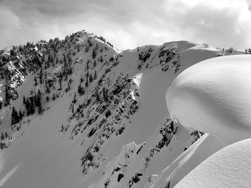
This is a zone I’d like to come back to again and again and learn well.
NOAA’s forecast is calling for 6-24″ of snow the next 2 days.
* WHAT...Snow expected. Total snow accumulations of 6 to 18 inches expected by
midday Thursday, mainly above eight thousand feet. Southwest slopes may locally
see in excess of 2 feet of snow. Mid elevation winds gusting as high as 50 mph,
especially south of I-70.
- NOAA SLC, UT today
FORECAST:
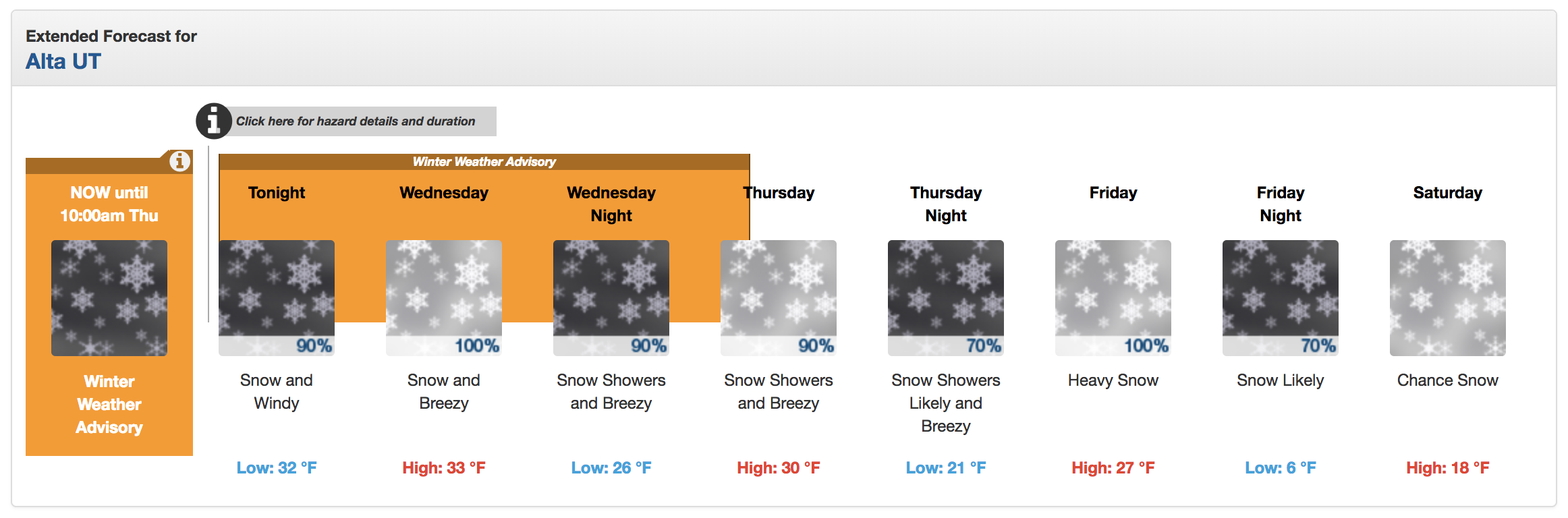
Winter Weather Advisory for Utah
URGENT - WINTER WEATHER MESSAGE
National Weather Service Salt Lake City UT
243 PM MST Tue Mar 5 2019

Wasatch Mountains I-80 North-Wasatch Mountains South of I-80-
Western Uinta Mountains-Wasatch Plateau/Book Cliffs-
Central Mountains-Southern Mountains-
Including the cities of Woodruff, Randolph, Alta, Brighton,
Mirror Lake Highway, Scofield, Cove Fort, Koosharem, Fish Lake,
Loa, Panguitch, and Bryce Canyon
243 PM MST Tue Mar 5 2019

...WINTER WEATHER ADVISORY IN EFFECT FROM 9 PM THIS EVENING TO
10 AM MST THURSDAY...

* WHAT...Snow expected. Total snow accumulations of 6 to 18 inches
  expected by midday Thursday, mainly above eight thousand feet.
  Southwest slopes may locally see in excess of 2 feet of snow.
  Mid elevation winds gusting as high as 50 mph, especially south
  of I-70.

* WHERE...The mountains of Utah.

* WHEN...From 9 PM this evening to 10 AM MST Thursday.

* ADDITIONAL DETAILS...Winter driving conditions are expected,
  especially above eight thousand feet, though at times as low as
  seven thousand feet. Gusty winds may cause blowing and drifting
  snow, locally reducing visibilities to near zero.
PHOTOS: