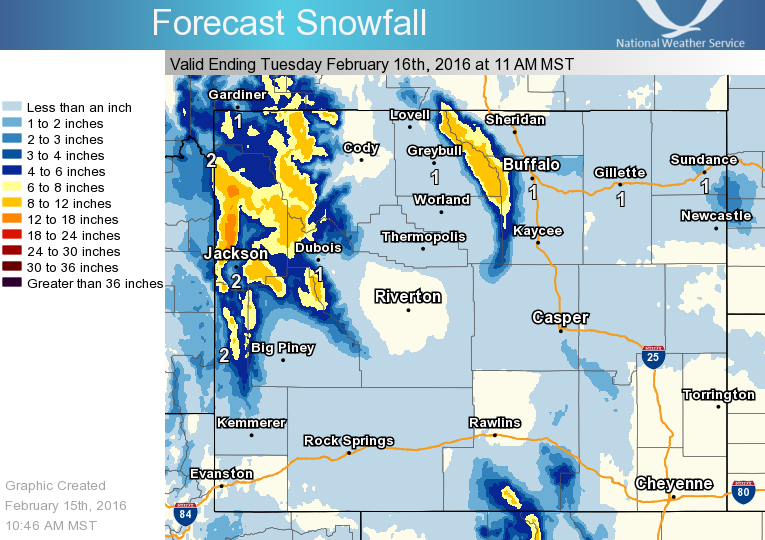
The Grand Teton mountains of Wyoming have already gotten 4-8″ of snowfall and they’re expecting another 3-6″ today.
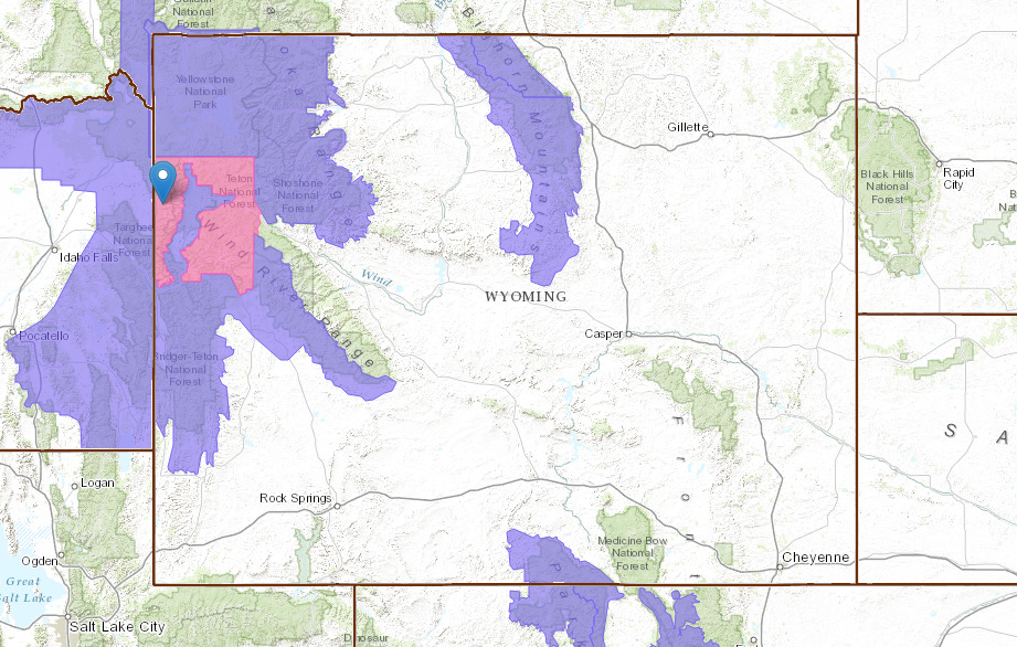
NOAA has issued a Winter Storm Warning today in the Tetons.
* SNOW REPORTS...4 TO 8 INCHES OF SNOW HAS ACCUMULATED IN THE
  TETON RANGE...AND IN THE TOGWOTEE PASS AREA AS OF 6 AM MONDAY.

* ADDITIONAL SNOW ACCUMULATION TODAY...3 TO 6 INCHES. - NOAA Riverton, WY today
Grand Targhee ski resort, WY is reporting 4″ of snow in the past 24 hours and 288″ of snowfall this season.
Jackson Hole, WY is reporting 7″ of snow in the past 24 hours and 290″ of snowfall this season.
“An active day across the Cowboy State. Snow is expected to continue through this afternoon and evening across the west and the Bighorn Mountains. An additional 2 to 6 inches is possible through Tuesday morning, with some locally higher amounts in the Tetons.
In addition, strong winds will be found across much of the region today, and for the Cody Foothills tomorrow. Widespread wind gusts of 40 to 50 MPH will be possible, with areas under High Wind Watches and Warnings expected to see wind gusts over 60 MPH.
Please report any snowfall or high wind gusts your experience. Thanks!” – NOAA Riverton, WY today
WINTER STORM WARNING for WYOMING:
URGENT - WINTER WEATHER MESSAGE
NATIONAL WEATHER SERVICE RIVERTON WY
1032 AM MST MON FEB 15 2016

...SIGNIFICANT SNOW AND BLOWING SNOW THROUGH THIS AFTERNOON
ACROSS PORTIONS OF WESTERN AND NORTHERN WYOMING...

.A MOIST PACIFIC FLOW WILL CONTINUE TO BRING SURGES OF LIGHT TO
MODERATE SNOW ACROSS PORTIONS OF WESTERN WYOMING AND THE BIGHORN
MOUNTAINS TODAY. THE HEAVIEST PERIOD OF SNOW IS EXPECTED THIS
MORNING. WEST TO NORTHWEST WIND AT 20 TO 35 MPH WITH GUSTS 40 TO
50 MPH WILL CAUSE AREAS OF BLOWING AND DRIFTING SNOW OVER
MOUNTAIN PASSES AND OPEN AREAS IN THE MOUNTAINS.

TETON AND GROS VENTRE MOUNTAINS-

...WINTER STORM WARNING REMAINS IN EFFECT UNTIL 5 PM MST THIS
AFTERNOON...

* TIMING...LIGHT TO MODERATE SNOW WILL CONTINUE TODAY.

* SNOW REPORTS...4 TO 8 INCHES OF SNOW HAS ACCUMULATED IN THE
  TETON RANGE...AND IN THE TOGWOTEE PASS AREA AS OF 6 AM MONDAY.

* ADDITIONAL SNOW ACCUMULATION TODAY...3 TO 6 INCHES.

* WIND AND VISIBILITY...WEST WINDS 20 TO 30 MPH WITH GUSTS TO 40
  MPH ON THE PASSES AND OPEN AREAS. OCCASIONAL VISIBILITY BELOW
  A QUARTER MILE IN SNOW AND BLOWING SNOW IS EXPECTED.

* MAIN IMPACT...TRAVEL WILL BE DIFFICULT AT TIMES ON MOUNTAIN
  PASSES. BEFORE TRAVELING...MOTORISTS SHOULD CHECK CURRENT ROAD
  CONDITIONS BY VISITING WYOROAD.INFO OR BY DIALING 511. IF YOUR
  PLANS INCLUDE TRAVEL INTO THE BACK COUNTRY...PLEASE MONITOR
  JHAVALANCHE.ORG.

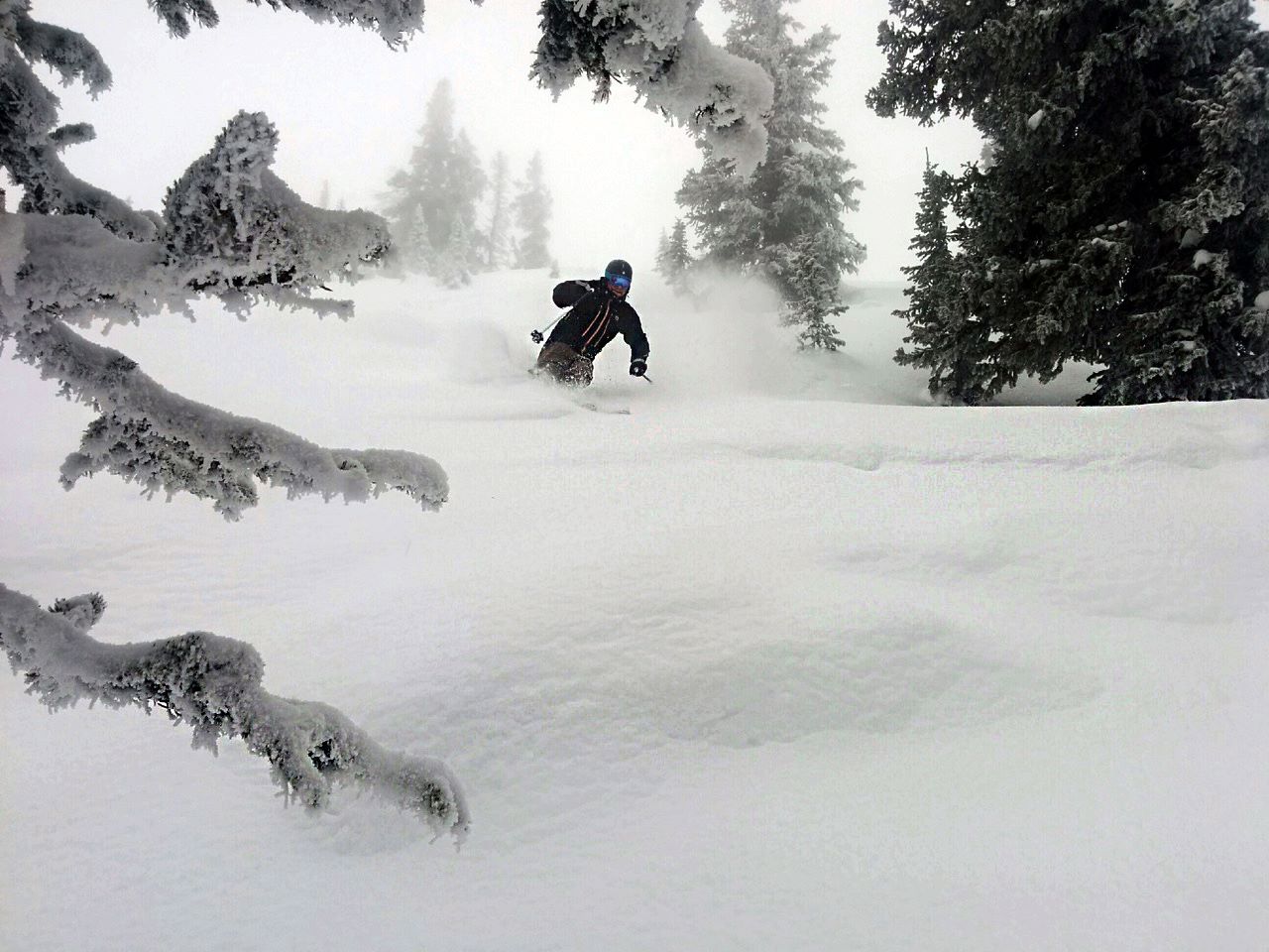
Much needed but +5C at the base of Teton Village, white rain at Casper and wind blown schmoo above. More like skiing at Drizzler BlackCloud, although the ski report did not suggest designer trash bags like the Drizz does.