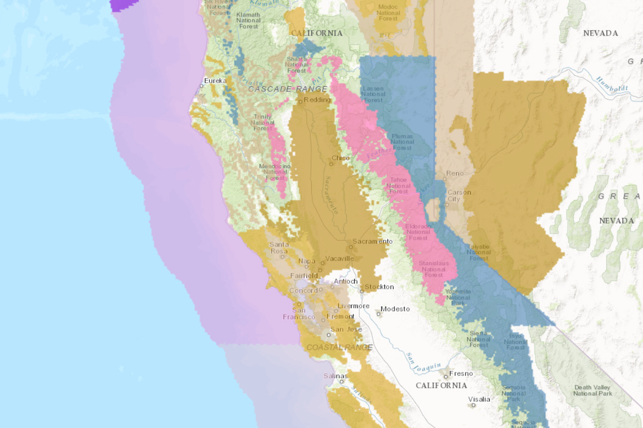
A Winter Storm Warning has been issued for much of the Eastern Sierra. A large storm impacting the area will more in late Thursday Night and stick around through Saturday.
In the Winter Storm Area, 2-4 FEET of snow is expected to fall Friday-Saturday.
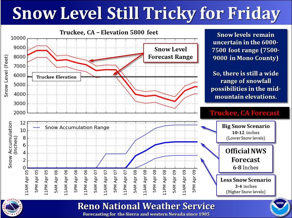
Snow levels are expected to start out around 7500ft and drop to or below 4000ft. Depending on the timing of that drop, snow totals at lower elevations could be substantial.
Additional Storm Information:
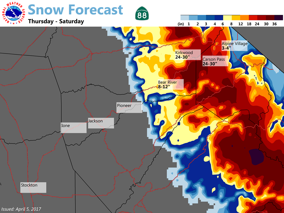
California: 2-4 FEET of Snow Friday-Saturday
* SNOW ACCUMULATIONS...6 to 12 inches of snow expected above 4500
  feet with 2 to 4 feet of snow expected above 6000 feet.
- NOAA Sacramento, CA

Kirkwood Winter Storm Warning:
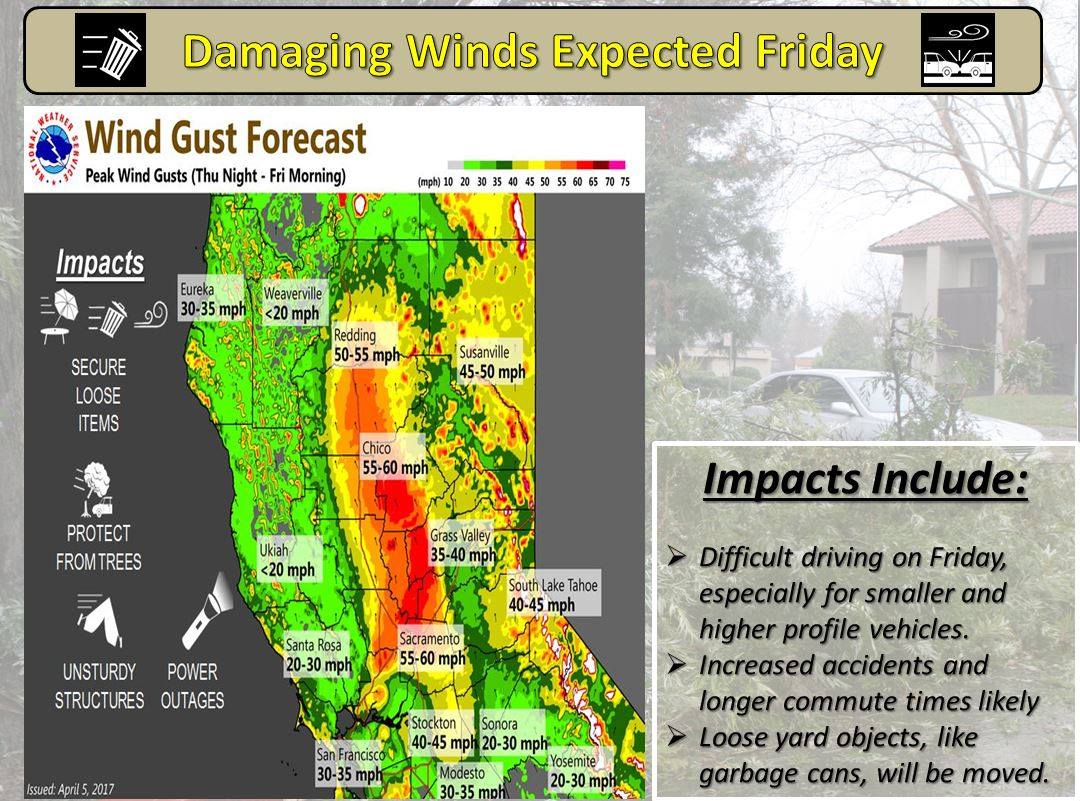
URGENT - WINTER WEATHER MESSAGE
National Weather Service Sacramento CA
330 AM PDT Thu Apr 6 2017

Shasta Lake Area / Northern Shasta County-
Mountains Southwestern Shasta County to Northern Lake County-
Western Plumas County/Lassen Park-
West Slope Northern Sierra Nevada-
Including the cities of Shasta Dam, Alder Springs, Chester,
Quincy, and Blue Canyon
330 AM PDT Thu Apr 6 2017

...WINTER STORM WARNING IN EFFECT FROM 6 PM THIS EVENING TO 6 PM
PDT SATURDAY...

The National Weather Service in Sacramento has issued a Winter
Storm Warning for snow, which is in effect from 6 PM this evening
to 6 PM PDT Saturday. The Winter Storm Watch is no longer in
effect.

* CONFIDENCE...High.

* Timing...Approaching storm will bring heavy snow starting this
  evening with heavier snowfall amounts Friday through Saturday.

* MAIN IMPACT...Heavy snow will create mountain travel delays and
  chain controls, and may result in road closures.

* LOCATIONS...Interstate 80 over Donner Pass, Highway 50 over Echo
  Summit, Highway 88 over Carson Pass and Lassen Volcanic National
  Park.

* SNOW ACCUMULATIONS...6 to 12 inches of snow expected above 4500
  feet with 2 to 4 feet of snow expected above 6000 feet.

* Other impacts...High wind gusts up to 60 mph will create
  periods of white out conditions with very low visibility in
  heavy snowfall. Travel is expected to become very difficult.
2 thoughts on “Winter Storm Warning Issued For California | 2-4 FEET of Snow Above 6000ft”