Winter Storm Warnings In Effect For Colorado | 12-18+” of Snow Possible Through Saturday

Chris Wallner | | Post Tag for WeatherWeather
DEEP DEEP DEEP at Copper Mountain last week. Image: Copper Mountain Facebook Page

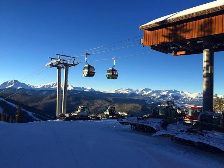
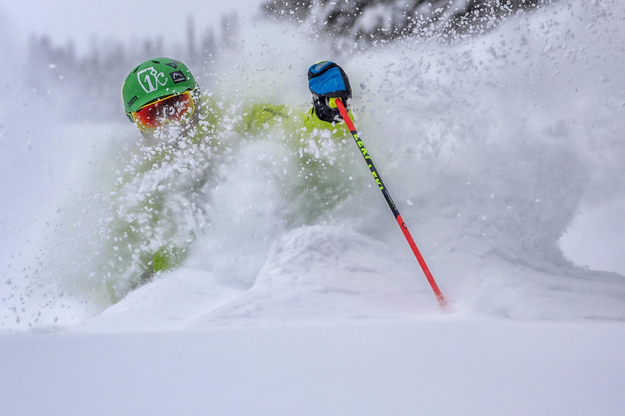
Look to Colorado this weekend for powder turns and free refills throughout the day. Storms will move through the area through Saturday afternoon.

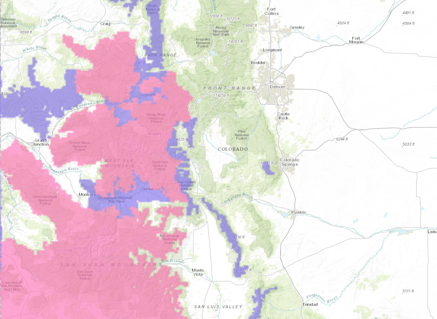
12-18″ of snow possible for Southwestern Colorado through Saturday.

Check out these 7 day snowfall totals for Colorado. Image: Tropical Tidbits
7 day precipitation totals are looking BIG for southwestern Colorado. Image: NOAA Today
7 day precipitation totals are looking BIG for Southwestern Colorado. Image: NOAA Today

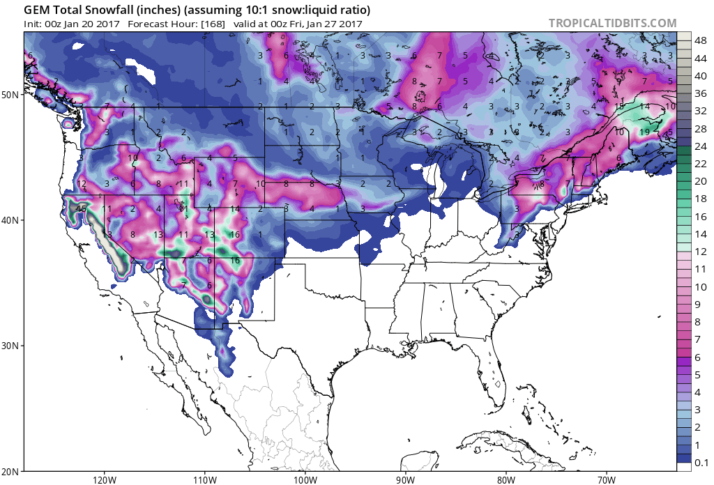
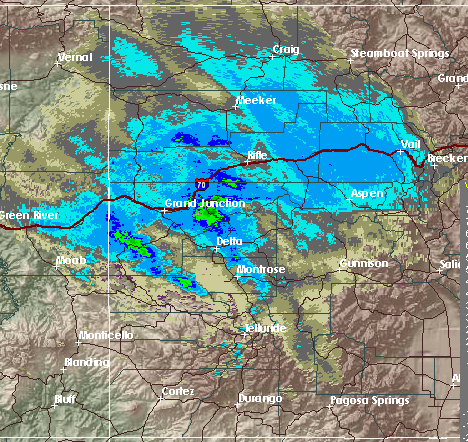
Successive storms moving through Southwestern Colorado will make for BIG snowfall and precipitation totals over the next 7 days. These storms are expected to persist through Saturday and into early Sunday, along with the possibility of more storms arriving midweek.

Storm moving through Colorado last night. Image: NOAA Grand Junction, CO
Light snow accumulations overnight. Image: NOAA Boulder, CO Yesterday

Southwestern Colorado Forecast: 12-18+” Through Saturday

* SNOW ACCUMULATION...8 TO 16 INCHES WITH LOCALLY HIGHER AMOUNTS
  POSSIBLE.
- NOAA Grand Junction, CO Today
PINK= Winter Storm Warning. PURPLE= Winter Weather Advisory. Image: NOAA Today
Winter weather sticks around all weekend, take precautionary measures. Image: NOAA Grand Junction, CO Today

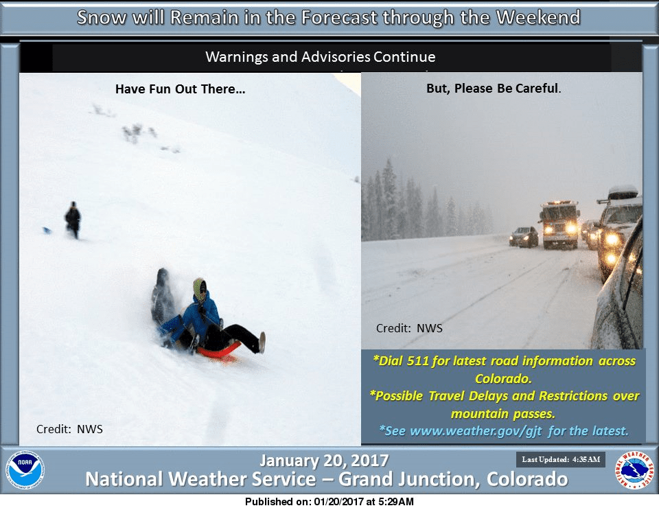
This storm is expected to impact travel and possibly implicate restrictions on mountain passes.

The heaviest snowfall of the weekend will arrive this afternoon and persist into early Saturday. If you’re looking for a powder fix this weekend, Southwestern Colorado on Saturday will be your best bet.

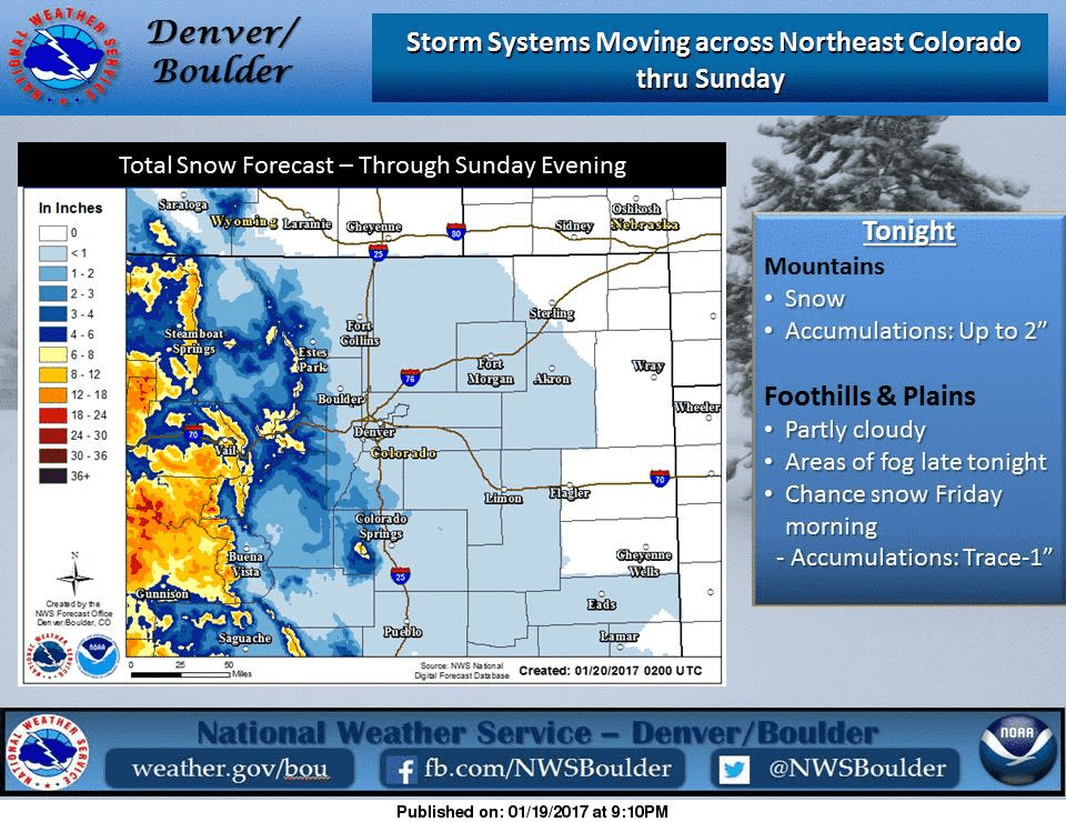
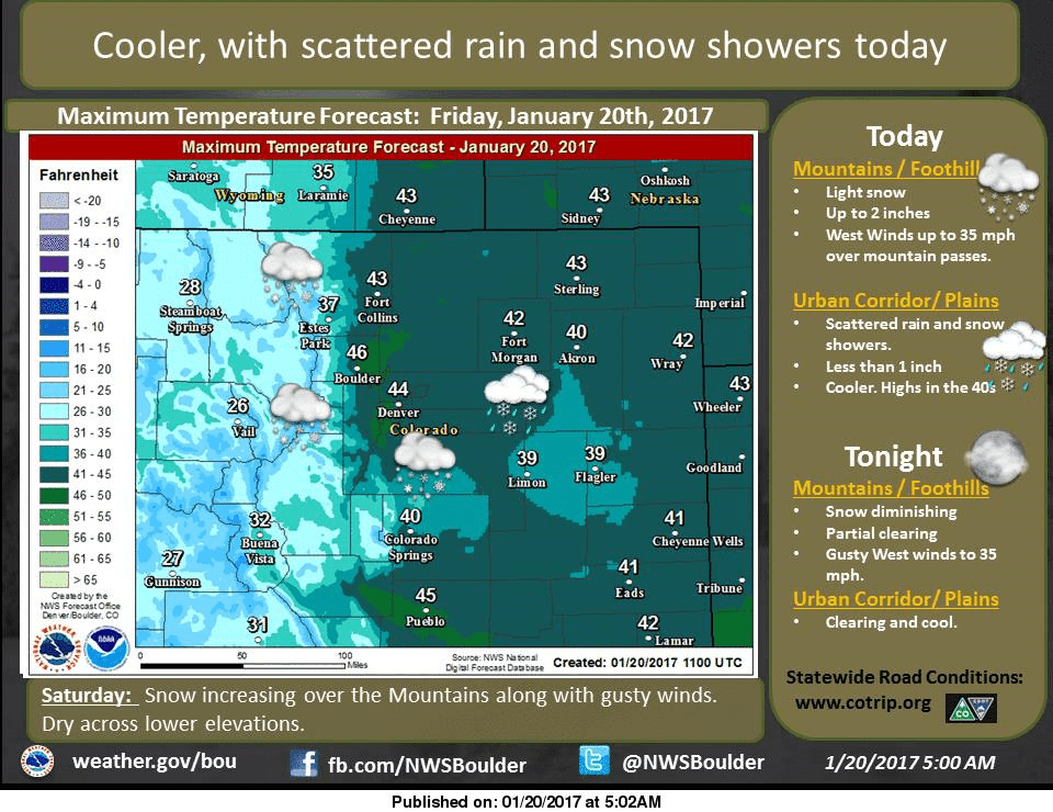
Warm temperatures are expected to persist in Eastern Colorado today, making for higher snow levels for the precipitation that is expected to fall there.

The long term forecasts are calling for below average temperatures and precipitation throughout the next 8-14 days.

MORE INFO:

Storm summary. Image: NOAA Pueblo, CO Yesterday
Warm temperatures persist in the east. Image: NOAA Boulder, CO Today
8-14 day temperature outlook is COLD for Colorado. Image: NOAA Today
8-14 day precipitation outlook doesn't look good for anyone. Image: NOAA Today
8-14 day precipitation outlook doesn’t look good for anyone in the lower 48. Image: NOAA Today

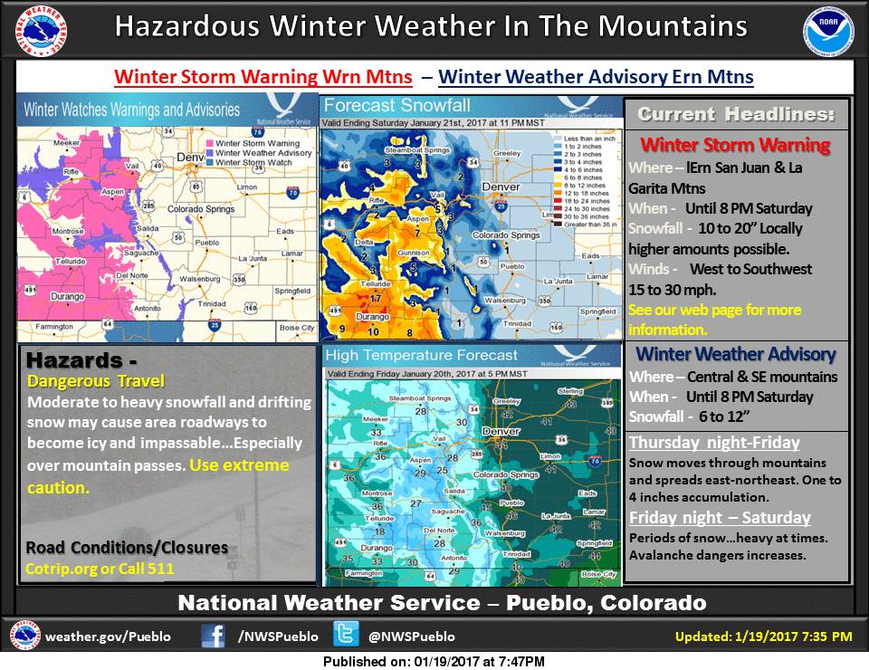
Winter Storm Warning:

URGENT - WINTER WEATHER MESSAGE
NATIONAL WEATHER SERVICE GRAND JUNCTION CO
702 AM MST FRI JAN 20 2017

...WINTER STORM WARNING REMAINS IN EFFECT UNTIL 6 AM MST SUNDAY...

* LOCATIONS INCLUDE THE CITIES OF...ASPEN...VAIL...SNOWMASS...
  BUFORD...TRAPPERS LAKE.

* TIMING...OCCASIONAL SNOW SHOWERS...HEAVY AT TIMES...WILL
  CONTINUE THROUGH SATURDAY NIGHT. THERE WILL BE BREAKS OR LULLS
  IN THE SNOWFALL THIS AFTERNOON.

* SNOW ACCUMULATION...8 TO 16 INCHES WITH LOCALLY HIGHER AMOUNTS
  POSSIBLE.

* WINDS...SOUTHWEST 10 TO 15 MPH WITH GUSTS UP TO 35 MPH.

* IMPACTS...MOUNTAIN ROADWAYS WILL BECOME SNOW PACKED OVERNIGHT
  WITH WINTER DRIVING CONDITIONS CONTINUING THROUGH THE WEEKEND.
  VISIBILITIES WILL BE REDUCED TO UNDER A HALF MILE AT TIMES.
Won't be sunny at Keystone Today. Image: Keystone Facebook Page Yesterday
Won’t be sunny at Keystone Today. Image: Keystone Facebook Page Yesterday

Related Articles

Got an opinion? Let us know...